Category:January 2009 in North Yorkshire
Deutsch: Bilder, die im Januar 2009 in North Yorkshire aufgenommen worden sind. Bitte beachten Sie, dass dies weder das Datum des Uploads noch das Datum des Scannens eines Fotos ist.
English: Images/pictures taken in North Yorkshire during January 2009. Note this is not the date of the upload, nor the date a photo was scanned.
Español: Fotografías o imágenes tomadas en North Yorkshire durante enero 2009. No es la fecha de subida ni escaneo, sino la fecha en que las fotografías o imágenes se crearon.
Esperanto: Bildoj faritaj en North Yorkshire en januaro 2009. Tio ne estas la dato, kiam la bildoj estis alŝutitaj aŭ skanitaj.
Français : Photographies ou images prises en North Yorkshire durant janvier 2009. Ce n'est pas la date du téléchargement ou du scan.
Galego: Fotografías ou imaxes tomadas en North Yorkshire durante xaneiro 2009. Non é a data de subida nin escaneamento, senón a data na que se crearon as fotografías ou imaxes.
Italiano: Fotografie o immagini scattate a North Yorkshire nel gennaio 2009. Nota bene: la data non si riferisce né a quella di upload né a quella in cui la foto è stata digitalizzata.
Norsk bokmål: Bilder tatt i North Yorkshire i løpet av januar 2009. Merk at dette ikke er datoen for opplasting, eller når et bilde har blitt skannet.
Norsk nynorsk: Bilete teke i North Yorkshire i løpet av januar 2009. Merk at dette ikkje er datoen for opplasting, eller når eit bilete har vorte skanna.
Русский: Изображения, сделанные в North Yorkshire в течение январь 2009 (не дата загрузки изображения).
Українська: Зображення, зроблені в North Yorkshire протягом січень 2009. Зауважте, що це не дата завантаження чи дата сканування фотографії.
| January 2008 | ← | January 2009 | → | January 2010 | |||||||
| Jan | Feb | Mar | Apr | May | Jun | Jul | Aug | Sep | Oct | Nov | Dec |
| 102 | 130 | 132 | 160 | 279 | 263 | 181 | 133 | 125 | 110 | 109 | 159 |
|---|---|---|---|---|---|---|---|---|---|---|---|
Subcategories
This category has the following 2 subcategories, out of 2 total.
Media in category "January 2009 in North Yorkshire"
The following 100 files are in this category, out of 100 total.
-
 Penfold postbox, Richmond - geograph.org.uk - 1120361.jpg 480 × 640; 112 KB
-
 Public toilets, Richmond - geograph.org.uk - 1120335.jpg 640 × 454; 84 KB
-
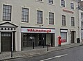 Woolworths, Richmond - geograph.org.uk - 1120364.jpg 640 × 467; 105 KB
-
 18thC Farmhouse in Kiplin. - geograph.org.uk - 1107056.jpg 640 × 480; 69 KB
-
 Olivers Mount Farm - geograph.org.uk - 1131852.jpg 640 × 480; 113 KB
-
 A Yorkshire Milestone - geograph.org.uk - 1133883.jpg 480 × 640; 152 KB
-
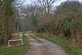 Access Road From Caravan Site - geograph.org.uk - 1145596.jpg 640 × 427; 78 KB
-
 All Saints', Farnley, North Yorkshire (3905757901).jpg 1,638 × 2,457; 3.26 MB
-
 An Inquisitive Goat, Seaton Hall - geograph.org.uk - 1145637.jpg 640 × 427; 66 KB
-
 Approaching Malton Station - geograph.org.uk - 1143792.jpg 640 × 480; 74 KB
-
 Arable Field at Cana - geograph.org.uk - 1131925.jpg 640 × 480; 87 KB
-
 Black Horse, High Street, Skipton - geograph.org.uk - 1108867.jpg 640 × 479; 77 KB
-
 Buried subway - geograph.org.uk - 1138924.jpg 635 × 421; 68 KB
-
 Cogden Gill Above Grinton.jpg 2,400 × 1,600; 2.82 MB
-

-
 Cottages in East Cowton - geograph.org.uk - 1103994.jpg 640 × 480; 51 KB
-
 Cringle Moor Plantation - geograph.org.uk - 1120115.jpg 640 × 427; 63 KB
-
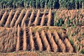 Cringle Moor Plantation - geograph.org.uk - 1120142.jpg 640 × 427; 121 KB
-
 Derelict passenger subway - geograph.org.uk - 1138917.jpg 640 × 427; 133 KB
-
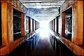 Derelict passenger subway - geograph.org.uk - 1138921.jpg 640 × 427; 79 KB
-

-
 Ed Alleyne Johnson.jpg 1,570 × 2,035; 426 KB
-
 Eller Beck - geograph.org.uk - 1106720.jpg 480 × 640; 74 KB
-
 Fan House, Grinkle Ironstone Mine - geograph.org.uk - 1140116.jpg 640 × 427; 70 KB
-
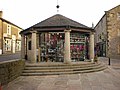
 Farmer's Market, Skipton - geograph.org.uk - 1107187.jpg 640 × 480; 84 KB
-
 Feeding the ducks - geograph.org.uk - 1107930.jpg 504 × 640; 137 KB
-
 Field at Carr House Farm - geograph.org.uk - 1131835.jpg 640 × 480; 62 KB
-
 Field Edge Footpath Muston Bottoms - geograph.org.uk - 1131819.jpg 640 × 480; 58 KB
-
 Field Oak - geograph.org.uk - 1128194.jpg 640 × 481; 53 KB
-
 Field off Easby Lane - geograph.org.uk - 1138559.jpg 427 × 640; 55 KB
-
 Field patterns in Littondale - geograph.org.uk - 1106055.jpg 640 × 428; 76 KB
-

-
 Fisher Medical Centre - geograph.org.uk - 1106672.jpg 640 × 480; 67 KB
-
 Footpath at Ellerton Moor - geograph.org.uk - 1135382.jpg 480 × 640; 90 KB
-
 Footpath from Osgodby to Scarborough - geograph.org.uk - 1132978.jpg 640 × 480; 115 KB
-
 Footpath near Crow House - geograph.org.uk - 1129472.jpg 640 × 480; 137 KB
-
 Footpath near Hag Dyke - geograph.org.uk - 1130931.jpg 640 × 480; 70 KB
-
 Footpath to Welburn - geograph.org.uk - 1134776.jpg 640 × 480; 77 KB
-
 Ford at Mill Beck - geograph.org.uk - 1125244.jpg 640 × 480; 122 KB
-
 Fountains Abbey, stonework - geograph.org.uk - 1114480.jpg 640 × 480; 577 KB
-
 Fountains, by MIMA - geograph.org.uk - 1128248.jpg 640 × 428; 76 KB
-
 Gypsy Lane railway station in 2009.jpg 640 × 461; 214 KB
-
 Hallams Yard - geograph.org.uk - 1108885.jpg 480 × 640; 66 KB
-
 Inside MIMA - geograph.org.uk - 1128246.jpg 640 × 428; 56 KB
-
 Kettlewell Carr - geograph.org.uk - 1134131.jpg 640 × 480; 93 KB
-
 Leeds and Liverpool Canal - geograph.org.uk - 1107186.jpg 640 × 480; 73 KB
-
 Leeds and Liverpool Canal - geograph.org.uk - 1108896.jpg 640 × 480; 78 KB
-
 Lidl supermarket, York Road - geograph.org.uk - 1131758.jpg 640 × 404; 62 KB
-
 New supermarket site, Thirsk - geograph.org.uk - 1119390.jpg 640 × 329; 53 KB
-
 New York Mill - geograph.org.uk - 1114094.jpg 640 × 480; 99 KB
-
 Nidd Footbridge at SE211597 - geograph.org.uk - 1114073.jpg 640 × 480; 122 KB
-
 No 8 Victoria Square - geograph.org.uk - 1108863.jpg 640 × 480; 75 KB
-
 North Door, St. Wilfrid's. - geograph.org.uk - 1106977.jpg 480 × 640; 137 KB
-
 Open space, in front of MIMA - geograph.org.uk - 1128250.jpg 640 × 428; 77 KB
-
 Pair of Boulders, Cold Moor - geograph.org.uk - 1120135.jpg 640 × 427; 72 KB
-
 Parallel roads - geograph.org.uk - 1116906.jpg 640 × 480; 56 KB
-
 Power Lines across the fields - geograph.org.uk - 1104062.jpg 640 × 480; 111 KB
-
 Rear Entrance to Ings Farm - geograph.org.uk - 1143079.jpg 640 × 427; 74 KB
-
 Red Lion, High Street - geograph.org.uk - 1108880.jpg 640 × 473; 85 KB
-
 Relic of Grinkle Ironstone Mine - geograph.org.uk - 1145582.jpg 640 × 427; 65 KB
-
 Relic of Grinkle Ironstone Mine - geograph.org.uk - 1145585.jpg 427 × 640; 69 KB
-

-
 Sea Cliffs - geograph.org.uk - 1133116.jpg 640 × 480; 49 KB
-
 Council offices on Water Street - geograph.org.uk - 1612860.jpg 640 × 480; 76 KB
-
 Skipton - Local Education Office - geograph.org.uk - 1124815.jpg 640 × 480; 89 KB
-
 Skipton - buildings NE of Mill Bridge - geograph.org.uk - 1124809.jpg 640 × 480; 103 KB
-
 Skipton and Knaresborough Road - geograph.org.uk - 1133871.jpg 640 × 480; 97 KB
-
 Skipton Library, High Street - geograph.org.uk - 1108876.jpg 640 × 480; 80 KB
-
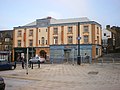
 Skipton's new bus station - geograph.org.uk - 1108897.jpg 640 × 480; 56 KB
-
 Skipton's new bus station - geograph.org.uk - 1108899.jpg 480 × 640; 62 KB
-
 Skipton's new bus station - geograph.org.uk - 1108900.jpg 480 × 640; 64 KB
-
 St James' retail park - geograph.org.uk - 1107919.jpg 640 × 421; 56 KB
-

-
 Steep Hill, Cowbar - geograph.org.uk - 1145268.jpg 640 × 427; 75 KB
-
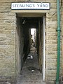 Sterling's Yard - geograph.org.uk - 1108884.jpg 480 × 640; 79 KB
-
 Strata - geograph.org.uk - 1108903.jpg 640 × 480; 67 KB
-
 Streetlights, at MIMA - geograph.org.uk - 1128343.jpg 640 × 428; 29 KB
-

-
 Tesco filling station, Thirsk - geograph.org.uk - 1119393.jpg 640 × 362; 55 KB
-
 The eastern flank of Buckden Pike - geograph.org.uk - 1609013.jpg 640 × 480; 51 KB
-
 The Narrow Boat, Victoria Street - geograph.org.uk - 1107196.jpg 480 × 640; 76 KB
-

-
 The Nidd - about to disappear - geograph.org.uk - 1129601.jpg 464 × 640; 112 KB
-
 The Shambles - geograph.org.uk - 1141715.jpg 640 × 431; 70 KB
-

-

-

-
 The Wharfe at Castley - geograph.org.uk - 1117639.jpg 640 × 480; 79 KB
-
 Trinity Methodist Church, Harrogate - geograph.org.uk - 1769940.jpg 480 × 640; 69 KB
-
 Victoria Mill - geograph.org.uk - 1107185.jpg 640 × 480; 61 KB
-
 Victoria Street, Skipton - geograph.org.uk - 1107195.jpg 480 × 640; 62 KB
-
 Victoria Street, Skipton - geograph.org.uk - 1108893.jpg 480 × 640; 86 KB
-
 War Memorial, Skipton - geograph.org.uk - 1108869.jpg 640 × 480; 63 KB
-
 Westgate, Skipton - geograph.org.uk - 1108904.jpg 640 × 480; 55 KB
-
 Wharfedale towards Burnsall - geograph.org.uk - 1251996.jpg 640 × 480; 61 KB
-
 What was Woolworths, Skipton - geograph.org.uk - 1108866.jpg 640 × 480; 61 KB
-

-
 York House, Malton - geograph.org.uk - 1141866.jpg 640 × 453; 74 KB
-
 Yorkersgate, Malton - geograph.org.uk - 1142206.jpg 554 × 640; 83 KB
-


.jpg)


