Category:January 2014 in York
Deutsch: Bilder, die im Januar 2014 in York aufgenommen worden sind. Bitte beachten Sie, dass dies weder das Datum des Uploads noch das Datum des Scannens eines Fotos ist.
English: Images/pictures taken in York during January 2014. Note this is not the date of the upload, nor the date a photo was scanned.
Español: Fotografías o imágenes tomadas en York durante enero 2014. No es la fecha de subida ni escaneo, sino la fecha en que las fotografías o imágenes se crearon.
Esperanto: Bildoj faritaj en York en januaro 2014. Tio ne estas la dato, kiam la bildoj estis alŝutitaj aŭ skanitaj.
Français : Photographies ou images prises en York durant janvier 2014. Ce n'est pas la date du téléchargement ou du scan.
Galego: Fotografías ou imaxes tomadas en York durante xaneiro 2014. Non é a data de subida nin escaneamento, senón a data na que se crearon as fotografías ou imaxes.
Italiano: Fotografie o immagini scattate a York nel gennaio 2014. Nota bene: la data non si riferisce né a quella di upload né a quella in cui la foto è stata digitalizzata.
Norsk bokmål: Bilder tatt i York i løpet av januar 2014. Merk at dette ikke er datoen for opplasting, eller når et bilde har blitt skannet.
Norsk nynorsk: Bilete teke i York i løpet av januar 2014. Merk at dette ikkje er datoen for opplasting, eller når eit bilete har vorte skanna.
Русский: Изображения, сделанные в York в течение январь 2014 (не дата загрузки изображения).
Українська: Зображення, зроблені в York протягом січень 2014. Зауважте, що це не дата завантаження чи дата сканування фотографії.
| January 2013 | ← | January 2014 | → | January 2015 | |||||||
| Jan | Feb | Mar | Apr | May | Jun | Jul | Aug | Sep | Oct | Nov | Dec |
| 103 | 129 | 68 | 264 | 19 | 419 | 526 | 190 | 190 | 56 | 80 | 35 |
|---|---|---|---|---|---|---|---|---|---|---|---|
Media in category "January 2014 in York"
The following 103 files are in this category, out of 103 total.
-
 Acres House (geograph 3810114).jpg 640 × 427; 75 KB
-
 Along Clifton Moor Gate - geograph.org.uk - 3815005.jpg 640 × 480; 105 KB
-
 Along Stockton Lane - geograph.org.uk - 3803112.jpg 640 × 427; 75 KB
-
 Along the muddy bridleway - geograph.org.uk - 3804511.jpg 640 × 427; 123 KB
-
 Along Towthorpe Moor Lane - geograph.org.uk - 3805786.jpg 640 × 427; 86 KB
-
 Along Wheldrake Lane - geograph.org.uk - 3810791.jpg 640 × 427; 63 KB
-
 Applecroft Road - geograph.org.uk - 3803088.jpg 640 × 427; 77 KB
-
 Approaching Heslington East - geograph.org.uk - 3810806.jpg 640 × 480; 73 KB
-
 Approaching Towthorpe Moor Lane - geograph.org.uk - 3805784.jpg 640 × 427; 80 KB
-
 Ashley Park Road - geograph.org.uk - 3803093.jpg 640 × 427; 69 KB
-
 B1222 - geograph.org.uk - 3810337.jpg 427 × 640; 101 KB
-
 Bridleway and A1237 - geograph.org.uk - 3804476.jpg 640 × 427; 84 KB
-
 Bridleway and electric fence - geograph.org.uk - 3804516.jpg 640 × 427; 75 KB
-

-
 Bridleway at Hopgrove Farm - geograph.org.uk - 3804471.jpg 427 × 640; 114 KB
-
 Bridleway beside the A1237 - geograph.org.uk - 3804487.jpg 640 × 427; 95 KB
-
 Bridleway from North Lane - geograph.org.uk - 3804526.jpg 640 × 427; 75 KB
-
 Bridleway off North Lane - geograph.org.uk - 3804502.jpg 640 × 427; 143 KB
-
 Bridleway to Hopgrove Farm - geograph.org.uk - 3803261.jpg 427 × 640; 117 KB
-
 Bridleway to North Lane - geograph.org.uk - 3804489.jpg 640 × 427; 93 KB
-
 Bridleway to Towthorpe Moor Lane - geograph.org.uk - 3804529.jpg 640 × 427; 65 KB
-
 Central Hall - geograph.org.uk - 3833602.jpg 640 × 480; 76 KB
-
 Changing fields - geograph.org.uk - 3804523.jpg 640 × 427; 137 KB
-
 Chemistry F Block - geograph.org.uk - 3833622.jpg 640 × 480; 84 KB
-
 Clifton Moor Gate - geograph.org.uk - 3815001.jpg 640 × 480; 59 KB
-
 Construction at Clifton Moor - geograph.org.uk - 3820047.jpg 640 × 480; 85 KB
-
 Crab Tree Grove - geograph.org.uk - 3805819.jpg 640 × 427; 75 KB
-
 Cycle path in New Earswick - geograph.org.uk - 3805823.jpg 640 × 427; 88 KB
-
 Cycle path to Bootham Stray Gates - geograph.org.uk - 3805825.jpg 640 × 427; 92 KB
-
 Cycle path to New Lane - geograph.org.uk - 3833620.jpg 640 × 480; 48 KB
-
 Decaying bales - geograph.org.uk - 3804518.jpg 640 × 427; 73 KB
-
 Derwent Way (geograph 3803084).jpg 640 × 427; 81 KB
-
 Downstream from Naburn Bridge - geograph.org.uk - 3834476.jpg 640 × 480; 57 KB
-
 Entering New Earswick - geograph.org.uk - 3805814.jpg 640 × 427; 52 KB
-
 Entering Wheldrake - geograph.org.uk - 3810792.jpg 640 × 427; 64 KB
-
 Field near A64 - geograph.org.uk - 3810098.jpg 640 × 427; 59 KB
-
 Fisherman Bridge - geograph.org.uk - 3834464.jpg 480 × 640; 64 KB
-
 Flooded gate - geograph.org.uk - 3804506.jpg 640 × 427; 102 KB
-
 Flying Legends - geograph.org.uk - 3820035.jpg 640 × 480; 76 KB
-
 Foss from Towthorpe Bridge - geograph.org.uk - 3805794.jpg 640 × 427; 67 KB
-
 Garth Way - geograph.org.uk - 3805821.jpg 640 × 427; 88 KB
-
 Hopgrove Lane South - geograph.org.uk - 3803115.jpg 640 × 427; 84 KB
-
 Hopgrove Roundabout - geograph.org.uk - 3803196.jpg 640 × 427; 74 KB
-
 House on Hopgrove Lane South - geograph.org.uk - 3803119.jpg 640 × 427; 87 KB
-
 Houses on Stockton Lane - geograph.org.uk - 3803109.jpg 640 × 427; 65 KB
-
 Houses on York Road - geograph.org.uk - 3805808.jpg 640 × 427; 70 KB
-
 Housing on Hopgrove Lane South - geograph.org.uk - 3803123.jpg 640 × 427; 76 KB
-
 Housing on Regent Street - geograph.org.uk - 3833610.jpg 640 × 480; 98 KB
-
 Langwith and Constantine colleges - geograph.org.uk - 3810814.jpg 640 × 480; 92 KB
-
 Layerthorpe cycle path - geograph.org.uk - 3833616.jpg 480 × 640; 130 KB
-
 Livestock along bridleway - geograph.org.uk - 3804503.jpg 640 × 427; 104 KB
-
 Looking along Towthorpe Moor Lane - geograph.org.uk - 3805790.jpg 640 × 427; 76 KB
-
 Looking towards Wheldrake Grange - geograph.org.uk - 3810790.jpg 640 × 427; 49 KB
-
 Main Street - geograph.org.uk - 3810794.jpg 640 × 427; 75 KB
-
 Malton Road - geograph.org.uk - 3802952.jpg 640 × 427; 81 KB
-
 Muddy bridleway - geograph.org.uk - 3804508.jpg 640 × 427; 102 KB
-
 Naburn - geograph.org.uk - 3810330.jpg 640 × 427; 92 KB
-
 Naburn Lane - geograph.org.uk - 3810103.jpg 640 × 427; 115 KB
-
 Naburn Lodge - geograph.org.uk - 3810115.jpg 640 × 427; 81 KB
-
 Nestle factory entrance - geograph.org.uk - 3805828.jpg 640 × 427; 65 KB
-
 North Lane - geograph.org.uk - 3804494.jpg 640 × 427; 86 KB
-
 Path along the old railway - geograph.org.uk - 3805826.jpg 640 × 427; 110 KB
-
 Path onto the Foss Islands Cycle route (geograph 3805831).jpg 640 × 427; 138 KB
-
 Pets at Home - geograph.org.uk - 3820045.jpg 640 × 480; 109 KB
-
 Railway and bridleway - geograph.org.uk - 3804483.jpg 640 × 427; 112 KB
-
 River Foss - geograph.org.uk - 3805797.jpg 640 × 427; 74 KB
-
 Ron Cooke Hub - geograph.org.uk - 3810816.jpg 640 × 480; 93 KB
-
 Ron Cooke Hub ^ Langwith - geograph.org.uk - 3810812.jpg 640 × 480; 84 KB
-
 Rowan Avenue - geograph.org.uk - 3805817.jpg 640 × 427; 84 KB
-
 Sheep in Towthorpe - geograph.org.uk - 3805792.jpg 640 × 427; 78 KB
-
 South Ings - geograph.org.uk - 3810346.jpg 640 × 427; 77 KB
-
 Sports Village - geograph.org.uk - 3810808.jpg 640 × 480; 85 KB
-
 St. Matthew's Church - geograph.org.uk - 3810334.jpg 427 × 640; 84 KB
-
 Start of bridleway - geograph.org.uk - 3804501.jpg 427 × 640; 129 KB
-
 Stockton Lane - geograph.org.uk - 3803103.jpg 640 × 427; 108 KB
-
 Sunset over Elvington Airfield - geograph.org.uk - 3810798.jpg 640 × 427; 49 KB
-
 Sunset over Wheldrake - geograph.org.uk - 3810796.jpg 640 × 427; 43 KB
-
 Tesco Exit - geograph.org.uk - 3820051.jpg 640 × 480; 103 KB
-
 Tesco Petrol Station - geograph.org.uk - 3820038.jpg 640 × 480; 82 KB
-
 The Foss - geograph.org.uk - 3833670.jpg 640 × 427; 85 KB
-
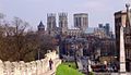
 The Minster - geograph.org.uk - 3828693.jpg 4,530 × 3,275; 7.59 MB
-
 Towards Acres House - geograph.org.uk - 3810107.jpg 640 × 427; 128 KB
-
 Towards Constantine College - geograph.org.uk - 3810811.jpg 640 × 480; 89 KB
-
 Towards the railway - geograph.org.uk - 3805800.jpg 640 × 427; 65 KB
-
 Towards Wheldrake Grange - geograph.org.uk - 3810676.jpg 640 × 427; 53 KB
-
 Towthorpe Moor Lane - geograph.org.uk - 3805791.jpg 640 × 427; 121 KB
-
 Towthorpe Road - geograph.org.uk - 3805804.jpg 640 × 427; 64 KB
-
 Track to A64 - geograph.org.uk - 3810100.jpg 640 × 427; 90 KB
-
 Track to Moor Lane - geograph.org.uk - 3810342.jpg 640 × 427; 67 KB
-
 Tree alongside Wheldrake Lane - geograph.org.uk - 3810679.jpg 640 × 427; 53 KB
-
 Tree near Wheldrake Grange - geograph.org.uk - 3810677.jpg 640 × 427; 63 KB
-
 Under the ring road - geograph.org.uk - 3805813.jpg 640 × 427; 68 KB
-
 University of York, J.B. Morrell Library - geograph.org.uk - 3814070.jpg 899 × 1,600; 275 KB
-

-
 Upstream from Naburn Bridge - geograph.org.uk - 3834469.jpg 640 × 480; 53 KB
-
 Walmgate Stray in the fog, York.jpg 2,560 × 1,920; 1.2 MB
-
 Wheldrake Grange - geograph.org.uk - 3810681.jpg 640 × 427; 60 KB
-
 Wheldrake Lane near Wheldrake Grange - geograph.org.uk - 3810680.jpg 640 × 427; 63 KB
-
 York Minster12082.jpg 599 × 344; 90 KB
-
 York Road - geograph.org.uk - 3805810.jpg 640 × 427; 63 KB
-
 York, UK - panoramio (88).jpg 1,540 × 1,122; 609 KB
-
 York, UK - panoramio (94).jpg 1,600 × 1,201; 678 KB
-
 York-Scarborough railway - geograph.org.uk - 3805801.jpg 640 × 427; 83 KB
.jpg)


.jpg)


.jpg)


.jpg)
.jpg)
