Category:January 2017 in the East Riding of Yorkshire
Ceremonial counties of England: Bedfordshire · Berkshire · Buckinghamshire · Cornwall · Derbyshire · Devon · Dorset · Durham · East Riding of Yorkshire · East Sussex · Essex · Gloucestershire · Greater London · Greater Manchester · Hampshire · Herefordshire · Hertfordshire · Isle of Wight · Kent · Lancashire · Leicestershire · Lincolnshire · Merseyside · Norfolk · North Yorkshire · Nottinghamshire · Oxfordshire · Shropshire · Somerset · South Yorkshire · Staffordshire · Suffolk · Surrey · Tyne and Wear · West Midlands · West Yorkshire · Worcestershire
City-counties: Bristol ·
Former historic counties:
Other former counties:
City-counties: Bristol ·
Former historic counties:
Other former counties:
Deutsch: Bilder, die im Januar 2017 in the East Riding of Yorkshire aufgenommen worden sind. Bitte beachten Sie, dass dies weder das Datum des Uploads noch das Datum des Scannens eines Fotos ist.
English: Images/pictures taken in the East Riding of Yorkshire during January 2017. Note this is not the date of the upload, nor the date a photo was scanned.
Español: Fotografías o imágenes tomadas en the East Riding of Yorkshire durante enero 2017. No es la fecha de subida ni escaneo, sino la fecha en que las fotografías o imágenes se crearon.
Esperanto: Bildoj faritaj en the East Riding of Yorkshire en januaro 2017. Tio ne estas la dato, kiam la bildoj estis alŝutitaj aŭ skanitaj.
Français : Photographies ou images prises en the East Riding of Yorkshire durant janvier 2017. Ce n'est pas la date du téléchargement ou du scan.
Galego: Fotografías ou imaxes tomadas en the East Riding of Yorkshire durante xaneiro 2017. Non é a data de subida nin escaneamento, senón a data na que se crearon as fotografías ou imaxes.
Italiano: Fotografie o immagini scattate a the East Riding of Yorkshire nel gennaio 2017. Nota bene: la data non si riferisce né a quella di upload né a quella in cui la foto è stata digitalizzata.
Norsk bokmål: Bilder tatt i the East Riding of Yorkshire i løpet av januar 2017. Merk at dette ikke er datoen for opplasting, eller når et bilde har blitt skannet.
Norsk nynorsk: Bilete teke i the East Riding of Yorkshire i løpet av januar 2017. Merk at dette ikkje er datoen for opplasting, eller når eit bilete har vorte skanna.
Русский: Изображения, сделанные в the East Riding of Yorkshire в течение январь 2017 (не дата загрузки изображения).
Українська: Зображення, зроблені в the East Riding of Yorkshire протягом січень 2017. Зауважте, що це не дата завантаження чи дата сканування фотографії.
| January 2016 | ← | January 2017 | → | January 2018 | |||||||
| Jan | Feb | Mar | Apr | May | Jun | Jul | Aug | Sep | Oct | Nov | Dec |
| 165 | 30 | 62 | 27 | 80 | 25 | 89 | 56 | 79 | 26 | 54 | 33 |
|---|---|---|---|---|---|---|---|---|---|---|---|
Subcategories
This category has only the following subcategory.
Media in category "January 2017 in the East Riding of Yorkshire"
The following 164 files are in this category, out of 164 total.
-
 1053155 Flight Sergeant Nicholas Saravanos (geograph 5251383).jpg 799 × 1,200; 478 KB
-
 1234614 Sergeant John Kirby (geograph 5251387).jpg 795 × 1,200; 301 KB
-
 169, Keldgate (geograph 5449337).jpg 640 × 426; 68 KB
-
 A little used footpath toward Hempholme Lock (geograph 5268447).jpg 4,532 × 3,354; 5.52 MB
-
 A sea of green (geograph 5436264).jpg 640 × 426; 46 KB
-
 A614 (geograph 5429799).jpg 640 × 426; 47 KB
-
 A63 eastbound at Melton (geograph 5254433).jpg 640 × 511; 63 KB
-
 A63 eastbound at Welton (geograph 5254431).jpg 640 × 513; 53 KB
-
 Across the fields near Withernwick Grange (geograph 5259016).jpg 640 × 474; 69 KB
-
 Afternoon shadow on the River Hull (geograph 5268580).jpg 4,546 × 3,372; 5.04 MB
-
 Aldbrough Road, Withernwick (geograph 5260848).jpg 1,200 × 799; 241 KB
-
 All Saint's Church, North Ferriby (geograph 5251233).jpg 679 × 1,200; 357 KB
-
 All Saint's Church, North Ferriby (geograph 5251234).jpg 799 × 1,200; 448 KB
-
 All Saint's Church, North Ferriby (geograph 5251237).jpg 649 × 1,200; 377 KB
-
 All Saint's Church, North Ferriby (geograph 5251238).jpg 540 × 1,200; 241 KB
-
 All Saint's Church, North Ferriby (geograph 5251239).jpg 812 × 1,200; 413 KB
-
 All Saint's Church, North Ferriby (geograph 5251241).jpg 776 × 1,200; 430 KB
-
 All Saint's Church, North Ferriby (geograph 5251242).jpg 752 × 1,200; 359 KB
-
 All Saint's Church, North Ferriby (geograph 5251244).jpg 690 × 1,200; 347 KB
-
 All Saint's Church, North Ferriby (geograph 5251340).jpg 758 × 1,200; 457 KB
-
 All Saint's Church, North Ferriby (geograph 5251341).jpg 799 × 1,200; 291 KB
-
 All Saint's Church, North Ferriby (geograph 5251342).jpg 1,200 × 799; 308 KB
-
 All Saint's Church, North Ferriby (geograph 5251343).jpg 858 × 1,200; 483 KB
-
 Almshouses (geograph 5451856).jpg 640 × 426; 54 KB
-
 Angram Farm Watton Carrs (geograph 5268636).jpg 4,608 × 3,456; 5.67 MB
-
 B1230 (geograph 5449335).jpg 640 × 426; 64 KB
-
 B1445 at Weeton village boundary (geograph 5255459).jpg 640 × 512; 57 KB
-

-
 Beverley 20 at York Grounds Farm - geograph.org.uk - 5254219.jpg 1,200 × 799; 480 KB
-
 Beverley 20 to Black Mill (geograph 5451897).jpg 640 × 426; 60 KB
-
 Beverley 20 Walk, The Westwood (geograph 5451882).jpg 640 × 426; 79 KB
-
 Beverley and Barmston Drain from Top Hill Low bridge (geograph 5268609).jpg 4,606 × 3,454; 7.72 MB
-
 Beverley and Barmston Drain Top Hill Low (geograph 5268602).jpg 4,574 × 3,410; 5.49 MB
-
 Beverley Minster (geograph 5246554).jpg 480 × 640; 70 KB
-
 Black Mill (geograph 5451898).jpg 426 × 640; 50 KB
-
 Black Mill (geograph 5451900).jpg 426 × 640; 52 KB
-
 Black Mill (geograph 5451903).jpg 425 × 640; 62 KB
-
 Black Mill (geograph 5451909).jpg 640 × 426; 54 KB
-
 Black Mill, The Westwood (geograph 5451889).jpg 640 × 426; 52 KB
-
 Black Mill, The Westwood (geograph 5456671).jpg 640 × 426; 63 KB
-
 Boggy pond (geograph 5449927).jpg 640 × 425; 59 KB
-
 Bow Lane towards Melton Bottom (geograph 5251570).jpg 1,200 × 799; 426 KB
-
 Bridleway towards Melton Bottom (geograph 5251568).jpg 1,200 × 799; 503 KB
-
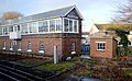 Bridlington South Signalbox (geograph 5424298).jpg 640 × 395; 85 KB
-
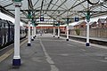 Bridlington Station (geograph 5403081).jpg 640 × 426; 79 KB
-
 Brookside, Welton (geograph 5251561).jpg 1,200 × 799; 313 KB
-
 Browns (The Former Corn Exchange) (geograph 5457551).jpg 640 × 426; 65 KB
-
 Cartwright Lane, B1230 (geograph 5451859).jpg 640 × 426; 71 KB
-
 Cartwright Lane, B1230 (geograph 5451860).jpg 640 × 426; 64 KB
-
 Cartwright Lane, B1230 (geograph 5451861).jpg 640 × 426; 86 KB
-
 Cemetery, Cartwright Lane (geograph 5451864).jpg 640 × 426; 83 KB
-
 Central Avenue (geograph 5451867).jpg 640 × 426; 85 KB
-
 Church Lane (geograph 5436273).jpg 640 × 426; 57 KB
-
 Clearway lorries at Melton Bottom (geograph 5251645).jpg 1,200 × 799; 535 KB
-
 Drain by Wood Lane (B1228) (geograph 5268622).jpg 1,024 × 768; 162 KB
-
 Driffield Town Hall (geograph 5436500).jpg 640 × 426; 67 KB
-
 Dry pond (geograph 5456660).jpg 640 × 426; 84 KB
-
 Easingwold Farm Watton Carrs (geograph 5268621).jpg 4,580 × 3,418; 4.92 MB
-
 Entering Watton on Carr Lane (geograph 5268657).jpg 4,608 × 3,456; 5.93 MB
-
 Entering Westwood Pasture, B1230 (geograph 5451872).jpg 640 × 426; 63 KB
-
 Environment Agency Incident Command Unit (geograph 5257196).jpg 1,200 × 799; 368 KB
-
 Farm track to Watton Abbey Farm (geograph 5436271).jpg 640 × 426; 58 KB
-
 Farm track to Watton Abbey Farm (geograph 5449931).jpg 640 × 425; 58 KB
-
 Farm track towards Turtle Hill (geograph 5254233).jpg 1,200 × 799; 388 KB
-
 Featherbed Drain and Featherbed Lane (geograph 5268624).jpg 1,024 × 768; 255 KB
-
 Fertiliser depot (geograph 5265604).jpg 1,024 × 662; 76 KB
-
 Flat farmland (geograph 5436274).jpg 640 × 426; 57 KB
-
 Footbridge over Roam Drain (geograph 5268497).jpg 4,608 × 3,456; 7.34 MB
-
 Footpath along hedge (geograph 5429901).jpg 640 × 426; 64 KB
-
 Footpath over Lock Hill to Hempholme (geograph 5268469).jpg 4,608 × 3,456; 7.12 MB
-
 Footpath, ditch and hedge (geograph 5436263).jpg 640 × 426; 75 KB
-
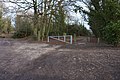
 Gate across Featherbed Lane (geograph 5265609).jpg 1,024 × 768; 257 KB
-
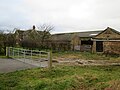
 Gatehouse Farm (geograph 5449929).jpg 640 × 426; 43 KB
-
 Golf Course, The Westwood (geograph 5451911).jpg 640 × 426; 68 KB
-
 Golf Course, The Westwood (geograph 5451913).jpg 640 × 426; 32 KB
-
 Golf Course, The Westwood (geograph 5451915).jpg 640 × 426; 60 KB
-
 Graveyard at St Helen's Church, Welton (geograph 5251559).jpg 1,200 × 799; 389 KB
-
 Hempholme Lock name board (geograph 5268565).jpg 3,069 × 2,304; 2.86 MB
-
 Keldgate Road (geograph-5451877).jpg 640 × 426; 68 KB
-
 Kilnwick New Cut (geograph 5436275).jpg 640 × 394; 40 KB
-
 Kilnwick New Cut (geograph 5449925).jpg 640 × 443; 62 KB
-
 Kirby Drain running south from Blue Keld (geograph 5268650).jpg 3,388 × 4,558; 6.31 MB
-
 Leaving Warter on the minor road to Huggate (geograph 5265572).jpg 4,414 × 3,180; 5.23 MB
-
 Lodge on York Rd - geograph.org.uk - 5456804.jpg 640 × 426; 66 KB
-
 Looking north on Roam Drain (geograph 5268484).jpg 4,538 × 3,362; 6.86 MB
-
 Lumps and bumps, The Westwood (geograph 5456662).jpg 640 × 426; 56 KB
-
 Main Street, Welwick, at North Lane (geograph 5255447).jpg 640 × 480; 47 KB
-
 Near Priest Ings (geograph 5443503).jpg 640 × 426; 48 KB
-
 Near Watton Abbey Farm (geograph 5429900).jpg 640 × 426; 43 KB
-
 Newbald Rd, York Rd junction - geograph.org.uk - 5456704.jpg 640 × 426; 104 KB
-
 Open woodland, The Westwood (geograph 5451884).jpg 640 × 426; 126 KB
-
 Over field to Middleflat Plantation (geograph 5268627).jpg 4,592 × 3,436; 7.24 MB
-
 Overcast sky but a little sun to cast a shadow on the River Hull (geograph 5268588).jpg 3,456 × 4,608; 5.3 MB
-
 Paddock, Hutton Cranswick (geograph 5429899).jpg 640 × 426; 49 KB
-
 Pasture, The Nuns (geograph 5436272).jpg 640 × 426; 54 KB
-
 Post Office on Church Road, North Ferriby (geograph 5254271).jpg 1,200 × 799; 356 KB
-
 Queengate (geograph 5451857).jpg 640 × 426; 70 KB
-
 River Hull New Cut above Hempholme Lock (geograph 5268547).jpg 4,504 × 3,312; 4.29 MB
-
 River Hull south of sluice gates at Hempholme Lock (geograph 5268561).jpg 4,530 × 3,350; 5.08 MB
-
 Rough grasses (geograph 5443500).jpg 640 × 347; 48 KB
-
 Rough grazing below Horn Hill (geograph 5252685).jpg 1,024 × 768; 218 KB
-
 Shops on Church Road, North Ferriby (geograph 5254264).jpg 1,200 × 799; 318 KB
-
 St Albans Church, Withernwick (geograph 5260812).jpg 1,200 × 804; 328 KB
-
 St Albans Church, Withernwick (geograph 5260821).jpg 1,200 × 799; 317 KB
-
 St Albans Church, Withernwick (geograph 5260824).jpg 799 × 1,200; 296 KB
-
 St Albans Church, Withernwick (geograph 5260828).jpg 640 × 1,200; 272 KB
-
 St Albans Church, Withernwick (geograph 5260840).jpg 1,200 × 799; 255 KB
-
 St Albans Churchyard, Withernwick (geograph 5260687).jpg 1,200 × 799; 516 KB
-
 St Albans Churchyard, Withernwick (geograph 5260817).jpg 1,200 × 799; 458 KB
-
 St Helen's Church, Welton (geograph 5251408).jpg 810 × 1,200; 319 KB
-
 St Helen's Church, Welton (geograph 5251412).jpg 1,200 × 799; 277 KB
-
 St Helen's Church, Welton (geograph 5251416).jpg 1,094 × 1,200; 660 KB
-
 St Helen's Church, Welton (geograph 5251418).jpg 735 × 1,200; 355 KB
-
 St Helen's Church, Welton (geograph 5251421).jpg 1,164 × 1,200; 488 KB
-
 St Helen's Church, Welton (geograph 5251422).jpg 769 × 1,200; 500 KB
-
 St Helen's Church, Welton (geograph 5251424).jpg 777 × 1,200; 436 KB
-
 St Helen's Church, Welton (geograph 5251434).jpg 733 × 1,200; 318 KB
-
 St Helen's Church, Welton (geograph 5251438).jpg 609 × 1,200; 290 KB
-
 St Helen's Church, Welton (geograph 5251446).jpg 807 × 1,200; 406 KB
-
 St Helen's Church, Welton (geograph 5251548).jpg 1,200 × 799; 222 KB
-
 St Helen's Church, Welton (geograph 5251551).jpg 1,200 × 1,064; 579 KB
-
 St Mary Parish Church Watton (geograph 5268670).jpg 4,596 × 3,440; 5.25 MB
-
 Sunrise near Withernwick (geograph 5259026).jpg 640 × 499; 145 KB
-
 Terrace Plantation towards the A63 (geograph 5251649).jpg 1,200 × 799; 585 KB
-
 Terrace, York Rd - geograph.org.uk - 5456795.jpg 640 × 426; 95 KB
-
 Terrace, York Rd - geograph.org.uk - 5456808.jpg 640 × 426; 71 KB
-
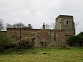
 The Blackmill (geograph 5246557).jpg 480 × 640; 56 KB
-
 The Bus Station, Beverley - geograph.org.uk - 5267589.jpg 1,024 × 768; 118 KB
-
 The Masters House (geograph 5251708).jpg 1,200 × 799; 413 KB
-
 The Royal Oak (geograph 5451868).jpg 640 × 426; 76 KB
-
 The Westwood (geograph 5451876).jpg 640 × 426; 63 KB
-
 The Westwood (geograph 5451879).jpg 640 × 426; 53 KB
-
 The Westwood (geograph 5451880).jpg 640 × 426; 75 KB
-
 The Westwood (geograph 5451881).jpg 640 × 426; 62 KB
-
 The Westwood (geograph 5451883).jpg 640 × 426; 78 KB
-
 The Westwood (geograph 5451894).jpg 640 × 426; 58 KB
-
 The Westwood (geograph 5451895).jpg 640 × 426; 54 KB
-
 The Westwood (geograph 5451906).jpg 640 × 426; 69 KB
-
 The Westwood (geograph 5451907).jpg 640 × 426; 68 KB
-
 The Westwood (geograph 5451914).jpg 640 × 426; 67 KB
-
 The Westwood (geograph 5451916).jpg 640 × 426; 68 KB
-
 The Westwood (geograph 5456661).jpg 640 × 426; 63 KB
-
 Throstle Nest Farm Watton Carrs (geograph 5268642).jpg 4,526 × 3,346; 5.71 MB
-
 Top Shop (geograph 5451865).jpg 640 × 426; 76 KB
-
 View towards Beverley Racecourse (geograph 5451892).jpg 640 × 426; 57 KB
-
 View towards Wressle Castle (geograph 5254348).jpg 1,024 × 768; 249 KB
-
 View towards Wressle Castle (geograph 5254727).jpg 1,024 × 768; 150 KB
-
 Walkington Road (geograph 5451885).jpg 640 × 426; 85 KB
-
 Walkington Road (geograph 5451886).jpg 640 × 426; 68 KB
-
 Watton Abbey Farm (geograph 5436268).jpg 640 × 388; 49 KB
-
 Watton Abbey Farm (geograph 5436269).jpg 640 × 426; 65 KB
-
 Watton level crossing from Church Lane (geograph 5268662).jpg 4,498 × 3,306; 4.5 MB
-
 Wesleyan Church, Withernwick (geograph 5260679).jpg 1,200 × 799; 272 KB
-
 Westwood (geograph 5451871).jpg 640 × 426; 43 KB
-
 Wind turbine (geograph 5436266).jpg 640 × 426; 21 KB
-
 Wind Turbine near York Grounds Farm (geograph 5254227).jpg 850 × 1,200; 205 KB
-
 Wooded pit, The Westwood (geograph 5451874).jpg 640 × 426; 88 KB
-
 Work on a small stream on Cowgate, Welton (geograph 5251557).jpg 1,200 × 799; 518 KB
-
 York Grounds Farm - geograph.org.uk - 5254161.jpg 1,200 × 799; 262 KB
-
 York Rd - geograph.org.uk - 5456737.jpg 640 × 426; 79 KB
-
 York Rd - geograph.org.uk - 5456765.jpg 640 × 426; 76 KB
-
 York Rd, The Westwood - geograph.org.uk - 5456739.jpg 640 × 426; 90 KB
-
 York Rd, The Westwood - geograph.org.uk - 5456745.jpg 640 × 426; 93 KB
-
 Yorkshire Wolds Way in Dale Plantation (geograph 5254255).jpg 1,200 × 799; 514 KB
.jpg)
.jpg)
.jpg)
.jpg)
.jpg)
.jpg)
.jpg)
.jpg)
.jpg)
.jpg)
.jpg)
.jpg)
.jpg)
.jpg)
.jpg)
.jpg)
.jpg)
.jpg)
.jpg)
.jpg)
.jpg)
.jpg)
.jpg)
.jpg)
.jpg)
.jpg)
.jpg)
.jpg)

.jpg)
.jpg)
.jpg)
.jpg)
.jpg)
.jpg)
.jpg)
.jpg)
.jpg)
.jpg)
.jpg)
.jpg)
.jpg)
.jpg)
.jpg)
.jpg)
.jpg)
_(geograph_5457551).jpg)
.jpg)
.jpg)
.jpg)
.jpg)
.jpg)
.jpg)
_(geograph_5268622).jpg)
.jpg)
.jpg)
.jpg)
.jpg)
.jpg)
.jpg)
.jpg)
.jpg)
.jpg)
.jpg)
.jpg)
.jpg)
.jpg)
.jpg)
.jpg)
.jpg)
.jpg)
.jpg)
.jpg)
.jpg)
.jpg)
.jpg)
.jpg)
.jpg)
.jpg)
.jpg)
.jpg)
.jpg)

.jpg)
.jpg)
.jpg)
.jpg)
.jpg)

.jpg)
.jpg)
.jpg)
.jpg)
.jpg)
.jpg)
.jpg)
.jpg)
.jpg)
.jpg)
.jpg)
.jpg)
.jpg)
.jpg)
.jpg)
.jpg)
.jpg)
.jpg)
.jpg)
.jpg)
.jpg)
.jpg)
.jpg)
.jpg)
.jpg)
.jpg)
.jpg)
.jpg)
.jpg)
.jpg)
.jpg)
.jpg)
.jpg)
.jpg)


.jpg)

.jpg)
.jpg)
.jpg)
.jpg)
.jpg)
.jpg)
.jpg)
.jpg)
.jpg)
.jpg)
.jpg)
.jpg)
.jpg)
.jpg)
.jpg)
.jpg)
.jpg)
.jpg)
.jpg)
.jpg)
.jpg)
.jpg)
.jpg)
.jpg)
.jpg)
.jpg)
.jpg)
.jpg)
.jpg)
.jpg)


.jpg)
.jpg)