Category:Joods monument in de Broerstraat, Appingedam
| Object location | | View all coordinates using: OpenStreetMap |
|---|
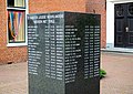
war memorial in Appingedam, the Netherlands  | |||||
| Upload media | |||||
| Instance of | |||||
|---|---|---|---|---|---|
| Genre | |||||
| Location | Appingedam, Eemsdelta, Groningen, Netherlands | ||||
| Street address |
| ||||
| Inception |
| ||||
| Date of official opening |
| ||||
 | |||||
|
This is a category about a war memorial in the Netherlands, number: 1854
|
Media in category "Joods monument in de Broerstraat, Appingedam"
The following 5 files are in this category, out of 5 total.
-
 20151009 Joods monument Appingedam.jpg 4,714 × 3,536; 2.18 MB
-
 InZicht Appingedam 115.JPG 3,648 × 2,598; 2.03 MB
-
 InZicht Appingedam 118.JPG 3,648 × 2,598; 1.6 MB
-
 InZicht Appingedam 119.JPG 3,385 × 2,400; 1.48 MB
-
 Joods monument Appingedam.jpg 1,368 × 1,824; 786 KB


