Category:July 2016 in Kent
Ceremonial counties of England: Bedfordshire · Berkshire · Buckinghamshire · Cambridgeshire · Cheshire · Cornwall · Cumbria · Derbyshire · Devon · Dorset · Durham · East Riding of Yorkshire · East Sussex · Essex · Gloucestershire · Greater London · Greater Manchester · Hampshire · Herefordshire · Hertfordshire · Isle of Wight · Kent · Lancashire · Leicestershire · Lincolnshire · Merseyside · Norfolk · North Yorkshire · Northamptonshire · Northumberland · Nottinghamshire · Oxfordshire · Shropshire · Somerset · Staffordshire · Suffolk · Surrey · Tyne and Wear · Warwickshire · West Midlands · West Sussex · West Yorkshire · Wiltshire · Worcestershire
City-counties: Bristol ·
Former historic counties:
Other former counties:
City-counties: Bristol ·
Former historic counties:
Other former counties:
Deutsch: Bilder, die im Juli 2016 in Kent aufgenommen worden sind. Bitte beachten Sie, dass dies weder das Datum des Uploads noch das Datum des Scannens eines Fotos ist.
English: Images/pictures taken in Kent during July 2016. Note this is not the date of the upload, nor the date a photo was scanned.
Español: Fotografías o imágenes tomadas en Kent durante julio 2016. No es la fecha de subida ni escaneo, sino la fecha en que las fotografías o imágenes se crearon.
Esperanto: Bildoj faritaj en Kent en julio 2016. Tio ne estas la dato, kiam la bildoj estis alŝutitaj aŭ skanitaj.
Français : Photographies ou images prises en Kent durant juillet 2016. Ce n'est pas la date du téléchargement ou du scan.
Galego: Fotografías ou imaxes tomadas en Kent durante xullo 2016. Non é a data de subida nin escaneamento, senón a data na que se crearon as fotografías ou imaxes.
Italiano: Fotografie o immagini scattate a Kent nel luglio 2016. Nota bene: la data non si riferisce né a quella di upload né a quella in cui la foto è stata digitalizzata.
Norsk bokmål: Bilder tatt i Kent i løpet av juli 2016. Merk at dette ikke er datoen for opplasting, eller når et bilde har blitt skannet.
Norsk nynorsk: Bilete teke i Kent i løpet av juli 2016. Merk at dette ikkje er datoen for opplasting, eller når eit bilete har vorte skanna.
Русский: Изображения, сделанные в Kent в течение июль 2016 (не дата загрузки изображения).
Українська: Зображення, зроблені в Kent протягом липень 2016. Зауважте, що це не дата завантаження чи дата сканування фотографії.
| July 2015 | ← | July 2016 | → | July 2017 | |||||||
| Jan | Feb | Mar | Apr | May | Jun | Jul | Aug | Sep | Oct | Nov | Dec |
| 125 | 19 | 134 | 73 | 584 | 32 | 66 | 559 | 17 | 31 | 182 | 119 |
|---|---|---|---|---|---|---|---|---|---|---|---|
Subcategories
This category has the following 4 subcategories, out of 4 total.
Media in category "July 2016 in Kent"
The following 62 files are in this category, out of 62 total.
-
 1 and 2 Union Square, Broadstairs - geograph.org.uk - 5064389.jpg 3,456 × 5,184; 6.31 MB
-
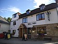 The Bell Inn, Bearsted (geograph 5039391).jpg 2,304 × 1,728; 834 KB
-
 28.07.16 Maidstone West 466.031 (28798323925).jpg 5,809 × 3,372; 11.06 MB
-
 28.07.16 Sheerness-on-Sea 466.033 (28682175221).jpg 5,838 × 3,306; 9.89 MB
-
 3 and 4 Union Square, Broadstairs - geograph.org.uk - 5064368.jpg 3,456 × 5,184; 6.36 MB
-
 375707 at Ramsgate .jpg 1,920 × 1,080; 794 KB
-
 37800 passes Wye.jpg 2,000 × 1,500; 935 KB
-
 5 and 6 Union Square, Broadstairs - geograph.org.uk - 5064312.jpg 3,456 × 5,184; 7.38 MB
-
 59104 Village of Great Elm at Allington Sidings on 13th July 2016.jpg 2,560 × 1,536; 1.06 MB
-
 A cat in Whitstable.jpg 4,284 × 2,856; 3.89 MB
-
 A228 - geograph.org.uk - 5225933.jpg 640 × 426; 90 KB
-
 A228 - geograph.org.uk - 5225934.jpg 640 × 426; 94 KB
-
 Accelerating towards a clear signal.jpg 4,000 × 3,000; 5.66 MB
-
 All Saints Church, Eastchurch - Altar 1.jpg 5,184 × 3,456; 6.08 MB
-
 All Saints Church, Eastchurch - Heritage fund.jpg 5,184 × 3,456; 4.63 MB
-
 All Saints Church, Eastchurch - Lady Chapel.jpg 5,184 × 3,456; 7.28 MB
-
 Allotments - geograph.org.uk - 5248314.jpg 640 × 426; 81 KB
-
 ASDA - geograph.org.uk - 5302582.jpg 640 × 426; 49 KB
-
 Blackhurst Lane (ex) - geograph.org.uk - 5225800.jpg 640 × 426; 92 KB
-
 Byron Avenue, Margate - geograph.org.uk - 5059113.jpg 2,448 × 2,448; 2.15 MB
-
 Cambrian rd - geograph.org.uk - 5329978.jpg 640 × 426; 58 KB
-
 Church of Christ - geograph.org.uk - 5329981.jpg 640 × 426; 52 KB
-
 Class 395 and the setting sun.jpg 4,000 × 3,000; 4.22 MB
-
 Cornford Lane - geograph.org.uk - 5249022.jpg 640 × 426; 105 KB
-
 D7612 (Steptoe) at Swanley New Barn Railway (28655968425).jpg 4,411 × 2,752; 4.09 MB
-
 Dickens House, 2 Victoria Parade, Broadstairs - geograph.org.uk - 5064703.jpg 5,184 × 3,456; 6.74 MB
-
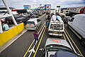 Dover Ferry.jpg 4,368 × 2,912; 2.74 MB
-
 Flower and Crafts Festival at St Thomas Church, Harty - geograph.org.uk - 5022052.jpg 4,608 × 3,456; 3.37 MB
-
 Folkestone Harbour station approach, 2016.JPG 3,089 × 2,048; 3.54 MB
-
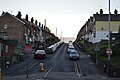
 Gravesend West Street - geograph-5063697-by-John-Baker.jpg 3,264 × 2,448; 1.63 MB
-
 High Brooms Station - geograph.org.uk - 5273688.jpg 640 × 426; 88 KB
-
 High Brooms Station - geograph.org.uk - 5329965.jpg 640 × 425; 63 KB
-
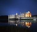 Leeds Castle At Night.jpg 3,435 × 2,996; 1.51 MB
-

-
 Looking east along Brewer Street - geograph.org.uk - 5039183.jpg 800 × 600; 121 KB
-
 Low tide in Whitstable - panoramio (1).jpg 5,065 × 3,376; 3.99 MB
-
 Low tide in Whitstable - panoramio (2).jpg 4,437 × 2,958; 4.44 MB
-
 Low tide in Whitstable - panoramio (3).jpg 5,062 × 3,374; 12.27 MB
-
 Low tide in Whitstable - panoramio (4).jpg 4,849 × 3,233; 9.2 MB
-
 Low tide in Whitstable - panoramio.jpg 4,655 × 3,103; 3.52 MB
-
 Low tide in Whitstable-1.jpg 5,012 × 3,341; 4.29 MB
-
 Low tide in Whitstable.jpg 3,452 × 2,301; 2.76 MB
-
 My camera sucks in low light.jpg 4,000 × 3,000; 4.25 MB
-
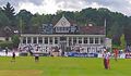
 Nevill Ground Tunbridge Wells pavilion (cropped).jpg 1,056 × 792; 576 KB
-
 Nevill Ground Tunbridge Wells pavilion.jpg 1,474 × 856; 892 KB
-
 Nevill Ground Tunbridge Wells Railway End.jpg 1,080 × 1,080; 127 KB
-
 North Sea - panoramio (1).jpg 4,388 × 2,928; 3.37 MB
-
 North Sea - panoramio.jpg 4,708 × 3,138; 3.77 MB
-
 Oyster shells in Whitstable.jpg 4,999 × 3,333; 4.51 MB
-
 Pitstock Road, Dungate (geograph 5016185).jpg 3,264 × 2,448; 1.95 MB
-
 Rabada.jpg 785 × 912; 414 KB
-
 Railway Bridge, Sandhurst Rd - geograph.org.uk - 5329974.jpg 640 × 425; 68 KB
-
 Rainbow over Tunbridge Wells - geograph.org.uk - 5262010.jpg 640 × 426; 43 KB
-
 Seagulls in Whitstable.jpg 3,129 × 2,086; 1.3 MB
-
 St John Ambulance, Silverdale Rd - geograph.org.uk - 5329990.jpg 640 × 426; 73 KB
-
 St Michael's Rd - geograph.org.uk - 5330002.jpg 640 × 426; 84 KB
-
 Wharfedale Road, Margate - geograph.org.uk - 5059173.jpg 2,448 × 2,448; 1.23 MB
-
 Whitstable - panoramio (1).jpg 4,972 × 3,314; 4.15 MB
-
 Whitstable - panoramio (2).jpg 4,866 × 3,244; 3.5 MB
-
 Whitstable - panoramio.jpg 4,844 × 3,229; 3.99 MB
-
 Woodlands Rd - geograph.org.uk - 5329993.jpg 640 × 426; 64 KB
-
 York Terrace, Birchington-on-Sea - geograph.org.uk - 5057043.jpg 2,448 × 2,448; 1.42 MB

.jpg)
.jpg)
.jpg)


_-_geograph.org.uk_-_5225800.jpg)


_at_Swanley_New_Barn_Railway_(28655968425).jpg)


.jpg)
.jpg)
.jpg)
.jpg)


.jpg)


.jpg)


.jpg)


.jpg)
.jpg)


