Category:June 2008 in Argyll and Bute
Council areas (municipalities) of Scotland: Aberdeenshire · Argyll and Bute · Edinburgh · Fife · Glasgow · Highland · Orkney Islands · Scottish Borders ·
Deutsch: Bilder, die im Juni 2008 in Argyll and Bute aufgenommen worden sind. Bitte beachten Sie, dass dies weder das Datum des Uploads noch das Datum des Scannens eines Fotos ist.
English: Images/pictures taken in Argyll and Bute during June 2008. Note this is not the date of the upload, nor the date a photo was scanned.
Español: Fotografías o imágenes tomadas en Argyll and Bute durante junio 2008. No es la fecha de subida ni escaneo, sino la fecha en que las fotografías o imágenes se crearon.
Esperanto: Bildoj faritaj en Argyll and Bute en junio 2008. Tio ne estas la dato, kiam la bildoj estis alŝutitaj aŭ skanitaj.
Français : Photographies ou images prises en Argyll and Bute durant juin 2008. Ce n'est pas la date du téléchargement ou du scan.
Galego: Fotografías ou imaxes tomadas en Argyll and Bute durante xuño 2008. Non é a data de subida nin escaneamento, senón a data na que se crearon as fotografías ou imaxes.
Italiano: Fotografie o immagini scattate a Argyll and Bute nel giugno 2008. Nota bene: la data non si riferisce né a quella di upload né a quella in cui la foto è stata digitalizzata.
Norsk bokmål: Bilder tatt i Argyll and Bute i løpet av juni 2008. Merk at dette ikke er datoen for opplasting, eller når et bilde har blitt skannet.
Norsk nynorsk: Bilete teke i Argyll and Bute i løpet av juni 2008. Merk at dette ikkje er datoen for opplasting, eller når eit bilete har vorte skanna.
Русский: Изображения, сделанные в Argyll and Bute в течение июнь 2008 (не дата загрузки изображения).
Українська: Зображення, зроблені в Argyll and Bute протягом червень 2008. Зауважте, що це не дата завантаження чи дата сканування фотографії.
| June 2007 | ← | June 2008 | → | June 2009 | |||||||
| Jan | Feb | Mar | Apr | May | Jun | Jul | Aug | Sep | Oct | Nov | Dec |
| 10 | 66 | 45 | 129 | 38 | 47 | 104 | 25 | 21 | 72 | 29 | 72 |
|---|---|---|---|---|---|---|---|---|---|---|---|
Media in category "June 2008 in Argyll and Bute"
The following 47 files are in this category, out of 47 total.
-
 Argyll Street - geograph.org.uk - 838052.jpg 640 × 480; 97 KB
-
 Argyll Street - geograph.org.uk - 838213.jpg 640 × 480; 102 KB
-
 Argyll Street - geograph.org.uk - 838216.jpg 640 × 480; 98 KB
-
 Blairmore Pier - geograph.org.uk - 864842.jpg 640 × 480; 80 KB
-
 Blairmore Pier Sign - geograph.org.uk - 864848.jpg 640 × 480; 90 KB
-
 Blairmore Shops - geograph.org.uk - 864859.jpg 640 × 480; 74 KB
-
 Bullwood Quarry - geograph.org.uk - 838166.jpg 640 × 480; 96 KB
-
 Chalets at Lochgoilhead - geograph.org.uk - 918702.jpg 640 × 481; 71 KB
-

-
 Colonsay House Gardens loggia.jpg 243 × 161; 13 KB
-
 Dunoon Ferry Terminal - geograph.org.uk - 851609.jpg 1,024 × 683; 143 KB
-
 Edward VII Postbox, Kirn - geograph.org.uk - 851643.jpg 683 × 1,024; 144 KB
-
 Forestry Road, Ormidale Forest - geograph.org.uk - 852680.jpg 1,024 × 683; 195 KB
-
 Former Post Office and shops, Kirn - geograph.org.uk - 851642.jpg 1,024 × 683; 154 KB
-
 Going fishing on Loch Ard Achadh - geograph.org.uk - 1257907.jpg 640 × 480; 71 KB
-
 Holy Loch - geograph.org.uk - 838228.jpg 640 × 480; 78 KB
-
 Hunter's Quay - geograph.org.uk - 837903.jpg 640 × 480; 94 KB
-
 Hunter's Quay - geograph.org.uk - 838222.jpg 480 × 640; 76 KB
-
 Hunter's Quay boathouse - geograph.org.uk - 837922.jpg 640 × 448; 85 KB
-
 Kilmun Cottage - geograph.org.uk - 865199.jpg 640 × 480; 69 KB
-
 Lussa Loch Dam Kintyre - geograph.org.uk - 863477.jpg 640 × 415; 94 KB
-
 Lussa Loch Kintyre West Side - geograph.org.uk - 863456.jpg 640 × 426; 85 KB
-
 Noughts and Crosses - geograph.org.uk - 837979.jpg 520 × 640; 115 KB
-
 Old boat looking over Loch Ard Achadh - geograph.org.uk - 1257897.jpg 640 × 480; 121 KB
-
 Old quayside building - geograph.org.uk - 838211.jpg 640 × 480; 87 KB
-
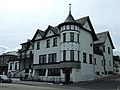 Ornate building at Kirn - geograph.org.uk - 838003.jpg 640 × 480; 89 KB
-
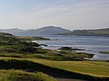
 Port Dubh - geograph.org.uk - 842361.jpg 640 × 428; 152 KB
-
 Post Office, Innellan - geograph.org.uk - 851619.jpg 1,024 × 683; 187 KB
-
 Road to Strachur, Otter Ferry - geograph.org.uk - 854531.jpg 1,024 × 683; 169 KB
-
 Sheep gathering at Gallanach - geograph.org.uk - 868329.jpg 640 × 480; 64 KB
-
 Skipness Castle - geograph.org.uk - 862866.jpg 640 × 446; 80 KB
-
 Skipness Castle - geograph.org.uk - 862872.jpg 640 × 385; 86 KB
-
 Skipness Kirk and Memorial - geograph.org.uk - 862855.jpg 640 × 425; 111 KB
-
 Strone Point - geograph.org.uk - 837899.jpg 640 × 480; 91 KB
-
 Strone Point - geograph.org.uk - 837915.jpg 640 × 480; 104 KB
-
 Strone Point - geograph.org.uk - 839230.jpg 640 × 480; 87 KB
-
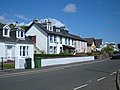 Strone Terrace - geograph.org.uk - 865190.jpg 640 × 480; 64 KB
-
 The Oystercatcher Pub and Restaurant - geograph.org.uk - 854543.jpg 1,024 × 683; 201 KB
-
 THE RUSSIAN TAVERN,Port Bannatyne, Isle of Bute.jpg 2,256 × 1,496; 1.9 MB
-
 This way to Gourock - geograph.org.uk - 838111.jpg 640 × 480; 88 KB
-
 Torosay Castle Gardens - geograph.org.uk - 1529308.jpg 480 × 640; 112 KB
-
 Victorian Postbox, Hunter's Quay - geograph.org.uk - 855417.jpg 683 × 1,024; 164 KB
-
-
 Village Inn, Arrochar - geograph.org.uk - 888669.jpg 640 × 480; 100 KB
-
 Welcome to Dunoon - geograph.org.uk - 838066.jpg 480 × 640; 102 KB
-
 West Bay, Dunoon - geograph.org.uk - 838194.jpg 640 × 480; 95 KB
-
 Western slopes of Beinn Oronsay - geograph.org.uk - 868107.jpg 640 × 480; 103 KB


