Category:June 2012 in Wales
English: Images taken in Wales in this month of 2012 (not the date of the upload).
| Jan | Feb | Mar | Apr | May | Jun | Jul | Aug | Sep | Oct | Nov | Dec | ||
| ← | 20 | 15 | 48 | 17 | 133 | 43 | 30 | 57 | 15 | 25 | 18 | 12 | → |
|---|
Subcategories
This category has the following 4 subcategories, out of 4 total.
C
- June 2012 in Carmarthen (19 F)
R
Media in category "June 2012 in Wales"
The following 39 files are in this category, out of 39 total.
-
 River Neath at Aberdulais Aqueduct.JPG 3,264 × 2,176; 3.12 MB
-
 Barmouth Bridge DSC01388c.jpg 1,152 × 888; 240 KB
-
 36 hour rainfall totals and evidence of erosion in West Wales, 8th-9th June 2012.tif 6,704 × 4,657; 2.15 MB
-
 Abergynolwyn Station (geograph 3103664).jpg 4,000 × 3,000; 4.01 MB
-
 Anglesey Hussars with cannon, Glynllifon.jpg 4,000 × 3,000; 4.35 MB
-

-
 Bridge over the A5, Chirk Bypass 3133987 d11b0211.jpg 640 × 430; 51 KB
-

-
 Carmel chapel, Troedyrhiw (geograph 2995821).jpg 640 × 561; 72 KB
-
 Coed Helen, Caernarfon.jpg 3,997 × 2,998; 1.46 MB
-
 DMU Lab 19 Iris II, Barry Tourist Railway 3.6.2012 009 (10196706745).jpg 2,048 × 1,536; 616 KB
-
 Elan Valley Visitor Centre - geograph.org.uk - 3014716.jpg 640 × 453; 64 KB
-
 Exterior detail, New Bethel chapel (geograph 2973278).jpg 640 × 480; 51 KB
-
 Ffordd-las fawr - geograph.org.uk - 2985031.jpg 640 × 480; 82 KB
-
 Former English Wesleyan Chapel, Troedyrhiw (geograph 2995792).jpg 542 × 640; 82 KB
-
 Journey to Snowdon Summit (7478150130).jpg 4,557 × 3,027; 12.63 MB
-
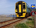
 Llanfairpwll railway station from walkway.JPG 4,288 × 2,848; 6.07 MB
-
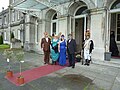 Masked ballgoers, Glynllifon.jpg 4,000 × 3,000; 4.98 MB
-

-
 No.2 'Dolgoch'.jpg 2,048 × 1,365; 2.27 MB
-
 Part of the Gower coast east of Mewslade (geograph 2977222).jpg 640 × 480; 80 KB
-
 Part of the graveyard at New Bethel chapel (geograph 2973270).jpg 640 × 480; 82 KB
-
 Roath Recreation Ground.jpg 1,984 × 1,488; 714 KB
-
 St. Tudor's church at Mynyddislwyn (geograph 2973236).jpg 640 × 480; 64 KB
-
 St. Tudor's church, Mynyddislwyn (geograph 2973244).jpg 640 × 480; 66 KB
-
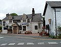 The Cornhill Inn, Rhayader - geograph.org.uk - 3017950.jpg 640 × 493; 71 KB
-
 The embankment of Lower Lliw reservoir (geograph 3005144).jpg 1,785 × 1,151; 1,007 KB
-
 The embankment of Lower Lliw reservoir (geograph 3005147).jpg 640 × 433; 98 KB
-
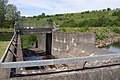 The overflow weir and spillway, Lower Lliw reservoir (geograph 3005138).jpg 1,955 × 1,300; 1.42 MB
-
 The pumping station at Lower Lliw reservoir (geograph 3005167).jpg 1,632 × 1,159; 1.04 MB
-

-
 The Three Tuns, Hay-on-Wye - geograph.org.uk - 3089938.jpg 640 × 378; 54 KB
-
 Toiledau dan ddaear.jpg 2,560 × 1,920; 1.95 MB
-
 Two Steamy Ladies (7676767912).jpg 4,511 × 2,633; 8.88 MB
-
 Twyn Tudor mound at Mynyddislwyn (geograph 2973257).jpg 640 × 480; 66 KB
-
 Uskmouth p.s to Stoke Gifford 4F56 with Class 66 951 in charge.jpg 2,630 × 1,844; 3.05 MB
-
 View down onto Mewslade Bay at low tide (geograph 2977172).jpg 640 × 480; 84 KB
-
 View down to Mewslade Bay at low tide (geograph 2977234).jpg 640 × 480; 70 KB
-


.jpg)


.jpg)

.jpg)

.jpg)

.jpg)
.jpg)


.jpg)
.jpg)

.jpg)
.jpg)

.jpg)
.jpg)
.jpg)
.jpg)


.jpg)
.jpg)

.jpg)
.jpg)
