Category:June 2017 in Maine
English: Images/pictures taken in Maine during June 2017. Note this is not the date of the upload, nor the date a photo was scanned.
States of the United States: Alabama · Alaska · Arizona · California · Colorado · Connecticut · Delaware · Florida · Georgia · Hawaii · Idaho · Illinois · Indiana · Iowa · Kentucky · Louisiana · Maine · Maryland · Massachusetts · Michigan · Minnesota · Mississippi · Missouri · Montana · Nebraska · Nevada · New Hampshire · New Jersey · New Mexico · New York · North Carolina · Ohio · Oklahoma · Oregon · Pennsylvania · Rhode Island · South Carolina · South Dakota · Tennessee · Texas · Utah · Vermont · Virginia · Washington · West Virginia · Wisconsin · Wyoming – Washington, D.C.
Guam
Guam
| June 2016 | ← | June 2017 | → | June 2018 | |||||||||
| Jan | Feb | Mar | Apr | May | Jun | Jul | Aug | Sep | Oct | Nov | Dec | ||
| ← | 23 | 9 | 11 | 12 | 97 | 120 | 20 | 19 | 9 | 8 | 2 | 5 | → |
|---|---|---|---|---|---|---|---|---|---|---|---|---|---|
Media in category "June 2017 in Maine"
The following 120 files are in this category, out of 120 total.
-
 Bald Mountain Trail image 3.jpg 4,608 × 3,456; 6 MB
-
 Bald Mountain Trail, Dedham, Maine image 1.jpg 4,608 × 3,456; 6.26 MB
-
 Bald Mountain Trail, Dedham, Maine image 2.jpg 4,608 × 3,456; 7.48 MB
-
 Bangor waterfront as seen from Brewer, Maine image 1.jpg 4,608 × 3,456; 4.12 MB
-
 Bangor waterfront as seen from Brewer, Maine image 2.jpg 4,608 × 3,456; 4.91 MB
-
 Beaver Dam Pond image 3.jpg 4,608 × 3,456; 4.65 MB
-
 Beaver Dam Pond image 4.jpg 4,608 × 3,456; 4.78 MB
-
 Bowditch Cemetery, Searsport Maine roadsign.jpg 4,608 × 3,456; 4.88 MB
-
 Brewer Maine Riverfront image 1.jpg 4,608 × 3,456; 4.52 MB
-
 Brewer waterfront image 1.jpg 4,608 × 3,456; 3.78 MB
-
 Brewer waterfront image 2.jpg 4,608 × 3,456; 5.31 MB
-
 Brewer waterfront image 3.jpg 4,608 × 3,456; 4.08 MB
-
 Brewer waterfront image 4.jpg 4,608 × 3,456; 4.18 MB
-
 Brewer waterfront image 5.jpg 4,608 × 3,456; 4.4 MB
-
 Brookside Cemetery, Dedham, Maine image 11.jpg 4,608 × 3,456; 7.26 MB
-
 Brookside Cemetery, Dedham, Maine image 12.jpg 3,456 × 4,608; 6.3 MB
-
 Brookside Cemetery, Dedham, Maine image 2.jpg 4,608 × 3,456; 5.55 MB
-
 Bubble Rock image three.jpg 4,608 × 3,456; 4.64 MB
-
 Buck's Tomb, Bucksport Maine image 5.jpg 3,456 × 4,608; 5.68 MB
-
 Carriage Road Overpass Bridge image three.jpg 4,608 × 3,456; 5.58 MB
-
 Carriage Road Overpass Bridge image two.jpg 4,608 × 3,456; 6.4 MB
-
 Chamberlain Bridge image 1.jpg 4,608 × 3,456; 3.81 MB
-
 Chamberlain Bridge image 2.jpg 4,608 × 3,456; 4.74 MB
-
 Civil War memorial, Searsport, Maine image 1.jpg 4,608 × 3,456; 5.86 MB
-
 Civil War memorial, Searsport, Maine image 2.jpg 4,608 × 3,456; 4.39 MB
-
 Civil War memorial, Searsport, Maine image 4.jpg 4,608 × 3,456; 3.9 MB
-
 Civilian Conservation Corps. memorial, Augusta, Maine.jpg 3,456 × 4,608; 4.24 MB
-
 Close up of artwork on Grave of Mrs. Abigail Park, Bowditch Cemetery, Searsport, Maine.jpg 4,608 × 3,456; 3.69 MB
-
 Close Up of Gemco Rotarider.jpg 4,608 × 3,456; 5.09 MB
-
 Close up of statue of deer, Unity Historical Society.jpg 4,608 × 3,456; 4.76 MB
-
 Dam on North Branch Marsh River, Frankfort, Maine image 1.jpg 4,608 × 3,456; 5.69 MB
-
 Dam on North Branch Marsh River, Frankfort, Maine image 2.jpg 4,608 × 3,456; 5.88 MB
-
 Dead Pines on Bald Mountain.jpg 4,608 × 3,456; 7.16 MB
-
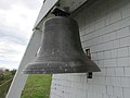
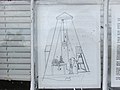 Diagram of Fort Point Light Station Fog Bell.jpg 4,608 × 3,456; 3.3 MB
-
 Ducks in Penobscot River image 1.jpg 4,608 × 3,456; 3.13 MB
-
 Ducks in Penobscot River image 2.jpg 4,608 × 3,456; 2.53 MB
-
 Ducks in Penobscot River image 3.jpg 4,608 × 3,456; 3.2 MB
-
 Ducks in Penobscot River image 4.jpg 4,608 × 3,456; 5.27 MB
-
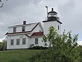
 Egg Rock Light Station.jpg 4,608 × 3,456; 3.6 MB
-
 Fire Escape (34556115963).jpg 1,022 × 1,400; 1.03 MB
-
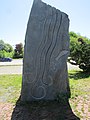
 Folk Art Tin Man.jpg 4,608 × 3,456; 4.31 MB
-
 Footbridge in Frankfort, Maine as seen from Rt. 1A.jpg 4,608 × 3,456; 4.19 MB
-
 Footbridge in Frankfort, Maine close image.jpg 4,608 × 3,456; 4.46 MB
-
 Footbridge in Frankfort, Maine distant image.jpg 4,608 × 3,456; 5.33 MB
-
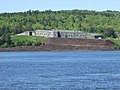
 Fort Knox as seen from the Bucksport waterfront summer view image 1.jpg 4,608 × 3,456; 4.67 MB
-
 Fort Knox as seen from the Bucksport waterfront summer view image 2.jpg 4,608 × 3,456; 5.54 MB
-
 Fort Point Hotel ruins image 5.jpg 3,456 × 4,608; 5.66 MB
-
 Fort Point Hotel ruins image 6.jpg 2,448 × 3,264; 3.92 MB
-
 Fort Point Light River Beacon Fog Bell Housing image 2.jpg 4,608 × 3,456; 3.63 MB
-
 Fort Point Light River Beacon Fog Bell image 2.jpg 4,608 × 3,456; 3.12 MB
-
 Fort Point Light River Beacon image 2.jpg 4,608 × 3,456; 3.48 MB
-
 Fort Pownall image 1.jpg 4,608 × 3,456; 5.8 MB
-
 Fort Pownall image 2.jpg 4,608 × 3,456; 5.63 MB
-
 Fort Pownall image 3.jpg 4,608 × 3,456; 3.08 MB
-
 Fort Pownall image 5.jpg 4,608 × 3,456; 5.43 MB
-
 Gemco Rotariders, Vintage Riding Lawn Mowers.jpg 4,608 × 3,456; 5.83 MB
-

-
 Grave of Captains Bill Vose Park, Bowditch Cemetery, Searsport, Maine.jpg 3,456 × 4,608; 3.91 MB
-
 Grave of Mary A. Pendelton, Bowditch Cemetery, Searsport, Maine.jpg 3,456 × 4,608; 4.96 MB
-
 Graves of Captain John Park and his wife Eliza, Bowditch Cemetery, Searsport, Maine.jpg 4,608 × 3,456; 4.35 MB
-

-
 Log Boom, Penobscot River.jpg 4,608 × 3,456; 4.07 MB
-
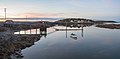
 Maine Harbor.jpg 5,472 × 3,648; 2.72 MB
-
 Meeting with Governor Paul LePage of Maine (35294062185).jpg 5,999 × 3,375; 4.3 MB
-
 Meeting with Governor Paul LePage of Maine (35294063125).jpg 5,999 × 3,375; 4.52 MB
-
 Memorial to Veterans of World War One, Unity, Maine.jpg 4,608 × 3,456; 5.49 MB
-
 Mount Bigelow panorama.jpg 16,501 × 3,000; 15.16 MB
-
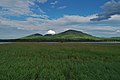 Mount Bigelow.jpg 5,250 × 3,500; 6.64 MB
-
 Mycetinis scorodonius (Fr.) A.W. Wilson & Desjardin 750396.jpg 2,000 × 1,500; 2.31 MB
-
 North Branch of Marsh River with dam in distance, Frankfort, Maine.jpg 4,608 × 3,456; 4.77 MB
-
 North Branch, Marsh River, Frankfort, Maine.jpg 4,608 × 3,456; 3.64 MB
-
 Ogunquit-Playhouse-2017.jpg 5,184 × 3,456; 8.79 MB
-
 Orrignton Pound outside view of gate.jpg 4,608 × 3,456; 5.02 MB
-
 Orrington Pound close up view.jpg 4,608 × 3,456; 5.96 MB
-
 Orrington Pound distant view.jpg 4,608 × 3,456; 4.92 MB
-
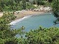
 Otter Creek empties into Otter Cove.jpg 4,608 × 3,456; 5.29 MB
-
 Pond seen from Cadillac Mountain image 2.jpg 4,608 × 3,456; 4.97 MB
-
 Pott's Point Sunset (34666648843).jpg 1,400 × 933; 939 KB
-
 Ready For Takeoff (35137066220).jpg 1,040 × 1,040; 744 KB
-
 Rocky Shore and Cliffs Adjacent to Thunder Hole.jpg 4,608 × 3,456; 5.12 MB
-
 Rotting hulk of a boat.jpg 2,448 × 3,264; 2.41 MB
-
 RS010.jpg 5,472 × 3,648; 2.55 MB
-
 Sand Beach Image Four.jpg 4,608 × 3,456; 6.07 MB
-
 Sand Beach Image Two.jpg 4,608 × 3,456; 6.01 MB
-
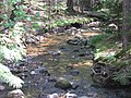 Stanley Brook image four.jpg 4,608 × 3,456; 6.12 MB
-
 Stanley Brook image seven.jpg 4,608 × 3,456; 6.11 MB
-
 Statue of a black bear, Unity Historical Society image 1.jpg 4,608 × 3,456; 4.92 MB
-
 Statue of a black bear, Unity Historical Society image 2.jpg 4,608 × 3,456; 4.87 MB
-
 Statue of deer, Unity Historical Society.jpg 4,608 × 3,456; 5.24 MB
-
 Statue of Moose, Unity Historical Society, image 1.jpg 4,608 × 3,456; 4.61 MB
-
 Statue of Moose, Unity Historical Society, image 2.jpg 4,608 × 3,456; 4.43 MB
-
 Stone bridge on Mount Desert Island image one three.jpg 4,608 × 3,456; 5.62 MB
-
 Stone bridge on Mount Desert Island image two.jpg 4,608 × 3,456; 6.22 MB
-
 Sunset (34603026654).jpg 1,400 × 692; 646 KB
-
 The Rocks Monument image 1.jpg 4,608 × 3,456; 4.42 MB
-
 The Rocks monument image 2.jpg 4,608 × 3,456; 5.19 MB
-
 The Rocks monument image 4.jpg 4,608 × 3,456; 5.44 MB
-
 The Rocks monument image 5.jpg 4,608 × 3,456; 5.81 MB
-
 The Rocks monument image 6.jpg 4,608 × 3,456; 6.37 MB
-
 The Rocks monument image 7.jpg 3,456 × 4,608; 4.16 MB
-
 Thunder Hole image four.jpg 4,608 × 3,456; 3.04 MB
-
 Thunder Hole image one.jpg 4,608 × 3,456; 4.43 MB
-
 Unity Pond, Unity, Maine image 1.jpg 4,608 × 3,456; 3.62 MB
-
 Unity Pond, Unity, Maine image 2.jpg 4,608 × 3,456; 3.03 MB
-
 Unity Pond, Unity, Maine image 3.jpg 4,608 × 3,456; 3.49 MB
-
 Unity Pond, Unity, Maine image 4.jpg 4,608 × 3,456; 5.91 MB
-
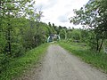
 View from Bald Mountain Hiking Trail, Dedahm, Maine, image 1.jpg 4,608 × 3,456; 4.75 MB
-
 View from Bald Mountain Hiking Trail, Dedahm, Maine, image 2.jpg 4,608 × 3,456; 4.81 MB
-
 View from Bald Mountain Hiking Trail, Dedahm, Maine, image 3.jpg 4,608 × 3,456; 4.38 MB
-
 View from Bald Mountain Hiking Trail, Dedahm, Maine, image 4.jpg 4,608 × 3,456; 5.43 MB
-
 View from Bald Mountain Hiking Trail, Dedham, Maine image 10.jpg 4,608 × 3,456; 5.05 MB
-
 View from Bald Mountain Hiking Trail, Dedham, Maine image 6.jpg 4,608 × 3,456; 5.13 MB
-
 View from Bald Mountain Hiking Trail, Dedham, Maine image 9.jpg 4,608 × 3,456; 5.23 MB
-
 View from Bald Mountain Hiking Trail, Dedham, Maine, image 5.jpg 4,608 × 3,456; 5.63 MB
-
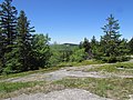
 View from the summit of Bald Mountain in Dedham, Maine image 1.jpg 4,608 × 3,456; 5 MB
-
 View from the summit of Bald Mountain in Dedham, Maine image 2.jpg 4,608 × 3,456; 4.36 MB
-
 View from the summit of Bald Mountain in Dedham, Maine image 3.jpg 4,608 × 3,456; 4.76 MB
-
 View from the summit of Bald Mountain in Dedham, Maine image 4.jpg 4,608 × 3,456; 4 MB
-
 View of the Porcupine Islands from Cadillac Mountain.jpg 5,184 × 3,456; 4.25 MB
-
 Wild Blueberry Bushes on Bald Mountain.jpg 4,608 × 3,456; 7.62 MB


.jpg)


.jpg)
.jpg)


_A.W._Wilson_%26_Desjardin_750396.jpg)


.jpg)
.jpg)


.jpg)


