Category:June 2020 in Hesse
Federal states of Germany:
| June in Hesse by year: | |
| 2020 in Hesse by month: | |
| Jan | Feb | Mar | Apr | May | Jun | Jul | Aug | Sep | Oct | Nov | Dec | ||
| ← | 10 | 9 | 11 | 9 | 42 | 34 | 3 | 86 | 12 | 37 | 7 | 9 | → |
|---|
Images taken in Hesse in this month of June 2020 (not the date of the upload). With CatScan, this allows one to browse any Hesse-related category by year or month. Images should be placed directly in this category, not in subcategories.
Subcategories
This category has the following 3 subcategories, out of 3 total.
'
*
Media in category "June 2020 in Hesse"
The following 31 files are in this category, out of 31 total.
-
102-Saalbachfeld.jpg 2,942 × 2,942; 6.56 MB
-
Bergpark Wilhelmshöhe - Baum 227 2020-06-05 a.JPG 3,648 × 2,736; 4.28 MB
-
Bergpark Wilhelmshöhe - Baum 227 2020-06-05 b.JPG 2,736 × 3,648; 3.98 MB
-
Bergpark Wilhelmshöhe - Baum 227 2020-06-05 c.JPG 3,648 × 2,736; 3.86 MB
-
Bergpark Wilhelmshöhe - Baum 227 2020-06-05 d.JPG 3,648 × 2,736; 3.85 MB
-
Bergpark Wilhelmshöhe - Baum 227 2020-06-05 e.JPG 2,736 × 3,648; 4.04 MB
-
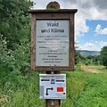
NP-Wald&Klima.jpg 3,024 × 3,024; 4.05 MB
-
Wiesbach an Bachweg bis Grüneburgweg R0015905.jpg 2,736 × 3,648; 3.47 MB
-
Wiesbach an Bachweg Ende Erreichbarkeit R0015904.jpg 2,736 × 3,648; 3.67 MB
-
Wiesbach an Bachweg vor Kapersburgstraße Beginn Verrohrung R0015891.jpg 3,648 × 2,736; 3.54 MB
-
Wiesbach an Bachweg vor Kapersburgstraße Beginn Verrohrung R0015892.jpg 3,648 × 2,736; 3.55 MB
-
Wiesbach Bach Pfingstborn Abfluss mittlere Quellen im Hang R0014899.jpg 3,648 × 2,736; 3.69 MB
-
Wiesbach Bach Pfingstborn am selbigen R0014877.jpg 3,648 × 2,736; 3.71 MB
-
Wiesbach Bach Pfingstborn an Haingasse R0014879.jpg 2,736 × 3,648; 3.65 MB
-
Wiesbach Bach Pfingstborn an Straße R0014902.jpg 2,736 × 3,648; 3.67 MB
-
Wiesbach Bach Pfingstborn mittlere Quellen R0014898.jpg 3,648 × 2,736; 3.7 MB
-
Wiesbach Bach Pfingstborn tiefere Quellen R0014906.jpg 2,736 × 3,648; 3.7 MB
-
Wiesbach Bach Pfingstborn Zufluss höhere R0014881.jpg 3,648 × 2,736; 3.64 MB
-
Wiesbach Bach Pfingstborn Zufluss höhere R0014883.jpg 2,736 × 3,648; 3.75 MB
-
Wiesbach Bach Pfingstborn Zufluss höherer beginnt R0014888.jpg 3,648 × 2,736; 3.7 MB
-
Wiesbach Bruchwald an Grundwies FFH R0016493.jpg 3,648 × 2,736; 3.61 MB
-
Wiesbach Brücke K 728 ober Kransberg mit Bach Pfingstborn R0014864.jpg 2,736 × 3,648; 3.74 MB
-
Wiesbach Brücke K 728 ober Kransberg mit Bach Pfingstborn R0014869.jpg 2,736 × 3,648; 3.71 MB
-
Wiesbach Brücke K 728 ober Kransberg R0014861.jpg 2,736 × 3,648; 3.71 MB
-
Wiesbach Brücke K 728 ober Kransberg R0014862.jpg 3,648 × 2,736; 3.64 MB
-
Wiesbach Erlengraben mündet R0015999.jpg 3,648 × 2,736; 3.65 MB
-
Wiesbach Erlengraben mündet R0016000.jpg 2,736 × 3,648; 3.71 MB
-
Wiesbach ober Brücke K 728 ober Kransberg R0014866.jpg 2,736 × 3,648; 3.69 MB
-
Wiesbach Schild "Zum Pfingstborn" R0014878.jpg 3,648 × 2,736; 3.56 MB
-
Wiesbach vor Lindenstraße R0015886.jpg 2,736 × 3,648; 3.61 MB
-
Wiesbach vor Lindenstraße R0015888.jpg 2,736 × 3,648; 3.68 MB


