Category:Köttweinsdorf
district of Waischenfeld  | |||||
| Upload media | |||||
| Instance of |
| ||||
|---|---|---|---|---|---|
| Location | Waischenfeld, Bayreuth, Upper Franconia, Bavaria, Germany | ||||
| Population |
| ||||
| Elevation above sea level |
| ||||
 | |||||
Subcategories
This category has the following 2 subcategories, out of 2 total.
K
- Kapelle Köttweinsdorf (1 F)
W
- Weiße Marter Fehing (8 F)
Media in category "Köttweinsdorf"
This category contains only the following file.
-
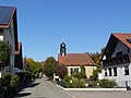 Köttweinsdorf.jpg 4,000 × 3,000; 4.48 MB