<nowiki>Kühlenthal; Kühlenthal; Kühlenthal; Kühlenthal; Kühlenthal; Kühlenthal; Kühlenthal; Килентал; 屈赫伦塔尔; Kühlenthal; Kühlenthal; 屈赫倫塔爾; Kühlenthal; Кюленталь; Кюленталь; 屈赫倫塔爾; Kühlenthal; Kühlenthal; Kühlenthal; Kühlenthal; Kühlenthal; Kühlenthal; Kühlenthal; Kühlenthal; Kühlenthal; Kühlenthal; Килентал; Куьленталь; Kilental; Կյուլենտալ; Кюленталь; Kühlenthal; Kühlenthal; Kühlenthal; Kühlenthal; Kühlenthal (munisipyo); Kühlenthal; کوهلنتال; キューレンタール; Kühlenthal; Kühlenthal; 屈赫伦塔尔; Kühlenthal; громада в Німеччині, федеральна земля Баварія; ドイツ、バイエルン州アウクスブルク郡の町村; település Németországban; obec v zemském okresu Augsburg v Německu; kota di Jerman; بلدية في أوغسبورغ، ألمانيا; kommune i Tyskland; gemeente in Beieren; municipality of Germany; commune allemande; gmejna w Bayerskej; Gemeinde im schwäbischen Landkreis Augsburg in Deutschland; komunë në Gjermani; komunumo en Bavario, Germanio; kumun alaman; Şaredariyeke Almanyayê; Kuhlenthal; Kuehlenthal; Kuehlenthal; Kuhlenthal; Kuehlenthal; Kuhlenthal; Kuehlenthal; Fertingen; Ahlingen; Anzenhof; Кüҳлентҳал; Кюлентал; Kuhlenthal; Kyulental; Kuehlenthal; Kuhlenthal; Kühlenthal</nowiki>


 DEU Kühlenthal COA.svg 512 × 610; 8 KB
 Wappen Kuehlenthal.png 274 × 269; 12 KB
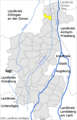 Kuehlenthal im Landkreis Augsburg.png 452 × 702; 51 KB
 Kühlenthal in A.svg 844 × 844; 1.35 MB
