Category:K-53 (Kansas highway)
 | number: | (fifty-three) |
|---|---|---|
| State highways in Kansas: | 33 · 34 · 39 · 41 · 42 · 43 · 44 · 47 · 49 · 51 · 52 · 53 · 55 · 57 · 58 · 60 · 61 · 62 · 63 · 64 · 66 · 67 · 68 · 71 |
state highway in Sumner County, Kansas, United States | |||||
| Upload media | |||||
| Instance of | |||||
|---|---|---|---|---|---|
| Location | Sumner County, Kansas | ||||
| Transport network | |||||
| Owned by | |||||
| Maintained by | |||||
| Length |
| ||||
| Terminus | |||||
| |||||
English: Media related to K-53 (Kansas highway), a 6.177-mile (9.941 km) state highway in Sumner County, Kansas, United States, that connect U.S. Route 81 (east of Peck) with K-15 (Kansas highway) on the eastern border of Mulvane.
Subcategories
This category has only the following subcategory.
Media in category "K-53 (Kansas highway)"
The following 2 files are in this category, out of 2 total.
-
 K-53.svg 600 × 600; 38 KB
-
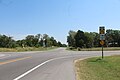 The eastern end of the K-53 (Kansas Highway).jpg 5,184 × 3,456; 4.92 MB
.jpg)