Category:Kalkgruvhagen
| Object location | | View all coordinates using: OpenStreetMap |
|---|
|
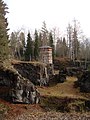
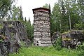
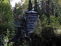
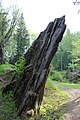
This is a category about an archaeological site or a monument in Sweden, number Garpenberg 241:1 in the RAÄ Fornsök database. |
Media in category "Kalkgruvhagen"
The following 11 files are in this category, out of 11 total.
-
 Bergslagssafari 120915 Kalkgruvhagen Garpenberg.jpg 4,072 × 3,054; 9.38 MB
-
 Finnhyttans kalkbrott May 2015 01.jpg 4,586 × 3,669; 15.45 MB
-
 Finnhyttans kalkbrott May 2015 02.jpg 6,016 × 4,016; 19.75 MB
-
 Finnhyttans kalkbrott May 2015 03.jpg 6,016 × 4,016; 26.53 MB
-
 Finnhyttans kalkbrott.jpg 2,304 × 3,072; 2.76 MB
-
 Kalkbrott i Garpenberg.JPG 5,184 × 3,456; 9.61 MB
-
 Kalkbrottet Finnhyttan Garpenberg.JPG 3,648 × 2,736; 3.25 MB
-
 Kalkbrottet i Garpenberg 1.jpg 2,304 × 3,456; 5.91 MB
-
 Kalkbrottet i Garpenberg 2.jpg 2,304 × 3,456; 4.87 MB
-
 Kalkbrottet i Garpenberg 3.jpg 3,456 × 2,304; 4.97 MB
-
 Kalkbrottet i Garpenberg.JPG 3,456 × 5,184; 9.27 MB


