Category:Kalmithaus
| Object location | | View all coordinates using: OpenStreetMap |
|---|
mountain in Germany  | |||||
| Upload media | |||||
| Instance of | |||||
|---|---|---|---|---|---|
| Location | Südliche Weinstraße, Rhineland-Palatinate, Germany | ||||
| Owned by | |||||
| Mountain range | |||||
| Elevation above sea level |
| ||||
| Different from | |||||
| official website | |||||
 | |||||
Media in category "Kalmithaus"
The following 8 files are in this category, out of 8 total.
-
 150502-Kalmit-06.jpg 3,000 × 1,987; 2.97 MB
-
 2010 Pfälzer Wald 120 Kalmithütte.jpg 2,592 × 1,944; 1.89 MB
-
 2012 Pfälzerwald 081 Kalmithaus.jpg 3,264 × 2,448; 2.82 MB
-
 2012 Pfälzerwald 088 Kalmit Tafel 1882.jpg 2,988 × 2,240; 3.63 MB
-
 2012 Pfälzerwald 091 Kalmit Tafel.jpg 3,264 × 2,448; 2.85 MB
-
 2013 Pfälzerwald 002 Kalmithaus ji.jpg 3,166 × 2,373; 2.99 MB
-
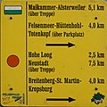 2021 Pfälzerwald 097 Kalmithaus Wandertafel ji.jpg 2,760 × 2,752; 2.24 MB
-
 KalmitGipfel.jpg 2,000 × 1,500; 2.48 MB


