Category:Kam Tin Tree House
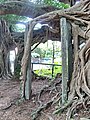
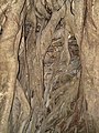
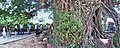
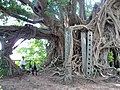
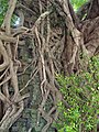
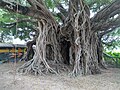
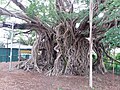
ruined building around which a tree has grown  | |||||
| Upload media | |||||
| Instance of | |||||
|---|---|---|---|---|---|
| Location |
| ||||
 | |||||
中文:錦田樹屋
Media in category "Kam Tin Tree House"
The following 28 files are in this category, out of 28 total.
-
 Kam Tin Tree House - 2007-09-30 13h55m08s SN200780.jpg 3,072 × 2,304; 2.64 MB
-
 Kam Tin Tree House - 2007-09-30 13h56m36s - P1b.jpg 2,707 × 4,521; 4.2 MB
-
 Kam Tin Tree House - 2007-09-30 13h58m58s SN200785.jpg 3,072 × 2,304; 2.6 MB
-
 Kam Tin Tree House - 2007-09-30 13h59m06s SN200786.jpg 2,304 × 3,072; 2.46 MB
-
 Kam Tin Tree House - 2007-09-30 13h59m22s - P1c.jpg 6,238 × 2,067; 3.75 MB
-
 Kam Tin Tree House - 2007-09-30 13h59m52s SN200790.jpg 2,304 × 3,072; 2.38 MB
-
 Kam Tin Tree House - 2007-09-30 14h00m08s SN200791.jpg 2,304 × 3,072; 2.41 MB
-
 Kam Tin Tree House - 2007-09-30 14h00m12s SN200792.jpg 3,072 × 2,304; 2.46 MB
-
 Kam Tin Tree House - 2007-09-30 14h00m32s SN200793.jpg 3,072 × 2,304; 2.34 MB
-
 Kam Tin Tree House - 2007-09-30 14h00m44s SN200794.jpg 2,304 × 3,072; 2.84 MB
-
 Kam Tin Tree House - 2007-09-30 14h01m08s - P1a.jpg 7,311 × 1,993; 4.16 MB
-
 Kam Tin Tree House - 2007-09-30 14h01m58s SN200799.jpg 2,304 × 3,072; 2.21 MB
-
 Kam Tin Tree House - 2007-09-30 14h02m10s SN200800.jpg 2,304 × 3,072; 2.48 MB
-
 Kam Tin Tree House - 2007-09-30 14h02m40s - P1a.jpg 5,103 × 2,022; 3.24 MB
-
 Kam Tin Tree House - 2007-09-30 14h03m30s SN200804.jpg 3,072 × 2,304; 2.43 MB
-
 Kam Tin Tree House - 2007-09-30 14h06m08s SN200808.jpg 3,072 × 2,304; 2.57 MB
-
 Kam Tin Tree House - 2007-09-30 14h07m18s SN200810.jpg 2,304 × 3,072; 2.59 MB
-
 Kam Tin Tree House - 2007-09-30 14h07m28s SN200811.jpg 2,304 × 3,072; 2.55 MB
-
 Kam Tin Tree House - 2007-09-30 14h07m40s SN200812.jpg 2,304 × 3,072; 2.72 MB
-
 Kam Tin Tree House - 2007-09-30 14h09m04s - P3a.jpg 2,247 × 4,007; 3.58 MB
-
 Kam Tin Tree House - 2007-09-30 14h09m04s SN200813.jpg 3,072 × 2,304; 2.76 MB
-
 Kam Tin Tree House - 2007-09-30 14h09m42s SN200816.jpg 3,072 × 2,304; 2.42 MB
-
 Kam Tin Tree House - 2007-09-30 14h10m54s - P1a.JPG 9,327 × 2,796; 9.12 MB
-
 Kam Tin Tree House - 2007-09-30 14h14m16s - P2a.jpg 3,858 × 2,108; 2.91 MB
-
 Kam Tin Tree House 01.jpg 4,160 × 3,120; 5.28 MB
-
 Kam Tin Tree House 2022.jpg 4,000 × 3,000; 10.73 MB
-
 Kam Tin Tree House.jpg 4,128 × 3,096; 4.31 MB
-
 錦田樹屋 2022.jpg 4,080 × 3,072; 6.16 MB


