Category:Kamienica Jana Kulikiewicza
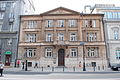
Aleje Ujazdowskie 49
| Object location | | View all coordinates using: OpenStreetMap |
|---|
 | |||||
| Upload media | |||||
| Instance of | |||||
|---|---|---|---|---|---|
| Location | Śródmieście, Warsaw, Masovian Voivodeship, Poland | ||||
| Street address |
| ||||
| Heritage designation |
| ||||
| Inception |
| ||||
| Significant event |
| ||||
 | |||||
Media in category "Kamienica Jana Kulikiewicza"
The following 6 files are in this category, out of 6 total.
-
 Ujazd2DSC 0929.JPG 3,008 × 2,000; 2.52 MB
-
 Ujazd46DSC 0969.JPG 3,008 × 2,000; 3.31 MB
-
 Ujazd47DSC 0970.JPG 2,000 × 3,008; 3.81 MB
-
 Ujazd49DSC 0972.JPG 1,738 × 2,433; 1.73 MB
-
 Warsaw caryatid hemifigures.jpg 1,536 × 2,048; 665 KB
-
 Warsaw door knocker.jpg 1,536 × 2,048; 879 KB


