Category:Kapelle St. Jakob Flums
| Object location | | View all coordinates using: OpenStreetMap |
|---|
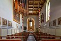
chapel in Flums in the canton of St. Gallen, Switzerland  | |||||
| Upload media | |||||
| Instance of | |||||
|---|---|---|---|---|---|
| Part of | |||||
| Location |
| ||||
| Street address |
| ||||
| Heritage designation | |||||
 | |||||
Media in category "Kapelle St. Jakob Flums"
The following 10 files are in this category, out of 10 total.
-
 Flums - Chapel of St. Jakob (53883576272).jpg 5,472 × 3,648; 8.03 MB
-
 Flums - Chapel of St. Jakob (53883577627).jpg 5,470 × 3,078; 8.07 MB
-
 Flums - Chapel of St. Jakob (53884480921).jpg 5,165 × 3,443; 7.71 MB
-
 Flums - Chapel of St. Jakob (53884713693).jpg 5,427 × 3,617; 8.8 MB
-
 Flums - Chapel of St. Jakob (53884714063).jpg 5,155 × 3,437; 8.63 MB
-
 Flums - Chapel of St. Jakob (53884811539).jpg 5,342 × 3,561; 8.03 MB
-
 Flums - Chapel of St. Jakob (53884811789).jpg 5,239 × 3,492; 8.05 MB
-
 Flums - Chapel of St. Jakob (53884811974).jpg 5,472 × 3,648; 7.22 MB
-
 Flums - Chapel of St. Jakob (53884812939).jpg 5,472 × 3,648; 7.46 MB
-
 Kapelle St. Jakob.jpg 4,898 × 3,265; 854 KB
.jpg)
.jpg)
.jpg)
.jpg)
.jpg)
.jpg)
.jpg)
.jpg)
.jpg)