Category:Karner Weitensfeld im Gurktal
| This category shows the protected monument with the number 105381 in Austria. (Commons, de, Wikidata) |
| Object location | | View all coordinates using: OpenStreetMap |
|---|
 | |||||
| Upload media | |||||
| Instance of | |||||
|---|---|---|---|---|---|
| Part of | |||||
| Location | Weitensfeld im Gurktal, Sankt Veit an der Glan District, Carinthia, Austria | ||||
| Heritage designation | |||||
 | |||||
Media in category "Karner Weitensfeld im Gurktal"
The following 23 files are in this category, out of 23 total.
-
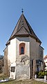
 AT-105381 Karner Pfarrkirche hl. Johannes Evangelist in Weitensfeld 02.jpg 3,456 × 5,184; 3.59 MB
-
 AT-105381 Karner Pfarrkirche hl. Johannes Evangelist in Weitensfeld 03.jpg 3,456 × 5,184; 3.82 MB
-
 AT-105381 Karner Pfarrkirche hl. Johannes Evangelist in Weitensfeld 04.jpg 5,184 × 3,456; 3.37 MB
-
 AT-105381 Karner Pfarrkirche hl. Johannes Evangelist in Weitensfeld 05.jpg 3,456 × 5,184; 3.33 MB
-
 Weitensfeld - Pfarrkirche - Karner.jpg 2,848 × 4,272; 4.21 MB
-
 AT-105381 Weitensfeld Friedhof Karner und Aufbahrungshalle 14082013 01.jpg 5,184 × 3,456; 2.35 MB
-
 Weitensfeld Wehrkirchhof Karner Apsis Ost-Ansicht 27032017 6996.jpg 3,849 × 6,779; 13.48 MB
-
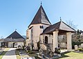
 Weitensfeld Wehrkirchhof Karner mit Aufbahrungshalle 19072017 0228.jpg 4,912 × 5,530; 15.09 MB
-
 Weitensfeld Wehrkirchhof Karner mit Aufbahrungshalle 27032017 7004.jpg 6,541 × 4,753; 15.89 MB
-
 Weitensfeld Wehrkirchhof Karner mit Aufbahrungshalle 27032017 7009.jpg 6,931 × 4,912; 16.63 MB
-
 Weitensfeld Wehrkirchhof Karner mit Aufbahrungshalle 27032017 7031.jpg 4,617 × 5,307; 14.71 MB
-
 Weitensfeld Wehrkirchhof Karner mit Aufbahrungshalle 27032017 7033.jpg 4,862 × 4,331; 11.87 MB
-
 Weitensfeld Wehrkirchhof Karner mit Aufbahrungshalle 30092020 9875.jpg 4,912 × 7,360; 21.11 MB
-
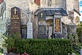
 Weitensfeld Wehrkirchhof Karner mit Aufbahrungshalle Grab Fam Gorton 27032017 7021.jpg 7,360 × 4,912; 26.36 MB
-
 Weitensfeld Wehrkirchhof Karner mit Aufbahrungshalle Grab Fam. Gorton 30092020 9869.jpg 7,360 × 4,912; 24.55 MB
-
 Weitensfeld Wehrkirchhof Karner mit Aufbahrungshalle O-Ansicht 30092020 9867.jpg 4,246 × 6,150; 16.85 MB
-
 Weitensfeld Wehrkirchhof Karner mit Aufbahrungshalle W-Ansicht 30092020 9874.jpg 4,609 × 7,068; 20.09 MB
-
 Weitensfeld Wehrkirchhof Karner Portal 19072017 0227.jpg 6,433 × 4,912; 11.04 MB
-
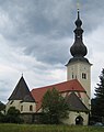
 Weitensfeld Wehrkirchhof Karner und Pfarrkirche hl Johannes Evangelist 27032017 6992.jpg 4,749 × 6,533; 14.57 MB
-
 Weitensfeld Wehrkirchhof Karner und Pfarrkirche hl. Johannes Evangelist 27032017 6994.jpg 5,481 × 4,760; 11.9 MB
-
 Weitensfeld Wehrkirchhof Karner und Pfarrkirche hl. Johannes Evangelist 30092020 9863.jpg 5,940 × 4,564; 15.95 MB
-
 Weitensfeld Wehrkirchhof Karner und Pfarrkirche hl. Johannes Evangelist 30092020 9866.jpg 6,506 × 4,714; 15.39 MB
-
 Weitensfeld Pfarrkirche.jpg 1,500 × 1,900; 627 KB


