Category:Kasteel Bronkhorst
| Object location | | View all coordinates using: OpenStreetMap |
|---|
 | |||||
| Upload media | |||||
| Instance of | |||||
|---|---|---|---|---|---|
| Location | Bronkhorst, Bronckhorst, Gelderland, Netherlands | ||||
| Street address |
| ||||
| Heritage designation |
| ||||
 | |||||
|
This is a category about rijksmonument number 34567
|
| Address |
|
Media in category "Kasteel Bronkhorst"
The following 8 files are in this category, out of 8 total.
-
 Bronkhorsst tuin kasteel 34567.jpg 4,288 × 2,848; 6.19 MB
-
 Exterieur - Bronkhorst - 20044021 - RCE.jpg 1,200 × 837; 249 KB
-
 Exterieur - Bronkhorst - 20044022 - RCE.jpg 1,200 × 837; 266 KB
-
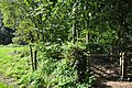
 Hek - Bronkhorst - 20044023 - RCE.jpg 1,200 × 973; 230 KB
-
 Poort kasteel Bronkhorst.jpg 1,283 × 994; 355 KB
-
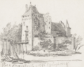 Slot Bronkhorst 1743.png 1,563 × 1,233; 2.24 MB
-
 Slot bronkhorst.jpg 480 × 300; 95 KB
-
 Toren kasteel Bronkhorst.jpg 1,280 × 964; 352 KB


