Category:Kasteel Soelen
| Object location | | View all coordinates using: OpenStreetMap |
|---|
castle in Zoelen, Netherlands .JPG) | |||||
| Upload media | |||||
| Instance of | |||||
|---|---|---|---|---|---|
| Location | Zoelen, Buren, Gelderland, Netherlands | ||||
| Has part(s) | |||||
| Heritage designation |
| ||||
 | |||||
|
This is a category about rijksmonumentcomplex number 513761
|
Kasteel:
|
This is a category about rijksmonument number 513760
|
Historisch tuin- en parkaanleg:
|
This is a category about rijksmonument number 513770
|
Brug:
|
This is a category about rijksmonument number 513771
|
Voorburcht met keermuren:
|
This is a category about rijksmonument number 513772
|
Koetshuis met toren:
|
This is a category about rijksmonument number 513773
|
Tuinvazen:
|
This is a category about rijksmonument number 513774
|
Poortgebouw:
|
This is a category about rijksmonument number 513775
|
Toegangshek:
|
This is a category about rijksmonument number 513776
|
Boerderij 'Aldenhaag':
|
This is a category about rijksmonument number 513777
|
Grafmonument:
|
This is a category about rijksmonument number 513778
|
Dienstwoning:
|
This is a category about rijksmonument number 513779
|
Tuinmuur:
|
This is a category about rijksmonument number 513780
|
Bijgebouw:
|
This is a category about rijksmonument number 513781
|
Tuinmanswoning:
|
This is a category about rijksmonument number 529499
|
| Address |
|
Media in category "Kasteel Soelen"
The following 91 files are in this category, out of 91 total.
-
 513760 Soelen - hoofdgebouw 2.jpg 3,000 × 2,000; 6.05 MB
-
 513760 Soelen - hoofdgebouw 3.jpg 2,785 × 1,300; 4.24 MB
-
 513760 Soelen - hoofdgebouw.jpg 3,000 × 2,374; 8.23 MB
-
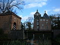
 513772 Kasteel Zoelen - Voorburcht en brug.jpg 3,000 × 2,000; 6.51 MB
-
 513775 Kasteel Soelen - poortgebouw.jpg 3,000 × 2,250; 7.37 MB
-
 513779 Dienstwoning bij Kasteel Soelen.jpg 3,000 × 2,000; 8.14 MB
-
 Achterzijde - Zoelen - 20224246 - RCE.jpg 968 × 1,200; 345 KB
-
 Aldenhaag detail kadasterkaart 1832.jpg 968 × 697; 63 KB
-
 Avondmaalsschotel - Zoelen - 20224244 - RCE.jpg 1,200 × 955; 277 KB
-
 Betimmering bibliotheek - Zoelen - 20224255 - RCE.jpg 1,200 × 953; 266 KB
-
 Cartouche aan het poortgebouw van kasteel Soelen.jpg 2,245 × 1,876; 813 KB
-
 Detail plafond bibliotheek - Zoelen - 20224254 - RCE.jpg 938 × 1,200; 212 KB
-
 Deurslot afkomstig uit de Voorst - Zoelen - 20224243 - RCE.jpg 1,200 × 940; 228 KB
-
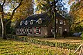
 Een boederij aan de Achterstraat in Zoelen.jpg 4,608 × 3,456; 5.89 MB
-
-
 Het complete plaatje van het kasteel.jpg 4,608 × 3,456; 5.55 MB
-
 IH 11428 01.JPG 1,704 × 2,272; 1.62 MB
-
 IH 11428 02.JPG 1,704 × 2,272; 1.66 MB
-
 IH 11428 03.JPG 2,272 × 1,704; 1.61 MB
-
 IH 11428 04.JPG 1,704 × 2,272; 1.61 MB
-
 IH 11428 05.JPG 1,704 × 2,272; 1.72 MB
-
 IH 11428 06.JPG 1,704 × 2,272; 1.64 MB
-
 IH 11428 10.JPG 1,704 × 2,272; 1.62 MB
-
 IH 11428 11.JPG 1,704 × 2,272; 1.64 MB
-
 IH 11428 12.JPG 1,704 × 2,272; 1.61 MB
-
 IH 11428 13.JPG 1,704 × 2,272; 1.65 MB
-
 IH 11428 14.JPG 2,272 × 1,704; 1.62 MB
-
 IH 11428 15.JPG 1,704 × 2,272; 1.67 MB
-
 IH 11428 16.JPG 1,200 × 1,600; 545 KB
-
 IH 11428 17.JPG 2,272 × 1,704; 1.61 MB
-
 IH 11428 18.JPG 1,704 × 2,272; 1.6 MB
-
 IH 11428 19.JPG 1,200 × 1,600; 585 KB
-
 IH 11428 20.JPG 1,200 × 1,600; 582 KB
-
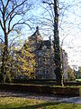
 Kasteel Soelen met Poortgebouw.jpg 4,770 × 3,177; 3.44 MB
-
 Kasteel Soelen te Zoelen.jpg 4,770 × 3,177; 2.82 MB
-
 Kasteel Soelen, RP-T-1919-18.jpg 7,456 × 4,842; 4.33 MB
-
 Kasteel Soelen.jpg 440 × 290; 126 KB
-
 Kasteel van Zoelen (Soelen).jpg 4,608 × 3,456; 5.92 MB
-
 Kasteel Zoelen 07.jpg 1,704 × 2,272; 1.61 MB
-
 Kasteel Zoelen 08.jpg 1,704 × 2,272; 1.6 MB
-
 Kasteel Zoelen 09.jpg 1,704 × 2,272; 1.58 MB
-
 Kasteel Zoelen 1728.jpg 6,106 × 4,182; 2.65 MB
-
 KasteelSoelen.jpg 798 × 570; 216 KB
-
 Koetshuis Kasteel Soelen vanaf de gracht 1.JPG 4,896 × 3,672; 6.45 MB
-
 Koetshuis Kasteel Soelen vanaf de gracht 2.JPG 4,896 × 3,672; 6.96 MB
-
 Koetshuis Kasteel Soelen.jpg 4,770 × 3,177; 2.96 MB
-
 Koetshuis torentje van het kasteel Soelen (Zoelen).jpg 3,456 × 4,608; 5.81 MB
-
 Overzicht - Zoelen - 20224237 - RCE.jpg 961 × 1,200; 257 KB
-
 Overzicht achtergevel - Zoelen - 20224242 - RCE.jpg 1,200 × 964; 279 KB
-
 Overzicht achtergevel - Zoelen - 20339447 - RCE.jpg 1,200 × 1,200; 424 KB
-
 Overzicht achtergevel - Zoelen - 20339450 - RCE.jpg 1,183 × 1,200; 397 KB
-
 Overzicht achtergevel en linker zijgevel - Zoelen - 20339449 - RCE.jpg 1,188 × 1,200; 477 KB
-
 Overzicht naar het westen, exterieur - Zoelen - 20224235 - RCE.jpg 964 × 1,200; 329 KB
-

-
 Overzicht stalgebouw met tuin op de voorgrond - Zoelen - 20404385 - RCE.jpg 1,200 × 973; 316 KB
-
 Overzicht van het omgracht kasteel - Zoelen - 20224259 - RCE.jpg 1,200 × 894; 190 KB
-

-
 Overzicht voorzijde - Zoelen - 20224241 - RCE.jpg 953 × 1,200; 318 KB
-
 Plaquette de Motte Aldenhaag.JPG 3,617 × 2,555; 2.3 MB
-
 Plaquette Kasteel Soelen.JPG 3,759 × 2,584; 2.44 MB
-
 Poort of Kasteel Soelen.jpg 701 × 468; 90 KB
-
 Poortgebouw - Zoelen - 20224239 - RCE.jpg 1,200 × 968; 398 KB
-
 Reproductie van tekening in bezit van Heer Volker - Zoelen - 20224248 - RCE.jpg 1,200 × 948; 226 KB
-
 Reproductie van tekening in bezit van Heer Volker - Zoelen - 20224249 - RCE.jpg 1,200 × 945; 245 KB
-
 Schilderij - Zoelen - 20224233 - RCE.jpg 960 × 1,200; 244 KB
-
 Schouw - Zoelen - 20224252 - RCE.jpg 967 × 1,200; 227 KB
-
 Schouw - Zoelen - 20224256 - RCE.jpg 957 × 1,200; 231 KB
-
 Schouw in de eetkamer - Zoelen - 20224253 - RCE.jpg 947 × 1,200; 213 KB
-
 Soelen (15).JPG 3,008 × 2,000; 2.18 MB
-
 Soelen Hoofdgebouw met Koetshuis.jpg 3,824 × 2,564; 4.21 MB
-
 Soelen Hoofdgebouw met Poortgebouw.jpg 4,487 × 3,356; 5.58 MB
-
 Soelen Koetshuis.jpg 4,576 × 3,414; 7.64 MB
-
 Soelen Poortgebouw.jpg 4,277 × 3,311; 7.15 MB
-
 Soelen Toegangshek.jpg 4,531 × 3,441; 7.86 MB
-
 Stalgebouwen vooraanzicht - Zoelen - 20224247 - RCE.jpg 1,200 × 964; 333 KB
-
 Toegangspoort voorzijde - Zoelen - 20224240 - RCE.jpg 971 × 1,200; 405 KB
-
 Torentje van bijgebouw - Zoelen - 20224238 - RCE.jpg 963 × 1,200; 275 KB
-
 Trapbalustrade - Zoelen - 20224251 - RCE.jpg 970 × 1,200; 238 KB
-

-

-

-
 Wilhelmina Adolphina Cornelia "Dolph" & Cornélie Caroline "Cox" van Asch van Wijck.jpg 1,536 × 2,374; 1.46 MB
-
 Witje door I.B.Xavery op 1e etage - Zoelen - 20224250 - RCE.jpg 959 × 1,200; 193 KB
-
 Zijaanzicht - Zoelen - 20224245 - RCE.jpg 1,200 × 964; 325 KB
-
 Zoelen - Achterstraat 7 - Kasteel Soelen - brug.JPG 3,888 × 2,592; 6.64 MB
-
 Zoelen - Achterstraat 7 - Kasteel Soelen - Koetshuis.JPG 4,803 × 3,489; 3.27 MB
-
 Zoelen - Achterstraat 7 - Kasteel Soelen - Poortgebouw wapensteen.JPG 3,261 × 2,179; 5.08 MB
-
 Zoelen - Achterstraat 7 - Kasteel Soelen - Poortgebouw.JPG 3,888 × 2,592; 6.56 MB
-
 Zoelen Achterstraat 3.jpg 4,212 × 3,101; 6.99 MB
-
 Zoelen Achterstraat 6 Tuinmuur.jpg 4,569 × 2,459; 5.48 MB
-
 Zoelen Achterstraat 6.jpg 4,526 × 3,369; 5.63 MB


.jpg)


.jpg)


