Category:Kasteelplein, Breda
| Camera location | | View all coordinates using: OpenStreetMap |
|---|
street in Breda, the Netherlands | |||||
| Upload media | |||||
| Instance of | |||||
|---|---|---|---|---|---|
| Location | Breda, North Brabant, Netherlands | ||||
 | |||||
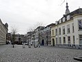
Nederlands: Afbeeldingen van het Kasteelplein, Breda, een straat en plein in het centrum van Breda in de provincie Noord-Brabant in het zuiden van Nederland. Aan het kasteelplein ligt ook het Kasteel van Breda. Dichtbij is het Park Valkenberg. Het kasteelplein wordt ook gebruikt tijdens evenementen.
Subcategories
This category has the following 10 subcategories, out of 10 total.
F
- Fontein Kasteelplein (7 F)
G
H
- Humphrey’s Restaurant Breda (5 F)
K
- Koningin Wilhelmina Paviljoen (21 F)
M
- Maczek-tentoonstelling (9 F)
P
- Prins Bernard Paviljoen (7 F)
V
- Vrede Fontein Breda (11 F)
Media in category "Kasteelplein, Breda"
The following 18 files are in this category, out of 18 total.
-
 2010-05-22-breda-by-RalfR-20.jpg 3,008 × 2,000; 3.16 MB
-
 Betoverend Breda 2018 DSCF5220.jpg 2,048 × 1,536; 1.6 MB
-
 Breda (1278529705).jpg 640 × 480; 168 KB
-
 Breda koningsdag 2024 07.jpg 5,472 × 3,648; 8.88 MB
-
 Breda koningsdag 2024 08.jpg 5,472 × 3,648; 9.09 MB
-
 Breda koningsdag 2024 09.jpg 5,472 × 3,648; 8.34 MB
-
 Breda koningsdag 2024 10.jpg 5,472 × 3,648; 8.57 MB
-
 Kasteelplein Breda 160.JPG 4,000 × 3,000; 4.68 MB
-
 Kasteelplein Breda DSCF8618.JPG 2,816 × 2,112; 2.77 MB
-
 Kasteelplein, Breda DSCF2096.JPG 2,816 × 2,112; 2.89 MB
-
 Kasteelplein, Breda P1030345 copy.jpg 3,264 × 2,448; 1.89 MB
-
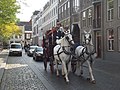 Koets Breda 03.JPG 4,288 × 3,216; 3.52 MB
-
 Koets Breda 04.JPG 4,288 × 3,216; 3.72 MB
-
 Overzicht - Breda - 20041316 - RCE.jpg 831 × 1,200; 207 KB
-
 P1000948copyKasteelplein.jpg 3,264 × 2,448; 6.03 MB
-
 P1010176Kasteelplein.JPG 3,264 × 2,448; 3.62 MB
-
 Pand Kasteelplein (Breda) DSCF2088.JPG 2,112 × 2,816; 2.63 MB
-
 Бреда, площадь перед замком.jpg 3,264 × 2,448; 2.35 MB


.jpg)


_DSCF2088.JPG)
