Category:Kells, County Kilkenny
town in Leinster, Ireland  | |||||
| Upload media | |||||
| Instance of | |||||
|---|---|---|---|---|---|
| Location | Kells, County Kilkenny, Leinster, Ireland | ||||
 | |||||
Subcategories
This category has the following 4 subcategories, out of 4 total.
Media in category "Kells, County Kilkenny"
The following 71 files are in this category, out of 71 total.
-
 A view of Kells Priory - geograph.org.uk - 4278591.jpg 2,000 × 1,424; 1.07 MB
-
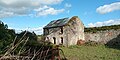 Abandoned house Kells.jpg 4,032 × 2,016; 2.99 MB
-
 Bridge over Kings river , Kells - geograph.org.uk - 565586.jpg 622 × 437; 75 KB
-
 Bridge over the M9, Northbound - geograph.org.uk - 6094956.jpg 800 × 533; 564 KB
-
 Farm Scene - geograph.org.uk - 5325472.jpg 640 × 480; 94 KB
-
 Fields to the river - geograph.org.uk - 4994617.jpg 1,600 × 1,200; 621 KB
-
 Gatehouse to the Priory - Kells, County Kilkenny - geograph.org.uk - 6278018.jpg 1,024 × 683; 116 KB
-
 Gateway into Kells Priory - geograph.org.uk - 4278623.jpg 2,000 × 1,500; 1.11 MB
-

-
 Grass Island - geograph.org.uk - 5325436.jpg 640 × 480; 81 KB
-
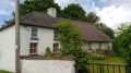 Half-thatch Haggard Road Kells.png 3,000 × 1,665; 6.48 MB
-
 House in converted school buildings - geograph.org.uk - 4277410.jpg 2,000 × 1,344; 917 KB
-
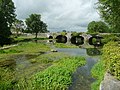
 Kells Bridge - geograph.org.uk - 1391830.jpg 640 × 427; 348 KB
-
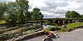
 Kells Bridge - geograph.org.uk - 4277413.jpg 2,000 × 1,500; 1.36 MB
-
 Kells Bridge with swans.jpg 4,032 × 2,016; 3.52 MB
-
 Kells Kells Priory River Kings 1.jpg 4,556 × 3,400; 10.2 MB
-
 Kells Kells Priory River Kings 2.jpg 4,553 × 3,268; 9.76 MB
-
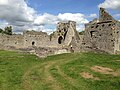
 Kells Priory - geograph.org.uk - 5917726.jpg 768 × 1,024; 182 KB
-
 Kells Priory, County Kilkenny - geograph.org.uk - 3361308.jpg 1,024 × 768; 170 KB
-
 Kells Priory, Kilkenny - geograph.org.uk - 5817078.jpg 3,264 × 2,448; 3.64 MB
-
 Kells Priory, Kilkenny - geograph.org.uk - 5817354.jpg 3,264 × 2,448; 3.07 MB
-
 Kells River Kings Bridge 1.jpg 4,563 × 3,101; 7.12 MB
-
 Kells River Kings Bridge 2.jpg 4,582 × 3,398; 6.43 MB
-
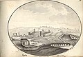 Kells, Co Kilkenny, 1794.jpg 580 × 399; 31 KB
-
 KellsKilkVillage.JPG 3,869 × 2,170; 4.74 MB
-
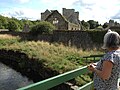
 King's River from the footbridge near Kells Priory - geograph.org.uk - 4278616.jpg 2,000 × 1,500; 1.21 MB
-
 KingsRiverKells.JPG 3,888 × 2,592; 6.32 MB
-
 Lacken Well 1 - Kells, County Kilkenny - geograph.org.uk - 5259695.jpg 640 × 437; 142 KB
-
 Lacken Well 2 - Kells, County Kilkenny - geograph.org.uk - 5259707.jpg 640 × 427; 158 KB
-
 Lane at Kilree - geograph.org.uk - 4179686.jpg 2,000 × 1,500; 1.21 MB
-
 Lay-by on the M9 Northbound towards junction 9 - geograph.org.uk - 4793983.jpg 1,200 × 799; 298 KB
-
 M9 Motorway Bridge - geograph.org.uk - 5848042.jpg 3,648 × 2,736; 2.94 MB
-
 M9 Northbound near Stoneyford - geograph.org.uk - 6094952.jpg 800 × 533; 680 KB
-
 M9 Northbound towards junction 9 - geograph.org.uk - 4793974.jpg 1,200 × 799; 250 KB
-
 M9 Northbound towards junction 9 - geograph.org.uk - 4793988.jpg 1,200 × 799; 268 KB
-
 M9 Northbound towards junction 9 - geograph.org.uk - 4793993.jpg 1,200 × 799; 293 KB
-
 M9 Northbound, Stonecarthy - geograph.org.uk - 6094442.jpg 800 × 533; 559 KB
-
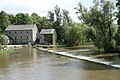
 Mill leat overflow, Hutchinson's Mill, Kells - geograph.org.uk - 4278604.jpg 2,000 × 1,462; 1.46 MB
-
 Mill on the King's River, Kells - geograph.org.uk - 1391838.jpg 640 × 430; 352 KB
-
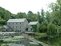
 Mullin's Mill, Kells - geograph.org.uk - 4278449.jpg 2,000 × 1,480; 1.14 MB
-
 Mullin's Mill, Kells - geograph.org.uk - 4278460.jpg 2,000 × 1,500; 1.23 MB
-
 Mullins Mill, Kells - geograph.org.uk - 1391832.jpg 640 × 417; 412 KB
-
 Mullins Mill, Kells, Co. Kilkenny - geograph.org.uk - 488490.jpg 640 × 426; 96 KB
-
 Mullins Mill, Kells, Waterwheel - geograph.org.uk - 1391835.jpg 427 × 640; 397 KB
-
 Northbound M9, LRI N 87 - geograph.org.uk - 6094953.jpg 800 × 533; 579 KB
-
 Old Building - geograph.org.uk - 5325477.jpg 640 × 480; 165 KB
-
 Old Mill at Kells.jpg 1,280 × 960; 686 KB
-

-
 Parking at the Priory - Kells, County Kilkenny - geograph.org.uk - 6274688.jpg 1,024 × 675; 167 KB
-
 Part of the ruins of Kells Priory - geograph.org.uk - 4278671.jpg 2,000 × 1,500; 947 KB
-

-
 Remains of the water mill in Kells Priory - geograph.org.uk - 4278653.jpg 2,000 × 1,500; 1.4 MB
-
 Rural Roads - geograph.org.uk - 5325451.jpg 640 × 480; 103 KB
-
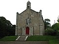 Saint Marys Church, Kells - geograph.org.uk - 565593.jpg 640 × 480; 53 KB
-
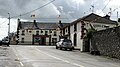
 Shirley's Bar, Kells - geograph.org.uk - 4277393.jpg 2,000 × 1,423; 690 KB
-
 Shop on the R697 - geograph.org.uk - 4277396.jpg 2,000 × 1,377; 644 KB
-
 Spring at Kilree - geograph.org.uk - 4179674.jpg 2,000 × 1,500; 1.79 MB
-
 Stained glass window in Shirley's Bar - geograph.org.uk - 4277389.jpg 2,000 × 1,500; 790 KB
-
 Stile and Ploughed Field - geograph.org.uk - 5325439.jpg 640 × 480; 140 KB
-
 Stream Bridge - geograph.org.uk - 5325464.jpg 640 × 480; 128 KB
-
 Thatched Cottage Garrynamann Lower.png 3,008 × 2,000; 11.41 MB
-
 The crossroads, Kells - geograph.org.uk - 4277385.jpg 2,000 × 1,273; 748 KB
-
 The Forge, Kells - geograph.org.uk - 4277382.jpg 2,000 × 1,458; 1.05 MB
-
 The L1023 goes over the M9 Northbound - geograph.org.uk - 4793987.jpg 1,200 × 799; 298 KB
-
 The Roman Catholic Church, Kells - geograph.org.uk - 4277403.jpg 2,000 × 1,323; 731 KB
-
 The ruins of Kells Priory - geograph.org.uk - 4278667.jpg 2,000 × 1,500; 997 KB
-
 The ruins of Kells Priory - geograph.org.uk - 5817073.jpg 3,264 × 2,448; 1.34 MB
-
 The weir for Hutchinson's Mill - geograph.org.uk - 4278598.jpg 2,000 × 1,500; 1.13 MB
-
 The weir for Mullin's Mill - geograph.org.uk - 4277415.jpg 2,000 × 1,500; 1.32 MB
-
 Undershot water wheel, Hutchinson's Mill, Kells - geograph.org.uk - 4278610.jpg 2,000 × 1,500; 1.25 MB
-
 Water Tower aka Bridge Tower at Kells Priory.jpg 4,032 × 2,016; 2.55 MB


