Category:Kempshott, Basingstoke
human settlement in United Kingdom | |||||
| Upload media | |||||
| Instance of | |||||
|---|---|---|---|---|---|
| Location |
| ||||
 | |||||
Subcategories
This category has only the following subcategory.
S
- Stratton Park, Basingstoke (18 F)
Media in category "Kempshott, Basingstoke"
The following 66 files are in this category, out of 66 total.
-
 Access road - Down Grange - geograph.org.uk - 725137.jpg 640 × 475; 96 KB
-
 Access road for Stratton Park - geograph.org.uk - 1212677.jpg 640 × 475; 92 KB
-

-
 Bertie the Bus - geograph.org.uk - 1629825.jpg 427 × 640; 133 KB
-
 Bungalows along Pack Lane - geograph.org.uk - 1212643.jpg 640 × 468; 61 KB
-
 Bungalows on Pack Lane - geograph.org.uk - 725119.jpg 640 × 452; 62 KB
-
 Closed For Business - geograph.org.uk - 830756.jpg 640 × 480; 59 KB
-
 Closed for some time - geograph.org.uk - 1235984.jpg 640 × 477; 76 KB
-
 Cottages by the running track - geograph.org.uk - 725132.jpg 640 × 456; 61 KB
-
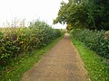 Cycle path by Kempshott - geograph.org.uk - 2688253.jpg 640 × 480; 115 KB
-
 Cycle path by Kempshott - geograph.org.uk - 3009624.jpg 640 × 480; 74 KB
-
 Cycle path by Kempshott - geograph.org.uk - 3704517.jpg 640 × 476; 116 KB
-
 Cycle path by Kempshott - geograph.org.uk - 3704520.jpg 640 × 481; 115 KB
-
 Cycle path by Kempshott - geograph.org.uk - 3704522.jpg 640 × 487; 117 KB
-
 Cycle path by Kempshott - geograph.org.uk - 3705127.jpg 640 × 478; 113 KB
-
 Cycle path by Kempshott - geograph.org.uk - 3705129.jpg 640 × 451; 104 KB
-
 Cycle path by Kempshott - geograph.org.uk - 3705131.jpg 640 × 479; 111 KB
-
 Cycle path by Kempshott - geograph.org.uk - 3705132.jpg 640 × 480; 126 KB
-
 Cycle path by Kempshott - geograph.org.uk - 3705134.jpg 640 × 473; 98 KB
-
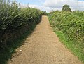
 Cyclepath - Kempshott - geograph.org.uk - 2685968.jpg 640 × 480; 106 KB
-
 Down Grange playing fields - geograph.org.uk - 2995204.jpg 640 × 480; 61 KB
-
 Down Grange playing fields - geograph.org.uk - 2995208.jpg 640 × 480; 74 KB
-
 Down Grange Sports Facility - geograph.org.uk - 725125.jpg 640 × 453; 41 KB
-
 Downgrange exit - geograph.org.uk - 723106.jpg 640 × 480; 104 KB
-
 Five Ways junction - geograph.org.uk - 1212623.jpg 640 × 471; 70 KB
-
 Footpath and trees - geograph.org.uk - 723114.jpg 640 × 480; 125 KB
-
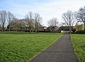
 Formal parkland at Down Grange - geograph.org.uk - 725135.jpg 640 × 473; 51 KB
-
 Homemade Skateboard Ramp - geograph.org.uk - 831924.jpg 640 × 480; 77 KB
-
 Houses along Pack Lane - geograph.org.uk - 1212640.jpg 640 × 467; 76 KB
-
 Houses off Firecrest Road - geograph.org.uk - 3377419.jpg 640 × 425; 73 KB
-
 Houses off Firecrest Road - geograph.org.uk - 3377422.jpg 640 × 425; 64 KB
-
 Houses off Firecrest Road - geograph.org.uk - 3377424.jpg 640 × 425; 77 KB
-
 I Approve^ - geograph.org.uk - 825146.jpg 640 × 480; 65 KB
-
 Interior Decor - geograph.org.uk - 831914.jpg 640 × 480; 70 KB
-
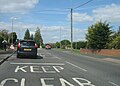 Keep Clear - geograph.org.uk - 1294154.jpg 640 × 460; 62 KB
-
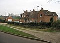
 Kempshott - geograph.org.uk - 73312.jpg 640 × 480; 117 KB
-
 Kempshott Grove - geograph.org.uk - 806353.jpg 640 × 480; 83 KB
-
 Kempshott Lane - geograph.org.uk - 1294145.jpg 640 × 469; 61 KB
-
 Kempshott Lane - geograph.org.uk - 1294148.jpg 640 × 474; 58 KB
-
-
 Kempshott Methodist Church - geograph.org.uk - 794101.jpg 640 × 480; 76 KB
-
 Kempshott Post Office - geograph.org.uk - 1235988.jpg 640 × 449; 77 KB
-
 Kempshott Roundabout, Basingstoke - geograph.org.uk - 125078.jpg 640 × 480; 317 KB
-
 Kendal Gardens - geograph.org.uk - 1212672.jpg 640 × 469; 62 KB
-
 Leafy gardens - Pack Lane - geograph.org.uk - 1236012.jpg 640 × 458; 76 KB
-
 Local shops - Pack Lane - geograph.org.uk - 1212646.jpg 640 × 466; 65 KB
-
 Looking across Five Ways - geograph.org.uk - 1235982.jpg 640 × 474; 57 KB
-
 New housing - Hatch Warren - geograph.org.uk - 831956.jpg 640 × 480; 72 KB
-
 Oceana Crescent - geograph.org.uk - 831957.jpg 640 × 480; 68 KB
-
 Oceana Crescent Flats - geograph.org.uk - 831962.jpg 640 × 480; 81 KB
-
 Oceana Crescent Play Area - geograph.org.uk - 831959.jpg 640 × 480; 58 KB
-
 Old Kempshott Lane - geograph.org.uk - 1235976.jpg 640 × 466; 61 KB
-
 On your marks - geograph.org.uk - 1212682.jpg 640 × 483; 60 KB
-
 Open ground behind Derwent Road - geograph.org.uk - 1235993.jpg 640 × 466; 96 KB
-
 Path to Derwent Road - geograph.org.uk - 1235997.jpg 640 × 472; 84 KB
-
 Playground for a Wet Day - geograph.org.uk - 830758.jpg 640 × 480; 80 KB
-
 Ready for a game - geograph.org.uk - 1236001.jpg 640 × 439; 40 KB
-
 Smashed Interiors - geograph.org.uk - 831918.jpg 640 × 480; 85 KB
-
 Snow west of Basingstoke - geograph.org.uk - 1627642.jpg 640 × 427; 115 KB
-
 Speed bumps - Pack Lane - geograph.org.uk - 1212629.jpg 640 × 479; 96 KB
-
 Squirrel Drive - geograph.org.uk - 830745.jpg 640 × 480; 132 KB
-
 St. Mark's church, Kempshott - geograph.org.uk - 794087.jpg 640 × 480; 83 KB
-
 Traffic calming - Kempshott Lane - geograph.org.uk - 1294147.jpg 640 × 481; 80 KB
-
 Warehouse Exterior - geograph.org.uk - 831948.jpg 640 × 480; 70 KB
-
 Warehouse Interior - geograph.org.uk - 831941.jpg 640 × 480; 89 KB
-
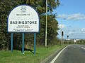 Welcome to Basingstoke - geograph.org.uk - 73847.jpg 640 × 480; 105 KB


