Category:Kennedy Building (Omaha, Nebraska)
| Object location | | View all coordinates using: OpenStreetMap |
|---|
_from_NW_1.JPG) | |||||
| Upload media | |||||
| Instance of | |||||
|---|---|---|---|---|---|
| Location | Nebraska | ||||
| Architect |
| ||||
| Heritage designation | |||||
 | |||||
Media in category "Kennedy Building (Omaha, Nebraska)"
The following 4 files are in this category, out of 4 total.
-
 Kennedy Building (Omaha) from NE 1.JPG 1,631 × 1,966; 955 KB
-
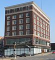 Kennedy Building (Omaha) from NW 1.JPG 1,596 × 1,740; 958 KB
-
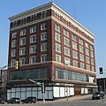 Kennedy Building (Omaha) from NW 2.JPG 1,710 × 1,713; 993 KB
-
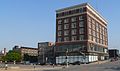 Kennedy Building (Omaha) from NW setting 1.JPG 2,560 × 1,522; 1.32 MB
_from_NE_1.JPG)
_from_NW_2.JPG)
_from_NW_setting_1.JPG)