Category:Kenninghall
village and civil parish in Norfolk, UK  | |||||
| Upload media | |||||
| Instance of | |||||
|---|---|---|---|---|---|
| Location | Breckland, Norfolk, East of England, England | ||||
| Area |
| ||||
| Said to be the same as | Kenninghall (Wikimedia duplicated page, civil parish) | ||||
| official website | |||||
 | |||||
Subcategories
This category has the following 5 subcategories, out of 5 total.
Media in category "Kenninghall"
The following 200 files are in this category, out of 233 total.
(previous page) (next page)-
 'The White Horse Inn' at Kenninghall - geograph.org.uk - 3066008.jpg 3,648 × 2,736; 2.8 MB
-
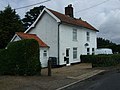
 A cottage in Church Street - geograph.org.uk - 1399655.jpg 640 × 580; 123 KB
-

-
 Altar of St.Mary's Church - geograph.org.uk - 4540932.jpg 2,304 × 3,072; 2.23 MB
-

-
 Back Lane sign - geograph.org.uk - 4540525.jpg 3,072 × 2,304; 1.96 MB
-
 Back Lane, Kenninghall - geograph.org.uk - 4540518.jpg 3,072 × 2,304; 1.72 MB
-
 Banham Road - geograph.org.uk - 3137255.jpg 1,024 × 768; 145 KB
-
 Banham Road - geograph.org.uk - 3137287.jpg 1,024 × 768; 157 KB
-
 Banham Road - geograph.org.uk - 4589309.jpg 640 × 480; 68 KB
-
 Banham Road - geograph.org.uk - 4589316.jpg 640 × 480; 74 KB
-
 Banham Road ^ Roadsign - geograph.org.uk - 5059345.jpg 3,072 × 2,304; 2.13 MB
-
 Banham Road, Kenninghall - geograph.org.uk - 4601955.jpg 640 × 480; 83 KB
-
 Banham Road, Kenninghall - geograph.org.uk - 5059277.jpg 3,072 × 2,304; 1.83 MB
-
 Banham Road, Kenninghall - geograph.org.uk - 5059364.jpg 3,072 × 2,304; 1.84 MB
-

-
 Bell Tower of St.Mary's Church - geograph.org.uk - 4540922.jpg 2,304 × 3,072; 1.6 MB
-
-
 Broiler house at Park common, Banham - geograph.org.uk - 2249117.jpg 640 × 480; 67 KB
-
 Brown And Green - geograph.org.uk - 3498028.jpg 1,024 × 768; 189 KB
-
 Church Farmhouse West - entrance - geograph.org.uk - 1399664.jpg 480 × 640; 88 KB
-
 Church Farmhouse West - geograph.org.uk - 1399657.jpg 640 × 480; 98 KB
-
 Church Farmhouse West - geograph.org.uk - 3137243.jpg 1,024 × 737; 154 KB
-
 Church Farmhouse West - south facade - geograph.org.uk - 1399661.jpg 640 × 480; 97 KB
-
 Church Street - geograph.org.uk - 1399647.jpg 640 × 480; 95 KB
-
 Church Street - geograph.org.uk - 1399669.jpg 640 × 480; 93 KB
-

-
 Church Street Victorian Postbox - geograph.org.uk - 4540954.jpg 3,072 × 2,304; 1.92 MB
-
 Church Street Victorian Postbox - geograph.org.uk - 4540957.jpg 3,072 × 2,304; 1.87 MB
-
 Church Street Victorian Postbox - geograph.org.uk - 4540958.jpg 2,291 × 3,046; 3.98 MB
-
 Church Street Victorian Postbox - geograph.org.uk - 4540959.jpg 2,265 × 3,011; 3.72 MB
-
 Claas Combine Harvester off Banham Road - geograph.org.uk - 5059287.jpg 3,072 × 2,304; 2.03 MB
-
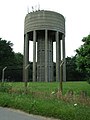 Concrete water tower - geograph.org.uk - 858047.jpg 480 × 640; 72 KB
-
 Cottages - geograph.org.uk - 3137275.jpg 1,024 × 768; 199 KB
-
 Cottages in Church Street - geograph.org.uk - 1399644.jpg 640 × 480; 78 KB
-
 Cottages in Church Street - geograph.org.uk - 1399668.jpg 464 × 640; 74 KB
-
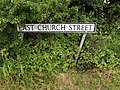
 Cottages in East Church Street - geograph.org.uk - 1577008.jpg 640 × 480; 118 KB
-
 Cottages in Quidenham Road - geograph.org.uk - 1399694.jpg 640 × 480; 80 KB
-
 Cottages in village centre (detail) - geograph.org.uk - 1399717.jpg 554 × 640; 116 KB
-
 Cottages in village centre - geograph.org.uk - 1399713.jpg 640 × 480; 91 KB
-
 Cottages on Banham Road - geograph.org.uk - 1399718.jpg 640 × 480; 82 KB
-
 Cottages on Church Street - geograph.org.uk - 1399710.jpg 640 × 480; 72 KB
-
 Cottages on Garboldisham Road - geograph.org.uk - 1399719.jpg 640 × 540; 72 KB
-
 Crashed Lancaster B111 GTU Memorial at Kenninghall - geograph.org.uk - 4513459.jpg 2,016 × 2,478; 923 KB
-
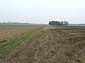
 Crop field off Banham Road - geograph.org.uk - 4589310.jpg 640 × 480; 86 KB
-
 Crop field off Banham Road - geograph.org.uk - 4589313.jpg 640 × 480; 84 KB
-

-
 Crop fields on the old airfield - geograph.org.uk - 4064466.jpg 640 × 480; 188 KB
-
 Drainage Ditch - geograph.org.uk - 3498034.jpg 1,024 × 768; 311 KB
-
 East Church Road, Kenninghall - geograph.org.uk - 4538954.jpg 3,072 × 2,304; 1.72 MB
-
 East Church Road, Kenninghall - geograph.org.uk - 4540961.jpg 3,072 × 2,304; 1.85 MB
-
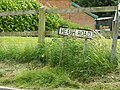
 East Church Street sign - geograph.org.uk - 4538956.jpg 3,072 × 2,304; 2 MB
-
 East Church Street ^ Church Street Victorian Postbox - geograph.org.uk - 4540965.jpg 3,072 × 2,304; 1.97 MB
-
 East Harling Road - geograph.org.uk - 4589283.jpg 640 × 480; 53 KB
-
 East Harling Road - geograph.org.uk - 4589286.jpg 640 × 480; 81 KB
-
 Electricity Sub Station off North Lopham Road - geograph.org.uk - 5059066.jpg 3,072 × 2,304; 1.87 MB
-
 Entering Kenninghall on Banham Road - geograph.org.uk - 5059270.jpg 3,072 × 2,304; 1.73 MB
-
 Entrance to Marshams Farm ^ Red Lion Lane Byway - geograph.org.uk - 5054586.jpg 3,072 × 2,304; 2.06 MB
-
 Farm buildings with chimney - geograph.org.uk - 4021415.jpg 4,320 × 3,240; 4.59 MB
-
 Farmland off Banham Road - geograph.org.uk - 5059285.jpg 3,072 × 2,216; 4.57 MB
-
 Fen Lane (track) - geograph.org.uk - 4589311.jpg 640 × 480; 85 KB
-
 Fersfield Road, Fersfield - geograph.org.uk - 4538908.jpg 3,072 × 2,304; 1.66 MB
-
 Fersfield Road, Kenninghall - geograph.org.uk - 4538934.jpg 3,072 × 2,304; 1.9 MB
-
 Fersfield Road, Kenninghall - geograph.org.uk - 4538960.jpg 3,072 × 2,304; 1.75 MB
-
 Field barn beside East Harling Road - geograph.org.uk - 2250001.jpg 640 × 480; 110 KB
-
 Field beside East Harling Road - geograph.org.uk - 2250008.jpg 640 × 480; 159 KB
-
 Field Boundary - geograph.org.uk - 3498048.jpg 1,024 × 768; 194 KB
-
 Field off East Harling Road - geograph.org.uk - 4601944.jpg 640 × 480; 79 KB
-
 Fields - geograph.org.uk - 3136871.jpg 1,024 × 768; 187 KB
-
 Font of St.Mary's Church - geograph.org.uk - 4540920.jpg 2,304 × 3,072; 1.98 MB
-
 Footpath - geograph.org.uk - 3498045.jpg 1,024 × 768; 243 KB
-
 Footpath across Fersfield airfield - geograph.org.uk - 4060831.jpg 640 × 480; 196 KB
-
 Footpath Junction - geograph.org.uk - 3498043.jpg 1,024 × 768; 225 KB
-
 Footpath Looking East - geograph.org.uk - 3498077.jpg 1,024 × 768; 276 KB
-
 Footpath past warehouses - geograph.org.uk - 4060830.jpg 640 × 480; 149 KB
-
 Footpath Sign - geograph.org.uk - 1702113.jpg 1,200 × 1,600; 613 KB
-

-
 Garboldisham Road sign - geograph.org.uk - 4545170.jpg 3,072 × 2,304; 1.87 MB
-
 Garboldisham Road, Kenninghall - geograph.org.uk - 4545128.jpg 3,072 × 2,304; 1.73 MB
-
 Garboldisham Road, Kenninghall - geograph.org.uk - 4545134.jpg 3,072 × 2,304; 1.69 MB
-
 Garboldisham Road, Kenninghall - geograph.org.uk - 4545156.jpg 3,072 × 2,304; 1.69 MB
-
 Garboldisham Road, Kenninghall - geograph.org.uk - 4545158.jpg 3,072 × 2,304; 2.01 MB
-
 Garboldisham Road, Kenninghall - geograph.org.uk - 4545162.jpg 3,072 × 2,304; 1.83 MB
-
 Garboldisham Road, Kenninghall - geograph.org.uk - 4545873.jpg 3,072 × 2,304; 1.72 MB
-
 Garboldisham Road, Kenninghall - geograph.org.uk - 4601948.jpg 640 × 480; 53 KB
-
 Garboldisham Road, Kenninghall in 1987 - geograph.org.uk - 2729007.jpg 914 × 623; 103 KB
-
 Garboldisham Road, Kenningham - geograph.org.uk - 5059244.jpg 3,072 × 2,304; 4.92 MB
-

-
 George V pillar box - geograph.org.uk - 1399688.jpg 450 × 640; 67 KB
-

-
 Grange Farm - geograph.org.uk - 1577004.jpg 640 × 480; 163 KB
-
 Green Farm - geograph.org.uk - 456063.jpg 640 × 477; 96 KB
-
 Hairflair - geograph.org.uk - 1399691.jpg 640 × 491; 80 KB
-
 Hangar beside the footpath - geograph.org.uk - 4060828.jpg 640 × 470; 131 KB
-
 Hardstanding beside the perimeter track - geograph.org.uk - 4064476.jpg 640 × 480; 122 KB
-
 Heath Road and entrance to Crown Milling - geograph.org.uk - 4541501.jpg 3,072 × 2,304; 1.77 MB
-
 Heath Road sign - geograph.org.uk - 4538951.jpg 3,072 × 2,304; 1.97 MB
-
 Heath Road sign - geograph.org.uk - 4541520.jpg 2,879 × 2,157; 2.53 MB
-
 Heath Road sign - geograph.org.uk - 5054282.jpg 3,072 × 2,304; 1.88 MB
-
 Heath Road, Edge Green, Kenninghall - geograph.org.uk - 4541495.jpg 3,072 × 2,304; 1.86 MB
-
 Heath Road, Kenninghall - geograph.org.uk - 4538953.jpg 3,072 × 2,304; 1.87 MB
-
 Heath Road, Kenninghall - geograph.org.uk - 4541518.jpg 2,935 × 2,058; 2.11 MB
-
 Heath Road, Kenninghall - geograph.org.uk - 5054280.jpg 3,072 × 2,304; 1.85 MB
-
 Houses on Banham Road - geograph.org.uk - 4589307.jpg 640 × 480; 67 KB
-
 Inside of St.Mary's Church - geograph.org.uk - 4540925.jpg 2,304 × 3,072; 2.09 MB
-
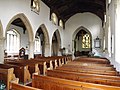 Inside St.Mary's Church - geograph.org.uk - 4540914.jpg 3,072 × 2,304; 1.91 MB
-
 Inside St.Mary's Church - geograph.org.uk - 4540928.jpg 2,304 × 3,072; 1.69 MB
-
 Intensive Poultry Rearing Sheds - geograph.org.uk - 352588.jpg 640 × 480; 172 KB
-
 Kenninghall Primary Electricity Sub Station - geograph.org.uk - 5059065.jpg 3,072 × 2,304; 1.71 MB
-
 Kenninghall Primary Electricity Sub Station - geograph.org.uk - 5059068.jpg 3,072 × 2,304; 1.91 MB
-
 Kenninghall Primary Electricity Sub Station sign - geograph.org.uk - 5059071.jpg 2,253 × 3,004; 4.08 MB
-
 Kenninghall Stores ^ Post Office - geograph.org.uk - 4540644.jpg 3,072 × 2,304; 1.89 MB
-
 Kenninghall Village Name sign on Banham Road - geograph.org.uk - 5059273.jpg 3,030 × 2,273; 6.08 MB
-
 Kenninghall village sign - geograph.org.uk - 3971867.jpg 4,320 × 3,240; 4.03 MB
-
 Kenninghall Village sign - geograph.org.uk - 4545140.jpg 3,072 × 2,304; 1.84 MB
-
 Kenninghall Village sign - geograph.org.uk - 4545144.jpg 2,181 × 2,900; 2.77 MB
-
 Kenninghall Village sign - geograph.org.uk - 4545148.jpg 2,240 × 2,978; 4.06 MB
-
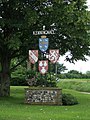 Kenninghall village sign - geograph.org.uk - 858057.jpg 480 × 640; 104 KB
-
 Kenninghall, Norfolk - geograph.org.uk - 42071.jpg 640 × 427; 64 KB
-
 Leading To Kenninghall Place - geograph.org.uk - 3498135.jpg 1,024 × 768; 194 KB
-
 Line Of The Old Runway - geograph.org.uk - 3498012.jpg 1,024 × 768; 197 KB
-
 Long Track - geograph.org.uk - 3498100.jpg 1,024 × 768; 295 KB
-
 Lopham Road sign - geograph.org.uk - 4545166.jpg 2,946 × 2,207; 3.31 MB
-
 Lopham Road, the B1113 - geograph.org.uk - 2136526.jpg 3,648 × 2,736; 1.13 MB
-
 Market Place George V Postbox - geograph.org.uk - 4540646.jpg 2,192 × 2,914; 2.41 MB
-
 Market Place George V Postbox - geograph.org.uk - 4540648.jpg 2,253 × 2,995; 3.01 MB
-
 Market Place George V Postbox - geograph.org.uk - 4540649.jpg 2,253 × 2,995; 2.99 MB
-
 Market Place sign - geograph.org.uk - 4540653.jpg 2,970 × 2,225; 1.82 MB
-
 Market Place, Kenninghall - geograph.org.uk - 4540913.jpg 3,072 × 2,304; 1.7 MB
-
 My Lord's Drive - geograph.org.uk - 3136870.jpg 1,024 × 768; 313 KB
-
 My Lord's Drive - geograph.org.uk - 355241.jpg 427 × 640; 74 KB
-
 No Marked Path - geograph.org.uk - 3497999.jpg 1,024 × 768; 197 KB
-
 North Lobham Road, Kenninghall - geograph.org.uk - 4544610.jpg 3,072 × 2,304; 1.62 MB
-
 North Lopham Road, Kenninghall - geograph.org.uk - 4544435.jpg 3,072 × 2,304; 1.82 MB
-
 North Lopham Road, Kenninghall - geograph.org.uk - 4544436.jpg 3,072 × 2,304; 1.81 MB
-
 North Lopham Road, Kenninghall - geograph.org.uk - 4545152.jpg 3,072 × 2,304; 1.79 MB
-
 North Lopham Road, Kenninghall - geograph.org.uk - 5054279.jpg 3,072 × 2,304; 1.76 MB
-
 North Lopham Road, Kenninghall - geograph.org.uk - 5054583.jpg 3,031 × 2,273; 3.32 MB
-
 North Lopham Road, Kenninghall - geograph.org.uk - 5059056.jpg 3,072 × 2,304; 1.63 MB
-
 North Lopham Road, Kenninghall - geograph.org.uk - 5059058.jpg 3,072 × 2,304; 1.95 MB
-
 North Lopham Road, Kenninghall - geograph.org.uk - 5059059.jpg 3,072 × 2,076; 2.62 MB
-
 North Lopham Road, Kenninghall - geograph.org.uk - 5059075.jpg 3,072 × 2,304; 1.81 MB
-
 North Lopham Road, Kenninghall - geograph.org.uk - 5059080.jpg 3,072 × 2,304; 1.73 MB
-
 Old Royal George, Kenninghall - geograph.org.uk - 3792867.jpg 640 × 480; 86 KB
-
 Ordnance Survey Cut Mark - geograph.org.uk - 4208269.jpg 640 × 480; 121 KB
-
 Organ of St.Mary's Church - geograph.org.uk - 4540930.jpg 2,228 × 2,962; 1.72 MB
-

-
 Partly Ploughed - geograph.org.uk - 3498069.jpg 1,024 × 768; 257 KB
-
 Partly thatched house, Kenninghall - geograph.org.uk - 4601950.jpg 640 × 480; 77 KB
-
 Path And Power lines - geograph.org.uk - 3498081.jpg 1,024 × 768; 215 KB
-
 Perimeter Track - geograph.org.uk - 3498022.jpg 1,024 × 768; 187 KB
-
 Poet's Corner, Kenninghall.jpg 3,024 × 4,032; 3.53 MB
-
 Post Office and Shop - geograph.org.uk - 1399686.jpg 640 × 552; 76 KB
-
 Post Office and stores, Kenninghall - geograph.org.uk - 4589295.jpg 640 × 480; 60 KB
-
 Poultry houses by High Starlings - geograph.org.uk - 2249951.jpg 640 × 480; 153 KB
-
 Poultry houses by High Starlings - geograph.org.uk - 2249957.jpg 640 × 453; 85 KB
-
 Poultry houses by High Starlings - geograph.org.uk - 2249959.jpg 640 × 480; 91 KB
-
 Pulpit of St.Mary's Church - geograph.org.uk - 4540927.jpg 2,304 × 3,072; 1.84 MB
-
 Quidenham Road - geograph.org.uk - 1399702.jpg 552 × 640; 79 KB
-
 RAF Fersfield - Technical site - geograph.org.uk - 4064480.jpg 640 × 480; 120 KB
-
 RAF Fersfield - Technical site - geograph.org.uk - 4064484.jpg 463 × 640; 206 KB
-
 RAF Fersfield - Technical site - geograph.org.uk - 4064487.jpg 640 × 480; 186 KB
-
 RAF Fersfield - Technical site - geograph.org.uk - 4064489.jpg 640 × 480; 130 KB
-
 RAF Fersfield - Technical site - geograph.org.uk - 4064490.jpg 640 × 480; 183 KB
-
 RAF Fersfield - Technical site - geograph.org.uk - 4064491.jpg 640 × 480; 169 KB
-
 RAF Fersfield - Technical site - geograph.org.uk - 4064492.jpg 640 × 480; 149 KB
-
 RAF Fersfield - Technical site - geograph.org.uk - 4800426.jpg 640 × 542; 479 KB
-
 Railway Goods Van - geograph.org.uk - 352245.jpg 640 × 510; 122 KB
-

-
 Ripening barley on the old airfield - geograph.org.uk - 4064468.jpg 640 × 480; 227 KB
-
 Road Junction - geograph.org.uk - 1702157.jpg 1,600 × 1,200; 460 KB
-
 Road junction just southeast of Kenninghall village - geograph.org.uk - 3065993.jpg 3,648 × 2,736; 3.05 MB
-

-
 Road Junction, Kenninghall in 1987 - geograph.org.uk - 2728979.jpg 935 × 617; 107 KB
-
 Roadsign on Banham Road - geograph.org.uk - 5059351.jpg 3,072 × 2,304; 2.01 MB
-
 Roadsign on Garboldisham Road - geograph.org.uk - 4545122.jpg 2,107 × 2,802; 3.21 MB
-
 Roadsign on Garboldisham Road - geograph.org.uk - 4545154.jpg 2,304 × 3,072; 2.61 MB
-
 Roadsign on Heath Road - geograph.org.uk - 4538958.jpg 2,304 × 3,072; 2.6 MB
-
 Roadsigns on Banham Road - geograph.org.uk - 5059378.jpg 3,072 × 2,304; 1.91 MB
-
 Roadsigns on Kenninghall Road - geograph.org.uk - 5059396.jpg 3,072 × 2,304; 1.83 MB
-
 Rural Industry - geograph.org.uk - 352268.jpg 640 × 480; 86 KB
-
 Sign for the Red Lion, Kenninghall - geograph.org.uk - 4589302.jpg 578 × 640; 64 KB
-

-
 Solar energy farm - geograph.org.uk - 4589285.jpg 640 × 480; 101 KB
-
 Spot the pillbox - geograph.org.uk - 2249921.jpg 640 × 480; 170 KB
-
 St Mary's Church, Kenninghall - geograph.org.uk - 4540915.jpg 3,072 × 2,304; 1.84 MB
-
 St.Mary's Church Notice Board - geograph.org.uk - 4540668.jpg 3,072 × 2,304; 2.03 MB
-
 St.Mary's Church Notice Board - geograph.org.uk - 4540936.jpg 3,007 × 2,253; 2.08 MB
-
 St.Mary's Church, Kenninghall - geograph.org.uk - 4540669.jpg 3,072 × 2,304; 2.17 MB
-
 Stained Glass Window of St.Mary's Church - geograph.org.uk - 4540935.jpg 2,215 × 2,944; 2.51 MB
-

-
 Sugar beet crop field - geograph.org.uk - 4064460.jpg 640 × 480; 171 KB
-

-
 Thatched cottage in Church Street - geograph.org.uk - 1399665.jpg 640 × 480; 97 KB
-

-
 Thatched cottage, Kenninghall - geograph.org.uk - 4601953.jpg 640 × 480; 69 KB
-
 The Butts, Kenninghall - geograph.org.uk - 4545854.jpg 2,304 × 3,072; 2.31 MB
-

-
 The Red Lion Public House sign - geograph.org.uk - 4540665.jpg 2,192 × 2,914; 1.78 MB
-
 The Red Lion Public House, Kenninghall - geograph.org.uk - 4540664.jpg 3,072 × 2,304; 1.96 MB


_-_geograph.org.uk_-_1399717.jpg)


_-_geograph.org.uk_-_4589311.jpg)


