Category:Kerkstraat 12, Vollenhove
| Object location | | View all coordinates using: OpenStreetMap |
|---|
building in Steenwijkerland, Netherlands  | |||||
| Upload media | |||||
| Instance of | |||||
|---|---|---|---|---|---|
| Location | Vollenhove, Vollenhove | ||||
| Street address |
| ||||
| Located on street |
| ||||
| Heritage designation |
| ||||
 | |||||
|
This is a category about rijksmonument number 10558
|
| Address |
|
}}
Media in category "Kerkstraat 12, Vollenhove"
The following 8 files are in this category, out of 8 total.
-
 Achtergevel - Vollenhove - 20245142 - RCE.jpg 1,200 × 956; 305 KB
-
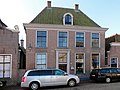 Kerkstraat12 Vollenhove.jpg 1,824 × 1,368; 285 KB
-
 Overzicht - Vollenhove - 20244822 - RCE.jpg 1,200 × 805; 159 KB
-
 Overzicht - Vollenhove - 20245144 - RCE.jpg 1,200 × 949; 247 KB
-
 Overzicht Kerkstraat - Vollenhove - 20244886 - RCE.jpg 1,200 × 1,200; 341 KB
-
 Voorgevel - Vollenhove - 20245143 - RCE.jpg 1,200 × 956; 210 KB
-
 Voorgevel - Vollenhove - 20245145 - RCE.jpg 807 × 1,200; 198 KB
-
 Voorgevel - Vollenhove - 20245146 - RCE.jpg 1,000 × 1,200; 231 KB


