Category:Kerkstraat 36, Vollenhove
| Object location | | View all coordinates using: OpenStreetMap |
|---|
 | |||||
| Upload media | |||||
| Instance of |
| ||||
|---|---|---|---|---|---|
| Location | Vollenhove, Vollenhove | ||||
| Street address |
| ||||
| Located on street |
| ||||
| Heritage designation |
| ||||
 | |||||
|
This is a category about rijksmonument number 10564
|
| Address |
|
Media in category "Kerkstraat 36, Vollenhove"
The following 4 files are in this category, out of 4 total.
-
 Gevel - Vollenhove - 20245195 - RCE.jpg 1,026 × 1,200; 211 KB
-
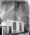
 Kerkstraat36 Vollenhove.jpg 1,368 × 1,824; 219 KB
-
 Trapgevel met 2 friezen, anno 1669 - Vollenhove - 20509811 - RCE.jpg 1,200 × 900; 117 KB
-
 Voorgevel - Vollenhove - 20245178 - RCE.jpg 809 × 1,200; 153 KB


