Category:Kershopefoot
English: Kershopefoot is a hamlet in the civil parish of Nicholforest, in the Carlisle district, in the county of Cumbria, England. It is located very close to the Scotland-England border and is near the Kershope Burn and the Liddel Water.
hamlet in Cumbria, England, UK  | |||||
| Upload media | |||||
| Instance of | |||||
|---|---|---|---|---|---|
| Location | Nicholforest, Carlisle, Cumbria, North West England, England | ||||
 | |||||
Media in category "Kershopefoot"
The following 161 files are in this category, out of 161 total.
-
 A corner of Kershope Forest - geograph.org.uk - 683433.jpg 640 × 480; 75 KB
-
 A corner of Kershope Forest - geograph.org.uk - 683458.jpg 640 × 480; 82 KB
-
 A corner of Kershope Forest - geograph.org.uk - 691165.jpg 640 × 480; 63 KB
-
 A drystane dyke on Kirk Hill - geograph.org.uk - 522020.jpg 640 × 480; 103 KB
-
 A fence on Millstone Edge - geograph.org.uk - 549773.jpg 640 × 480; 104 KB
-
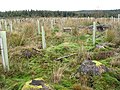
 A forest of Tuley Tubes - geograph.org.uk - 683455.jpg 640 × 480; 86 KB
-
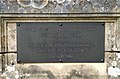 A plaque at Frank Coutts Court - geograph.org.uk - 818242.jpg 639 × 420; 149 KB
-
 A straight road in Kershope Forest - geograph.org.uk - 691700.jpg 640 × 480; 71 KB
-
 Access control in Kershope Forest - geograph.org.uk - 691204.jpg 640 × 480; 63 KB
-
 Access control, Kershope Forest - geograph.org.uk - 547919.jpg 640 × 480; 147 KB
-
 Avenue of trees on the road to Kershope - geograph.org.uk - 687990.jpg 640 × 480; 116 KB
-
 B6318 - geograph.org.uk - 323540.jpg 640 × 480; 89 KB
-
 Bailey Water - geograph.org.uk - 523134.jpg 480 × 640; 138 KB
-
 Boundary fence - geograph.org.uk - 522006.jpg 640 × 480; 113 KB
-

-
 Clear fell in Kershope Forest - geograph.org.uk - 683452.jpg 640 × 480; 92 KB
-
 Converted barn at Stonegarthside Hall - geograph.org.uk - 691196.jpg 640 × 480; 68 KB
-
 Currick Sike - geograph.org.uk - 662528.jpg 640 × 427; 61 KB
-
-
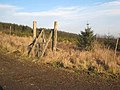
 Deer proof gate in Kershope Forest - geograph.org.uk - 691708.jpg 640 × 480; 79 KB
-
-
 Firebreak in Kershope Forest - geograph.org.uk - 691720.jpg 640 × 480; 79 KB
-
 Footpath near Kershope Forest - geograph.org.uk - 683446.jpg 640 × 480; 82 KB
-
 Forest road at Black Rigg - geograph.org.uk - 691717.jpg 640 × 480; 76 KB
-
 Forest road in Kershope Forest - geograph.org.uk - 691192.jpg 640 × 480; 65 KB
-
 Forest road in Kershope Forest - geograph.org.uk - 691195.jpg 640 × 480; 81 KB
-
 Forest road on Wakey Hill - geograph.org.uk - 683438.jpg 640 × 480; 71 KB
-
 Forest Track - geograph.org.uk - 662501.jpg 640 × 427; 69 KB
-
 Forest Track - geograph.org.uk - 663689.jpg 640 × 416; 73 KB
-
 Forest Track - geograph.org.uk - 663705.jpg 640 × 427; 62 KB
-
 Forest track in Kershope Forest - geograph.org.uk - 691712.jpg 640 × 480; 72 KB
-

-
 Huskies in Kershope Forest - geograph.org.uk - 683447.jpg 640 × 480; 83 KB
-
 Huskies in Kershope Forest - geograph.org.uk - 691193.jpg 640 × 480; 81 KB
-
 Signpost in Kershope Forest - geograph.org.uk - 691189.jpg 640 × 480; 89 KB
-
 Kershope Burn - geograph.org.uk - 3161777.jpg 2,560 × 1,920; 2.94 MB
-
 Kershope Foot station site geograph-3719746-by-Ben-Brooksbank.jpg 2,338 × 1,364; 4.16 MB
-
 Langcleughside - geograph.org.uk - 691180.jpg 640 × 480; 80 KB
-
 Long Cairn - geograph.org.uk - 280440.jpg 640 × 480; 138 KB
-
 Long Cairn - geograph.org.uk - 663116.jpg 640 × 354; 78 KB
-
 Long Cairn - geograph.org.uk - 663119.jpg 640 × 290; 73 KB
-
 Moorland fence - geograph.org.uk - 520612.jpg 640 × 480; 121 KB
-
 Moorland road above Kershope Burn - geograph.org.uk - 525220.jpg 640 × 473; 117 KB
-
-
 Pill box near Saughs Farm - geograph.org.uk - 683731.jpg 640 × 480; 66 KB
-
 Puddles in the road - geograph.org.uk - 683735.jpg 480 × 640; 68 KB
-
 Redgatehead - geograph.org.uk - 547828.jpg 640 × 480; 120 KB
-
 Road in Kershope Forest - geograph.org.uk - 547967.jpg 640 × 480; 136 KB
-
 Roadside pile of logs - geograph.org.uk - 688000.jpg 640 × 480; 76 KB
-
 Small stream in Kershope Forest - geograph.org.uk - 691168.jpg 640 × 480; 97 KB
-
 Telephone and pillar boxes at Bushfield - geograph.org.uk - 551251.jpg 640 × 480; 144 KB
-
 The Kershope Burn - geograph.org.uk - 691724.jpg 640 × 480; 87 KB
-
 The Kershope valley below Kershope Bridge - geograph.org.uk - 209006.jpg 640 × 480; 109 KB
-
 The Old Dog and Gun - geograph.org.uk - 547818.jpg 640 × 480; 94 KB
-
 Valley of the Crook Burn - geograph.org.uk - 683726.jpg 640 × 480; 88 KB
-
 Valley of the Crook Burn - geograph.org.uk - 691744.jpg 640 × 480; 94 KB
-
 Woodland path and stream - geograph.org.uk - 691171.jpg 640 × 480; 96 KB
-
 A forestry road at Knowe Head - geograph.org.uk - 933513.jpg 427 × 640; 141 KB
-
 A forestry road at Tinnisburn - geograph.org.uk - 933496.jpg 640 × 427; 139 KB
-

-
 A forestry road in Tinnisburn Forest - geograph.org.uk - 947819.jpg 640 × 427; 156 KB
-
 Access gate to plantation - geograph.org.uk - 323508.jpg 640 × 480; 130 KB
-
 An unusual place for a bird's nest - geograph.org.uk - 819395.jpg 600 × 417; 144 KB
-
 B6318 downhill towardsGreenrigg - geograph.org.uk - 553160.jpg 640 × 480; 144 KB
-
 Bailey Water - geograph.org.uk - 662934.jpg 427 × 640; 72 KB
-
 Bailey Water - geograph.org.uk - 663685.jpg 640 × 427; 68 KB
-

-
 Barns at Stoneknowe - geograph.org.uk - 547832.jpg 640 × 480; 130 KB
-
 Bartle's Burn - geograph.org.uk - 552354.jpg 640 × 480; 168 KB
-
 Bartle's Burn near Craiggy Ford - geograph.org.uk - 552358.jpg 480 × 640; 193 KB
-
 Blackburn Farm - geograph.org.uk - 520606.jpg 640 × 480; 108 KB
-
 Boggy ground at Millstone Edge - geograph.org.uk - 548151.jpg 640 × 480; 99 KB
-
 Boulder - geograph.org.uk - 332189.jpg 480 × 640; 113 KB
-
 Boulder - geograph.org.uk - 727190.jpg 640 × 480; 92 KB
-
 Bridge over Chapel Burn at Warwicksland - geograph.org.uk - 323526.jpg 640 × 480; 133 KB
-
 Bridge over the Rae Burn - geograph.org.uk - 577632.jpg 640 × 480; 156 KB
-
 Bungalow near Stonygate - geograph.org.uk - 687972.jpg 640 × 480; 83 KB
-
 Care^ Red squirrels crossing - geograph.org.uk - 552088.jpg 480 × 640; 201 KB
-
 Caulside - geograph.org.uk - 535504.jpg 640 × 426; 146 KB
-
 Caulside crofts - geograph.org.uk - 535575.jpg 640 × 426; 109 KB
-
 Chamot Hill - geograph.org.uk - 691187.jpg 640 × 480; 63 KB
-
 Cooms Fell - geograph.org.uk - 548140.jpg 640 × 480; 110 KB
-
 Cooms Fell trig point - geograph.org.uk - 548133.jpg 624 × 469; 104 KB
-
 Cottage at Harelaw - geograph.org.uk - 535582.jpg 640 × 426; 140 KB
-
 Craiggyford Bridge - geograph.org.uk - 551253.jpg 640 × 478; 183 KB
-

-
 Crossing of the Bailey Water - geograph.org.uk - 547965.jpg 640 × 480; 152 KB
-
 Cuddy's Burn - geograph.org.uk - 662951.jpg 640 × 427; 98 KB
-
 Cuddy's Hall - geograph.org.uk - 662925.jpg 640 × 459; 66 KB
-
 Descent into Liddesdale - geograph.org.uk - 683424.jpg 640 × 480; 66 KB
-
 Descent into Liddesdale - geograph.org.uk - 687961.jpg 640 × 480; 86 KB
-
 Disused garage in Newcastleton - geograph.org.uk - 595705.jpg 640 × 455; 108 KB
-
 Disused railway - geograph.org.uk - 323554.jpg 640 × 480; 183 KB
-
 Disused railway bridge - geograph.org.uk - 323548.jpg 640 × 480; 226 KB
-
 Easy access - geograph.org.uk - 323531.jpg 640 × 480; 152 KB
-
 Entrance to Scottish Woodlands plantation - geograph.org.uk - 552083.jpg 640 × 477; 128 KB
-
 Environmental house - geograph.org.uk - 323538.jpg 640 × 480; 191 KB
-
 Farm track and grazing field - geograph.org.uk - 520867.jpg 640 × 480; 113 KB
-
 Farmyard at Lordstown - geograph.org.uk - 547833.jpg 640 × 480; 123 KB
-
 Field Near Tweeden Burn - geograph.org.uk - 608612.jpg 640 × 480; 184 KB
-
 Forest Track - geograph.org.uk - 662517.jpg 427 × 640; 69 KB
-
 Forest Walk - geograph.org.uk - 84237.jpg 640 × 426; 126 KB
-
 Forests in the valley of the Langley Burn - geograph.org.uk - 547817.jpg 640 × 480; 132 KB
-
 Former School Harelaw - geograph.org.uk - 535490.jpg 640 × 426; 136 KB
-

-
 Greenrigg - geograph.org.uk - 551254.jpg 640 × 480; 132 KB
-
 Grouse moorland at Blackgate Rig - geograph.org.uk - 548165.jpg 640 × 480; 117 KB
-
 Hairpin bend at Longcleughside - geograph.org.uk - 552089.jpg 640 × 480; 152 KB
-
 Heather moorland at Black Edge - geograph.org.uk - 548131.jpg 640 × 480; 109 KB
-
 High moorland - geograph.org.uk - 549513.jpg 478 × 589; 108 KB
-
 Hollin Cleugh - geograph.org.uk - 662476.jpg 640 × 350; 50 KB
-
 Hollin Cleugh - geograph.org.uk - 663086.jpg 640 × 333; 54 KB
-
 Hopeshouse Farm, near Catlowdy - geograph.org.uk - 248973.jpg 640 × 480; 63 KB
-
 House above the Kershope valley - geograph.org.uk - 691200.jpg 640 × 507; 79 KB
-
 How are the mighty fallen^ - geograph.org.uk - 691729.jpg 640 × 480; 69 KB
-
 Keeled over trees near Liddel Park - geograph.org.uk - 552079.jpg 640 × 480; 189 KB
-
 Kershope Lodge - geograph.org.uk - 691186.jpg 640 × 480; 63 KB
-
 Kershopefoot - geograph.org.uk - 85192.jpg 640 × 480; 194 KB
-
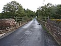 Kershopefoot Bridge - geograph.org.uk - 674490.jpg 640 × 480; 93 KB
-
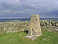 Kirk Hill triangulation pillar - geograph.org.uk - 521973.jpg 640 × 480; 116 KB
-
 Line of Stones - geograph.org.uk - 332185.jpg 640 × 480; 94 KB
-
 Linns View Harelaw - geograph.org.uk - 535584.jpg 640 × 426; 108 KB
-
 Loch Knowe - geograph.org.uk - 548162.jpg 480 × 640; 121 KB
-
 Long Cairn - geograph.org.uk - 280445.jpg 640 × 480; 146 KB
-
 Looking out over Liddesdale - geograph.org.uk - 687995.jpg 640 × 480; 83 KB
-

-
 Looking towards Tinnis Hill - geograph.org.uk - 413399.jpg 640 × 423; 39 KB
-
 Monument - geograph.org.uk - 280443.jpg 480 × 640; 125 KB
-
 Moorland bridge - geograph.org.uk - 520611.jpg 637 × 460; 107 KB
-
 Moorland road - geograph.org.uk - 520615.jpg 640 × 480; 115 KB
-
 Nookfoot Farm - geograph.org.uk - 683426.jpg 640 × 480; 78 KB
-
 Old Hall - geograph.org.uk - 687975.jpg 640 × 480; 71 KB
-
 Old Shed - geograph.org.uk - 662963.jpg 640 × 427; 120 KB
-
 Peppermoss - geograph.org.uk - 323457.jpg 640 × 480; 232 KB
-
 Public bridleway to Catlowdy - geograph.org.uk - 522755.jpg 640 × 480; 108 KB
-

-
 Quarry on Greena Hill - geograph.org.uk - 204422.jpg 640 × 480; 168 KB
-
 Redgatehead - geograph.org.uk - 663185.jpg 640 × 355; 58 KB
-
 Road from Stonegarthside to Bushfield - geograph.org.uk - 552085.jpg 640 × 475; 134 KB
-
 Road south over Cuddyshall Bridge - geograph.org.uk - 525287.jpg 640 × 468; 99 KB
-
 Rough grazing at Stanygill Rig - geograph.org.uk - 520614.jpg 640 × 480; 98 KB
-
 Rough grazing on Bedda Hill - geograph.org.uk - 520608.jpg 640 × 480; 109 KB
-
 Rough grazing on Greena Hill - geograph.org.uk - 520872.jpg 640 × 480; 108 KB
-
 Scrubland at Gillside - geograph.org.uk - 521148.jpg 637 × 452; 104 KB
-
 Scrubland by the B6357 - geograph.org.uk - 520860.jpg 640 × 480; 122 KB
-
 Several black sheep in this family^ - geograph.org.uk - 248972.jpg 640 × 480; 69 KB
-
 Sheds at Brown Knowe - geograph.org.uk - 551250.jpg 640 × 480; 158 KB
-
 Sign for Windy Edge - geograph.org.uk - 332194.jpg 640 × 480; 165 KB
-
 Sike in field at Nookgate - geograph.org.uk - 551255.jpg 640 × 480; 177 KB
-
 Sleet Beck and Craiggyford Bridge - geograph.org.uk - 552362.jpg 480 × 640; 206 KB
-
 Slow lambs - geograph.org.uk - 522764.jpg 640 × 468; 112 KB
-
 Smithy Gill joins Bailey Water - geograph.org.uk - 525269.jpg 640 × 480; 160 KB
-
 Start of forest track - geograph.org.uk - 553163.jpg 640 × 480; 175 KB
-
 The Waverley line in Liddesdale - geograph.org.uk - 683432.jpg 640 × 480; 65 KB
-
 Tinnis - geograph.org.uk - 280439.jpg 640 × 480; 133 KB
-

-
 Tinnis from Whita - geograph.org.uk - 281451.jpg 640 × 480; 46 KB
-
 Tinnis Well - geograph.org.uk - 332181.jpg 640 × 480; 84 KB
-
 Tom's Sike Bridge - geograph.org.uk - 674506.jpg 640 × 480; 88 KB
-
 Track to forest at Liddel Park - geograph.org.uk - 551249.jpg 640 × 440; 145 KB
-
 View south from Tinnis - geograph.org.uk - 280438.jpg 640 × 480; 69 KB


