Category:Keta (Ghana)
| Object location | | View all coordinates using: OpenStreetMap |
|---|
coastal community in Volta Region, Ghana  | |||||
| Upload media | |||||
| Instance of | |||||
|---|---|---|---|---|---|
| Location | Keta Municipal District, Volta Region, Ghana | ||||
| Heritage designation | |||||
| Population |
| ||||
| Different from | |||||
 | |||||
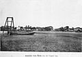
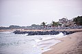
Keta (hist. "Quitta" or similarly) is the capital of the Keta Municipal District of the Volta Region of Ghana. The town is located on the spit between the Awuna Lagoon (Keta Lagoon) and the Atlantic Ocean.According to their tradition was Keta founded in 1678 by Ewe groups which came from the town "Ketu" east of the Mono river (in contemporary southwestern Nigeria).
Subcategories
This category has the following 6 subcategories, out of 6 total.
- Beaches of Keta (Ghana) (5 F)
- Markets in Keta (Ghana) (2 F)
A
Media in category "Keta (Ghana)"
The following 11 files are in this category, out of 11 total.
-
 Blue sea at Havedzi.JPG 3,072 × 1,728; 1.43 MB
-
 Flooding in Keta.jpg 4,160 × 3,120; 7.73 MB
-
 Keta Lagunenseite.jpg 2,995 × 2,080; 1.35 MB
-
 Keta Sea Defends.jpg 6,016 × 4,016; 3.85 MB
-
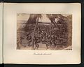
 Orphelinat Quittah.jpg 580 × 372; 52 KB
-
 Soccer (14488692682).jpg 3,336 × 1,344; 2.29 MB
-
 The National Archives UK - CO 1069-30-22-001.jpg 600 × 398; 192 KB
-
 The National Archives UK - CO 1069-30-23.jpg 929 × 748; 123 KB
-
 The National Archives UK - CO 1069-39-13-1-001.jpg 672 × 474; 139 KB
-
 The National Archives UK - CO 1069-39-14-1-001.jpg 621 × 469; 102 KB
-
 Une leçon de catéchisme.jpg 1,350 × 896; 953 KB


.jpg)