Category:Kiambu County
county in Kenya   | |||||
| Upload media | |||||
| Instance of | |||||
|---|---|---|---|---|---|
| Location | Central Province | ||||
| Capital |
| ||||
| Population |
| ||||
| official website | |||||
 | |||||
Kiambu County is one of the 47 counties of Kenya. It is located in the central region of the country.
Subcategories
This category has the following 9 subcategories, out of 9 total.
B
- B3 road (Kenya) (14 F)
G
- Gatundu (6 F)
J
- Juja (5 F)
K
- Kiambu High School (11 F)
L
M
- Mau-Mau Cave (13 F)
R
- Ragia Forest (5 F)
T
Media in category "Kiambu County"
The following 72 files are in this category, out of 72 total.
-
 Kiambu County Flag.svg 1,052 × 744; 20 KB
-
 A panorama of Githunguri town center.jpg 17,592 × 3,360; 26.13 MB
-
 A104 road in Kenya 01.jpg 5,568 × 3,712; 9.79 MB
-
 A104 road in Kenya 02.jpg 5,568 × 3,712; 9.68 MB
-
 B3 in Kiambu County 01.jpg 5,568 × 3,712; 9.75 MB
-
 B3 in Kiambu County 02.jpg 5,568 × 3,712; 11.93 MB
-
 B3 in Kiambu County 03.jpg 5,568 × 3,712; 11.53 MB
-
 B3 in Kiambu County 04.jpg 5,568 × 3,712; 9.43 MB
-
 Backflip at Fourteen Falls.jpg 2,048 × 1,536; 1 MB
-
 Bathi Dam in Kijabe, Kiambu Kenya.jpg 2,048 × 1,536; 645 KB
-

-
 Fresh lettuce from a farm at Limuru.jpg 1,440 × 1,800; 657 KB
-
 Game day.jpg 4,096 × 3,072; 6.93 MB
-
 Gatamaiyu Falls, Githunguri Town.jpg 1,080 × 1,350; 502 KB
-
 Gatamaiyu Falls, Githunguri.jpg 1,080 × 1,349; 274 KB
-
 Girls' home at Kijabe, Kenya, c. 1914.jpg 778 × 675; 190 KB
-
 Go Saints!.jpg 3,026 × 2,422; 6.62 MB
-
 Grass thatched resort.jpg 5,184 × 3,888; 4.58 MB
-
 Jiggers- children with.jpg 960 × 960; 107 KB
-
 Kenya (16027789749).jpg 4,000 × 2,667; 1.75 MB
-
 Kenya 2013. Rift Valley from the road Naivasha-Nairobi - panoramio (2).jpg 3,648 × 2,736; 4.43 MB
-
 Kenya 2013. Rift Valley from the road Naivasha-Nairobi - panoramio (3).jpg 3,648 × 2,736; 4.35 MB
-
 Kenya 2013. Rift Valley from the road Naivasha-Nairobi - panoramio (4).jpg 3,648 × 2,736; 4.04 MB
-
 Kenya 2013. Rift Valley from the road Naivasha-Nairobi - panoramio (5).jpg 3,648 × 2,736; 3.79 MB
-
 Kenya 2013. Rift Valley from the road Naivasha-Nairobi - panoramio (6).jpg 3,648 × 2,736; 3.65 MB
-
 Kenya 2013. Rift Valley from the road Naivasha-Nairobi - panoramio.jpg 2,592 × 1,944; 2.69 MB
-
 Kenya 2013. Rift Valley. Viewpoint. - panoramio (1).jpg 4,608 × 2,592; 5.55 MB
-
 Kenya 2013. Rift Valley. Viewpoint. - panoramio.jpg 4,608 × 3,456; 7.33 MB
-
 Kenya 2013. The road at Rift Valley - panoramio.jpg 2,592 × 1,944; 2.54 MB
-
 Kenya 2013. The road Naivasha-Nairobi - panoramio.jpg 3,648 × 2,736; 4.84 MB
-
 Kenya 2013. The Road Nakuru-Nairobi - panoramio.jpg 2,592 × 1,944; 2.72 MB
-
 Kenya 2013. The road Nakuru-Nairobi at Rift Valley - panoramio (1).jpg 2,592 × 1,944; 2.84 MB
-
 Kenya 2013. The road Nakuru-Nairobi at Rift Valley - panoramio.jpg 2,592 × 1,944; 2.82 MB
-
 Kenya 2013. Viewpoint Rift Valley at the road Naivasha-Nairobi - panoramio.jpg 4,608 × 3,456; 6.98 MB
-
 Kiambu County in Nairobi Metro.png 545 × 600; 170 KB
-
 Kiambu location map.png 545 × 600; 961 KB
-
 Kikuyu town.jpg 640 × 480; 188 KB
-
 Lari Weather.jpg 1,600 × 1,200; 176 KB
-
 Limuru Kiambu Tea Plantation.jpg 4,032 × 2,915; 3 MB
-
 Limuru tea zone kenya.jpg 1,080 × 810; 195 KB
-
 Make sure am in the photo.jpg 4,096 × 3,072; 8 MB
-
 Mt Longonot.jpg 259 × 194; 7 KB
-
 Munjiru Wa Gaita Farm.jpg 4,912 × 1,080; 2.43 MB
-
 Nairobi - panoramio.jpg 3,840 × 2,160; 4.38 MB
-
 Naivasha Rd, Kenya - panoramio.jpg 4,000 × 3,000; 4.58 MB
-
 Nixion.jpg 4,128 × 3,096; 2.29 MB
-
 Nkk.jpg 4,128 × 3,096; 2.29 MB
-
 Nyaloi.jpg 1,080 × 607; 140 KB
-
 Nyambari Town.jpg 1,600 × 1,200; 220 KB
-
 People of Kenya 01.jpg 5,568 × 3,712; 8.93 MB
-
 People of Kenya 02.jpg 5,568 × 3,712; 9.87 MB
-
 Pictures at the Rock at Viewpoint Rift Valley. Kenya 2013 - panoramio.jpg 3,648 × 2,736; 5.19 MB
-
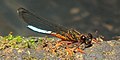 Platycypha amboniensis 81171690 (cropped).jpg 667 × 335; 42 KB
-
 Platycypha amboniensis 81171690.jpg 960 × 468; 83 KB
-
 Rift Valley, Kenya - panoramio (1).jpg 4,000 × 3,000; 4.65 MB
-
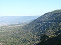 Rift Valley, Kenya - panoramio.jpg 4,000 × 3,000; 4.77 MB
-
 Rift Valley. Viewpoint. Kenya 2013. - panoramio (2).jpg 4,608 × 3,456; 7.69 MB
-
 Rift Valley. Viewpoint. Kenya 2013. - panoramio (3).jpg 4,608 × 2,592; 6.14 MB
-
 Rift Valley. Viewpoint. Kenya 2013. - panoramio (4).jpg 2,304 × 1,056; 1.14 MB
-
 Rift Valley. Viewpoint. Kenya 2013. - panoramio (5).jpg 4,608 × 2,592; 5.56 MB
-
 Rift Valley. Viewpoint. Kenya 2013. - panoramio.jpg 4,608 × 3,456; 7.46 MB
-
 Ruiru Area Map.png 1,193 × 669; 225 KB
-
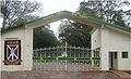 Schoolgate.jpg 1,694 × 1,028; 282 KB
-
 The road Nakuru-Nairobi at Rift Valley. Kenya 2013. - panoramio.jpg 2,592 × 1,944; 2.49 MB
-
 Tourist at Lari View Point.jpg 960 × 720; 146 KB
-
 UDDT block at Gachoire Girls High School (3503744187).jpg 640 × 480; 133 KB
-
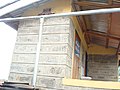 UDDT block at Gachoire Girls High Scool (3504556686).jpg 3,072 × 2,304; 2.11 MB
-
 Unidentified animal of Kenya 01.jpg 5,568 × 3,712; 9.86 MB
-
 Unidentified animal of Kenya 02.jpg 5,568 × 3,712; 9.13 MB
-
 Votive Chapel built by Italian P.O.W. on 1942 - panoramio.jpg 2,048 × 1,536; 1.42 MB
-
 Wangige vegetable local market in Kiambu Kenya.jpg 1,440 × 1,800; 433 KB
-
 Zeetech University (142052131).jpeg 2,048 × 1,365; 1.14 MB


.jpg)
.jpg)
.jpg)
.jpg)
.jpg)
.jpg)

.jpg)


.jpg)


.jpg)

.jpg)

.jpg)
.jpg)
.jpg)
.jpg)


.jpg)
.jpg)


.jpeg)