Category:Kidwelly
town in Carmarthenshire, Wales  | |||||
| Upload media | |||||
| Instance of | |||||
|---|---|---|---|---|---|
| Location | Carmarthenshire, Wales | ||||
| official website | |||||
 | |||||
Cymraeg: Tref hynafol yn Sir Gaerfyrddin, ar lan y ddwy afon Gwendraeth -- afon Gwendraeth Fach ac afon Gwendraeth Fawr -- yw Cydweli (Saesneg: Kidwelly).
English: Kidwelly is a town in Carmarthenshire, west Wales, approximately 10 miles west of the main town of Llanelli.
Norsk bokmål: Kidwelly er en by i Carmarthenshire i det vestlige Wales. Den ligger ved elven Gwendraeth over Carmarthen Bay.
Subcategories
This category has the following 12 subcategories, out of 12 total.
A
C
- Capel Sul, Kidwelly (5 F)
E
K
- Kidwelly railway station (9 F)
- Kidwelly Tinplate Works (2 F)
- Kidwelly Town Hall (3 F)
- Kymer's Quay (8 F)
M
- St Mary's Church, Kidwelly (13 F)
- Mynyddygarreg (10 F)
S
T
- Tanylan Farm (6 F)
Media in category "Kidwelly"
The following 200 files are in this category, out of 288 total.
(previous page) (next page)-
 30 to 40 at the edge of Kidwelly - geograph.org.uk - 3905947.jpg 800 × 781; 251 KB
-
 A bend in the river, Kidwelly - geograph.org.uk - 3387101.jpg 640 × 479; 84 KB
-
 A fine defensive site - geograph.org.uk - 4156444.jpg 3,099 × 3,670; 2.66 MB
-
 A glimpse of Kidwelly Quay - geograph.org.uk - 3394723.jpg 639 × 640; 166 KB
-

-

-
 A484 at Priory Street - geograph.org.uk - 3266897.jpg 640 × 480; 53 KB
-
 A484 Kidwelly by-pass - geograph.org.uk - 3266891.jpg 640 × 480; 54 KB
-
 A494 near Bryn Glas - geograph.org.uk - 3266898.jpg 640 × 480; 77 KB
-
 Afon Gwendraeth Fach River - geograph.org.uk - 4287683.jpg 640 × 480; 74 KB
-
 Afon Gwendraeth Fach River - geograph.org.uk - 4287690.jpg 640 × 480; 60 KB
-
 Along Station Road, Kidwelly - geograph.org.uk - 3914498.jpg 800 × 621; 115 KB
-
 An entrance to Kidwelly railway station - geograph.org.uk - 3394044.jpg 640 × 558; 122 KB
-
 Anthony's Hotel, Kidwelly - geograph.org.uk - 3394137.jpg 640 × 462; 68 KB
-

-
 Bench with a view of the river, Kidwelly - geograph.org.uk - 3387104.jpg 640 × 480; 103 KB
-
 Best Kebab and Pizza, Kidwelly - geograph.org.uk - 3993446.jpg 796 × 800; 148 KB
-

-

-

-
 Bridge Street Kidwelly - geograph.org.uk - 3993942.jpg 640 × 640; 116 KB
-
 Bridge Street, Kidwelly - geograph.org.uk - 4572392.jpg 800 × 600; 103 KB
-
 Burns Pet Nutrition, Kidwelly - geograph.org.uk - 3387059.jpg 640 × 425; 72 KB
-
 Busy Bugs Day Nursery in Kidwelly - geograph.org.uk - 3914575.jpg 800 × 550; 110 KB
-
 Cae Ffynnon, Kidwelly - geograph.org.uk - 3905967.jpg 800 × 693; 146 KB
-
 Canal at Kidwelly Quay - geograph.org.uk - 389010.jpg 480 × 640; 128 KB
-
 Capel Horeb, Mynyddygarreg - geograph.org.uk - 4135772.jpg 1,200 × 900; 232 KB
-
 Car showroom - geograph.org.uk - 6170041.jpg 3,264 × 2,448; 2 MB
-
 Car showroom, Pembrey Road, Kidwelly - geograph.org.uk - 3183109.jpg 2,288 × 1,712; 1.31 MB
-
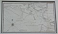 Carmarthen, Laugharne & Kidwelly Bay, Bar and Harbours. William Morris 1748.jpg 4,250 × 2,527; 2.15 MB
-

-
 Castle News, Kidwelly - geograph.org.uk - 3993894.jpg 770 × 800; 148 KB
-
 Castle Street Kidwelly - geograph.org.uk - 4156455.jpg 4,320 × 3,240; 2.57 MB
-
 Castle Street, Kidwelly - geograph.org.uk - 2754460.jpg 640 × 480; 83 KB
-
 Cattle grazing on drained farmland at Pinged Marsh - geograph.org.uk - 3183098.jpg 2,288 × 1,712; 1.25 MB
-
 Causeway Street, Kidwelly - geograph.org.uk - 3183127.jpg 2,288 × 1,712; 1.36 MB
-
 Coleman Farm from Glan yr Afon - geograph.org.uk - 862532.jpg 640 × 480; 76 KB
-
 Colemans Dovecote, May 2014.JPG 4,000 × 3,000; 7.01 MB
-
 Corner Spar in Kidwelly - geograph.org.uk - 3905913.jpg 800 × 513; 111 KB
-
 Country Antiques (Wales) Ltd, Kidwelly - geograph.org.uk - 3769858.jpg 751 × 800; 139 KB
-
 Country Antiques, Kidwelly - geograph.org.uk - 3994000.jpg 734 × 800; 241 KB
-
 Country lane - geograph.org.uk - 580148.jpg 640 × 480; 112 KB
-
 Craylands Park, Kidwelly - geograph.org.uk - 3905997.jpg 800 × 556; 146 KB
-
 Cydweli B^B in Kidwelly - geograph.org.uk - 3993294.jpg 800 × 591; 114 KB
-
 Cydweli Industrial Museum - geograph.org.uk - 1656076.jpg 640 × 409; 73 KB
-
 Cydweli Industrial Museum - geograph.org.uk - 721264.jpg 640 × 431; 74 KB
-
 Dacia dealership in Kidwelly - geograph.org.uk - 3993300.jpg 800 × 514; 113 KB
-
 Down to Rogerlay Farm - geograph.org.uk - 3594020.jpg 2,393 × 1,987; 2.03 MB
-
 East side of sewage works, Kidwelly - geograph.org.uk - 3980352.jpg 774 × 800; 228 KB
-
 Eastern end of Station Road, Kidwelly - geograph.org.uk - 3993409.jpg 647 × 800; 113 KB
-

-
-
 End of the 30mph zone in Kidwelly - geograph.org.uk - 3387061.jpg 640 × 480; 144 KB
-
 Estuary railway bridge, Kidwelly - geograph.org.uk - 3980622.jpg 800 × 800; 158 KB
-
 Farmland near Kidwelly - geograph.org.uk - 807168.jpg 640 × 423; 124 KB
-
 Ffarm Maes Gwenllian Farm - geograph.org.uk - 4287894.jpg 640 × 480; 126 KB
-

-
 Footbridge over canal - geograph.org.uk - 6170933.jpg 2,048 × 1,536; 975 KB
-
 Footpath alongside Gwendraeth estuary - geograph.org.uk - 6170019.jpg 2,048 × 1,536; 1.69 MB
-

-
 Former Castle School, Kidwelly - geograph.org.uk - 3994355.jpg 800 × 706; 182 KB
-
 Former Steam Bakery in Kidwelly - geograph.org.uk - 3906051.jpg 800 × 592; 121 KB
-

-

-
 Gate and signalbox, Kidwelly - geograph.org.uk - 3394752.jpg 640 × 596; 141 KB
-
 Ger - Near Penlan Isaf - geograph.org.uk - 4287710.jpg 640 × 480; 62 KB
-
 Glan Yr Afon, Kidwelly - geograph.org.uk - 3008082.jpg 480 × 640; 69 KB
-
 Glan-yr-afon 2004 sign, Kidwelly - geograph.org.uk - 4572994.jpg 800 × 800; 203 KB
-
 Gravells Dacia Kidwelly - geograph.org.uk - 5590257.jpg 1,600 × 1,200; 384 KB
-
 Gwendraeth estuary - geograph.org.uk - 6170010.jpg 2,048 × 1,536; 1.27 MB
-
 Gwendraeth estuary - geograph.org.uk - 6180284.jpg 3,172 × 2,378; 2.95 MB
-
 Gwendraeth Fach - geograph.org.uk - 3413490.jpg 1,024 × 680; 156 KB
-
 Gwendraeth Fach estuary - geograph.org.uk - 6170037.jpg 6,450 × 2,438; 5.26 MB
-
 Gwendraeth Fach estuary near Kidwelly - geograph.org.uk - 3980662.jpg 800 × 600; 118 KB
-
 Gwendraeth Fach railway bridge, Kidwelly, Wales.jpg 1,920 × 1,080; 597 KB
-
 Gwendraeth Fach river, Kidwelly - geograph.org.uk - 3993930.jpg 800 × 600; 141 KB
-
 Gwendraeth Fawr downstream of the Commissioner's Bridge - geograph.org.uk - 5590206.jpg 1,600 × 1,200; 349 KB
-
 Gwendreath Fach - geograph.org.uk - 3853933.jpg 1,024 × 687; 669 KB
-
 Gwenllian Memorial Kidwelly - geograph.org.uk - 1897709.jpg 2,816 × 1,880; 2.9 MB
-
 Heading for Kidwelly station - geograph.org.uk - 4156410.jpg 4,320 × 3,240; 3.51 MB
-
 Hen gerbydau rheilffordd Old railway stock - geograph.org.uk - 6746992.jpg 1,024 × 682; 276 KB
-
 Hen gerbydau rheilffordd Old railway stock - geograph.org.uk - 6746994.jpg 1,024 × 682; 229 KB
-
 Hen heol - Old road - geograph.org.uk - 4431776.jpg 640 × 480; 151 KB
-
 Hen reilffordd - Disused railway - geograph.org.uk - 6747021.jpg 1,024 × 681; 289 KB
-
 Hen reilffordd Disused railway - geograph.org.uk - 6746997.jpg 1,024 × 682; 238 KB
-
 A History of Kidwelly (IA historyofkidwell01jone).pdf 670 × 1,089, 246 pages; 7.63 MB
-
 Houses at Kingswood - geograph.org.uk - 6033504.jpg 3,264 × 2,448; 2.09 MB
-
 Housing variety in Kidwelly - geograph.org.uk - 3993281.jpg 800 × 688; 138 KB
-
 Housing variety in Water Street Kidwelly - geograph.org.uk - 3905943.jpg 800 × 526; 123 KB
-

-

-
 Interpretation Board on Mynydd y Garreg - geograph.org.uk - 4135799.jpg 1,024 × 768; 157 KB
-
 Inwardly-sloping metal barrier, Kidwelly - geograph.org.uk - 4572979.jpg 800 × 709; 174 KB
-
 Jacob Chivers blue plaque, Kidwelly - geograph.org.uk - 3769863.jpg 603 × 640; 124 KB
-
 Jogging towards Ferryside from Kidwelly - geograph.org.uk - 4576830.jpg 772 × 800; 158 KB
-

-
 Josie's, Kidwelly - geograph.org.uk - 3993083.jpg 800 × 629; 114 KB
-
 Junction at the NW edge of Kidwelly - geograph.org.uk - 3906018.jpg 800 × 669; 192 KB
-

-
 Kia Motors in Kidwelly - geograph.org.uk - 3993328.jpg 800 × 426; 88 KB
-
 Kidwelly - panoramio (1).jpg 3,872 × 2,592; 3.64 MB
-
 Kidwelly - panoramio.jpg 7,138 × 2,540; 8.89 MB
-
 Kidwelly Carmarthen Wales.jpg 1,062 × 827; 152 KB
-
 Kidwelly Castle - geograph.org.uk - 5597633.jpg 1,600 × 1,200; 402 KB
-
 Kidwelly Castle - geograph.org.uk - 6033508.jpg 3,213 × 1,448; 1.26 MB
-
 Kidwelly Castle - geograph.org.uk - 6274434.jpg 2,048 × 1,536; 1.27 MB
-
 Kidwelly Castle car park - geograph.org.uk - 3994495.jpg 800 × 635; 186 KB
-
 Kidwelly Castle public toilets - geograph.org.uk - 3994385.jpg 766 × 800; 213 KB
-
 Kidwelly castle walls - geograph.org.uk - 5714249.jpg 640 × 480; 153 KB
-
 Kidwelly Cemetery - geograph.org.uk - 3905985.jpg 800 × 524; 173 KB
-
 Kidwelly Church - geograph.org.uk - 4419577.jpg 1,600 × 1,067; 317 KB
-
 Kidwelly Fire and Rescue Station - geograph.org.uk - 3914381.jpg 800 × 480; 126 KB
-
 Kidwelly from Mynyddgarreg - geograph.org.uk - 1348496.jpg 640 × 480; 75 KB
-
 Kidwelly post office - geograph.org.uk - 3769903.jpg 770 × 800; 173 KB
-
 Kidwelly Post Office - geograph.org.uk - 3914645.jpg 800 × 644; 122 KB
-
 Kidwelly Quay - geograph.org.uk - 1153016.jpg 640 × 480; 305 KB
-
 Kidwelly Quay - geograph.org.uk - 4156406.jpg 4,320 × 3,240; 2.37 MB
-
 Kidwelly Quay - geograph.org.uk - 4156418.jpg 3,240 × 4,320; 2.15 MB
-
 Kidwelly Quay - geograph.org.uk - 6170907.jpg 2,048 × 1,536; 1.34 MB
-
 Kidwelly Quay and Dock.jpg 4,256 × 2,832; 4.14 MB
-
 Kidwelly Quay car park - geograph.org.uk - 3980608.jpg 800 × 582; 148 KB
-
 Kidwelly RFC.JPG 2,469 × 1,695; 1.48 MB
-
 Kidwelly seen from Pembrey Mountain - geograph.org.uk - 2247327.jpg 640 × 480; 290 KB
-
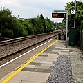
 Kidwelly Station - geograph.org.uk - 3831725.jpg 1,200 × 809; 1.18 MB
-
 Kidwelly station, 1999 - geograph.org.uk - 5441619.jpg 2,398 × 1,510; 2.41 MB
-
 Kidwelly Telephone Exchange - geograph.org.uk - 3914818.jpg 800 × 537; 124 KB
-
 Kidwelly Town Centre Public Conveniences.jpg 4,608 × 2,592; 5.16 MB
-
 Kidwelly war memorial - geograph.org.uk - 1154700.jpg 640 × 480; 276 KB
-
 Kidwelly War Memorial - geograph.org.uk - 3994278.jpg 799 × 800; 171 KB
-
 Kidwelly War Memorial - geograph.org.uk - 5597624.jpg 1,600 × 1,200; 414 KB
-
 Kidwelly War Memorial - geograph.org.uk - 5597627.jpg 1,200 × 1,600; 256 KB
-
 Kidwelly, Carmarthen, Wales-LCCN2001703454.jpg 3,646 × 2,708; 3.04 MB
-
 Kidwelly, Carmarthen, Wales-LCCN2001703454.tif 3,646 × 2,708; 28.25 MB
-
 Kidwelly, old bakery - geograph.org.uk - 2057301.jpg 1,024 × 681; 164 KB
-
 Kidwelly, old bakery - geograph.org.uk - 2057306.jpg 1,024 × 681; 142 KB
-

-

-
 Kymer's Canal, Kidwelly - geograph.org.uk - 3980459.jpg 800 × 600; 179 KB
-
 Kymer's Quay, Gwendraeth Fach, Kidwelly, Wales. Basin.jpg 1,920 × 1,080; 1.02 MB
-
 Kymer's Quay, Gwendraeth Fach, Kidwelly, Wales. Entrance wall.jpg 1,920 × 1,080; 681 KB
-
 Lady Street houses, Kidwelly - geograph.org.uk - 3993193.jpg 720 × 800; 141 KB
-
 Lane - north east Pont-newydd - geograph.org.uk - 1259674.jpg 640 × 425; 178 KB
-

-

-
 Llacharn Castle, Carmarthenshire.jpeg 900 × 672; 163 KB
-
 Llys Gwenllian, Kidwelly - geograph.org.uk - 3905958.jpg 800 × 600; 160 KB
-
 Long barn, Water Street, Kidwelly - geograph.org.uk - 3905940.jpg 800 × 559; 143 KB
-
 Looking from Kidwelly Castle over the Gwendraeth estuary - geograph.org.uk - 2055845.jpg 1,600 × 1,064; 390 KB
-

-
 Maes yr Haf (Summer Way),Kidwelly - geograph.org.uk - 3008083.jpg 480 × 640; 67 KB
-
 Masons Arms, Kidwelly - geograph.org.uk - 3905922.jpg 800 × 694; 147 KB
-
 Minafon Surgery, Kidwelly - geograph.org.uk - 3914596.jpg 800 × 703; 188 KB
-
 Monksford Street, Kidwelly - geograph.org.uk - 2015312.jpg 640 × 480; 71 KB
-

-
 Mr Joseph, Kidwelly - geograph.org.uk - 3769879.jpg 800 × 759; 135 KB
-

-
 Muddy bank of the Gwendraeth, Kidwelly - geograph.org.uk - 4572923.jpg 800 × 540; 146 KB
-

-
 Murco shop in Kidwelly - geograph.org.uk - 3993298.jpg 800 × 708; 140 KB
-
 Mynydd y Garreg - geograph.org.uk - 4288100.jpg 640 × 480; 135 KB
-
 NW boundary of Kidwelly - geograph.org.uk - 3387054.jpg 640 × 469; 121 KB
-
 Obverse (FindID 59328).jpg 301 × 222; 44 KB
-
 Old School Building - geograph.org.uk - 3833657.jpg 640 × 480; 64 KB
-
 Old school building in Kidwelly - geograph.org.uk - 3993318.jpg 800 × 525; 134 KB
-
 Old stile - geograph.org.uk - 6170025.jpg 3,264 × 2,448; 3.18 MB
-
 Old village stocks, Kidwelly - geograph.org.uk - 6274452.jpg 3,264 × 2,448; 3.53 MB
-

-
 On the A484 near Pant-glas - geograph.org.uk - 3617331.jpg 2,840 × 2,343; 1.72 MB
-
 Orchard Villa, Kidwelly - geograph.org.uk - 3914844.jpg 800 × 613; 120 KB
-
 Ordnance Survey Cut Mark - geograph.org.uk - 3833555.jpg 480 × 640; 95 KB
-
 Ordnance Survey Cut Mark - geograph.org.uk - 3833583.jpg 480 × 640; 102 KB
-
 Ordnance Survey Cut Mark - geograph.org.uk - 3833591.jpg 480 × 640; 77 KB
-
 Ordnance Survey Cut Mark - geograph.org.uk - 3833633.jpg 480 × 640; 66 KB
-
 Ordnance Survey Cut Mark - geograph.org.uk - 3833641.jpg 480 × 640; 100 KB
-
 Ordnance Survey Cut Mark - geograph.org.uk - 3833648.jpg 480 × 640; 116 KB
-
 Ordnance Survey Cut Mark - geograph.org.uk - 3833671.jpg 480 × 640; 109 KB
-

-

-

-
 Our Lady and St Cadoc's Church, Kidwelly by Peter Kazmierczak Geograph 3619705.jpg 3,314 × 2,592; 1.62 MB
-

-
 Pembrey Road, Kidwelly - geograph.org.uk - 3619724.jpg 2,040 × 2,205; 984 KB
-
 Penlan Uchaf - geograph.org.uk - 4287765.jpg 640 × 480; 80 KB
-
 Peter Peric Master Butcher in Kidwelly - geograph.org.uk - 3993184.jpg 626 × 640; 103 KB
-

-

-
 Plough ^ Harrow, Kidwelly - geograph.org.uk - 3993260.jpg 800 × 664; 127 KB
-
 Princess Gwenllian Centre, Kidwelly - geograph.org.uk - 3914631.jpg 800 × 603; 154 KB
-
 Priory Street houses in Kidwelly - geograph.org.uk - 3993242.jpg 800 × 612; 139 KB
-

-
 Public toilets in Kidwelly - geograph.org.uk - 3993082.jpg 800 × 583; 141 KB
-
 Pwll Gwenllian Pool - geograph.org.uk - 2800064.jpg 480 × 640; 81 KB
-
 Pwll Gwenllian Pool - geograph.org.uk - 2800101.jpg 3,264 × 2,448; 4.2 MB
-
 Pwll Gwenllian Pool - geograph.org.uk - 4287856.jpg 640 × 480; 82 KB
-

-

-
 Quay Road fork, Kidwelly - geograph.org.uk - 3980308.jpg 800 × 631; 177 KB
-
 Quay Road signpost, Kidwelly - geograph.org.uk - 3769933.jpg 800 × 774; 188 KB
-

-
 Railway Line - geograph.org.uk - 807177.jpg 640 × 481; 232 KB


_Ltd,_Kidwelly_-_geograph.org.uk_-_3769858.jpg)


.jpg)


,Kidwelly_-_geograph.org.uk_-_3008083.jpg)


_Kidwelly_-_geograph.org.uk_-_3387073.jpg)


.jpg)


_-_geograph.org.uk_-_4006365.jpg)
_-_geograph.org.uk_-_3833619.jpg)
_-_geograph.org.uk_-_3833605.jpg)


