Category:Kilrea
village in Northern Ireland  | |||||
| Upload media | |||||
| Instance of | |||||
|---|---|---|---|---|---|
| Location | County Londonderry, Northern Ireland | ||||
 | |||||
Deutsch: Kilrea ( irisch: Cill Ria; dt.: „Graue Kirche“) ist eine Kleinstadt (engl. village) im Nordosten Irlands im County Londonderry in Nordirland.
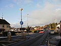
English: Kilrea is a village in County Londonderry, Northern Ireland, close to the boundary with County Antrim. In the 2001 Census it had a population of 1,513 people. It is situated high up the Bann Valley on a vantage point above the river.
Media in category "Kilrea"
The following 167 files are in this category, out of 167 total.
-
 1st Kilrea Presbyterian Church - geograph.org.uk - 5470574.jpg 640 × 480; 150 KB
-
 2nd Kilrea Presbyterian Church - geograph.org.uk - 5470675.jpg 640 × 480; 160 KB
-
 A Scott, Kilrea - geograph.org.uk - 2477539.jpg 640 × 480; 43 KB
-
 A Water Witch on the Bann (1) - geograph.org.uk - 193937.jpg 640 × 426; 171 KB
-
 A Water Witch on the Bann (2) - geograph.org.uk - 193944.jpg 640 × 426; 152 KB
-

-
 Agivey Road Kilrea.JPG 3,968 × 2,976; 3.12 MB
-
 Antrim Arms, Kilrea - geograph.org.uk - 2476963.jpg 640 × 480; 49 KB
-

-

-
 Bann Road, Kilrea - geograph.org.uk - 3895983.jpg 640 × 360; 235 KB
-
 Beeswax Antiques, Kilrea - geograph.org.uk - 2476944.jpg 640 × 480; 51 KB
-
 Beeswax Antiques, Kilrea - geograph.org.uk - 5470612.jpg 640 × 480; 142 KB
-
 Bells Costcutter, Kilrea - geograph.org.uk - 2477548.jpg 640 × 480; 56 KB
-
 Bovedy Presbyterian Church - geograph.org.uk - 840153.jpg 640 × 479; 54 KB
-
 Bridge Street Fuels, Kilrea - geograph.org.uk - 2476968.jpg 640 × 480; 41 KB
-
 Bridge Street, Kilrea - geograph.org.uk - 2476970.jpg 640 × 480; 50 KB
-
 Bridge Street, Kilrea - geograph.org.uk - 3895992.jpg 640 × 480; 256 KB
-
 Church of Ireland Hall, Kilrea - geograph.org.uk - 2476881.jpg 640 × 480; 43 KB
-
 Church Street, Kilrea - geograph.org.uk - 1455761.jpg 640 × 480; 85 KB
-
 Church Street, Kilrea - geograph.org.uk - 2476442.jpg 640 × 480; 50 KB
-
 Church Street, Kilrea - geograph.org.uk - 2476445.jpg 640 × 480; 49 KB
-
 Church Street, Kilrea - geograph.org.uk - 3896001.jpg 640 × 480; 252 KB
-
 Church Street, Kilrea - geograph.org.uk - 5470568.jpg 640 × 480; 157 KB
-
 Claragh Hill - geograph.org.uk - 840082.jpg 640 × 479; 72 KB
-
 Claragh Townland - geograph.org.uk - 840081.jpg 640 × 479; 76 KB
-
 Claragh Townland - geograph.org.uk - 840084.jpg 640 × 479; 61 KB
-
 Claragh Townland - geograph.org.uk - 840119.jpg 640 × 479; 72 KB
-
 Closed garage, Kilrea - geograph.org.uk - 3895988.jpg 640 × 480; 248 KB
-
 Coastguard launch on the Bann - geograph.org.uk - 374128.jpg 640 × 426; 149 KB
-
 Coleraine Street, Kilrea - geograph.org.uk - 1455764.jpg 640 × 480; 69 KB
-
 Coleraine Street, Kilrea - geograph.org.uk - 2477531.jpg 640 × 480; 41 KB
-
 Corner protector, Kilrea - geograph.org.uk - 5470699.jpg 640 × 480; 144 KB
-
 Cottages, Kilrea - geograph.org.uk - 5470674.jpg 640 × 480; 146 KB
-
 Danske Bank, Kilrea - geograph.org.uk - 5470667.jpg 640 × 480; 180 KB
-

-
 Direction sign, Kilrea - geograph.org.uk - 5470597.jpg 640 × 480; 172 KB
-
 Direction sign, Maghera Street, Kilrea - geograph.org.uk - 5470681.jpg 640 × 480; 159 KB
-
 Donaghy Bros, Kilrea - geograph.org.uk - 2476373.jpg 640 × 480; 47 KB
-
 Drumnagarner RC Church - geograph.org.uk - 840133.jpg 640 × 479; 55 KB
-
 Drumnagarner Road, Kilrea - geograph.org.uk - 840123.jpg 640 × 479; 54 KB
-
 Drumnameric Hill - geograph.org.uk - 840101.jpg 640 × 479; 53 KB
-
 Drumnameric Hill - geograph.org.uk - 840111.jpg 640 × 479; 69 KB
-
 Drumnameric Hill - geograph.org.uk - 840115.jpg 640 × 479; 64 KB
-
 Emporium, Kilrea - geograph.org.uk - 2476420.jpg 640 × 480; 51 KB
-
 Emporium, Kilrea - geograph.org.uk - 2476426.jpg 640 × 480; 53 KB
-
 Emporium, Kilrea - geograph.org.uk - 5470690.jpg 640 × 480; 158 KB
-
 Enterprise Workshop, Kilrea - geograph.org.uk - 2476455.jpg 640 × 480; 58 KB
-
 Fairhill Veterinary Centre, Kilrea - geograph.org.uk - 5470678.jpg 640 × 480; 145 KB
-
 Fairhill Veterinary Centre, Kilrea - geograph.org.uk - 858036.jpg 640 × 479; 67 KB
-
 Fire station, Kilrea - geograph.org.uk - 2476448.jpg 640 × 480; 38 KB
-

-
 Fish pass, River Bann at Portna - geograph.org.uk - 287998.jpg 640 × 426; 131 KB
-
 Fry R Tuck, Kilrea - geograph.org.uk - 2477525.jpg 640 × 480; 47 KB
-
 GA Hogg ^ Son, Kilrea - geograph.org.uk - 5470704.jpg 640 × 480; 148 KB
-
 Gemma's - Angela Mullaghan Opticians - geograph.org.uk - 2476419.jpg 640 × 480; 48 KB
-
 George A Hogg ^ Son, Kilrea - geograph.org.uk - 2476431.jpg 640 × 480; 49 KB
-
 Goods on display, Kilrea - geograph.org.uk - 5470685.jpg 640 × 480; 163 KB
-
 H A McIlrath ^ Sons Ltd Kilrea - geograph.org.uk - 2476367.jpg 640 × 480; 42 KB
-

-
 Information plaque, Kilrea - geograph.org.uk - 5470696.jpg 640 × 480; 154 KB
-

-
 J Rainey Bookmaker, Kilrea - geograph.org.uk - 2477506.jpg 640 × 480; 62 KB
-
 Joshua Paul ^ Son - Martin's, Kilrea - geograph.org.uk - 2477546.jpg 640 × 480; 63 KB
-
 K E Shields Pharmacy, Kilrea - geograph.org.uk - 2477528.jpg 640 × 480; 53 KB
-
 K R D Credit Union, Kilrea - geograph.org.uk - 2476439.jpg 640 × 480; 42 KB
-
 Kelly's Inn, Kilrea - geograph.org.uk - 2476415.jpg 640 × 480; 50 KB
-
 Kerr Group Insurance, Kilrea - geograph.org.uk - 2476939.jpg 640 × 480; 48 KB
-
 Kilrea 858305.jpg 640 × 479; 60 KB
-
 Kilrea Bridge - geograph.org.uk - 4048851.jpg 2,592 × 1,944; 1.46 MB
-
 Kilrea Bridge - geograph.org.uk - 5470548.jpg 640 × 480; 143 KB
-
 Kilrea Mission Hall - geograph.org.uk - 848333.jpg 640 × 479; 48 KB
-
 Kilrea Orange Hall - geograph.org.uk - 5470671.jpg 640 × 480; 153 KB
-
 Kilrea Orange Hall - geograph.org.uk - 848331.jpg 640 × 479; 49 KB
-
 Kilrea Orange Hall.JPG 3,264 × 2,448; 1.53 MB
-
 Kilrea Town Hall - geograph.org.uk - 2477518.jpg 640 × 480; 41 KB
-
 Kilrea Town Hall, The Diamond, Kilrea - geograph.org.uk - 5470691.jpg 640 × 480; 144 KB
-
 Kilrea, County Derry - Londonderry - geograph.org.uk - 4063416.jpg 640 × 480; 168 KB
-
 Kilrea, County Derry - Londonderry - geograph.org.uk - 676302.jpg 640 × 479; 55 KB
-
 Kilrea, Rasharkin ^ Dunloy sign - geograph.org.uk - 2476883.jpg 640 × 480; 27 KB
-
 Kilrea, Raskarkin ^ Dunloy Credit Union - geograph.org.uk - 5470594.jpg 640 × 480; 183 KB
-
 Lisnagrot Road, Kilrea - geograph.org.uk - 2476450.jpg 640 × 480; 52 KB
-
 Lock gates, Movanagher, River Bann - geograph.org.uk - 426181.jpg 640 × 426; 126 KB
-
 Mace, Kilrea - geograph.org.uk - 2476959.jpg 640 × 480; 49 KB
-
 Maghera Street, Kilrea - geograph.org.uk - 2476371.jpg 640 × 480; 46 KB
-
 Maghera Street, Kilrea - geograph.org.uk - 5470659.jpg 640 × 480; 171 KB
-
 Maghera Street, Kilrea - geograph.org.uk - 5470687.jpg 640 × 480; 163 KB
-
 Mc Kiernan ^ Sons, Kilrea - geograph.org.uk - 2477552.jpg 640 × 480; 47 KB
-
 McAtmney's Butchers, Kilrea - geograph.org.uk - 2476956.jpg 640 × 480; 48 KB
-
 McCloy Chemist, Kilrea - geograph.org.uk - 2477538.jpg 640 × 480; 54 KB
-
 McCloy's, The Diamond, Kilrea - geograph.org.uk - 2477536.jpg 640 × 480; 59 KB
-
 McCloys, Kilrea - geograph.org.uk - 5470652.jpg 640 × 480; 159 KB
-
 Mercers Arms Public House, Kilrea - geograph.org.uk - 2477513.jpg 640 × 480; 53 KB
-
 Moneygran Wood near Kilrea (1) - geograph.org.uk - 486136.jpg 640 × 427; 127 KB
-
 Movanagher lock, Lower Bann navigation - geograph.org.uk - 229890.jpg 640 × 426; 132 KB
-
 Mullins, Kilrea - geograph.org.uk - 2476952.jpg 640 × 480; 47 KB
-
 Murals, Kilrea - geograph.org.uk - 2476456.jpg 640 × 480; 63 KB
-
 New Road, Kilrea - geograph.org.uk - 1455758.jpg 640 × 480; 93 KB
-
 Northern Bank, Kilrea - geograph.org.uk - 858029.jpg 640 × 478; 54 KB
-
 Notice board, Mercers Arms, Kilrea - geograph.org.uk - 2477510.jpg 640 × 480; 78 KB
-
 O'Brien - KE Shields Pharmacy, Kilrea - geograph.org.uk - 5470695.jpg 640 × 480; 152 KB
-
 O'Brien, Kilrea - geograph.org.uk - 2477533.jpg 640 × 480; 48 KB
-

-
 Portna lock, River Bann (1) - geograph.org.uk - 193921.jpg 640 × 426; 120 KB
-
 Portna lock, River Bann (2) - geograph.org.uk - 193925.jpg 640 × 426; 142 KB
-
 Powder Puff, Kilrea - geograph.org.uk - 2477523.jpg 640 × 480; 48 KB
-
 Pub with WIFI, Kilrea - geograph.org.uk - 5470706.jpg 640 × 480; 169 KB
-
 Rainey's - geograph.org.uk - 3896015.jpg 640 × 480; 222 KB
-
 Rainey's Public House, Kilrea - geograph.org.uk - 5470686.jpg 640 × 480; 170 KB
-
 Rainey's, Kilrea - geograph.org.uk - 2476414.jpg 640 × 480; 44 KB
-
 River Bann at Hutchinson's Quay - geograph.org.uk - 220928.jpg 640 × 426; 139 KB
-
 Road at Kilrea - geograph.org.uk - 840097.jpg 640 × 479; 54 KB
-
 Roundabout, Kilrea - geograph.org.uk - 2476424.jpg 640 × 480; 47 KB
-
 Roundabout, Kilrea - geograph.org.uk - 5470566.jpg 640 × 480; 155 KB
-
 Second Kilrea Presbyterian Church - geograph.org.uk - 858027.jpg 640 × 479; 58 KB
-
 Sign outside St Patrick's Church, Kilrea - geograph.org.uk - 3896008.jpg 640 × 500; 307 KB
-
 Sign, Kilrea - geograph.org.uk - 1455765.jpg 640 × 480; 93 KB
-
 Sinn Féin Offices - New Golden House - geograph.org.uk - 2476943.jpg 640 × 480; 46 KB
-

-

-
 St Patrick's Church of Ireland, Kilrea - geograph.org.uk - 5470544.jpg 640 × 480; 159 KB
-
 Sugar ^ Spice, Kilrea - geograph.org.uk - 2477494.jpg 640 × 480; 39 KB
-

-
 SVP Thrift Shop, Kilrea - geograph.org.uk - 2476411.jpg 640 × 480; 49 KB
-
 SVP, Kilrea - geograph.org.uk - 5470663.jpg 640 × 480; 152 KB
-
 Talk of the Town, Kilrea - geograph.org.uk - 2476436.jpg 640 × 480; 50 KB
-
 Telephone box, Kilrea - geograph.org.uk - 5470702.jpg 640 × 480; 192 KB
-

-

-
 The Barber's - geograph.org.uk - 3896017.jpg 640 × 480; 290 KB
-
 The Barber's, Kilrea - geograph.org.uk - 2476416.jpg 640 × 480; 52 KB
-
 The Cafe - The Salon, Kilrea - geograph.org.uk - 2477545.jpg 640 × 480; 51 KB
-
 The Coffee Bean - Prosperous House - geograph.org.uk - 2477542.jpg 640 × 480; 57 KB
-
 The Diamond, Kilrea - geograph.org.uk - 1455762.jpg 640 × 480; 64 KB
-
 The old abbey, Kilrea - geograph.org.uk - 5470555.jpg 640 × 480; 147 KB
-
 The Pizza Box, Kilrea - geograph.org.uk - 2477544.jpg 640 × 480; 43 KB
-
 The River Bann at Portna near Kilrea - geograph.org.uk - 486025.jpg 640 × 427; 81 KB
-
 The River Bann near Ballymoney - geograph.org.uk - 475382.jpg 640 × 426; 77 KB
-
 The River Bann near Kilrea - geograph.org.uk - 279715.jpg 640 × 426; 117 KB
-
 The Video Shack, Kilrea - geograph.org.uk - 2476434.jpg 640 × 480; 53 KB
-
 The word on the street - geograph.org.uk - 3895982.jpg 640 × 360; 228 KB
-
 Vacant hotel, Kilrea - geograph.org.uk - 5470692.jpg 640 × 480; 178 KB
-
 Vivo, The Diamond, Kilrea - geograph.org.uk - 5470701.jpg 640 × 480; 185 KB
-
 War Memorial, Kilrea - geograph.org.uk - 1455763.jpg 640 × 480; 80 KB
-
 Arable land in the Bann Valley - geograph.org.uk - 611721.jpg 640 × 324; 48 KB
-
 Bann Road - geograph.org.uk - 676292.jpg 640 × 479; 82 KB
-
 Blackrock Road - geograph.org.uk - 840142.jpg 640 × 479; 64 KB
-
 Bog near Fort Hill - geograph.org.uk - 582239.jpg 640 × 479; 60 KB
-
 Crossmore Hill - geograph.org.uk - 582240.jpg 640 × 479; 58 KB
-
 Culcrew School - geograph.org.uk - 494892.jpg 640 × 314; 94 KB
-

-
 Field gate near Ballymoney - geograph.org.uk - 475515.jpg 640 × 426; 84 KB
-
 First Kilrea Presbyterian Church - geograph.org.uk - 342207.jpg 640 × 479; 47 KB
-
 Gortcranny Townland - geograph.org.uk - 676290.jpg 640 × 479; 82 KB
-
 Kilrea - geograph.org.uk - 342208.jpg 640 × 317; 34 KB
-
 Kilrea, Derry-Londonderry - geograph.org.uk - 342205.jpg 640 × 479; 58 KB
-
 Lislea Protestant Hall - geograph.org.uk - 582199.jpg 640 × 479; 55 KB
-
 Lislea Townland - geograph.org.uk - 582203.jpg 640 × 479; 71 KB
-
 Lislea Townland - geograph.org.uk - 582212.jpg 640 × 479; 68 KB
-
 Lislea Townland - geograph.org.uk - 582213.jpg 640 × 479; 59 KB
-
 Moneygran Wood near Kilrea (2) - geograph.org.uk - 486194.jpg 640 × 427; 119 KB
-
 Road at Lislea - geograph.org.uk - 582208.jpg 640 × 303; 51 KB
-

-

-

-
 The Kilrea Bridge - geograph.org.uk - 279711.jpg 640 × 426; 154 KB
-
 The Vow Road near Ballymoney - geograph.org.uk - 475514.jpg 640 × 426; 71 KB


_-_geograph.org.uk_-_193937.jpg)
_-_geograph.org.uk_-_193944.jpg)


_-_geograph.org.uk_-_486136.jpg)


_-_geograph.org.uk_-_193921.jpg)
_-_geograph.org.uk_-_193925.jpg)


_-_geograph.org.uk_-_5470559.jpg)


_-_geograph.org.uk_-_486194.jpg)


