Category:King George VI post boxes in the East Riding of Yorkshire
Media in category "King George VI post boxes in the East Riding of Yorkshire"
The following 43 files are in this category, out of 43 total.
-
 Bricknell Avenue, Cottingham (geograph 6081775).jpg 5,184 × 3,888; 4.41 MB
-
 Bricknell Avenue, Cottingham (geograph 6081776).jpg 5,184 × 3,888; 5.3 MB
-
 Close up, George VI postbox on former Post Office, Wold Newton (geograph 5178305).jpg 1,321 × 2,752; 487 KB
-
-
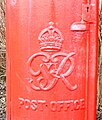
 Cypher, George VI postbox on Church Green, Bridlington - geograph.org.uk - 4817295.jpg 1,595 × 1,604; 724 KB
-

-

-
 Detail, George VI postbox on Church Green, Bridlington - geograph.org.uk - 4817297.jpg 2,322 × 3,636; 1.39 MB
-

-
 Former Post Office, Warter (geograph 7046571).jpg 640 × 480; 92 KB
-
 Former Post Office, Warter (geograph 7046573).jpg 1,024 × 810; 183 KB
-
 Former Post Office, Wold Newton (geograph 5178306).jpg 2,697 × 1,766; 943 KB
-
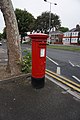
 George VI Pillar Box, Church Green, Bridlington - geograph.org.uk - 2255269.jpg 768 × 1,024; 393 KB
-
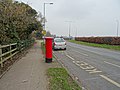
 George VI postbox and telephone box on Wold Road, Hull (geograph 6081750).jpg 5,184 × 3,888; 4.83 MB
-

-
 George VI postbox on Bempton Lane, Bridlington - geograph.org.uk - 5449974.jpg 1,456 × 2,256; 1.2 MB
-
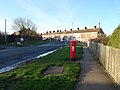
 George VI postbox on Bricknell Avenue, Cottingham (geograph 6081774).jpg 2,522 × 4,709; 3.17 MB
-
 George VI postbox on Church Green, Bridlington - geograph.org.uk - 4817293.jpg 1,376 × 2,472; 1.26 MB
-

-
 George VI postbox on former Post Office, Wold Newton (geograph 5178304).jpg 1,686 × 2,354; 771 KB
-
 George VI postbox on Howdale Road, Hull (geograph 6345697).jpg 2,218 × 4,012; 2.32 MB
-
 George VI postbox on North Marine Drive - geograph.org.uk - 4805406.jpg 351 × 640; 111 KB
-

-
 George VI postbox on North Road, Withernsea (geograph 6373520).jpg 305 × 640; 50 KB
-

-
 George VI postbox on South Marine Drive, Bridlington - geograph.org.uk - 4822811.jpg 1,690 × 2,999; 555 KB
-
 George VI postbox on the B1246, Warter (geograph 7046569).jpg 566 × 1,024; 138 KB
-
 George VI Postbox on Willerby Road, Hull (geograph 5908903).jpg 1,064 × 1,600; 784 KB
-
 George VI postbox on Willerby Road, Hull (geograph 6081743).jpg 2,856 × 5,127; 3.87 MB
-
 George VI postbox on Wold Road, Hull (geograph 6081749).jpg 2,251 × 4,209; 2.55 MB
-
 Houses on Greenhow Close, Hull (geograph 6345699).jpg 4,435 × 2,775; 2.31 MB
-
 Houses on Queen Street North, Withernsea (geograph 6373540).jpg 4,753 × 3,318; 2.59 MB
-
 Houses on Willerby Road, Hull (geograph 6081747).jpg 5,184 × 3,888; 6.8 MB
-
 Howdale Road, Hull (geograph 6345700).jpg 4,314 × 2,966; 2.65 MB
-
 Howdale Road, Hull (geograph 6345701).jpg 4,411 × 3,342; 3.4 MB
-
 North Road (B1242), Withernsea (geograph 6373524).jpg 4,699 × 3,190; 2.52 MB
-
 North Road (B1242), Withernsea (geograph 6373525).jpg 5,184 × 3,888; 4.63 MB
-
 North Road, Withernsea (geograph 3611072).jpg 1,024 × 768; 185 KB
-
 Queen Street North, Withernsea (geograph 6373541).jpg 5,184 × 3,888; 3.44 MB
-
 Queen Street North, Withernsea (geograph 6373542).jpg 4,002 × 2,778; 2.41 MB
-
 Shops on Wold Road, Hull (geograph 6081048).jpg 640 × 407; 55 KB
-
 Willerby Road, Hull (geograph 6081745).jpg 5,184 × 3,888; 4.01 MB
-
 Wold Road, Hull (geograph 6081751).jpg 5,184 × 3,888; 4.72 MB
.jpg)
.jpg)
.jpg)


.jpg)
.jpg)
.jpg)

.jpg)


.jpg)


.jpg)
.jpg)


.jpg)
.jpg)

.jpg)
.jpg)
.jpg)
.jpg)
.jpg)
.jpg)
.jpg)
.jpg)
.jpg)
,_Withernsea_(geograph_6373524).jpg)
,_Withernsea_(geograph_6373525).jpg)
.jpg)
.jpg)
.jpg)
.jpg)
.jpg)
.jpg)