Category:Kings Sutton
English: Kings Sutton is a village and civil parish in South Northamptonshire, England in the valley of the River Cherwell. The parish includes the hamlets of Astrop contiguous with eastern end of Kings Sutton and Upper Astrop about 1 mile (1.6 km) north-east, in the same area as the shrunken villages of Great and Little Purston.
village in Northamptonshire, UK .png) | |||||
| Upload media | |||||
| Instance of | |||||
|---|---|---|---|---|---|
| Location | West Northamptonshire, Northamptonshire, East Midlands, England | ||||
| Population |
| ||||
| Area |
| ||||
| official website | |||||
 | |||||
Subcategories
This category has the following 11 subcategories, out of 11 total.
A
- Astrop House (4 F)
G
- Great Purston (4 F)
K
- Kings Sutton foot crossing (7 F)
- Kings Sutton Lock (3 F)
- Kings Sutton War Memorial (1 F)
L
- Little Purston (1 F)
R
- Kings Sutton railway station (28 F)
U
- Upper Astrop (3 F)
Media in category "Kings Sutton"
The following 200 files are in this category, out of 241 total.
(previous page) (next page)-
 70016 Kings Sutton.jpg 3,979 × 2,821; 2.97 MB
-
 70016 shimmer Kings Sutton.jpg 1,570 × 1,213; 576 KB
-
 All roads lead to Rome - geograph.org.uk - 1381367.jpg 427 × 640; 183 KB
-
 Approaching Keepers - geograph.org.uk - 1381382.jpg 640 × 426; 171 KB
-
 Approaching King's Sutton - geograph.org.uk - 1360949.jpg 640 × 426; 171 KB
-
 Approaching Walton Grounds House - geograph.org.uk - 5333252.jpg 640 × 480; 69 KB
-
 Astrop Grange - geograph.org.uk - 6284067.jpg 800 × 528; 84 KB
-
 Astrop Road, Kings Sutton - geograph.org.uk - 6281282.jpg 800 × 600; 155 KB
-
 Aynho Road crosses the M40 - geograph.org.uk - 4962369.jpg 1,500 × 1,125; 147 KB
-
 B4100 Banbury Road where it passes over the M40 - geograph.org.uk - 3417739.jpg 1,024 × 683; 163 KB
-
 B4100 Bridge, M40 - geograph.org.uk - 2686758.jpg 640 × 430; 52 KB
-
 B4100 towards Adderbury - geograph.org.uk - 6281334.jpg 800 × 616; 136 KB
-

-
 Banbury Lane railway bridge - geograph.org.uk - 5817774.jpg 5,202 × 3,465; 3.35 MB
-
 Banbury Lane towards Banbury - geograph.org.uk - 6281239.jpg 800 × 600; 89 KB
-
 Banbury Lane, Kings Sutton - geograph.org.uk - 6281273.jpg 800 × 600; 109 KB
-
 Baptist Chapel, Wales Street - geograph.org.uk - 3410024.jpg 683 × 1,024; 185 KB
-
 Benchmark on the Baptist Chapel, Wales Street - geograph.org.uk - 3410021.jpg 683 × 1,024; 242 KB
-
 Benchmark on ^2 Whittall Street - geograph.org.uk - 3420501.jpg 686 × 1,024; 264 KB
-
 Benchmark on ^72 Banbury Lane - geograph.org.uk - 3410008.jpg 656 × 1,024; 212 KB
-

-
 Bridge to Sutton Lodge Farm - geograph.org.uk - 1325099.jpg 640 × 419; 82 KB
-
 Bridleway down towards Newbottle - geograph.org.uk - 5901246.jpg 1,600 × 1,066; 472 KB
-
 Bridleway to Buston Farm - geograph.org.uk - 5902057.jpg 1,600 × 1,066; 502 KB
-
 Bridleway to Purston - geograph.org.uk - 5902052.jpg 1,600 × 1,066; 613 KB
-
 Bridleway to Purston - geograph.org.uk - 5902067.jpg 1,600 × 1,066; 541 KB
-
 Bridleway to Sandy Lane - geograph.org.uk - 5902059.jpg 1,600 × 1,066; 553 KB
-
 Bridleway towards Buston Farm - geograph.org.uk - 6284125.jpg 800 × 600; 101 KB
-
 Bridleway up to Rosamond's Bower - geograph.org.uk - 5901245.jpg 1,600 × 1,066; 470 KB
-
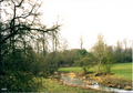
 Brook by Walton Grounds - geograph.org.uk - 2699839.jpg 640 × 480; 113 KB
-
 Brookfield House Crossing - geograph.org.uk - 1325082.jpg 640 × 417; 80 KB
-
 Bungalows, Astrop - geograph.org.uk - 6285199.jpg 5,184 × 3,888; 7.54 MB
-
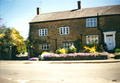
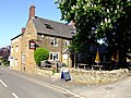 Butchers Arms, Kings Sutton - geograph.org.uk - 434495.jpg 640 × 480; 126 KB
-
 Byway heading to Walton Grounds - geograph.org.uk - 2699747.jpg 640 × 480; 67 KB
-
 Byway heading to Walton Grounds - geograph.org.uk - 2699820.jpg 640 × 480; 71 KB
-
 Car sales on Aynho Road - geograph.org.uk - 6281332.jpg 640 × 480; 74 KB
-
 Carved tree trunk at B4100 entrance to Aynho - geograph.org.uk - 3419936.jpg 683 × 1,024; 165 KB
-
 Cemetery lych gate Kings Sutton - geograph.org.uk - 116951.jpg 480 × 640; 145 KB
-
 Cemetery, Kings Sutton - geograph.org.uk - 6281317.jpg 800 × 600; 196 KB
-
 Cherwell Valley Business Park from Twyford Wharf - geograph.org.uk - 5817917.jpg 5,202 × 3,465; 3.05 MB
-
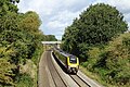
 Chiltern Line - geograph.org.uk - 3310499.jpg 640 × 480; 59 KB
-
 Church of St Peter and St Paul, Kings Sutton, Northants.jpg 2,811 × 3,386; 1.13 MB
-
 Cobbler's pits Spinney - geograph.org.uk - 5901007.jpg 1,600 × 1,066; 463 KB
-
 Copse at Kings Sutton - geograph.org.uk - 5901000.jpg 1,600 × 1,066; 423 KB
-
 Corner of Richmond Street, Kings Sutton - geograph.org.uk - 5817758.jpg 5,202 × 3,465; 3.7 MB
-
 Cottage off Astrop Road - geograph.org.uk - 6284054.jpg 800 × 600; 129 KB
-
 Cottages and signpost at Kings Sutton - geograph.org.uk - 5817746.jpg 5,202 × 3,465; 3.47 MB
-
 Cottages in Kings Sutton - geograph.org.uk - 3829543.jpg 1,200 × 802; 1.26 MB
-
 Crooked window in Astrop Road, Kings Sutton - geograph.org.uk - 5817748.jpg 5,202 × 3,465; 2.86 MB
-
 CrossCountry train heading for Oxford - geograph.org.uk - 6281233.jpg 800 × 535; 180 KB
-
 Crossroads in Kings Sutton - geograph.org.uk - 1670053.jpg 856 × 1,280; 193 KB
-

-
 Disused sidings near Kings Sutton - geograph.org.uk - 4520925.jpg 640 × 426; 105 KB
-
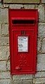 Elizabeth II postbox on Upper Astrop Road - geograph.org.uk - 6285198.jpg 1,989 × 3,726; 1.72 MB
-
 Entering Kings Sutton - geograph.org.uk - 1381430.jpg 640 × 425; 200 KB
-
 Entering Kings Sutton - geograph.org.uk - 6281290.jpg 640 × 480; 99 KB
-
 Entrance to Keepers - geograph.org.uk - 1381383.jpg 640 × 426; 178 KB
-
 Entrance to Lowfields - geograph.org.uk - 1381412.jpg 640 × 426; 180 KB
-
 Farm bridge at Kings Sutton - geograph.org.uk - 1325066.jpg 640 × 413; 78 KB
-
 Farm track, Upper Astrop - geograph.org.uk - 6284071.jpg 800 × 600; 124 KB
-
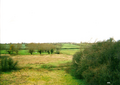
 Farmland east of Kings Sutton - geograph.org.uk - 5629050.jpg 1,024 × 768; 237 KB
-
 Farmland east of Walton Grounds - geograph.org.uk - 2736723.jpg 1,024 × 768; 221 KB
-
 Farmland north of the B4100 - geograph.org.uk - 3308283.jpg 1,024 × 768; 198 KB
-
 Farmland south of Kings Sutton - geograph.org.uk - 3366275.jpg 640 × 430; 42 KB
-
 Farmland south of Kings Sutton - geograph.org.uk - 3366281.jpg 640 × 324; 25 KB
-
 Farmland, Kings Sutton - geograph.org.uk - 6224982.jpg 1,024 × 683; 221 KB
-
 Field Barn - geograph.org.uk - 1381373.jpg 640 × 426; 205 KB
-
 Field edge hedge - geograph.org.uk - 5901230.jpg 1,600 × 1,066; 468 KB
-
 Field entrance off Banbury Lane - geograph.org.uk - 6281235.jpg 800 × 600; 98 KB
-
 Field near Newbottle Farm - geograph.org.uk - 6284036.jpg 800 × 600; 94 KB
-
 Field near the Farthinghoe Stream - geograph.org.uk - 6284138.jpg 640 × 480; 80 KB
-
 Field off Upper Astrop Road - geograph.org.uk - 6284076.jpg 800 × 600; 85 KB
-
 Field path from Twyford Bridge to Kings Sutton - geograph.org.uk - 5817909.jpg 5,202 × 3,465; 3.24 MB
-
 Fields near Astrop Hill Farm - geograph.org.uk - 6284088.jpg 800 × 600; 76 KB
-
 Fields near King's Sutton - geograph.org.uk - 3938614.jpg 2,000 × 1,097; 733 KB
-
 Fields near Kings Sutton - geograph.org.uk - 4520907.jpg 640 × 426; 50 KB
-
 Fields near Kings Sutton - geograph.org.uk - 4520908.jpg 640 × 426; 48 KB
-
 Flooding in the Cherwell Valley - geograph.org.uk - 3366255.jpg 640 × 430; 35 KB
-
 Flooding near Kings Sutton - geograph.org.uk - 3366247.jpg 640 × 430; 32 KB
-
 Flooding near Kings Sutton - geograph.org.uk - 3366252.jpg 640 × 430; 31 KB
-
 Flour Mill - geograph.org.uk - 1381646.jpg 640 × 426; 206 KB
-
 Footbridge over stream - geograph.org.uk - 3308274.jpg 640 × 480; 83 KB
-
 Footpath (Station Road), King's Sutton - geograph.org.uk - 1473443.jpg 640 × 480; 112 KB
-
 Footpath ahead to Buston Farm - geograph.org.uk - 2699890.jpg 640 × 480; 131 KB
-
 Footpath along the track to Astrop Hill Farm - geograph.org.uk - 5901215.jpg 1,600 × 1,066; 480 KB
-
 Footpath heading to Kings Sutton - geograph.org.uk - 2699867.jpg 640 × 480; 70 KB
-

-
 Footpath in Kings Sutton - geograph.org.uk - 1360952.jpg 427 × 640; 198 KB
-
 Footpath to Buston Farm - geograph.org.uk - 5901210.jpg 1,600 × 1,066; 507 KB
-
 Footpath to Little Purston leaves the farm track - geograph.org.uk - 5901225.jpg 1,600 × 1,066; 348 KB
-
 Footpath to Middleton Cheney - geograph.org.uk - 5901227.jpg 1,600 × 1,066; 568 KB
-
 Footpaths off Banbury Lane, Kings Sutton - geograph.org.uk - 5817760.jpg 5,202 × 3,465; 4.09 MB
-
 Ford At Walton Grounds - geograph.org.uk - 3261150.jpg 3,872 × 2,592; 2.39 MB
-
 G R Postbox, King's Sutton - geograph.org.uk - 1473456.jpg 640 × 574; 98 KB
-
 Gallops through the woods - geograph.org.uk - 1381381.jpg 640 × 427; 189 KB
-
 Gate on the bridleway to Cobbler's pits spinney - geograph.org.uk - 5901008.jpg 1,600 × 1,066; 520 KB
-
 Grassland off Mill Lane - geograph.org.uk - 6281291.jpg 800 × 600; 112 KB
-
 Great Purston Village - geograph.org.uk - 6294622.jpg 1,600 × 1,067; 304 KB
-
 Green Lane towards Kings Sutton - geograph.org.uk - 6284045.jpg 640 × 480; 102 KB
-
 Hillside field off Upper Astrop Road - geograph.org.uk - 6284105.jpg 640 × 480; 65 KB
-
 Horses in field on south side of Banbury Lane - geograph.org.uk - 3410003.jpg 1,024 × 683; 222 KB
-
 House at Astrop - geograph.org.uk - 1381592.jpg 640 × 426; 202 KB
-

-
 House at Kings Sutton - geograph.org.uk - 1381362.jpg 640 × 426; 207 KB
-
 Houses on Astrop Road, Kings Sutton - geograph.org.uk - 6281280.jpg 800 × 600; 100 KB
-
 Houses on Banbury Lane - geograph.org.uk - 3410016.jpg 1,024 × 683; 177 KB
-
 Houses on Banbury Lane, Kings Sutton - geograph.org.uk - 6281242.jpg 800 × 600; 146 KB
-

-
 Industrial area near Kings Sutton - geograph.org.uk - 1334869.jpg 640 × 427; 71 KB
-
 Kings Sutton 1 (7).png 2,062 × 1,492; 4.85 MB
-
 King's Sutton 360 Panorama.jpg 5,401 × 1,080; 2.03 MB
-
 King's Sutton Cottages - geograph.org.uk - 4766711.jpg 1,600 × 1,200; 296 KB
-
-
 King's sutton Mk3.jpg 3,492 × 2,440; 1.22 MB
-
 King's Sutton MMB 01 Cherwell Valley Line 43366.jpg 3,681 × 2,274; 2.54 MB
-
 King's Sutton post office - geograph.org.uk - 441160.jpg 640 × 419; 118 KB
-
 King's Sutton station, 2001 - geograph.org.uk - 5447571.jpg 2,398 × 1,592; 3.17 MB
-
 King's Sutton`3.jpg 4,152 × 2,988; 1.31 MB
-
 Kings Sutton 1 (2).png 1,717 × 1,219; 2.55 MB
-
 Kings Sutton 1 (3).png 2,076 × 1,496; 5.16 MB
-
 Kings Sutton 1 (4).png 1,733 × 1,193; 4.48 MB
-
 Kings Sutton 1 (5).png 1,742 × 1,224; 3.26 MB
-
 Kings Sutton 1 (6).png 2,081 × 1,473; 3.62 MB
-
 Kings Sutton 1 (8).png 2,054 × 1,462; 5.15 MB
-
 Kings Sutton 1 geograph-2478601-by-Ben-Brooksbank.jpg 2,394 × 1,376; 678 KB
-
 Kings Sutton 2 geograph-2478688-by-Ben-Brooksbank.jpg 2,394 × 1,392; 526 KB
-
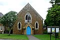 Kings Sutton Baptist church - geograph.org.uk - 1381629.jpg 640 × 426; 196 KB
-
 Kings Sutton express at Astrop geograph-2912773-by-Ben-Brooksbank.jpg 2,254 × 1,448; 1.51 MB
-
 Kings Sutton from Banbury Lane - geograph.org.uk - 5817761.jpg 5,202 × 3,465; 3.55 MB
-

-
 Kings Sutton green - geograph.org.uk - 1381618.jpg 640 × 427; 186 KB
-
 Kings Sutton mk1.png 1,747 × 1,206; 4.91 MB
-
 Kings Sutton up express geograph-2897740-by-Ben-Brooksbank.jpg 2,211 × 1,449; 1.15 MB
-
-
 Leaving Astrophill Farm - geograph.org.uk - 1381392.jpg 640 × 426; 197 KB
-
 Little Purston - geograph.org.uk - 5902078.jpg 1,600 × 1,066; 400 KB
-

-
 M40 approaching the River Cherwell - geograph.org.uk - 2461350.jpg 640 × 297; 45 KB
-
 M40 Aynho Road crosses - geograph.org.uk - 3125633.jpg 3,108 × 2,116; 1.17 MB
-
-
 M40 motorway crosses the railway - geograph.org.uk - 3022802.jpg 640 × 480; 54 KB
-
 M40 motorway north of Aynho - geograph.org.uk - 3022770.jpg 640 × 480; 63 KB
-
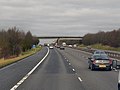
 M40 northbound - geograph.org.uk - 3224295.jpg 640 × 480; 41 KB
-
 M40 northbound near Aynho - geograph.org.uk - 6281341.jpg 800 × 574; 101 KB
-
 M40 northbound near Kings Sutton - geograph.org.uk - 6281326.jpg 800 × 600; 97 KB
-
 M40 south near Mill House Farm - geograph.org.uk - 2829664.jpg 640 × 481; 36 KB
-
 Manor House, Kings Sutton (geograph 3308197).jpg 1,024 × 768; 185 KB
-

-
 Mill House Farm - geograph.org.uk - 4516000.jpg 1,024 × 776; 262 KB
-
 Mill Lane towards Kings Sutton - geograph.org.uk - 6281319.jpg 800 × 600; 146 KB
-
 Mill Lane towards Kings Sutton - geograph.org.uk - 6281327.jpg 800 × 600; 110 KB
-
 Minor Road towards Banbury - geograph.org.uk - 6284120.jpg 800 × 600; 99 KB
-
 Minor Road towards Banbury - geograph.org.uk - 6284268.jpg 800 × 600; 90 KB
-
 Monoculture - geograph.org.uk - 5333250.jpg 640 × 480; 68 KB
-
 Monoculture - on the footpath - geograph.org.uk - 5333251.jpg 640 × 480; 87 KB
-
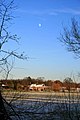 Moon over Mill House Farm - geograph.org.uk - 2203306.jpg 427 × 640; 66 KB
-
 Narrow footpath going south - geograph.org.uk - 5900997.jpg 1,066 × 1,600; 416 KB
-
 Nell Bridge - geograph.org.uk - 3308291.jpg 1,024 × 768; 157 KB
-

-
 Northbound M40 near Kings Sutton - geograph.org.uk - 3297000.jpg 640 × 480; 359 KB
-

-
 Pasture at Kings Sutton - geograph.org.uk - 1381615.jpg 427 × 640; 192 KB
-
 Pasture land - geograph.org.uk - 4520927.jpg 640 × 426; 49 KB
-
 Path north of Kings Sutton - geograph.org.uk - 1381364.jpg 640 × 427; 189 KB
-
 Path round Rosamond's Bower - geograph.org.uk - 5901249.jpg 1,600 × 1,066; 644 KB
-
 Path through Newbottle Spinney - geograph.org.uk - 5901234.jpg 1,600 × 1,066; 650 KB
-
 Pond at Astrop - geograph.org.uk - 1381596.jpg 640 × 426; 192 KB
-
 Power lines across the field - geograph.org.uk - 5902062.jpg 1,600 × 1,066; 353 KB
-
 Power lines running down to Buston Farm - geograph.org.uk - 5901222.jpg 1,600 × 1,066; 336 KB
-
 Purston Manor and stables - geograph.org.uk - 5902074.jpg 1,600 × 1,066; 414 KB
-

-
 Railway towards Banbury - geograph.org.uk - 6281234.jpg 800 × 600; 178 KB
-
 Richmond Street, King's Sutton - geograph.org.uk - 1473262.jpg 640 × 480; 65 KB
-
 Ridges and furrows by the Banbury road - geograph.org.uk - 5900993.jpg 1,600 × 1,066; 301 KB
-
 Road (footpath) to Astrop Hill Farm - geograph.org.uk - 6284095.jpg 800 × 600; 108 KB
-
 Road through Newbottle Spinney - geograph.org.uk - 5901235.jpg 1,600 × 1,066; 530 KB
-
 Road to Newbottle church - geograph.org.uk - 5629051.jpg 800 × 600; 154 KB
-
 Rosamond's Bower - geograph.org.uk - 5902058.jpg 1,600 × 1,066; 617 KB
-
 Round the curve to Kings Sutton - geograph.org.uk - 1325062.jpg 640 × 411; 77 KB
-

-
 Spire, Kings Sutton Church - geograph.org.uk - 4520910.jpg 640 × 426; 28 KB
-
 St Peter and St Paul church, Kings Sutton - geograph.org.uk - 5817743.jpg 5,202 × 3,465; 3.48 MB
-
 Start of footpath to Kings Sutton - geograph.org.uk - 3308277.jpg 1,024 × 768; 251 KB
-
 Station Road Scene, King's Sutton - geograph.org.uk - 1473431.jpg 640 × 480; 83 KB
-
 Steps, Kings Sutton Station - geograph.org.uk - 4520914.jpg 640 × 426; 97 KB
-
 Stream between the fields - geograph.org.uk - 5901233.jpg 1,600 × 1,066; 394 KB
-
 Stream by the Astrop road - geograph.org.uk - 5900995.jpg 1,600 × 1,066; 585 KB
-
 Stubble field beside the B4100 - geograph.org.uk - 6281329.jpg 800 × 600; 88 KB
-
 Stubble field near Walton Grounds - geograph.org.uk - 6281322.jpg 800 × 600; 107 KB
-
 Studleigh Farm No. 2 Crossing - geograph.org.uk - 1325086.jpg 640 × 422; 80 KB
-
 Sundial at Astrop - geograph.org.uk - 1381443.jpg 640 × 426; 168 KB
-
 Sutton Lodge Farm road - geograph.org.uk - 5817905.jpg 5,202 × 3,465; 3.09 MB
-

-

-
 The 'Hovis' building, King's Sutton - geograph.org.uk - 1473415.jpg 480 × 640; 101 KB
-
 The Butchers Arms, Kings Sutton - geograph.org.uk - 5817752.jpg 5,202 × 3,465; 3.49 MB
-
 The Butchers Arms, Kings Sutton - geograph.org.uk - 6281277.jpg 800 × 600; 144 KB
-
 The Farthinghoe Stream - geograph.org.uk - 6284129.jpg 640 × 480; 86 KB
-
 The Farthinghoe Stream - geograph.org.uk - 6284133.jpg 800 × 600; 111 KB
-
 The Post Office, King's Sutton - geograph.org.uk - 1473394.jpg 640 × 480; 90 KB


,_King%27s_Sutton_-_geograph.org.uk_-_1473443.jpg)


.png)

_-_geograph.org.uk_-_1473314.jpg)


.png)
.png)
.png)
.png)
.png)


.jpg)


_to_Astrop_Hill_Farm_-_geograph.org.uk_-_6284095.jpg)


