Category:Kirby Bedon
English: Kirby Bedon is a small village in South Norfolk which lies approximately 3½ miles (5½ km) southeast of Norwich on the road to Bramerton. It covers an area of and had a population of 186 in 77 households as of the 2001 census.
village and civil parish in Norfolk, England, UK  | |||||
| Upload media | |||||
| Instance of | |||||
|---|---|---|---|---|---|
| Location | South Norfolk, Norfolk, East of England, England | ||||
| Area |
| ||||
 | |||||
Subcategories
This category has the following 3 subcategories, out of 3 total.
M
- St Marys Church, Kirby Bedon (16 F)
S
Media in category "Kirby Bedon"
The following 200 files are in this category, out of 651 total.
(previous page) (next page)-
 'The Oaks' office complex, Kirby Bedon - geograph.org.uk - 122380.jpg 640 × 480; 109 KB
-
 A crop of wheat - geograph.org.uk - 1391788.jpg 640 × 480; 72 KB
-
 A field boundary hedge - geograph.org.uk - 4370471.jpg 640 × 480; 377 KB
-
 A fine mansion - geograph.org.uk - 1284055.jpg 640 × 573; 93 KB
-
 A glimpse of the River Yare at Bramerton - geograph.org.uk - 6226351.jpg 800 × 591; 150 KB
-
 A hare enjoying the evening sunshine - geograph.org.uk - 1391792.jpg 500 × 640; 123 KB
-
 A hole in the fence - geograph.org.uk - 5385503.jpg 640 × 480; 394 KB
-
 A lime kiln - geograph.org.uk - 1574253.jpg 640 × 480; 130 KB
-
 A new sewage pipeline - geograph.org.uk - 5261189.jpg 640 × 583; 316 KB
-
 A path leading into Old Wood - geograph.org.uk - 6174553.jpg 800 × 585; 226 KB
-
 A redundant kissing gate - geograph.org.uk - 1284010.jpg 480 × 640; 143 KB
-
 A seat by the path - geograph.org.uk - 1284034.jpg 640 × 480; 131 KB
-
 A section of Cycle Route 1 - geograph.org.uk - 1388281.jpg 640 × 480; 135 KB
-

-

-
 A146 Loddon Road ^ The Old Feathers Public House - geograph.org.uk - 3623739.jpg 3,072 × 2,304; 1.23 MB
-

-
 A47 crosses Whitlingham Lane - geograph.org.uk - 3718952.jpg 640 × 430; 60 KB
-
 Able Community Care - geograph.org.uk - 1388664.jpg 640 × 480; 99 KB
-
 Able Community Care - geograph.org.uk - 1388667.jpg 640 × 480; 103 KB
-
 Able Community Care - geograph.org.uk - 1388671.jpg 640 × 489; 95 KB
-

-
 Agrimony (Agrimonia eupatoria) - flower - geograph.org.uk - 5436141.jpg 458 × 640; 197 KB
-
 Agrimony (Agrimonia eupatoria) - flower - geograph.org.uk - 5436144.jpg 616 × 640; 244 KB
-
 Agrimony (Agrimonia eupatoria) - flowers - geograph.org.uk - 5436143.jpg 640 × 627; 409 KB
-
 Agrimony (Agrimonia eupatoria) - geograph.org.uk - 5436132.jpg 634 × 640; 572 KB
-
 Agrimony (Agrimonia eupatoria) - geograph.org.uk - 5436134.jpg 586 × 640; 547 KB
-
 Agrimony (Agrimonia eupatoria) - geograph.org.uk - 5436136.jpg 504 × 640; 519 KB
-
 Agrimony (Agrimonia eupatoria) - geograph.org.uk - 5436138.jpg 640 × 480; 483 KB
-

-
 Anglian Water Station by Mill Hill - geograph.org.uk - 1532728.jpg 640 × 454; 146 KB
-

-

-
 Arts ^ Crafts style house in Bixley - geograph.org.uk - 2349918.jpg 640 × 482; 190 KB
-
 Arts ^ Crafts style house in Bixley - geograph.org.uk - 2349921.jpg 640 × 484; 206 KB
-
 B-24 Liberator, 42-50439, crash memorial, 18-08-1944 - geograph.org.uk - 6507348.jpg 2,862 × 2,541; 1.54 MB
-
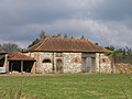 Barn at Church Farm, Kirby Bedon - geograph.org.uk - 148917.jpg 640 × 480; 80 KB
-
 Barn, Hill Farm - geograph.org.uk - 3744289.jpg 640 × 430; 85 KB
-
 Barn, Hill Farm - geograph.org.uk - 3744292.jpg 640 × 430; 58 KB
-
 Barn, Stud Farm - geograph.org.uk - 3734301.jpg 640 × 430; 68 KB
-
 Barn, Whitlingham - geograph.org.uk - 5544867.jpg 640 × 480; 68 KB
-
 Beneath the Postwick viaduct - geograph.org.uk - 5385357.jpg 471 × 640; 274 KB
-
 Bicycles dumped in the undergrowth - geograph.org.uk - 6226349.jpg 800 × 591; 235 KB
-
 Big Day Out - sculpture on the riverbank - geograph.org.uk - 1387393.jpg 574 × 640; 125 KB
-
 Big gap in fence - geograph.org.uk - 1284015.jpg 640 × 480; 81 KB
-
 Blue hydrangea flowers - geograph.org.uk - 6226358.jpg 800 × 586; 103 KB
-
 Bluebells and Forget-me-nots - geograph.org.uk - 1284025.jpg 640 × 480; 124 KB
-
 Boating on the River Yare - geograph.org.uk - 5544860.jpg 640 × 480; 53 KB
-
 Boats moored on the River Yare - geograph.org.uk - 5385343.jpg 640 × 467; 357 KB
-
 Boats on the River Yare - geograph.org.uk - 5385340.jpg 640 × 480; 368 KB
-
 Boats on the River Yare - geograph.org.uk - 5385342.jpg 640 × 480; 379 KB
-
 Boatyard on the River Yare - geograph.org.uk - 5385308.jpg 640 × 475; 372 KB
-
 Boer Plantation - geograph.org.uk - 3751749.jpg 640 × 430; 49 KB
-
 Bottles on a windowsill - geograph.org.uk - 2349926.jpg 564 × 600; 209 KB
-
 Bottles on a windowsill - geograph.org.uk - 2349929.jpg 562 × 600; 218 KB
-
 Boulder at The Old Stracey, Kirby Bedon - geograph.org.uk - 3756359.jpg 640 × 480; 178 KB
-

-
 Brassicas - geograph.org.uk - 3734252.jpg 640 × 430; 64 KB
-
 Brassicas - geograph.org.uk - 3734257.jpg 640 × 430; 63 KB
-
 Brassicas - geograph.org.uk - 3734265.jpg 640 × 430; 79 KB
-
 Brassicas - geograph.org.uk - 3734271.jpg 640 × 430; 70 KB
-
 Brassicas, Hill Farm - geograph.org.uk - 3744296.jpg 640 × 430; 65 KB
-
 Bridleway off Kirby Rd - geograph.org.uk - 3744285.jpg 640 × 430; 76 KB
-
 Bridleway sign - geograph.org.uk - 3621771.jpg 2,086 × 2,785; 2.37 MB
-
 Bridleway to Kirby Bedon - geograph.org.uk - 1391805.jpg 640 × 480; 94 KB
-
 Bridleway ^ entrance to the Sewage Works - geograph.org.uk - 3621761.jpg 3,072 × 2,304; 1.37 MB
-

-

-

-
 Buddleia and Rosebay willowherb - geograph.org.uk - 1387410.jpg 640 × 480; 120 KB
-
 Bulbous Buttercup (Ranunculus bulbosus) - geograph.org.uk - 5385302.jpg 640 × 579; 644 KB
-

-
 By Mill Hill - geograph.org.uk - 3734315.jpg 640 × 430; 42 KB
-
 Car park, Whitlingham Country Park - geograph.org.uk - 3718925.jpg 640 × 430; 89 KB
-
 Cattle grazing in Whitlingham Marsh - geograph.org.uk - 5385434.jpg 640 × 480; 381 KB
-
 Chervil (Anthriscus cerefolium) - geograph.org.uk - 5385419.jpg 634 × 640; 517 KB
-
 Church Cottage sign - geograph.org.uk - 3621947.jpg 3,072 × 2,304; 1.43 MB
-
 Church Farm (farmhouse) - geograph.org.uk - 5972020.jpg 800 × 598; 137 KB
-
 Church Farm as seen from Easthill Lane - geograph.org.uk - 5972015.jpg 800 × 598; 136 KB
-
 Church Farm barn conversion - geograph.org.uk - 5703582.jpg 640 × 361; 210 KB
-
 Church House - geograph.org.uk - 1283989.jpg 480 × 640; 116 KB
-
 Church House - geograph.org.uk - 3273117.jpg 2,805 × 2,104; 1.83 MB
-
 Church of St Andrew, Kirby Bedon - geograph.org.uk - 3603416.jpg 4,320 × 3,240; 5.69 MB
-
 Church of St Andrews, Kirby Bedon - geograph.org.uk - 3744226.jpg 640 × 430; 96 KB
-
 Church of St Mary (remains) - geograph.org.uk - 3744233.jpg 377 × 640; 76 KB
-
 Church of St Mary (remains) - geograph.org.uk - 3744235.jpg 640 × 430; 80 KB
-
 Church of St Mary (remains) - geograph.org.uk - 3744238.jpg 640 × 608; 132 KB
-
 Church Road, Kirby Bedon - geograph.org.uk - 3756338.jpg 640 × 463; 201 KB
-
 Circular walk on Whitlingham Marsh - geograph.org.uk - 5385267.jpg 640 × 480; 403 KB
-
 Circular walk on Whitlingham Marsh - geograph.org.uk - 5385273.jpg 640 × 480; 427 KB
-
 Colourful bramble leaves - geograph.org.uk - 5520968.jpg 640 × 581; 533 KB
-
 Common Fiddleneck (Amsinckia micrantha) - geograph.org.uk - 5385394.jpg 640 × 586; 594 KB
-
 Common Fiddleneck (Amsinckia micrantha) - geograph.org.uk - 5385395.jpg 640 × 480; 306 KB
-
 Common Fiddleneck (Amsinckia micrantha) - geograph.org.uk - 5385399.jpg 640 × 602; 357 KB
-
 Common Sainfoin (Onobrychis viciifolia) - geograph.org.uk - 5436101.jpg 616 × 640; 231 KB
-
 Common Sainfoin (Onobrychis viciifolia) - geograph.org.uk - 5436103.jpg 586 × 640; 283 KB
-
 Common Sainfoin (Onobrychis viciifolia) - geograph.org.uk - 5436104.jpg 552 × 640; 259 KB
-
 Conifer wood beside Cycle Route 1 - geograph.org.uk - 4370477.jpg 640 × 480; 458 KB
-
 Conservation area beside Cycle Route 1 - geograph.org.uk - 4370485.jpg 640 × 480; 424 KB
-
 Construction machinery - geograph.org.uk - 5261188.jpg 640 × 480; 347 KB
-

-

-
 Construction site beside Sallow Lane - geograph.org.uk - 5261183.jpg 640 × 480; 344 KB
-
 Corner of The Street and Kirby Rd - geograph.org.uk - 3744265.jpg 640 × 430; 69 KB
-
 Cottage by the River - geograph.org.uk - 1964528.jpg 640 × 475; 121 KB
-
 Cow parsley and buttercups - geograph.org.uk - 5385292.jpg 480 × 640; 444 KB
-

-
 Creeping Cinquefoil (Potentilla reptans) - geograph.org.uk - 5385426.jpg 640 × 614; 554 KB
-
 Creeping Cinquefoil (Potentilla reptans) - geograph.org.uk - 5385428.jpg 640 × 583; 542 KB
-
 Crocuses in St Andrew's churchyard - geograph.org.uk - 5703573.jpg 636 × 640; 581 KB
-
 Crop field by Stud Farm - geograph.org.uk - 5521038.jpg 640 × 480; 351 KB
-

-

-
 Crop fields by Kirby Bedon - geograph.org.uk - 5521012.jpg 640 × 480; 295 KB
-
 Crop fields west of Kirby Bedon - geograph.org.uk - 5703540.jpg 640 × 480; 312 KB
-

-
 Cycle route 1 - geograph.org.uk - 3734282.jpg 640 × 430; 97 KB
-
 Cycle Route 1 - geograph.org.uk - 4370481.jpg 640 × 480; 359 KB
-

-
 Cycle Route 1 to Whitlingham - geograph.org.uk - 4370469.jpg 640 × 480; 397 KB
-

-
 Daffodils flowering in December - geograph.org.uk - 4786760.jpg 640 × 390; 125 KB
-
 Daffodils flowering in December - geograph.org.uk - 4786762.jpg 640 × 570; 497 KB
-
 Damaged grave in St Andrew's churchyard - geograph.org.uk - 5703564.jpg 640 × 557; 515 KB
-
 Danger sign - geograph.org.uk - 5385517.jpg 640 × 480; 357 KB
-
 Dark clouds over Mill Hill - geograph.org.uk - 5521040.jpg 640 × 480; 367 KB
-

-

-
 Disused farm track - geograph.org.uk - 5703525.jpg 640 × 480; 394 KB
-
 Dog litter bin - geograph.org.uk - 5385265.jpg 640 × 555; 527 KB
-

-
 Drifted snow - geograph.org.uk - 5698088.jpg 3,456 × 2,592; 3.89 MB
-
 Drilled field below Timber Hill - geograph.org.uk - 4370465.jpg 640 × 480; 397 KB
-
 Drilled field by Kirby Marsh - geograph.org.uk - 4370467.jpg 640 × 480; 410 KB
-
 Easthill Lane - geograph.org.uk - 3744196.jpg 640 × 430; 91 KB
-
 Easthill Lane looking towards Kirby Bedon - geograph.org.uk - 115687.jpg 640 × 480; 137 KB
-
 Easthill Lane looking towards Kirby Bedon - geograph.org.uk - 80726.jpg 640 × 480; 154 KB
-
 Easthill Lane past St Mary's Cottages - geograph.org.uk - 5703584.jpg 640 × 478; 327 KB
-
 Easthill Lane past St Mary's Cottages - geograph.org.uk - 5703586.jpg 640 × 473; 326 KB
-

-
 Entering Bramerton on Kirby Road - geograph.org.uk - 3622027.jpg 3,072 × 2,304; 1.06 MB
-
 Entering Kirby Bedon on Kirby Road - geograph.org.uk - 3621743.jpg 2,983 × 2,241; 963 KB
-
 Entrance (gate 1) to Anglian Water - geograph.org.uk - 1388563.jpg 640 × 480; 68 KB
-
 Entrance into Riverside Lodge - geograph.org.uk - 6226356.jpg 800 × 591; 154 KB
-
 Entrance to Church Cottage - geograph.org.uk - 3621944.jpg 3,072 × 2,304; 1.65 MB
-
-
 Entrance to Hall Park - geograph.org.uk - 3621822.jpg 3,072 × 2,304; 1.36 MB
-
 Entrance to Hall Park - geograph.org.uk - 3621832.jpg 3,072 × 2,304; 1.28 MB
-
 Entrance to Kirby Bedon, Kirby Rd - geograph.org.uk - 3744302.jpg 640 × 430; 66 KB
-
 Entrance to Kirby House - geograph.org.uk - 3734317.jpg 640 × 430; 89 KB
-
 Fallen masonry near St Mary's Tower - geograph.org.uk - 3273109.jpg 1,925 × 2,567; 2.77 MB
-
 Farm buildings, Whitlingham - geograph.org.uk - 5544871.jpg 640 × 480; 49 KB
-
 Farm shed, Kirby Bedon - geograph.org.uk - 3756387.jpg 640 × 480; 246 KB
-

-
 Farm track on the edge of a crop field - geograph.org.uk - 5521011.jpg 640 × 480; 288 KB
-
 Farmland - geograph.org.uk - 3734272.jpg 640 × 430; 58 KB
-
 Farmland at the rise in Mill Hill - geograph.org.uk - 4290211.jpg 640 × 480; 174 KB
-
 Farmland by Kirby Rd - geograph.org.uk - 3751652.jpg 640 × 361; 41 KB
-
 Fence surrounding the Old Rectory - geograph.org.uk - 5703536.jpg 474 × 640; 403 KB
-
 Field beside bridleway - geograph.org.uk - 1388340.jpg 640 × 480; 100 KB
-
 Field beside the path to Kirby Road - geograph.org.uk - 3756392.jpg 640 × 403; 151 KB
-
 Field bindweed (Convolvulus arvensis) - geograph.org.uk - 5436152.jpg 640 × 595; 256 KB
-

-
 Field by Kirby Bedon - geograph.org.uk - 4370474.jpg 640 × 480; 360 KB
-
 Field by Kirby Marsh - geograph.org.uk - 4370459.jpg 640 × 480; 427 KB
-

-
 Field near Stud Farm - geograph.org.uk - 4370489.jpg 640 × 480; 371 KB
-

-
 Field of Brassicas - geograph.org.uk - 3734247.jpg 640 × 430; 74 KB
-
 Field of Brassicas - geograph.org.uk - 3734250.jpg 640 × 430; 76 KB
-
 Field of Brassicas - geograph.org.uk - 3734253.jpg 640 × 430; 48 KB
-
 Field of Brassicas - geograph.org.uk - 3734260.jpg 640 × 430; 76 KB
-
 Field of Brassicas - geograph.org.uk - 3734269.jpg 640 × 347; 50 KB
-
 Field of Daffodils, Kirby Bedon - geograph.org.uk - 151549.jpg 640 × 480; 129 KB
-
 Fields by Kirby Bedon - geograph.org.uk - 3756382.jpg 640 × 353; 152 KB
-
 Fields by Kirby Bedon - geograph.org.uk - 4370484.jpg 640 × 480; 392 KB
-
 Fields by Kirby Bedon - geograph.org.uk - 5703507.jpg 640 × 480; 367 KB
-
 Fields by Stud Farm - geograph.org.uk - 4370491.jpg 640 × 480; 377 KB
-
 Fields by Stud Farm - geograph.org.uk - 4370492.jpg 640 × 480; 355 KB
-
 Fields by Whitlingham - geograph.org.uk - 4370483.jpg 640 × 414; 317 KB
-
 Fields south of Kirby Bedon - geograph.org.uk - 3756393.jpg 640 × 480; 210 KB
-
 Fields south of Kirby Bedon - geograph.org.uk - 3756394.jpg 640 × 362; 147 KB
-
 Fields south of Kirby Bedon - geograph.org.uk - 3756399.jpg 640 × 480; 209 KB
-
 Fields west of Kirby Bedon - geograph.org.uk - 5703512.jpg 612 × 640; 470 KB
-
 Flotsam trapped behind old moorings - geograph.org.uk - 1387399.jpg 480 × 640; 143 KB
-
 Footpath approaching private road - geograph.org.uk - 1388438.jpg 640 × 480; 109 KB
-
 Footpath crossing road - geograph.org.uk - 1387371.jpg 640 × 480; 128 KB
-

-
 Footpath to the A146 road - geograph.org.uk - 3756397.jpg 640 × 480; 246 KB
-
 Footpath to the A146 road, Kirby Bedon - geograph.org.uk - 3756379.jpg 640 × 480; 269 KB
-
 Footpath to the sewage works - geograph.org.uk - 1388366.jpg 640 × 480; 114 KB
-
 Fox Road, Framingham Pigot - geograph.org.uk - 3623733.jpg 3,072 × 2,304; 1.28 MB
-
 Frozen pond in Kirby Bedon - geograph.org.uk - 116687.jpg 640 × 480; 131 KB
-
 Galls on aspen - geograph.org.uk - 5521049.jpg 640 × 567; 469 KB
-
 Galls on aspen - geograph.org.uk - 5521051.jpg 640 × 594; 460 KB
-
 Galls on aspen - geograph.org.uk - 5521054.jpg 640 × 615; 480 KB
-
 Galls on aspen - geograph.org.uk - 5521057.jpg 640 × 596; 478 KB
-
 Galls on mugwort (Artemisia vulgaris) - geograph.org.uk - 5528757.jpg 637 × 640; 310 KB
-
 Galls on mugwort (Artemisia vulgaris) - geograph.org.uk - 5528759.jpg 640 × 594; 290 KB
-
 Galls on mugwort (Artemisia vulgaris) - geograph.org.uk - 5528761.jpg 640 × 617; 279 KB


_nest_-_geograph.org.uk_-_5519849.jpg)
_nest_-_geograph.org.uk_-_5519852.jpg)

_-_geograph.org.uk_-_5544865.jpg)


_-_flower_-_geograph.org.uk_-_5436141.jpg)
_-_flower_-_geograph.org.uk_-_5436144.jpg)
_-_flowers_-_geograph.org.uk_-_5436143.jpg)
_-_geograph.org.uk_-_5436132.jpg)
_-_geograph.org.uk_-_5436134.jpg)
_-_geograph.org.uk_-_5436136.jpg)
_-_geograph.org.uk_-_5436138.jpg)


_-_flowering_-_geograph.org.uk_-_5385415.jpg)
_-_geograph.org.uk_-_5385409.jpg)
_-_geograph.org.uk_-_5385411.jpg)

_-_geograph.org.uk_-_5385302.jpg)


_-_geograph.org.uk_-_5385419.jpg)

_-_geograph.org.uk_-_5972020.jpg)


_-_geograph.org.uk_-_3744233.jpg)
_-_geograph.org.uk_-_3744235.jpg)
_-_geograph.org.uk_-_3744238.jpg)


_-_geograph.org.uk_-_5385394.jpg)
_-_geograph.org.uk_-_5385395.jpg)
_-_geograph.org.uk_-_5385399.jpg)
_-_geograph.org.uk_-_5436101.jpg)
_-_geograph.org.uk_-_5436103.jpg)
_-_geograph.org.uk_-_5436104.jpg)


_-_geograph.org.uk_-_5385426.jpg)
_-_geograph.org.uk_-_5385428.jpg)


_to_Anglian_Water_-_geograph.org.uk_-_1388563.jpg)


_-_geograph.org.uk_-_5436152.jpg)


_-_geograph.org.uk_-_5528757.jpg)
_-_geograph.org.uk_-_5528759.jpg)
_-_geograph.org.uk_-_5528761.jpg)