Category:Kirkby Lonsdale
town in Cumbria, England, UK  | |||||
| Upload media | |||||
| Instance of | |||||
|---|---|---|---|---|---|
| Location | South Lakeland, Cumbria, North West England, England | ||||
 | |||||
English: Kirkby Lonsdale is a small town in Cumbria, England, on the River Lune. It is situated thirteen miles (21 km) south-east from Kendal along the A65. The parish of Kirkby Lonsdale had a population of 1771 recorded in the 2001 census.cite web
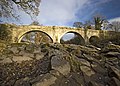
Nederlands: Kirkby Lonsdale is een Engels stadje van ongeveer 2500 inwoners in Cumbria aan de Lune. Het ligt op 21 km zuidoostwaarts van Kendal. Het stadje is bekend om zijn Duivelsbrug uit 1370 over de Lune.
Română: Kirkby Lonsdale este un oraş în comitatul Cumbria, regiunea North West, Anglia. Oraşul se află în districtul South Lakeland.
Subcategories
This category has the following 16 subcategories, out of 16 total.
D
- Devil's Bridge, Kirkby Lonsdale (89 F)
K
- Kirkby Lonsdale War Memorial (4 F)
M
- Main Street, Kirkby Lonsdale (22 F)
- Mill Brow, Kirkby Lonsdale (7 F)
P
R
S
- Salt Pie Lane, Kirkby Lonsdale (12 F)
- Stanley Bridge, Kirkby Lonsdale (13 F)
- Swine Market, Kirkby Lonsdale (11 F)
U
Media in category "Kirkby Lonsdale"
The following 200 files are in this category, out of 608 total.
(previous page) (next page)-
 160406 3 Kirkby Lonsdale (26127644163).jpg 4,896 × 3,672; 6.15 MB
-
 2 and 4 Beck Head, Kirkby Lonsdale.jpg 3,264 × 2,448; 1.05 MB
-
 3 Beck Head, Kirkby Lonsdale.jpg 3,264 × 2,448; 1.75 MB
-
 A bridleway leading to Tosca Cottage - geograph.org.uk - 3126835.jpg 800 × 600; 247 KB
-
 A change in level of the Lune - geograph.org.uk - 5216734.jpg 1,600 × 1,200; 838 KB
-
 A far pavilion - geograph.org.uk - 776311.jpg 640 × 425; 57 KB
-
 A public bridleway to Scar Brow - geograph.org.uk - 3126810.jpg 800 × 600; 374 KB
-
 A road junction at Kesrstwick - geograph.org.uk - 3126801.jpg 800 × 600; 188 KB
-
 A view from Devil's Bridge - geograph.org.uk - 6057818.jpg 1,600 × 1,194; 706 KB
-

-
 A65 at Fleet Farm entrance - geograph.org.uk - 2901281.jpg 5,184 × 3,456; 2.63 MB
-
 A65 at Fleet Farm lay-by - geograph.org.uk - 2901299.jpg 5,184 × 3,456; 4.59 MB
-
 A65 near Lane House - geograph.org.uk - 1829985.jpg 620 × 464; 101 KB
-
 Abbot Hall, Kirkby Lonsdale - geograph.org.uk - 5602041.jpg 640 × 480; 411 KB
-
 Above Hollin Hall - geograph.org.uk - 2268198.jpg 640 × 425; 59 KB
-
 Admiring Ruskin's View, Kirkby Lonsdale - geograph.org.uk - 5916999.jpg 1,024 × 768; 1.13 MB
-
 Aikrigg Green - geograph.org.uk - 3079721.jpg 640 × 480; 75 KB
-

-
 Amos Green - Green-Hickley-Bridge-b07563 - Kirkby Lonsdale Bridge.jpg 2,250 × 1,517; 280 KB
-

-
 An unusual precast concrete stile - geograph.org.uk - 4141238.jpg 4,000 × 3,000; 4.73 MB
-
 Arriving at High Biggins - geograph.org.uk - 3523075.jpg 1,600 × 1,200; 454 KB
-
 B6254 near Underley Lodge - geograph.org.uk - 1829941.jpg 480 × 640; 110 KB
-
 B6254 Old Scotch Road - geograph.org.uk - 5998360.jpg 800 × 600; 813 KB
-
 B6254, Deansbiggin - geograph.org.uk - 5998322.jpg 800 × 600; 706 KB
-
 B6254, Old Scotch Road - geograph.org.uk - 5998355.jpg 800 × 533; 733 KB
-
 B6446 junction from A65 - geograph.org.uk - 4002931.jpg 640 × 445; 107 KB
-
 Bar-code road sign by A65 - geograph.org.uk - 2607110.jpg 425 × 640; 318 KB
-
 Barclays Bank, Kirkby Lonsdale - geograph.org.uk - 5944007.jpg 4,000 × 5,040; 4.11 MB
-
 Barn near Biggins Home Farm - geograph.org.uk - 4228465.jpg 1,066 × 800; 354 KB
-
 Barn south of Pells Yeat - geograph.org.uk - 1829990.jpg 640 × 480; 77 KB
-
 Beck, Underley Park - geograph.org.uk - 2267482.jpg 640 × 480; 86 KB
-
 Belle Vue farm - geograph.org.uk - 3126829.jpg 800 × 600; 294 KB
-
 Bench mark on barn north of Kearstwick - geograph.org.uk - 2267495.jpg 480 × 640; 163 KB
-
 Bench mark on milestone - geograph.org.uk - 2268131.jpg 480 × 640; 146 KB
-
 Bench Mark, Kearstwick - geograph.org.uk - 1813200.jpg 640 × 480; 169 KB
-
 Beneath Lunefield Drive, Kirkby Lonsdale - geograph.org.uk - 1910704.jpg 640 × 480; 135 KB
-
 Biggins Cottage, Kirkby Lonsdale.jpg 1,066 × 800; 314 KB
-
 Biggins Hall (geograph 7362280).jpg 1,280 × 875; 920 KB
-
 Biggins Home Farm - geograph.org.uk - 4228464.jpg 1,066 × 800; 159 KB
-
 Biggins Home Farm - geograph.org.uk - 5413193.jpg 5,089 × 3,393; 1.64 MB
-
 Biggins House, High Biggins, near Kirkby Lonsdale - geograph.org.uk - 6288992.jpg 1,600 × 1,200; 526 KB
-
 Biggins Road - geograph.org.uk - 5413386.jpg 5,184 × 3,456; 1.97 MB
-
 Booth's Supermarket, Kirkby Lonsdale - geograph.org.uk - 2337531.jpg 3,872 × 2,592; 3.27 MB
-
 Booths Supermarket Car Park, Kirkby Lonsdale - geograph.org.uk - 2393451.jpg 4,320 × 3,240; 2.81 MB
-
 Booths, Kirkby Lonsdale - geograph.org.uk - 735013.jpg 640 × 480; 143 KB
-
 Bridge over "The Drain", Underley - geograph.org.uk - 4227639.jpg 2,816 × 2,112; 620 KB
-
 Bridge over the River Lune - geograph.org.uk - 1018352.jpg 640 × 124; 28 KB
-
 Bridge through the trees - geograph.org.uk - 928490.jpg 640 × 426; 129 KB
-
 Bridge, Underley Park - geograph.org.uk - 2267472.jpg 480 × 640; 124 KB
-

-
 Bridleway and Lowther Plantation - geograph.org.uk - 4227970.jpg 1,066 × 800; 183 KB
-
 Bridleway from Deansbiggin leading to minor road - geograph.org.uk - 4227935.jpg 1,066 × 800; 271 KB
-
 Bridleway junction near Lupton Beck - geograph.org.uk - 2268170.jpg 640 × 480; 108 KB
-
 Bridleway near Old Town - geograph.org.uk - 1808417.jpg 640 × 480; 184 KB
-
 Bridleway near Tosca - geograph.org.uk - 1808398.jpg 640 × 481; 129 KB
-
 Bridleway Passing Hollin Hall - geograph.org.uk - 4228065.jpg 1,066 × 800; 252 KB
-
 Bridleway Passing Hollin Hall - geograph.org.uk - 4228071.jpg 2,816 × 2,112; 529 KB
-
 Bridleway through Deansbiggin Plantation - geograph.org.uk - 4227950.jpg 1,066 × 800; 359 KB
-
 Bridleway to A65 - geograph.org.uk - 4228060.jpg 1,066 × 800; 279 KB
-
 Bus Shelter, near Kirkby Lonsdale - geograph.org.uk - 40485.jpg 640 × 480; 150 KB
-
 Calf Top in snow - geograph.org.uk - 4281283.jpg 3,264 × 2,448; 3.09 MB
-
 Carr and Bleasdale - geograph.org.uk - 1808764.jpg 640 × 480; 113 KB
-
 Cavendish Gardens, Kirkby Lonsdale - geograph.org.uk - 1910758.jpg 480 × 640; 152 KB
-
 Cemetery crocuses - geograph.org.uk - 3878192.jpg 2,048 × 1,536; 1.52 MB
-
 Cemetery North of Cockpit Hill - geograph.org.uk - 5601942.jpg 640 × 480; 692 KB
-

-
 Churchyard gates, Kirkby Lonsdale - geograph.org.uk - 5945840.jpg 2,415 × 2,411; 1.54 MB
-
 Civic Society Plaque, Swinemarket - geograph.org.uk - 5998455.jpg 800 × 600; 522 KB
-
 Confluence of "The Drain" and the River Lune - geograph.org.uk - 4227634.jpg 1,066 × 800; 426 KB
-
 Countryside to the North of Kirkby Lonsdale - geograph.org.uk - 5327026.jpg 5,184 × 3,456; 5.86 MB
-
 Crest, High Biggins - geograph.org.uk - 2268225.jpg 640 × 480; 180 KB
-
 Cricket field at Kirkby Lonsdale - geograph.org.uk - 4177502.jpg 2,668 × 1,998; 3.46 MB
-
 Cricket field, Kirkby Lonsdale - geograph.org.uk - 3767912.jpg 640 × 426; 215 KB
-
 Cricket ground at Kirkby Lonsdale - geograph.org.uk - 1907966.jpg 640 × 480; 142 KB
-
 Deansbiggin Farm - geograph.org.uk - 4227939.jpg 1,066 × 800; 247 KB
-
 Deansbiggin Tram Plantation - geograph.org.uk - 5052901.jpg 5,184 × 3,456; 1.83 MB
-
 Devil's Bridge (1) - geograph.org.uk - 6265492.jpg 4,320 × 3,240; 3.94 MB
-
 Devil's Bridge (2) - geograph.org.uk - 6265494.jpg 4,320 × 3,240; 2.45 MB
-
 Devil's Bridge (3) - geograph.org.uk - 6265495.jpg 4,320 × 3,240; 3.89 MB
-
 Devil's Bridge - geograph.org.uk - 4177518.jpg 1,280 × 960; 1.35 MB
-
 Devil's Bridge - geograph.org.uk - 4436113.jpg 3,857 × 2,767; 4.14 MB
-
 Devil's Bridge - geograph.org.uk - 5413182.jpg 5,184 × 3,456; 1.88 MB
-
 Devil's Bridge and the River Lune - geograph.org.uk - 4227621.jpg 1,066 × 800; 305 KB
-
 Devil's Bridge, Kirkby Lonsdale - geograph.org.uk - 3302513.jpg 2,048 × 1,536; 547 KB
-
 Devil's Bridge, Kirkby Lonsdale - geograph.org.uk - 3766305.jpg 640 × 426; 188 KB
-
 Devil's Bridge, Kirkby Lonsdale - geograph.org.uk - 4827867.jpg 2,592 × 1,944; 734 KB
-
 Devil's Bridge, Kirkby Lonsdale - geograph.org.uk - 5073287.jpg 1,024 × 678; 270 KB
-
 Devil's Bridge, Kirkby Lonsdale - geograph.org.uk - 5216724.jpg 1,600 × 1,200; 801 KB
-
 Devil's Bridge, Kirkby Lonsdale - geograph.org.uk - 6276757.jpg 1,024 × 683; 226 KB
-
 Devils Bridge, Kirkby Lonsdale - geograph.org.uk - 4591124.jpg 640 × 427; 186 KB
-

-

-
 Drainage channel at Underley Park - geograph.org.uk - 5127695.jpg 1,280 × 960; 912 KB
-
 Entrance to Underley Garden - geograph.org.uk - 4227929.jpg 1,066 × 800; 369 KB
-
 Ewe and lambs at Wood End - geograph.org.uk - 4919982.jpg 800 × 600; 124 KB
-
 Faith, Hope and Charity - geograph.org.uk - 4607678.jpg 2,304 × 3,758; 7.88 MB
-
 Fence-eating tree - geograph.org.uk - 3313806.jpg 640 × 425; 235 KB
-

-
 Field with sheep near Tearnside Hall - geograph.org.uk - 5188836.jpg 1,600 × 1,200; 703 KB
-
 Finger of Woodland by Underley Park - geograph.org.uk - 2393442.jpg 4,320 × 3,240; 4.78 MB
-
 Fire station, New Road, Kirkby Lonsdale - geograph.org.uk - 5190933.jpg 1,600 × 1,061; 722 KB
-
 Fleet Farm - geograph.org.uk - 4228051.jpg 1,066 × 800; 190 KB
-
 Fleet Farm - geograph.org.uk - 4228054.jpg 1,066 × 800; 205 KB
-
 Fleet farmhouse - geograph.org.uk - 2268175.jpg 640 × 480; 117 KB
-

-
 Footpath heading for High Biggins - geograph.org.uk - 2268212.jpg 640 × 480; 62 KB
-
 Footpath leaves the road - geograph.org.uk - 6265501.jpg 4,320 × 3,240; 4.12 MB
-
 Footpath north of Kirkby Lonsdale - geograph.org.uk - 3313812.jpg 640 × 425; 224 KB
-
 Footpath past the Cemetery Wall - geograph.org.uk - 5601945.jpg 640 × 480; 596 KB
-
 Footpath through Lily Wood - geograph.org.uk - 5127697.jpg 1,280 × 960; 1.68 MB
-
 Footpath to Devil's Bridge - geograph.org.uk - 4914936.jpg 800 × 600; 137 KB
-
 Footpath, Hot Ridding - geograph.org.uk - 1808635.jpg 640 × 481; 154 KB
-
 Footpath, Tosca - geograph.org.uk - 1808384.jpg 640 × 480; 128 KB
-

-
 Gallowber Lane - geograph.org.uk - 3523068.jpg 1,600 × 1,200; 1,011 KB
-
 Garages on Robraine, Kirkby Lonsdale - geograph.org.uk - 5925364.jpg 3,555 × 2,298; 1.21 MB
-
 Gate post with bench mark - geograph.org.uk - 2267599.jpg 640 × 480; 136 KB
-
 Gate, Tosca - geograph.org.uk - 1808374.jpg 640 × 480; 157 KB
-

-
 Gateway by B6254 - geograph.org.uk - 3313792.jpg 640 × 425; 140 KB
-
 Gateway off Bridge Brow, Kirkby Lonsdale - geograph.org.uk - 1909603.jpg 640 × 480; 197 KB
-
 Gazebo, St Mary's churchyard, Kirkby Lonsdale - geograph.org.uk - 5945896.jpg 3,328 × 3,326; 3.05 MB
-
 Geological Map NW England Garwood 1912 01.jpg 5,829 × 9,171; 6.38 MB
-
 George V postbox on Robraine, Kirkby Lonsdale - geograph.org.uk - 5925363.jpg 1,270 × 2,337; 649 KB
-
 Grassland at Underley Park - geograph.org.uk - 5127692.jpg 1,280 × 960; 900 KB
-
 Gravestone of 'John Smith' - geograph.org.uk - 4827823.jpg 1,810 × 2,525; 828 KB
-
 Haweswater Aqueduct - geograph.org.uk - 984973.jpg 640 × 480; 164 KB
-
 High Biggins - geograph.org.uk - 4228468.jpg 1,066 × 800; 238 KB
-
 High Biggins Manor - geograph.org.uk - 4914896.jpg 960 × 720; 180 KB
-
 Hop House - geograph.org.uk - 4227961.jpg 2,816 × 2,112; 537 KB
-
 Hophouse Lane (N) - geograph.org.uk - 5998188.jpg 800 × 600; 385 KB
-
 Hophouse Lane (S) - geograph.org.uk - 5998189.jpg 800 × 600; 355 KB
-
 Hophouse Lane - geograph.org.uk - 1829992.jpg 640 × 480; 150 KB
-
 Horse Market, by Jingling Lane - geograph.org.uk - 2393213.jpg 4,320 × 3,240; 4.96 MB
-
 Horse Market, Kirkby Lonsdale - geograph.org.uk - 799176.jpg 480 × 640; 168 KB
-

-
 Houses in Binfold Croft, Kirkby Lonsdale - geograph.org.uk - 1910660.jpg 640 × 480; 169 KB
-
 Houses off Robraine, Kirkby Lonsdale - geograph.org.uk - 5925325.jpg 640 × 480; 61 KB
-

-
 Jingling Lane, Kirkby Lonsdale - geograph.org.uk - 1910794.jpg 480 × 640; 170 KB
-
 Jingling Lane, Kirkby Lonsdale - geograph.org.uk - 5073262.jpg 1,024 × 678; 194 KB
-
 Jingling Lane, Kirkby Lonsdale - geograph.org.uk - 6065537.jpg 1,024 × 768; 312 KB
-
 John Parr memorial, St Mary's church - geograph.org.uk - 5945910.jpg 3,985 × 3,990; 5.35 MB
-
 John Ruskin's View, River Lune, Kirkby Lonsdale, Yorkshire (24424615535).jpg 4,784 × 3,079; 5.8 MB
-
 Jumper, Market Square, Kirkby Lonsdale - geograph.org.uk - 1910860.jpg 480 × 640; 106 KB
-
 Junction of Gallowber lane and Well Lane - geograph.org.uk - 3523061.jpg 1,600 × 1,200; 475 KB
-
 Junction of Hophouse Lane and the A65 - geograph.org.uk - 1829994.jpg 640 × 480; 103 KB
-
 Junction of Market Street and Main Street, Kirkby Lonsdale - geograph.org.uk - 5944025.jpg 4,456 × 3,744; 3.83 MB
-
 Junction of the old A65 with the new A65 - geograph.org.uk - 1830008.jpg 640 × 480; 100 KB
-
 Junction of Well Lane and the old A65 - geograph.org.uk - 1830000.jpg 640 × 480; 123 KB
-
 Kayakers under instruction beneath Devils Bridge - geograph.org.uk - 5548611.jpg 1,000 × 750; 233 KB
-
 Kearstwick - geograph.org.uk - 5998426.jpg 800 × 600; 714 KB
-
 Kearstwick Bridge South - geograph.org.uk - 2957818.jpg 1,024 × 768; 195 KB
-
 Kearstwick Hill.jpg 1,024 × 768; 167 KB
-
 Kearstwick House - geograph.org.uk - 6232756.jpg 1,024 × 768; 183 KB
-
 Kearstwick Lodge.jpg 1,066 × 800; 287 KB
-
 Kearstwick, beck - geograph.org.uk - 2957803.jpg 1,024 × 768; 229 KB
-
 Kings Arms Hotel, Kirkby Lonsdale - geograph.org.uk - 5217778.jpg 1,200 × 1,600; 856 KB
-
 Kirfit Hall - geograph.org.uk - 5413178.jpg 5,184 × 3,456; 1.68 MB
-
 LA6 100 Kirkby Lonsdale P.O. (3065706545) (2).jpg 960 × 1,280; 220 KB
-
 Kirkby Lonsdale - Devil's Bridge - geograph.org.uk - 3766375.jpg 640 × 457; 202 KB
-
 Kirkby Lonsdale - geograph.org.uk - 5413185.jpg 5,184 × 3,456; 1.79 MB
-
 Kirkby Lonsdale - geograph.org.uk - 5413202.jpg 5,184 × 2,321; 1.92 MB
-
 Kirkby Lonsdale - River Lune - geograph.org.uk - 3768004.jpg 529 × 640; 224 KB
-
 Kirkby Lonsdale ... (3066547746) (2).jpg 1,280 × 960; 135 KB
-
 Kirkby Lonsdale buildings (1) (geograph 6260330).jpg 4,320 × 3,240; 2.95 MB
-
 Kirkby Lonsdale buildings (10) - geograph.org.uk - 6263916.jpg 2,824 × 3,765; 3.21 MB
-
 Kirkby Lonsdale buildings (11) - geograph.org.uk - 6263917.jpg 3,103 × 4,138; 3.67 MB
-
 Kirkby Lonsdale buildings (12) - geograph.org.uk - 6263918.jpg 3,154 × 4,205; 3.4 MB
-
 Kirkby Lonsdale buildings (13) - geograph.org.uk - 6263919.jpg 3,240 × 4,320; 3.38 MB
-
 Kirkby Lonsdale buildings (14) - geograph.org.uk - 6263920.jpg 4,223 × 3,167; 2.48 MB
-
 Kirkby Lonsdale buildings (15) (geograph 6263923).jpg 4,320 × 3,240; 2.49 MB
-
 Kirkby Lonsdale buildings (16) (geograph 6263925).jpg 3,755 × 2,816; 1.91 MB
-
 Kirkby Lonsdale buildings (17) - geograph.org.uk - 6263940.jpg 4,320 × 3,240; 2.75 MB
-
 Kirkby Lonsdale buildings (18) (geograph 6263971).jpg 3,240 × 4,320; 2.53 MB
-
 Kirkby Lonsdale buildings (19) (geograph 6263974).jpg 4,320 × 3,240; 2.28 MB
-
 Kirkby Lonsdale buildings (2) - geograph.org.uk - 6260331.jpg 4,320 × 3,240; 2.73 MB
-
 Kirkby Lonsdale buildings (20) (geograph 6263976).jpg 4,320 × 3,240; 2.4 MB
-
 Kirkby Lonsdale buildings (21) (geograph 6264044).jpg 2,876 × 3,835; 1.89 MB
-
 Kirkby Lonsdale buildings (22) - geograph.org.uk - 6264052.jpg 2,654 × 3,539; 1.79 MB
-
 Kirkby Lonsdale buildings (23) - geograph.org.uk - 6264054.jpg 3,240 × 4,320; 2.16 MB
-
 Kirkby Lonsdale buildings (24) (geograph 6264689).jpg 2,505 × 3,339; 1.64 MB
-
 Kirkby Lonsdale buildings (25) (geograph 6264702).jpg 2,888 × 3,851; 1.93 MB
-
 Kirkby Lonsdale buildings (26) (geograph 6264703).jpg 3,111 × 4,148; 2.11 MB
-
 Kirkby Lonsdale buildings (27) (geograph 6264705).jpg 3,084 × 4,113; 2.36 MB
-
 Kirkby Lonsdale buildings (28) (geograph 6264708).jpg 3,240 × 4,320; 2.36 MB
-
 Kirkby Lonsdale buildings (29) (geograph 6264715).jpg 2,863 × 3,817; 1.66 MB
-
 Kirkby Lonsdale buildings (3) - geograph.org.uk - 6261881.jpg 2,914 × 3,886; 3.51 MB
-
 Kirkby Lonsdale buildings (30) - geograph.org.uk - 6264748.jpg 4,066 × 3,049; 2.1 MB
-
 Kirkby Lonsdale buildings (31) (geograph 6264759).jpg 4,320 × 3,240; 1.79 MB
-
 Kirkby Lonsdale buildings (32) (geograph 6264769).jpg 4,320 × 3,240; 2.17 MB
-
 Kirkby Lonsdale buildings (33) (geograph 6264773).jpg 4,320 × 3,240; 3.54 MB
-
 Kirkby Lonsdale buildings (34) (geograph 6264812).jpg 3,240 × 4,320; 2.76 MB
-
 Kirkby Lonsdale buildings (35) (geograph 6264816).jpg 3,240 × 4,320; 2.7 MB
-
 Kirkby Lonsdale buildings (36) (geograph 6264821).jpg 3,240 × 4,320; 2.89 MB
-
 Kirkby Lonsdale buildings (37) (geograph 6265526).jpg 3,240 × 4,320; 2.13 MB
-
 Kirkby Lonsdale buildings (38) - geograph.org.uk - 6267262.jpg 4,213 × 3,159; 2.51 MB
-
 Kirkby Lonsdale buildings (39) - geograph.org.uk - 6267263.jpg 4,320 × 3,240; 2.58 MB
-
 Kirkby Lonsdale buildings (4) - geograph.org.uk - 6261922.jpg 3,240 × 4,320; 3.02 MB
.jpg)


.jpg)


_-_geograph.org.uk_-_6265492.jpg)
_-_geograph.org.uk_-_6265494.jpg)
_-_geograph.org.uk_-_6265495.jpg)


_-_geograph.org.uk_-_5998188.jpg)
_-_geograph.org.uk_-_5998189.jpg)


.jpg)


_(2).jpg)


_(2).jpg)
_(geograph_6260330).jpg)
_-_geograph.org.uk_-_6263916.jpg)
_-_geograph.org.uk_-_6263917.jpg)
_-_geograph.org.uk_-_6263918.jpg)
_-_geograph.org.uk_-_6263919.jpg)
_-_geograph.org.uk_-_6263920.jpg)
_(geograph_6263923).jpg)
_(geograph_6263925).jpg)
_-_geograph.org.uk_-_6263940.jpg)
_(geograph_6263971).jpg)
_(geograph_6263974).jpg)
_-_geograph.org.uk_-_6260331.jpg)
_(geograph_6263976).jpg)
_(geograph_6264044).jpg)
_-_geograph.org.uk_-_6264052.jpg)
_-_geograph.org.uk_-_6264054.jpg)
_(geograph_6264689).jpg)
_(geograph_6264702).jpg)
_(geograph_6264703).jpg)
_(geograph_6264705).jpg)
_(geograph_6264708).jpg)
_(geograph_6264715).jpg)
_-_geograph.org.uk_-_6261881.jpg)
_-_geograph.org.uk_-_6264748.jpg)
_(geograph_6264759).jpg)
_(geograph_6264769).jpg)
_(geograph_6264773).jpg)
_(geograph_6264812).jpg)
_(geograph_6264816).jpg)
_(geograph_6264821).jpg)
_(geograph_6265526).jpg)
_-_geograph.org.uk_-_6267262.jpg)
_-_geograph.org.uk_-_6267263.jpg)
_-_geograph.org.uk_-_6261922.jpg)