Category:Kirkdale, North Yorkshire
valley near Kirkbymoorside in North Yorkshire, England, UK | |||||
| Upload media | |||||
| Instance of | |||||
|---|---|---|---|---|---|
| Location | Ryedale, North Yorkshire, Yorkshire and the Humber, England | ||||
| Different from | |||||
 | |||||
Subcategories
This category has only the following subcategory.
K
Media in category "Kirkdale, North Yorkshire"
The following 18 files are in this category, out of 18 total.
-
 Downstream from the ford - geograph.org.uk - 801838.jpg 640 × 479; 174 KB
-
 Ford and Footbridge - geograph.org.uk - 801828.jpg 640 × 479; 145 KB
-
 Ford and Footbridge - geograph.org.uk - 869518.jpg 640 × 418; 117 KB
-
 Hodge Beck Footbridge - geograph.org.uk - 870769.jpg 640 × 427; 122 KB
-
 Hyaena phalanges (39838867242).jpg 799 × 597; 195 KB
-
 Kirkdale Cave - geograph.org.uk - 1072214.jpg 640 × 480; 130 KB
-
 Kirkdale cave - geograph.org.uk - 801851.jpg 479 × 640; 176 KB
-
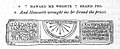
 Kirkdale Sundial.jpg 2,096 × 848; 378 KB
-
 Kirkdale Wood West - geograph.org.uk - 1341543.jpg 640 × 480; 87 KB
-
 St Gregory's Minster in Kirkdale.jpg 2,000 × 1,499; 1.81 MB
-
 The Ford has no Water - geograph.org.uk - 1350211.jpg 640 × 480; 136 KB
-
 Tides sundial.jpg 2,096 × 848; 378 KB
-
 Viaduct over Hodge Beck - geograph.org.uk - 1341531.jpg 640 × 480; 136 KB
-
 Welburn Rail Bridges - geograph.org.uk - 1202575.jpg 640 × 480; 126 KB
-
 Wrecked Footbridge - geograph.org.uk - 1341563.jpg 640 × 480; 151 KB
-
 Yellow Dead Nettle - geograph.org.uk - 801862.jpg 479 × 640; 113 KB
-
 Bridleway through meadow - geograph.org.uk - 553589.jpg 640 × 480; 117 KB
-
 Potato field near Lund Court Farm - geograph.org.uk - 466377.jpg 640 × 410; 62 KB


.jpg)


