Category:Kirkoswald, Cumbria
English: The village and former market town of Kirkoswald lies in the Lower Eden Valley of Cumbria or Cumberland, situated about nine miles from Penrith. The village is usually referred to locally as KO. The civil parish includes the villages of Kirkoswald and Renwick, and the hamlets of Staffield, High Bankhill, Parkhead and Scales.
village and civil parish in Cumbria, England  | |||||
| Upload media | |||||
| Instance of | |||||
|---|---|---|---|---|---|
| Location | Eden, Cumbria, North West England, England | ||||
| Population |
| ||||
| Said to be the same as | Kirkoswald (Wikimedia duplicated page, civil parish) | ||||
 | |||||
Subcategories
This category has the following 16 subcategories, out of 16 total.
B
- Black Fell, Pennines (2 F)
C
- The College, Kirkoswald (3 F)
- Croglin Low Hall (1 F)
D
- Demesne Farmhouse, Eden (1 F)
E
- Eden Bridge (B6413) (15 F)
H
- Haresceugh (2 F)
K
- Kirkoswald Castle (5 F)
L
N
- Nether Haresceugh (1 F)
- Nunnery, Kirkoswald (3 F)
O
- Kirkoswald Belltower (6 F)
R
S
Media in category "Kirkoswald, Cumbria"
The following 200 files are in this category, out of 582 total.
(previous page) (next page)-
 A distant prospect of Kirkoswald - geograph.org.uk - 4130939.jpg 640 × 480; 492 KB
-
 A fine tree in Staffield - geograph.org.uk - 3890593.jpg 3,872 × 2,592; 4.43 MB
-
 A grey stone on Greystone Edge - geograph.org.uk - 3944750.jpg 640 × 480; 103 KB
-
 A prospect of Eden - geograph.org.uk - 5164848.jpg 640 × 481; 261 KB
-
 A prospect of Renwick - geograph.org.uk - 4132108.jpg 640 × 480; 512 KB
-
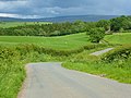 A road, Kirkoswald - geograph.org.uk - 4335588.jpg 640 × 480; 162 KB
-
 A686 at Hartside Top - geograph.org.uk - 2391067.jpg 640 × 427; 252 KB
-
 A686 between Alston and Melmerby - geograph.org.uk - 3765633.jpg 640 × 480; 36 KB
-

-
 A686 descending from Hartside Summit - geograph.org.uk - 3643527.jpg 4,320 × 3,240; 3.93 MB
-

-
 A686 towards Hartside Summit - geograph.org.uk - 5510842.jpg 640 × 480; 41 KB
-
 A686 towards Hartside Summit - geograph.org.uk - 5510847.jpg 640 × 480; 38 KB
-
 Above Renwick Fell - geograph.org.uk - 4587502.jpg 4,608 × 3,456; 3.51 MB
-
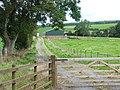 Access road and barn at Park Head - geograph.org.uk - 4131318.jpg 640 × 480; 518 KB
-

-
 Ascending Black Fell - geograph.org.uk - 1892423.jpg 640 × 480; 65 KB
-
 Barley field near Mastone Steps - geograph.org.uk - 4131166.jpg 640 × 480; 486 KB
-
 Barley field, Viol Moor - geograph.org.uk - 6179918.jpg 4,320 × 3,240; 1.56 MB
-
 Barns at Busk - geograph.org.uk - 5190496.jpg 640 × 480; 285 KB
-
 Benchmark and dated stone of Eden Bridge - geograph.org.uk - 3026942.jpg 683 × 1,024; 198 KB
-
 Bend on A686 at Green Fell - geograph.org.uk - 4002417.jpg 640 × 309; 71 KB
-
 Between Hartside Cross and Greenfell Raise - geograph.org.uk - 6194350.jpg 1,703 × 1,277; 748 KB
-

-
 Bield by Seavy Sike - geograph.org.uk - 3946043.jpg 640 × 480; 88 KB
-
 Blunderfield - geograph.org.uk - 1129667.jpg 640 × 431; 108 KB
-
 Bog Cotton - geograph.org.uk - 1895664.jpg 640 × 480; 105 KB
-
 Boundary Stone - geograph.org.uk - 5906266.jpg 635 × 1,024; 162 KB
-
 Boundary stone, Raven Bridge.jpg 480 × 640; 197 KB
-
 Boundary tree, Kirkoswald - geograph.org.uk - 1143221.jpg 640 × 480; 102 KB
-
 Bridge over Croglin Water. - geograph.org.uk - 261782.jpg 480 × 640; 135 KB
-
 Briggle Beck - geograph.org.uk - 2708953.jpg 3,331 × 2,592; 1.56 MB
-
 Busk - geograph.org.uk - 5190499.jpg 640 × 480; 284 KB
-
 Busk lime kiln and quarry - geograph.org.uk - 3946098.jpg 640 × 480; 111 KB
-
 C2C off-road route to Hartside Pass - geograph.org.uk - 5192901.jpg 640 × 480; 282 KB
-
 C2C off-road route to Hartside Pass - geograph.org.uk - 5192913.jpg 640 × 480; 302 KB
-
 Cairn east of Watch Hill, NY 63437 45963 - geograph.org.uk - 5721750.jpg 1,500 × 934; 1.16 MB
-
 Camp on Thack Moor - geograph.org.uk - 4587521.jpg 4,608 × 3,456; 3.72 MB
-
 Church path, Kirkoswald - geograph.org.uk - 1815735.jpg 1,600 × 1,200; 822 KB
-
 Clint Burn - geograph.org.uk - 2754220.jpg 600 × 450; 334 KB
-
 Clint Lane - geograph.org.uk - 1214905.jpg 640 × 480; 88 KB
-
 Clint Lane - geograph.org.uk - 2754222.jpg 600 × 450; 201 KB
-
 Clint Lane - geograph.org.uk - 2754234.jpg 600 × 450; 244 KB
-
 Clouds above Thack Moor - geograph.org.uk - 4587536.jpg 4,608 × 3,456; 3.59 MB
-
 Coast to Coast marker on Hartside Summit - geograph.org.uk - 3883321.jpg 3,872 × 2,592; 3.85 MB
-
 Cocklock lime kiln - geograph.org.uk - 3946071.jpg 640 × 480; 82 KB
-
 Confluence on Ricker Gill - geograph.org.uk - 5192907.jpg 640 × 480; 273 KB
-
 Cottage beside Raven Beck - geograph.org.uk - 5099408.jpg 480 × 640; 445 KB
-
 Cottage on the bend in High Bankhill - geograph.org.uk - 4185002.jpg 640 × 480; 362 KB
-
 Country road and house near Moor Edge - geograph.org.uk - 4131346.jpg 640 × 480; 399 KB
-
 Country road east of Mastone Steps - geograph.org.uk - 4131191.jpg 640 × 480; 400 KB
-
 Croglin Bridge - geograph.org.uk - 2708926.jpg 3,838 × 2,518; 1.97 MB
-
 Croglin Bridge, Croglin - geograph.org.uk - 2754471.jpg 600 × 450; 448 KB
-
 Croglin Water - geograph.org.uk - 2750116.jpg 600 × 450; 328 KB
-
 Croglin Water - geograph.org.uk - 2750121.jpg 600 × 450; 387 KB
-
 Croglin Water - geograph.org.uk - 2750162.jpg 600 × 450; 338 KB
-
 Croglin Water - geograph.org.uk - 2750166.jpg 600 × 450; 289 KB
-
 Croglin Water - geograph.org.uk - 2750173.jpg 600 × 450; 322 KB
-
 Croglin Water - geograph.org.uk - 2750175.jpg 600 × 450; 301 KB
-
 Croglin Water - geograph.org.uk - 3891965.jpg 3,872 × 2,592; 6.64 MB
-
 Croglin Water - geograph.org.uk - 4131072.jpg 640 × 480; 505 KB
-
 Croglin Water and Top of Waterfall - geograph.org.uk - 2750072.jpg 600 × 450; 405 KB
-
 Croglin Water and Wayerfall - geograph.org.uk - 2750113.jpg 600 × 450; 327 KB
-
 Croglin Water from Croglin Bridge - geograph.org.uk - 2754475.jpg 600 × 450; 426 KB
-
 Croglin Water Gorge - geograph.org.uk - 2750100.jpg 600 × 450; 365 KB
-
 Crossroads above Kirkoswald - geograph.org.uk - 956295.jpg 640 × 425; 95 KB
-
 Currick east of Watch Hill - geograph.org.uk - 3944723.jpg 640 × 480; 96 KB
-
 Currick on Watch Fell - geograph.org.uk - 1560165.jpg 640 × 480; 73 KB
-
 Currick, Watch Hill - geograph.org.uk - 4587489.jpg 4,608 × 3,456; 3.9 MB
-

-
 Daleraven - geograph.org.uk - 1542683.jpg 640 × 345; 77 KB
-
 Daleraven Bridge - geograph.org.uk - 4068669.jpg 1,600 × 1,200; 687 KB
-
 Daleraven Bridge - geograph.org.uk - 4184994.jpg 640 × 480; 643 KB
-
 Dated lintel, Kirkoswald - geograph.org.uk - 1143447.jpg 502 × 640; 85 KB
-
 Datestone on the old chapel, Kirkoswald - geograph.org.uk - 1143497.jpg 640 × 603; 105 KB
-
 Davygill Farm - geograph.org.uk - 1214898.jpg 640 × 480; 94 KB
-
 Davygill Farm - geograph.org.uk - 2754438.jpg 600 × 450; 229 KB
-
 Davygill Farm ^ Lino Beck - geograph.org.uk - 2754447.jpg 600 × 450; 270 KB
-
 Dead Man's Slack - geograph.org.uk - 3903331.jpg 3,608 × 2,406; 1.88 MB
-
 Distant Hills - geograph.org.uk - 3313999.jpg 1,024 × 683; 137 KB
-

-
 Disused Lime kilns - geograph.org.uk - 4492604.jpg 4,000 × 3,000; 3.37 MB
-
 Disused quarry by Raven Beck - geograph.org.uk - 5529535.jpg 720 × 540; 141 KB
-
 Disused quarry, Twotop Hill - geograph.org.uk - 5510833.jpg 640 × 480; 60 KB
-
 Drain feeding Bleaberry Gill - geograph.org.uk - 3944764.jpg 640 × 480; 82 KB
-
 Drainage work below Scales Moor - geograph.org.uk - 4131183.jpg 640 × 480; 441 KB
-

-
 Dry Stone Wall and Moorland Track - geograph.org.uk - 2751466.jpg 600 × 450; 246 KB
-
 Dry Stone Wall Below Watch Hill - geograph.org.uk - 3402508.jpg 3,072 × 2,304; 3.8 MB
-
 Dyrah Hill - geograph.org.uk - 2708960.jpg 3,888 × 2,086; 1.71 MB
-
 Dyrah Hill - geograph.org.uk - 2709043.jpg 3,888 × 2,441; 1.75 MB
-
 Earthworks at Haresceugh - geograph.org.uk - 4492575.jpg 4,000 × 3,000; 3.06 MB
-
 Easter Sunday Morning At Hartside Summit - geograph.org.uk - 5353812.jpg 1,600 × 1,201; 263 KB
-
 Eden below Kirkoswald - geograph.org.uk - 1766959.jpg 3,072 × 2,304; 3.19 MB
-

-
 Entering Kirkoswald - geograph.org.uk - 3898129.jpg 3,872 × 2,592; 3.08 MB
-
 Entrance to the caravan site - geograph.org.uk - 5849685.jpg 1,024 × 768; 541 KB
-
 Fallen Currick - geograph.org.uk - 1321835.jpg 640 × 480; 110 KB
-
 Farm road at Staffield - geograph.org.uk - 4130797.jpg 640 × 480; 467 KB
-
 Farm road near Whin Fell - geograph.org.uk - 4130979.jpg 640 × 480; 437 KB
-
 Farmland below Westgarth Hill - geograph.org.uk - 3894488.jpg 3,872 × 2,592; 5.49 MB
-
 Farmland near Renwick - geograph.org.uk - 1567570.jpg 640 × 480; 131 KB
-
 Farmland, Kirkoswald - geograph.org.uk - 2758635.jpg 640 × 480; 154 KB
-
 Farmland, Kirkoswald - geograph.org.uk - 2758749.jpg 640 × 480; 167 KB
-
 Farmland, Kirkoswald - geograph.org.uk - 4438879.jpg 480 × 640; 179 KB
-
 Fellgate - geograph.org.uk - 1542699.jpg 640 × 427; 122 KB
-
 Fence and wall line along moorland ridge - geograph.org.uk - 5721910.jpg 1,500 × 843; 1.04 MB
-
 Field and church gateways, Kirkoswald - geograph.org.uk - 1143300.jpg 640 × 480; 124 KB
-
 Field and trees near Kirkoswald - geograph.org.uk - 4699295.jpg 640 × 480; 58 KB
-
 Field and wall near Mastone Steps - geograph.org.uk - 4131171.jpg 640 × 480; 473 KB
-
 Field below Cockshaw Wood - geograph.org.uk - 3898106.jpg 3,872 × 2,592; 3.37 MB
-
 Field near Scales - geograph.org.uk - 4185156.jpg 640 × 480; 449 KB
-
 Field near the top of Potter's Bank - geograph.org.uk - 4130957.jpg 640 × 480; 491 KB
-
 Field of barley near Staffield - geograph.org.uk - 4130814.jpg 640 × 480; 512 KB
-
 Field of beet at Kirkoswald - geograph.org.uk - 3890602.jpg 3,872 × 2,592; 5.06 MB
-
 Field of oats near Renwick - geograph.org.uk - 4132111.jpg 640 × 480; 417 KB
-
 Field of sheep near Croglin High Hall - geograph.org.uk - 4131075.jpg 640 × 480; 389 KB
-
 Field of sheep near Renwick - geograph.org.uk - 4132110.jpg 640 × 480; 461 KB
-

-
 Field south east of Kirkoswald - geograph.org.uk - 4961538.jpg 1,024 × 768; 203 KB
-
 Field south of Haresceugh - geograph.org.uk - 5720605.jpg 1,499 × 750; 950 KB
-
 Field with sheep and Haresceugh Farm - geograph.org.uk - 4132133.jpg 640 × 480; 455 KB
-
 Field with sheep near Renwick - geograph.org.uk - 4131327.jpg 640 × 480; 439 KB
-
 Field with trig point on Scales Moor - geograph.org.uk - 2068406.jpg 2,000 × 919; 1.54 MB
-
 Fields and stone wall near Raven Bridge - geograph.org.uk - 4132131.jpg 640 × 480; 475 KB
-
 Fields below Scales Moor - geograph.org.uk - 4131189.jpg 640 × 480; 436 KB
-
 Fields below The Mains Farm - geograph.org.uk - 3897822.jpg 3,872 × 2,592; 3.82 MB
-
 Fields east of Long Moor - geograph.org.uk - 4131198.jpg 640 × 480; 347 KB
-
 Fields near Five Lane Ends - geograph.org.uk - 4132127.jpg 640 × 480; 457 KB
-
 Fine tree by Eden Bridge - geograph.org.uk - 3897914.jpg 3,753 × 2,502; 4.39 MB
-
 Flooded fields by the River Eden - geograph.org.uk - 3897829.jpg 3,872 × 2,592; 3.68 MB
-
 Flower fringed lane near Renwick - geograph.org.uk - 6179915.jpg 4,320 × 3,240; 2.58 MB
-
 Fog Close - geograph.org.uk - 955871.jpg 640 × 425; 42 KB
-
-
 Footbridge over Lino Beck - geograph.org.uk - 2754454.jpg 600 × 450; 385 KB
-
 Footpath above Raven Beck - geograph.org.uk - 5529566.jpg 640 × 480; 50 KB
-
 Footpath and Lino Beck - geograph.org.uk - 2754239.jpg 600 × 450; 266 KB
-
 Footpath at Nether Haresceugh - geograph.org.uk - 5529595.jpg 640 × 480; 58 KB
-
 Footpath by Raven Beck - geograph.org.uk - 114530.jpg 640 × 480; 211 KB
-
 Footpath leading to Davygill Farm - geograph.org.uk - 2754432.jpg 600 × 450; 370 KB
-
 Footpath to Old Parks - geograph.org.uk - 5529612.jpg 640 × 480; 79 KB
-
 Forest track near Dead Man's Slack - geograph.org.uk - 3903340.jpg 3,872 × 2,592; 3.75 MB
-
 Former "The Black Bull", Kirkoswald - June 2017 (1) - geograph.org.uk - 5432727.jpg 1,500 × 1,074; 1.47 MB
-
 Former "The Black Bull", Kirkoswald - June 2017 (2) - geograph.org.uk - 5432729.jpg 1,500 × 1,176; 1.32 MB
-
 Former Midland Bank, Kirkoswald.jpg 2,560 × 1,920; 1.99 MB
-
 Former shop(^) Kirkoswald - geograph.org.uk - 1143402.jpg 640 × 474; 65 KB
-
 Freshly mown field near Lincowell - geograph.org.uk - 4131338.jpg 640 × 480; 455 KB
-
 Freshly mown field near Lincowell - geograph.org.uk - 4131340.jpg 640 × 480; 468 KB
-
 Further Still Up Track Towards Thack Moor - geograph.org.uk - 3402057.jpg 3,072 × 2,304; 4.55 MB
-
 Further Up Track To Thack Moor - geograph.org.uk - 3402040.jpg 3,072 × 2,304; 4.17 MB
-
 Gamblesby Fell - geograph.org.uk - 4070716.jpg 640 × 480; 56 KB
-

-
 Gate and stile south of Kirkoswald - geograph.org.uk - 4961550.jpg 1,024 × 768; 268 KB
-
 Gateway in dry stone wall - geograph.org.uk - 5720821.jpg 1,500 × 943; 1.47 MB
-
 Geese over the Eden flood plain - geograph.org.uk - 3897899.jpg 3,323 × 2,215; 1.93 MB
-
 George House - geograph.org.uk - 382439.jpg 640 × 480; 77 KB
-
 Gibson's Hills - geograph.org.uk - 2709010.jpg 3,811 × 2,477; 1.87 MB
-
 Glassonby Beck - geograph.org.uk - 1768017.jpg 640 × 480; 351 KB
-
 Glassonby Beck - geograph.org.uk - 4184995.jpg 640 × 480; 539 KB
-
 Glassonby Beck from Daleraven Bridge - geograph.org.uk - 4961517.jpg 1,024 × 768; 335 KB
-
-
 Graffiti in disused quarry by Raven Beck - geograph.org.uk - 5529555.jpg 640 × 480; 152 KB
-
 Graining Beck - geograph.org.uk - 5192899.jpg 640 × 480; 246 KB
-
 Grassland at Staffield - geograph.org.uk - 4130880.jpg 640 × 480; 453 KB
-
 Graveyard, St Oswald's Church - geograph.org.uk - 4376223.jpg 640 × 456; 216 KB
-
 Grazing, Hartside Cross - geograph.org.uk - 5510859.jpg 640 × 480; 83 KB
-
 Green Rigg - geograph.org.uk - 1392542.jpg 640 × 387; 82 KB
-
 Groglin Water Gorge - geograph.org.uk - 2750091.jpg 600 × 450; 354 KB
-
 Grouse Beaters' Huts - geograph.org.uk - 2751456.jpg 600 × 450; 353 KB
-
 Hagg, Croglin Water - geograph.org.uk - 1895653.jpg 640 × 480; 117 KB
-
 Haggs above Croglin Water - geograph.org.uk - 1893847.jpg 640 × 480; 64 KB
-
 Hairpin Bend near Hartside Summit - geograph.org.uk - 6198082.jpg 4,128 × 2,006; 2.59 MB
-
 Hairpin bend on A686 at Hartside Top - geograph.org.uk - 4002401.jpg 640 × 309; 29 KB
-
 Hairpin bend on the A686 - geograph.org.uk - 2456692.jpg 640 × 445; 30 KB
-
 Haresceugh Fell - geograph.org.uk - 1392609.jpg 640 × 372; 41 KB
-
 Haresceugh Fell - geograph.org.uk - 3944652.jpg 640 × 480; 100 KB
-
 Haresceugh Fell - geograph.org.uk - 780148.jpg 640 × 480; 136 KB
-
 Haresceugh Fell - geograph.org.uk - 782890.jpg 640 × 480; 126 KB
-
 Haresceugh Ford - geograph.org.uk - 3894552.jpg 3,872 × 2,592; 4.8 MB
-
 Hartside - geograph.org.uk - 1392576.jpg 640 × 423; 83 KB
-
 Hartside - geograph.org.uk - 1738667.jpg 3,451 × 1,657; 856 KB
-
 Hartside Cross - geograph.org.uk - 3946135.jpg 640 × 480; 87 KB
-
 Hartside Gate - geograph.org.uk - 3313997.jpg 1,024 × 683; 126 KB
-
 Hartside Height - geograph.org.uk - 781582.jpg 640 × 480; 147 KB
-
 Hill slope west of Hartside Height - geograph.org.uk - 4345709.jpg 1,500 × 867; 984 KB
-
 Hillside grazing beside the A686 - geograph.org.uk - 5510839.jpg 640 × 434; 51 KB
-
 Hillside Inn, Kirkoswald - geograph.org.uk - 1998635.jpg 2,560 × 1,920; 1.66 MB
-
 Holl Gill - geograph.org.uk - 2708901.jpg 2,865 × 1,984; 879 KB
-
 Horse and vardo descending Hartside (A686) - geograph.org.uk - 6194353.jpg 1,547 × 1,161; 476 KB
-
 House at Townfoot, Renwick - geograph.org.uk - 4185190.jpg 640 × 480; 499 KB
-
 House in the village, Kirkoswald - geograph.org.uk - 1143285.jpg 640 × 490; 79 KB
-
 House near Croglin Bridge - geograph.org.uk - 2754484.jpg 600 × 450; 274 KB
-
 How Scales - geograph.org.uk - 955691.jpg 640 × 425; 65 KB
-
 Improvised Water Trough - geograph.org.uk - 4587500.jpg 3,295 × 4,314; 3.52 MB
-
 Interlocking spurs on Ricker Gill - geograph.org.uk - 5192909.jpg 640 × 480; 297 KB
-
 Interlocking spurs on Seavy Sike - geograph.org.uk - 5191904.jpg 480 × 640; 291 KB
-
 Isolated cottage near Hartside Summit - geograph.org.uk - 3643515.jpg 4,320 × 3,240; 2.92 MB
-
 Issues (a spring^), Kirkoswald - geograph.org.uk - 1143246.jpg 640 × 480; 112 KB
-
 Kilnbank - geograph.org.uk - 1394908.jpg 640 × 419; 122 KB
-
 Kirkoswald - geograph.org.uk - 1129685.jpg 640 × 480; 112 KB


_-_geograph.org.uk_-_3763187.jpg)


_-_geograph.org.uk_-_5432727.jpg)
_-_geograph.org.uk_-_5432729.jpg)

_Kirkoswald_-_geograph.org.uk_-_1143402.jpg)


_-_geograph.org.uk_-_5529561.jpg)


_-_geograph.org.uk_-_6194353.jpg)


,_Kirkoswald_-_geograph.org.uk_-_1143246.jpg)

