Category:Klooster Van De Paters Kapucijnen (Tilburg)
| Object location | | View all coordinates using: OpenStreetMap |
|---|
 | |||||
| Upload media | |||||
| Instance of | |||||
|---|---|---|---|---|---|
| Part of | |||||
| Location | Tilburg, North Brabant, Netherlands | ||||
| Street address |
| ||||
| Located on street |
| ||||
| Heritage designation |
| ||||
 | |||||
Nederlands: Capucijnenkerk - anno 1882
|
This is a category about rijksmonumentcomplex number 521077
|
Klooster
|
This is a category about rijksmonument number 521078
|
Kerk
|
This is a category about rijksmonument number 521079
|
Werkhuis
|
This is a category about rijksmonument number 521080
|
| Address |
|
Subcategories
This category has the following 2 subcategories, out of 2 total.
Media in category "Klooster Van De Paters Kapucijnen (Tilburg)"
The following 15 files are in this category, out of 15 total.
-
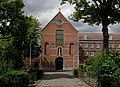
 521078-KloosterCapucijnen.JPG 3,008 × 2,000; 4.69 MB
-
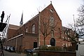
 521079 Capucijnerkerk.jpg 4,891 × 3,556; 13.73 MB
-
 521079-KloosterkerkCapucijnen.JPG 2,000 × 3,008; 4.99 MB
-
 Exterieur begraafplaats in kloosterpandhof - 20000353 - RCE.jpg 954 × 1,200; 287 KB
-
 Exterieur klooster, achtergevel - 20000352 - RCE.jpg 951 × 1,200; 241 KB
-
 Exterieur klooster, zijgevel - 20000357 - RCE.jpg 1,190 × 1,200; 340 KB
-
 Exterieur Kloosterkerk, voorzijde - 20000354 - RCE.jpg 1,190 × 1,200; 445 KB
-
 Exterieur overzicht begraafplaats in pandhof - 20000355 - RCE.jpg 1,188 × 1,200; 313 KB
-
 Exterieur overzicht begraafplaats in pandhof - 20000356 - RCE.jpg 1,198 × 1,200; 411 KB
-
 Exterieur werkhuizen - 20000358 - RCE.jpg 1,193 × 1,200; 315 KB
-
 Korvelseweg 165, Tilburg - infobord.jpg 6,000 × 4,000; 5.84 MB
-
 Korvelseweg 165, Tilburg - ingang kerk.jpg 4,000 × 6,000; 5.67 MB
-
 Korvelseweg 165, Tilburg - kerk.jpg 4,000 × 6,000; 6.58 MB
-
 Korvelseweg 165, Tilburg - klooster.jpg 4,000 × 6,000; 6.68 MB
-
 Overzicht kloostercomplex met westgevel kloosterkerk - Tilburg - 20344135 - RCE.jpg 1,188 × 1,200; 441 KB


