Category:Klosterkirche (Sonnefeld)
| Object location | | View all coordinates using: OpenStreetMap |
|---|
cultural heritage monument D-4-73-166-3 (0) in Sonnefeld, Bavaria  | |||||
| Upload media | |||||
| Instance of | |||||
|---|---|---|---|---|---|
| Location | Sonnefeld, Coburg, Upper Franconia, Bavaria, Germany | ||||
| Street address |
| ||||
| Heritage designation | |||||
 | |||||
This is the category of the Bavarian Baudenkmal (cultural heritage monument) with the ID D-4-73-166-3 (Wikidata)
|
Subcategories
This category has only the following subcategory.
I
Media in category "Klosterkirche (Sonnefeld)"
The following 11 files are in this category, out of 11 total.
-
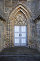
 Chorraum Klosterkirche.jpg 2,709 × 3,612; 2.46 MB
-
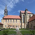
 Sonnefeld Klosterkirche.jpg 3,292 × 2,469; 1.51 MB
-
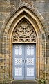 Sonnefeld Tür Kirche-20230827-RM-152542.jpg 3,017 × 5,098; 7.5 MB
-
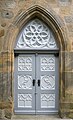 Sonnefeld Tür Kirche-20230827-RM-152611.jpg 2,913 × 4,770; 7.23 MB
-
 Sonnefeld-Klosterkirche-00.jpg 3,744 × 3,744; 3.26 MB
-
 Sonnefeld-Klosterkirche-01.jpg 3,405 × 5,108; 3.89 MB
-
 Sonnefeld-Klosterkirche-04.jpg 3,115 × 4,153; 2.92 MB
-
 Sonnefeld-Klosterkirche-05.jpg 3,621 × 4,828; 5.63 MB
-
 Sonnefeld-Klosterkirche-06.jpg 3,744 × 5,616; 3 MB
-
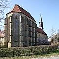
 Sonnefeld-Klosterkirche-Südseite.jpg 3,744 × 3,744; 2.73 MB
-
 Sonnefeld-Klosterkirche.jpg 4,112 × 2,805; 1.49 MB


