Category:Knockholt
English: Knockholt is a village and civil parish in Kent, England lying approximately 5 miles south of Orpington and 3 miles northwest of Sevenoaks. It is part of the Sevenoaks district and according to the 2001 census it had a population of 1,166. The village is located at 51°18'36" north 0°6'18" East.
village and civil parish in Sevenoaks, Kent, United Kingdom .jpg) | |||||
| Upload media | |||||
| Instance of | |||||
|---|---|---|---|---|---|
| Location | Sevenoaks, Kent, South East England, England | ||||
| Area |
| ||||
 | |||||
Subcategories
This category has the following 7 subcategories, out of 7 total.
Media in category "Knockholt"
The following 200 files are in this category, out of 242 total.
(previous page) (next page)-
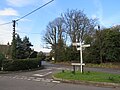
 A complicated signpost at Knockholt Pound - geograph.org.uk - 3630111.jpg 4,000 × 3,000; 3.99 MB
-

-
 An ex - public house, Knockholt - geograph.org.uk - 2064898.jpg 640 × 430; 137 KB
-
 An old entrance to Cophall Wood - geograph.org.uk - 3204827.jpg 4,000 × 3,000; 3.96 MB
-
 Approaching Knockholt Pound on Main Rd - geograph.org.uk - 2068319.jpg 640 × 430; 128 KB
-
 Approaching the crossroads at Single's Cross - geograph.org.uk - 3630104.jpg 4,000 × 3,000; 4.33 MB
-
 Bastion Wood - geograph.org.uk - 2191523.jpg 3,072 × 2,304; 3.07 MB
-
 Beech tree on the edge of Cooper's Wood - geograph.org.uk - 3204861.jpg 3,000 × 4,000; 4.15 MB
-
 Beech tree overlooking Sundridge Lane - geograph.org.uk - 3204852.jpg 3,000 × 4,000; 4.19 MB
-
 Birchwood Lane - geograph.org.uk - 1976879.jpg 640 × 430; 124 KB
-
 Bluebells in Birches Croft - geograph.org.uk - 4460852.jpg 1,600 × 1,064; 526 KB
-
 Bluebells in Birches Croft - geograph.org.uk - 4464209.jpg 1,600 × 1,064; 756 KB
-
 Bluebells in Long Bottoms Shaw - geograph.org.uk - 4464205.jpg 1,600 × 1,064; 716 KB
-
 Bluebells, Birches Croft - geograph.org.uk - 3485852.jpg 1,064 × 1,600; 711 KB
-
 Blueberry Wood - geograph.org.uk - 2068311.jpg 640 × 430; 178 KB
-
 Brasted Lodge - geograph.org.uk - 2069240.jpg 640 × 425; 82 KB
-
 Bridleway along the Kent boundary - geograph.org.uk - 2573183.jpg 640 × 480; 203 KB
-
 Burlings Lane beside Bastion Wood - geograph.org.uk - 2192117.jpg 3,072 × 2,304; 3.24 MB
-
 Business end of Coolings Nurseries - geograph.org.uk - 740574.jpg 640 × 480; 81 KB
-
 Chapel Croft - geograph.org.uk - 2657821.jpg 640 × 430; 152 KB
-
 Chevening Lane - geograph.org.uk - 2058833.jpg 640 × 430; 144 KB
-
 Chevening Lane - geograph.org.uk - 2060273.jpg 640 × 430; 181 KB
-
 Chevening Lane - geograph.org.uk - 2060277.jpg 640 × 430; 155 KB
-
 Chevening Lane, near Knockholt Pound - geograph.org.uk - 6085561.jpg 1,024 × 768; 242 KB
-
 Chines Farm entrance, Main Rd - geograph.org.uk - 2060378.jpg 640 × 430; 134 KB
-
 Communications masts, Knockholt - geograph.org.uk - 1977861.jpg 640 × 428; 109 KB
-
 Converted pub, Knockholt - geograph.org.uk - 2587717.jpg 1,600 × 1,200; 632 KB
-
 Coolings Garden Centre and Nurseries - geograph.org.uk - 740593.jpg 640 × 480; 121 KB
-
 Coolings Nursery - Rushmore Hill - geograph.org.uk - 199954.jpg 640 × 480; 154 KB
-
 Cops End - geograph.org.uk - 6418084.jpg 1,024 × 678; 828 KB
-
 Cottage on Chevening Lane - geograph.org.uk - 2060286.jpg 640 × 430; 135 KB
-
 Cottage, Star Hill Rd - geograph.org.uk - 2654349.jpg 640 × 430; 103 KB
-
 Cottages on Chevening Lane - geograph.org.uk - 2058836.jpg 640 × 430; 143 KB
-
 Crossroads at Lett's Green - geograph.org.uk - 4464111.jpg 1,600 × 1,064; 506 KB
-
 Crossroads at Single's Cross - geograph.org.uk - 3630100.jpg 4,000 × 3,000; 3.95 MB
-
 Deerleap Cottage, Halstead Lane - geograph.org.uk - 2068456.jpg 640 × 430; 168 KB
-
 Dry valley north of Knockholt church - geograph.org.uk - 4464201.jpg 1,600 × 1,064; 364 KB
-

-
 Entrance to Chevening - geograph.org.uk - 6418074.jpg 1,024 × 678; 1,005 KB
-
 Entrance to public footpath, near the Washneys - geograph.org.uk - 3486009.jpg 1,064 × 1,600; 628 KB
-
 Entrance to The Grange, Chevening Lane - geograph.org.uk - 2060282.jpg 640 × 430; 177 KB
-
 Fallen Tree on footpath in Newyear Wood - geograph.org.uk - 2191484.jpg 3,072 × 2,304; 2.68 MB
-
 Farmland, Knockholt Pound - geograph.org.uk - 2657832.jpg 640 × 430; 74 KB
-
 Ferns and bluebells, Hayman's Wood - geograph.org.uk - 3486013.jpg 1,600 × 1,064; 462 KB
-
 Field by Main Rd - geograph.org.uk - 2060360.jpg 640 × 430; 119 KB
-
 Field by Main Rd, Knockholt - geograph.org.uk - 2064994.jpg 640 × 430; 112 KB
-
 Field east of Stoneings Lane - geograph.org.uk - 2573130.jpg 640 × 480; 105 KB
-
 Field west of New Years Lane, Lett's Green - geograph.org.uk - 4464327.jpg 1,600 × 1,064; 275 KB
-
 Fields beside Shelleys - geograph.org.uk - 1984253.jpg 1,024 × 768; 257 KB
-
 Filling Station, Main Rd - geograph.org.uk - 2068434.jpg 640 × 430; 128 KB
-
 First yards of footpath north from the Washneys - geograph.org.uk - 3486008.jpg 1,600 × 1,064; 700 KB
-
 Flint built house, Blueberry Rd - geograph.org.uk - 2064802.jpg 640 × 430; 163 KB
-
 Flower display at Coolings - geograph.org.uk - 5055533.jpg 4,608 × 3,456; 3.42 MB
-
 Footpath and bridleway junction beside Newyears Wood - geograph.org.uk - 2191478.jpg 3,072 × 2,304; 1.82 MB
-
 Footpath down the side of Long Bottoms Shaw - geograph.org.uk - 3486017.jpg 1,600 × 1,064; 686 KB
-
 Footpath junction near Little Jockey's Wood - geograph.org.uk - 2192121.jpg 3,072 × 2,304; 2.13 MB
-
 Footpath off Halstead Lane - geograph.org.uk - 2068452.jpg 640 × 430; 110 KB
-
 Footpath off Halstead Lane - geograph.org.uk - 2068455.jpg 640 × 430; 197 KB
-
 Footpath off Main Rd - geograph.org.uk - 2060345.jpg 640 × 430; 142 KB
-
 Footpath off Shelleys Lane - geograph.org.uk - 4464107.jpg 1,064 × 1,600; 348 KB
-
 Footpath sign, Knockholt Pound - geograph.org.uk - 3445848.jpg 1,600 × 1,064; 437 KB
-
 Footpath south of Knockholt village - geograph.org.uk - 3445676.jpg 1,600 × 1,064; 491 KB
-
 Footpath to Horns Green - geograph.org.uk - 2192118.jpg 3,072 × 2,304; 2.06 MB
-
 Footpath, Chapel Croft - geograph.org.uk - 2657816.jpg 640 × 430; 152 KB
-
 Former Crown Public House - geograph.org.uk - 2070416.jpg 640 × 425; 86 KB
-
 Former entrance, Knockholt House - geograph.org.uk - 6416613.jpg 1,024 × 678; 1.2 MB
-
 Former school, Knockholt Main Road - geograph.org.uk - 3445851.jpg 1,600 × 1,064; 435 KB
-
 Garden Avenue in Court Lodge - geograph.org.uk - 1575675.jpg 640 × 427; 107 KB
-
 Garden Centre Entrance - geograph.org.uk - 6395049.jpg 4,032 × 3,024; 3.46 MB
-
 Gate into Cooper's Wood, Main Rd - geograph.org.uk - 2060393.jpg 640 × 430; 183 KB
-

-
 Gates to Wood Farm - geograph.org.uk - 2573140.jpg 640 × 480; 175 KB
-
 Grange Cottages, Chevening Lane - geograph.org.uk - 2060291.jpg 640 × 430; 176 KB
-
 Halstead Lane - geograph.org.uk - 2068436.jpg 640 × 430; 141 KB
-
 Halstead Lane - geograph.org.uk - 2068450.jpg 640 × 430; 150 KB
-
 Halstead Lane - geograph.org.uk - 2657836.jpg 640 × 430; 106 KB
-
 Halstead Lane heading north - geograph.org.uk - 2068454.jpg 640 × 430; 171 KB
-
 Halstead Lane heading to Halstead - geograph.org.uk - 2068453.jpg 640 × 430; 162 KB
-
 Halstead Lane, near Knockholt Pound - geograph.org.uk - 6085625.jpg 1,024 × 768; 268 KB
-
 Harrow Road, Knockholt Pound - geograph.org.uk - 6085590.jpg 1,024 × 768; 157 KB
-
 Hay bales by the North Downs Way - geograph.org.uk - 2058816.jpg 640 × 430; 135 KB
-
 Hay bales on the North Downs - geograph.org.uk - 2058789.jpg 640 × 430; 122 KB
-
 Hayman's Wood - geograph.org.uk - 1575623.jpg 427 × 640; 129 KB
-
 Homefield Cottage, Blueberry Lane - geograph.org.uk - 2060399.jpg 640 × 430; 122 KB
-
 House, Halstead Lane - geograph.org.uk - 2657838.jpg 640 × 430; 122 KB
-

-
 Houses on Chevening Lane, Knockholt Pound - geograph.org.uk - 6085569.jpg 1,024 × 768; 193 KB
-
 Houses on Knockholt Road - geograph.org.uk - 1917647.jpg 1,024 × 768; 156 KB
-
 Impressive entrance gateway, Knockholt - geograph.org.uk - 2064905.jpg 640 × 398; 116 KB
-
 In Chapel Croft - geograph.org.uk - 2657819.jpg 640 × 430; 134 KB
-
 Isolated house at Park Corner - geograph.org.uk - 2068448.jpg 640 × 430; 134 KB
-
 Ivy Farm telecom mast - geograph.org.uk - 2069174.jpg 640 × 425; 54 KB
-
 Ivy Farm telecom mast - geograph.org.uk - 817505.jpg 426 × 640; 44 KB
-
 Ivy Lane, Knockholt Pound - geograph.org.uk - 2060329.jpg 640 × 430; 167 KB
-
 Jockey's Wood, Knockholt TN14 - geograph.org.uk - 75648.jpg 640 × 481; 68 KB
-
 Junction of Main Road and Harrow Road - geograph.org.uk - 2587713.jpg 1,600 × 1,200; 516 KB
-
 Junction on Main Road, Knockholt - geograph.org.uk - 1578037.jpg 640 × 427; 78 KB
-

-
 Kissing Gate on North Downs Way - geograph.org.uk - 1578121.jpg 640 × 461; 135 KB
-
 Kissing Gate on the North Downs Way - geograph.org.uk - 1578109.jpg 640 × 427; 129 KB
-
 Knockholt Main Road - geograph.org.uk - 2879143.jpg 1,024 × 768; 631 KB
-
 Knockholt Main Road - geograph.org.uk - 3445853.jpg 1,600 × 1,064; 355 KB
-
 Knockholt oak trees (1).jpg 2,736 × 3,648; 4.72 MB
-
 Knockholt oak trees (2).jpg 2,736 × 3,648; 4.81 MB
-
 Knockholt oak trees (3).jpg 2,736 × 3,648; 4.99 MB
-
 Knockholt Pound village centre - geograph.org.uk - 6085579.jpg 1,024 × 768; 188 KB
-
 Knockholt Village Hall - geograph.org.uk - 2060339.jpg 640 × 430; 113 KB
-
 Knockholt Village Hall - geograph.org.uk - 2060341.jpg 640 × 430; 114 KB
-
 Knockholt Village Sign - geograph.org.uk - 2068442.jpg 640 × 430; 157 KB
-
 Lane near the Washneys - geograph.org.uk - 3486004.jpg 1,064 × 1,600; 827 KB
-
 Lett's Green - geograph.org.uk - 3173227.jpg 640 × 425; 372 KB
-
 Lett's Green Crossroads - geograph.org.uk - 1060148.jpg 640 × 427; 106 KB
-
 Lett's Green Crossroads - geograph.org.uk - 2191487.jpg 3,072 × 2,304; 2.52 MB
-
 Lodge and flint wall, Main Rd - geograph.org.uk - 2064823.jpg 640 × 403; 119 KB
-
 Looking across the pond at Lett's Green - geograph.org.uk - 3204514.jpg 4,000 × 3,000; 4.22 MB
-
 Lychgate leading to St Katherine's Church, Knockholt - geograph.org.uk - 3204870.jpg 4,000 × 3,000; 4.09 MB
-
 Main Rd - geograph.org.uk - 2060386.jpg 640 × 430; 160 KB
-
 Main Rd and Sundridge Lane junction - geograph.org.uk - 2064829.jpg 640 × 430; 128 KB
-

-

-
 Main Rd to Knockholt - geograph.org.uk - 2060363.jpg 640 × 430; 163 KB
-
 Main Rd to Knockholt Pound - geograph.org.uk - 2064979.jpg 640 × 430; 173 KB
-
 Main Rd, Blueberry Lane junction - geograph.org.uk - 2060406.jpg 640 × 430; 148 KB
-
 Main Rd, heading to Knockholt Pound - geograph.org.uk - 2064985.jpg 640 × 430; 158 KB
-
 Main Rd, Knockholt - geograph.org.uk - 2064806.jpg 640 × 430; 154 KB
-
 Main Rd, Knockholt - geograph.org.uk - 2064934.jpg 640 × 430; 141 KB
-
 Main Rd, Knockholt Pound - geograph.org.uk - 2060333.jpg 640 × 430; 133 KB
-
 Main Rd, towards Knockholt - geograph.org.uk - 2060358.jpg 640 × 430; 151 KB
-
 Main Road, Knockholt - geograph.org.uk - 2070406.jpg 640 × 425; 90 KB
-
 Main Road, Knockholt - geograph.org.uk - 2588940.jpg 1,600 × 1,200; 590 KB
-
 Main Road, Knockholt - geograph.org.uk - 6084653.jpg 1,024 × 768; 220 KB
-
 Mariners Lodge - geograph.org.uk - 2657813.jpg 640 × 430; 112 KB
-
 Muddy track near Knockholt Pound - geograph.org.uk - 6085618.jpg 1,024 × 768; 365 KB
-
 Near Cacket's Farm - geograph.org.uk - 3173126.jpg 640 × 425; 414 KB
-
 Near The Washneys - geograph.org.uk - 3173259.jpg 640 × 425; 397 KB
-
 New Years Lane north of Lett's Green - geograph.org.uk - 4464214.jpg 1,600 × 1,064; 592 KB
-
 North Down Way signpost, Chevening Lane - geograph.org.uk - 2058826.jpg 640 × 430; 201 KB
-
 North Downs Way - geograph.org.uk - 3803637.jpg 640 × 428; 153 KB
-
 North Downs Way at Knockholt - geograph.org.uk - 6085415.jpg 1,024 × 768; 375 KB
-
 North Downs Way at Knockholt - geograph.org.uk - 6085466.jpg 1,024 × 768; 390 KB
-
 North Downs Way at Knockholt - geograph.org.uk - 6085468.jpg 1,024 × 768; 269 KB
-
 North Downs Way by Sundridge Lane - geograph.org.uk - 1977875.jpg 640 × 428; 165 KB
-
 North Downs Way crosses Sundrige Lane - geograph.org.uk - 1578105.jpg 640 × 427; 127 KB
-
 North Downs Way heading west - geograph.org.uk - 2058805.jpg 640 × 430; 127 KB
-
 North Downs Way meets Sundridge Hill - geograph.org.uk - 3445857.jpg 1,600 × 1,064; 390 KB
-
 North Downs Way near Knockholt Pound - geograph.org.uk - 6085512.jpg 1,024 × 768; 256 KB
-
 North Downs Way off Chevening Lane - geograph.org.uk - 2058829.jpg 640 × 430; 189 KB
-
 North Downs Way sign - geograph.org.uk - 1984328.jpg 1,024 × 768; 195 KB
-
 North Downs Way south of Knockholt Pound - geograph.org.uk - 1902179.jpg 640 × 426; 134 KB
-

-
 North Downs Way viewed from Sundridge Lane - geograph.org.uk - 3204857.jpg 4,000 × 3,000; 4.17 MB
-
 North Lodge - geograph.org.uk - 6418090.jpg 1,024 × 678; 798 KB
-
 North of Washneys Road - geograph.org.uk - 3173261.jpg 640 × 425; 277 KB
-
 Old London Road, Knockholt Pound - geograph.org.uk - 2588870.jpg 1,600 × 1,200; 620 KB
-
 Old London Road, Knockholt Pound - geograph.org.uk - 2590107.jpg 1,600 × 1,200; 272 KB
-
 Old London Road, Knockholt Pound - geograph.org.uk - 6085602.jpg 1,024 × 768; 146 KB
-
 Orange mushroom in Hayman's Wood - geograph.org.uk - 1575620.jpg 640 × 427; 87 KB
-

-
 Path by Knockholt Beeches - geograph.org.uk - 3803661.jpg 640 × 428; 158 KB
-
 Path through a field, Knockholt - geograph.org.uk - 6085410.jpg 1,024 × 768; 313 KB
-
 Petrol station, Knockholt Pound - geograph.org.uk - 3445859.jpg 1,600 × 1,064; 329 KB
-
 Postbox, Main Rd - geograph.org.uk - 2068328.jpg 640 × 430; 152 KB
-
 Postbox, Main Rd, Knockholt - geograph.org.uk - 2064989.jpg 640 × 430; 176 KB
-
 Power line woodland ride - geograph.org.uk - 1977899.jpg 640 × 428; 170 KB
-
 Pre-Worboys sign, Knockholt Pound - geograph.org.uk - 2587706.jpg 1,600 × 1,200; 275 KB
-
 Pre-Worboys sign, Knockholt Pound - geograph.org.uk - 2588874.jpg 1,600 × 1,200; 551 KB
-
 Public footpath near Knockholt - geograph.org.uk - 6084617.jpg 1,024 × 768; 338 KB
-
 Radio Masts in Knockholt - geograph.org.uk - 1578047.jpg 640 × 427; 33 KB
-
 Radio Transmitter Tower, Knockholt - geograph.org.uk - 2064940.jpg 640 × 430; 75 KB
-
 Randle's Lane - geograph.org.uk - 3630081.jpg 4,000 × 3,000; 4.08 MB
-
 Randle's Lane - geograph.org.uk - 3630107.jpg 4,000 × 3,000; 3.97 MB
-
 Randle's Lane looking south - geograph.org.uk - 3630086.jpg 4,000 × 3,000; 4.43 MB
-
 Road and footpath by Newyears Wood - geograph.org.uk - 740906.jpg 640 × 480; 109 KB
-
 Road junction at Knockholt Pound - geograph.org.uk - 6085594.jpg 1,024 × 768; 214 KB
-

-
 Rocks Forge, Knockholt - geograph.org.uk - 2064918.jpg 640 × 430; 143 KB
-
 Rushmore Hill - geograph.org.uk - 2789366.jpg 640 × 428; 172 KB
-
 Rushmore Hill - geograph.org.uk - 3173287.jpg 640 × 425; 391 KB
-
 Scott's Lodge Cottages - geograph.org.uk - 1974984.jpg 640 × 426; 82 KB
-
 Sheep grazing - geograph.org.uk - 6418065.jpg 1,024 × 678; 817 KB
-
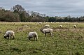
 Sheep grazing near Knockholt - geograph.org.uk - 6084594.jpg 1,024 × 768; 164 KB
-
 Shelley's Lane off Main Rd, Knockholt - geograph.org.uk - 2064928.jpg 640 × 430; 156 KB
-
 Shelleys Lane - geograph.org.uk - 3204817.jpg 4,000 × 3,000; 4.11 MB
-
 Shelleys Lane - geograph.org.uk - 3204824.jpg 4,000 × 3,000; 4.2 MB
-
 Shelleys Lane - Steep Hill 1-5 - geograph.org.uk - 1428766.jpg 640 × 400; 105 KB
-
 Signpost at Lett's Green - geograph.org.uk - 3204478.jpg 4,000 × 3,000; 3.99 MB
-
 Spring flowers, Knockholt churchyard - geograph.org.uk - 3446322.jpg 1,600 × 1,064; 374 KB
-

-
 St Katharine's School, Knockholt - geograph.org.uk - 2070744.jpg 640 × 425; 103 KB
-
 St. Katharine's Church, Knockholt - geograph.org.uk - 6084647.jpg 1,024 × 768; 155 KB
-
 Steep descent on Shelleys Lane - geograph.org.uk - 4464213.jpg 1,064 × 1,600; 606 KB
-
 Stile near Knockholt - geograph.org.uk - 6084603.jpg 1,024 × 768; 273 KB
-
 Stoneings Lane, near Knockholt - geograph.org.uk - 4460601.jpg 1,064 × 1,600; 586 KB
-
 Sundridge Lane - geograph.org.uk - 1578097.jpg 640 × 427; 107 KB
-
 Terraced cottages, Main Rd, Knockholt - geograph.org.uk - 2064819.jpg 640 × 430; 164 KB
-
 The entrance to the Mill House - geograph.org.uk - 2058841.jpg 640 × 430; 141 KB
-
 The Mill House - geograph.org.uk - 2058786.jpg 640 × 430; 138 KB
-
 The North Downs Way - geograph.org.uk - 167796.jpg 640 × 480; 148 KB
-
 The North Downs Way in Ash Platt - geograph.org.uk - 1578114.jpg 640 × 427; 126 KB
-
 The North Downs Way near Brasted Lane - geograph.org.uk - 4922132.jpg 4,608 × 3,456; 5.18 MB

_-_geograph.org.uk_-_2064813.jpg)


.jpg)
.jpg)
.jpg)


_-_geograph.org.uk_-_2068445.jpg)


