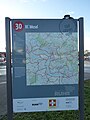
Category:Knotenpunktsystem radrevier.ruhr
Knotenpunktsystem radrevier.ruhr ist ein Fahrradknotenpunktsystem im Ruhrgebiet.
Media in category "Knotenpunktsystem radrevier.ruhr"
The following 200 files are in this category, out of 507 total.
(previous page) (next page)-
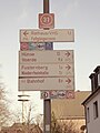
 Radrevier.ruhr Knotenpunkt 02 Gasstraße, Wegweiser.jpg 1,456 × 2,592; 855 KB
-
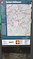
 Radrevier.ruhr Knotenpunkt 1 An der Seseke, Kamen Karte.jpg 3,672 × 4,896; 6.74 MB
-
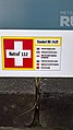
 Radrevier.ruhr Knotenpunkt 1 An der Seseke, Kamen Rettungspunkt.jpg 4,896 × 3,672; 6.1 MB
-
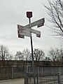
 Radrevier.ruhr Knotenpunkt 1 An der Seseke, Kamen Wegweiser.jpg 3,672 × 4,896; 6.54 MB
-
 Radrevier.ruhr Knotenpunkt 1 Kamen-Ost Karte.jpg 3,672 × 4,896; 6.58 MB
-
 Radrevier.ruhr Knotenpunkt 1 Kamen-Ost Rettungspunkt.jpg 4,896 × 3,672; 6 MB
-
 Radrevier.ruhr Knotenpunkt 1 Kamen-Ost Wegweiser.jpg 3,672 × 4,896; 6.76 MB
-
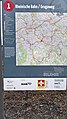 Radrevier.ruhr Knotenpunkt 1 Rheinische Bahn-Grugaweg Karte.jpg 1,456 × 2,592; 1.64 MB
-
 Radrevier.ruhr Knotenpunkt 1 Rheinische Bahn-Grugaweg Rettungspunkt.jpg 1,456 × 2,592; 1.19 MB
-
 Radrevier.ruhr Knotenpunkt 1 Rheinische Bahn-Grugaweg Wegweiser.jpg 2,592 × 1,456; 1.65 MB
-
 Radrevier.ruhr Knotenpunkt 1 Rodenhorst Karte.jpg 2,268 × 4,032; 1.73 MB
-
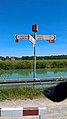
 Radrevier.ruhr Knotenpunkt 1 Uferstraße Wegweiser.jpg 2,592 × 1,456; 1.67 MB
-
 Radrevier.ruhr Knotenpunkt 10 Hamm-Uentrop Karte.jpg 1,456 × 2,592; 2.37 MB
-
 Radrevier.ruhr Knotenpunkt 10 Hamm-Uentrop Wegweiser.jpg 1,456 × 2,592; 1.47 MB
-
 Radrevier.ruhr Knotenpunkt 10 Lindnerstraße Wegweiser.jpg 2,592 × 1,456; 893 KB
-
 Radrevier.ruhr Knotenpunkt 11 Hamm-Werries Karte.jpg 1,456 × 2,592; 2.19 MB
-
 Radrevier.ruhr Knotenpunkt 11 Hamm-Werries Rettungspunkt.jpg 1,456 × 2,592; 1.51 MB
-
 Radrevier.ruhr Knotenpunkt 11 Hamm-Werries Wegweiser.jpg 1,456 × 2,592; 2.38 MB
-
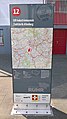
 Radrevier.ruhr Knotenpunkt 12 Bf. Oberhausen-Rheinisches Industriemuseum Wegweiser.jpg 2,592 × 1,456; 636 KB
-
 Radrevier.ruhr Knotenpunkt 12 LVR Industriemuseum Zinkfabrik Altenberg Karte.jpg 1,456 × 2,592; 1.42 MB
-
 Radrevier.ruhr Knotenpunkt 12 LVR Industriemuseum Zinkfabrik Altenberg Rettungspunkt.jpg 1,456 × 2,592; 946 KB
-
 Radrevier.ruhr Knotenpunkt 12 Maximilianpark Karte.jpg 1,456 × 2,592; 2.38 MB
-
 Radrevier.ruhr Knotenpunkt 12 Maximilianpark Wegweiser.jpg 1,456 × 2,592; 1.59 MB
-
 Radrevier.ruhr Knotenpunkt 13 Geitheufer, Hamm Karte.jpg 1,456 × 2,592; 1.49 MB
-
 Radrevier.ruhr Knotenpunkt 13 Geitheufer, Hamm Rettungspunkt.jpg 2,592 × 1,456; 854 KB
-
 Radrevier.ruhr Knotenpunkt 13 Geitheufer, Hamm Wegweiser.jpg 2,592 × 1,456; 1.5 MB
-
 Radrevier.ruhr Knotenpunkt 13 Grüner Pfad, HOAG-Bahn Karte.jpg 1,456 × 2,592; 1.36 MB
-
 Radrevier.ruhr Knotenpunkt 13 Grüner Pfad, HOAG-Bahn Rettungspunkt.jpg 2,592 × 1,456; 853 KB
-
 Radrevier.ruhr Knotenpunkt 13 Grüner Pfad, HOAG-Bahn Wegweiser.jpg 2,592 × 1,456; 1.95 MB
-
 Radrevier.ruhr Knotenpunkt 14 Bahnhof Kamen Karte.jpg 3,672 × 4,896; 6.65 MB
-
 Radrevier.ruhr Knotenpunkt 14 Bahnhof Kamen Rettungspunkt.jpg 4,896 × 3,672; 5.93 MB
-
 Radrevier.ruhr Knotenpunkt 14 Bahnhof Kamen Wegweiser.jpg 3,672 × 4,896; 6.81 MB
-
 Radrevier.ruhr Knotenpunkt 14 Breckerfeld Karte.jpg 1,456 × 2,592; 1.68 MB
-
 Radrevier.ruhr Knotenpunkt 14 Breckerfeld Rettungspunkt.jpg 1,456 × 2,592; 960 KB
-
 Radrevier.ruhr Knotenpunkt 14 Breckerfeld Wegweiser.jpg 2,592 × 1,456; 1.55 MB
-
 Radrevier.ruhr Knotenpunkt 14 Nelskamp Karte.jpg 2,268 × 4,032; 4.11 MB
-
 Radrevier.ruhr Knotenpunkt 14 Schwarze Heide Karte.jpg 1,456 × 2,592; 1.8 MB
-
 Radrevier.ruhr Knotenpunkt 14 Schwarze Heide Rettungspunkt.jpg 2,592 × 1,456; 1.09 MB
-
 Radrevier.ruhr Knotenpunkt 14 Schwarze Heide Wegweiser.jpg 2,592 × 1,456; 1.48 MB
-
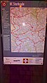 Radrevier.ruhr Knotenpunkt 15 Bf. Sterkrade Karte.jpg 1,456 × 2,592; 1.2 MB
-
 Radrevier.ruhr Knotenpunkt 15 Bf. Sterkrade Rettungspunkt.jpg 2,592 × 1,456; 933 KB
-
 Radrevier.ruhr Knotenpunkt 15 Bf. Sterkrade Wegweiser.jpg 1,456 × 2,592; 1,000 KB
-
 Radrevier.ruhr Knotenpunkt 15 Ennepetal-Voerde Karte.jpg 1,456 × 2,592; 1.79 MB
-
 Radrevier.ruhr Knotenpunkt 15 Ennepetal-Voerde Rettungspunkt.jpg 1,456 × 2,592; 1.27 MB
-
 Radrevier.ruhr Knotenpunkt 15 Ennepetal-Voerde Wegweiser.jpg 1,456 × 2,592; 1.89 MB
-
 Radrevier.ruhr Knotenpunkt 15 Kamen Seseke Karte.jpg 3,672 × 4,896; 6.93 MB
-
 Radrevier.ruhr Knotenpunkt 15 Kamen Seseke Wegweiser.jpg 3,672 × 4,896; 6.56 MB
-
 Radrevier.ruhr Knotenpunkt 15 Schetterstraße Karte.jpg 2,268 × 4,032; 5.08 MB
-
 Radrevier.ruhr Knotenpunkt 16 Bf. Ennepetal Karte.jpg 1,456 × 2,592; 1.04 MB
-
 Radrevier.ruhr Knotenpunkt 16 Bf. Ennepetal Rettungspunkt.jpg 1,456 × 2,592; 940 KB
-
 Radrevier.ruhr Knotenpunkt 16 Bf. Ennepetal Wegweiser.jpg 2,592 × 1,456; 1.08 MB
-
 Radrevier.ruhr Knotenpunkt 16 Halde Haniel Karte.jpg 3,672 × 4,896; 6.85 MB
-
 Radrevier.ruhr Knotenpunkt 16 Halde Haniel Rettungspunkt.jpg 4,896 × 3,672; 6.57 MB
-
 Radrevier.ruhr Knotenpunkt 16 Halde Haniel Wegweiser.jpg 3,672 × 4,896; 6.82 MB
-
 Radrevier.ruhr Knotenpunkt 17 Bahnhof Schwelm Karte.jpg 1,456 × 2,592; 1.53 MB
-
 Radrevier.ruhr Knotenpunkt 17 Bahnhof Schwelm Rettungspunkt.jpg 1,456 × 2,592; 1.32 MB
-
 Radrevier.ruhr Knotenpunkt 17 Bahnhof Schwelm Wegweiser.jpg 2,592 × 1,456; 1.63 MB
-
 Radrevier.ruhr Knotenpunkt 17 Grafenmühle Karte.jpg 3,672 × 4,896; 7.03 MB
-
 Radrevier.ruhr Knotenpunkt 17 Grafenmühle Rettungspunkt.jpg 4,896 × 3,672; 6.65 MB
-
 Radrevier.ruhr Knotenpunkt 17 Grafenmühle Wegweiser.jpg 3,672 × 4,896; 6.59 MB
-
 Radrevier.ruhr Knotenpunkt 17 Halde Rheinpreußen Karte.jpg 3,672 × 4,896; 6.58 MB
-
 Radrevier.ruhr Knotenpunkt 17 Halde Rheinpreußen Rettungspunkt.jpg 4,896 × 3,672; 5.19 MB
-
 Radrevier.ruhr Knotenpunkt 17 Halde Rheinpreußen Wegweiser.jpg 3,672 × 4,896; 6.87 MB
-
 Radrevier.ruhr Knotenpunkt 17 Schloss Schwansbell Karte.jpg 3,672 × 4,896; 6.82 MB
-
 Radrevier.ruhr Knotenpunkt 17 Schloss Schwansbell Rettungspunkt.jpg 4,896 × 3,672; 6.64 MB
-
 Radrevier.ruhr Knotenpunkt 17 Schloss Schwansbell Wegweiser.jpg 3,672 × 4,896; 6.8 MB
-
 Radrevier.ruhr Knotenpunkt 18 Heideseee Karte.jpg 3,672 × 4,896; 6.68 MB
-
 Radrevier.ruhr Knotenpunkt 18 Heideseee Rettungspunkt.jpg 4,896 × 3,672; 6.67 MB
-
 Radrevier.ruhr Knotenpunkt 18 Heideseee Wegweiser.jpg 3,672 × 4,896; 6.73 MB
-
 Radrevier.ruhr Knotenpunkt 18 Lünen-Beckinghausen Karte.jpg 3,672 × 4,896; 7.13 MB
-
 Radrevier.ruhr Knotenpunkt 18 Lünen-Beckinghausen Rettungspunkt.jpg 4,896 × 3,672; 6.68 MB
-
 Radrevier.ruhr Knotenpunkt 18 Lünen-Beckinghausen Wegweiser.jpg 3,672 × 4,896; 7.16 MB
-
 Radrevier.ruhr Knotenpunkt 19 Schermbeck Landwehr Karte.jpg 3,672 × 4,896; 6.43 MB
-
 Radrevier.ruhr Knotenpunkt 19 Schermbeck Landwehr Rettungspunkt.jpg 4,896 × 3,672; 6.35 MB
-
 Radrevier.ruhr Knotenpunkt 19 Schermbeck Landwehr Wegweiser.jpg 3,672 × 4,896; 6.83 MB
-
 Radrevier.ruhr Knotenpunkt 2 Bergkamen-Rünthe Karte.jpg 3,672 × 4,896; 6.65 MB
-
 Radrevier.ruhr Knotenpunkt 2 Bergkamen-Rünthe Rettungspunkt.jpg 4,896 × 3,672; 6.03 MB
-
 Radrevier.ruhr Knotenpunkt 2 Bergkamen-Rünthe Wegweiser.jpg 4,896 × 3,672; 6.42 MB
-
 Radrevier.ruhr Knotenpunkt 2 Hbf. Mülheim an der Ruhr Karte.jpg 1,456 × 2,592; 1.66 MB
-
 Radrevier.ruhr Knotenpunkt 2 Hbf. Mülheim an der Ruhr Rettungspunkt.jpg 1,456 × 2,592; 1.04 MB
-
 Radrevier.ruhr Knotenpunkt 2 Hbf. Mülheim an der Ruhr Wegweiser.jpg 2,592 × 1,456; 1.61 MB
-
 Radrevier.ruhr Knotenpunkt 2 Zum Tollberg Karte.jpg 2,268 × 4,032; 4.49 MB
-
 Radrevier.ruhr Knotenpunkt 20 Preußenhafen Lünen Karte.jpg 3,672 × 4,896; 6.76 MB
-
 Radrevier.ruhr Knotenpunkt 20 Preußenhafen Lünen Wegweiser.jpg 3,672 × 4,896; 6.5 MB
-
 Radrevier.ruhr Knotenpunkt 21 Lünen-Süd Karte.jpg 3,672 × 4,896; 6.35 MB
-
 Radrevier.ruhr Knotenpunkt 21 Lünen-Süd Wegweiser.jpg 3,672 × 4,896; 7.15 MB
-
 Radrevier.ruhr Knotenpunkt 21 Springorum-Radweg Karte.jpg 1,456 × 2,592; 1.71 MB
-
 Radrevier.ruhr Knotenpunkt 21 Springorum-Radweg Rettungspunkt.jpg 1,456 × 2,592; 980 KB
-
 Radrevier.ruhr Knotenpunkt 21 Springorum-Radweg Wegweiser.jpg 2,592 × 1,456; 1.66 MB
-
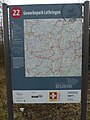 Radrevier.ruhr Knotenpunkt 22 Gewerbepark Lothringen Karte.jpg 3,672 × 4,896; 6.65 MB
-
 Radrevier.ruhr Knotenpunkt 22 Gewerbepark Lothringen Rettungspunkt.jpg 4,896 × 3,672; 6.56 MB
-
 Radrevier.ruhr Knotenpunkt 23 Drevenack Karte.jpg 3,672 × 4,896; 7.17 MB
-
 Radrevier.ruhr Knotenpunkt 23 Drevenack Rettungspunkt.jpg 4,896 × 3,672; 5.5 MB
-
 Radrevier.ruhr Knotenpunkt 23 Drevenack Wegweiser.jpg 3,672 × 4,896; 6.5 MB
-
 Radrevier.ruhr Knotenpunkt 23 Duisburg-Lohmannsheide Karte.jpg 3,672 × 4,896; 7.05 MB
-
 Radrevier.ruhr Knotenpunkt 23 Duisburg-Lohmannsheide Rettungspunkt.jpg 4,896 × 3,672; 5.97 MB
-
 Radrevier.ruhr Knotenpunkt 23 Duisburg-Lohmannsheide Wegweiser.jpg 3,672 × 4,896; 6.67 MB
-
 Radrevier.ruhr Knotenpunkt 24 Bahnhof Lünen Karte.jpg 3,672 × 4,896; 6.77 MB
-
 Radrevier.ruhr Knotenpunkt 24 Bahnhof Lünen Rettungspunkt.jpg 4,896 × 3,672; 6.6 MB
-
 Radrevier.ruhr Knotenpunkt 24 Bahnhof Lünen Wegweiser.jpg 3,672 × 4,896; 7.01 MB
-
 Radrevier.ruhr Knotenpunkt 24 Kemnader See, Karte.jpg 1,456 × 2,592; 1.64 MB
-
 Radrevier.ruhr Knotenpunkt 24 Kemnader See, Rettungspunkt.jpg 1,456 × 2,592; 1.15 MB
-
 Radrevier.ruhr Knotenpunkt 24 Kemnader See, Wegweiser.jpg 1,456 × 2,592; 1.61 MB
-
 Radrevier.ruhr Knotenpunkt 25 Landschaftspark Duisburg-Nord Karte.jpg 1,456 × 2,592; 1.82 MB
-
 Radrevier.ruhr Knotenpunkt 25 Landschaftspark Duisburg-Nord Rettungspunkt.jpg 1,456 × 2,592; 1.04 MB
-
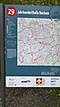
 Radrevier.ruhr Knotenpunkt 25 Schleuse Hattingen Karte.jpg 1,456 × 2,592; 1.68 MB
-
 Radrevier.ruhr Knotenpunkt 25 Schleuse Hattingen Rettungspunkt.jpg 1,456 × 2,592; 1.22 MB
-
 Radrevier.ruhr Knotenpunkt 25 Schleuse Hattingen Wegweiser.jpg 1,456 × 2,592; 2.07 MB
-
 Radrevier.ruhr Knotenpunkt 25 Schlossmühle Buddenburg Karte.jpg 3,672 × 4,896; 6.62 MB
-
 Radrevier.ruhr Knotenpunkt 25 Schlossmühle Buddenburg Rettungspunkt.jpg 4,896 × 3,672; 6.6 MB
-
 Radrevier.ruhr Knotenpunkt 25 Schlossmühle Buddenburg Wegweiser.jpg 3,672 × 4,896; 6.47 MB
-
 Radrevier.ruhr Knotenpunkt 26 Technologiezentrum LÜNTEC Karte.jpg 3,672 × 4,896; 6.82 MB
-
 Radrevier.ruhr Knotenpunkt 26 Technologiezentrum LÜNTEC Rettungspunkt.jpg 4,896 × 3,672; 6.66 MB
-
 Radrevier.ruhr Knotenpunkt 26 Technologiezentrum LÜNTEC Wegweiser.jpg 3,672 × 4,896; 6.35 MB
-
 Radrevier.ruhr Knotenpunkt 27 Bahnhof Bönen Karte.jpg 3,672 × 4,896; 6.85 MB
-
 Radrevier.ruhr Knotenpunkt 27 Bahnhof Bönen Rettungspunkt.jpg 4,896 × 3,672; 5.85 MB
-
 Radrevier.ruhr Knotenpunkt 27 Bahnhof Bönen Wegweiser.jpg 3,672 × 4,896; 6.29 MB
-
 Radrevier.ruhr Knotenpunkt 27 Schwimmbrücke Dahlhausen Karte.jpg 1,456 × 2,592; 1.34 MB
-
 Radrevier.ruhr Knotenpunkt 27 Schwimmbrücke Dahlhausen Rettungspunkt.jpg 1,456 × 2,592; 1.03 MB
-
 Radrevier.ruhr Knotenpunkt 27 Schwimmbrücke Dahlhausen Wegweiser.jpg 1,456 × 2,592; 1.29 MB
-
 Radrevier.ruhr Knotenpunkt 28 Bochum-Dahlhausen Karte.jpg 1,456 × 2,592; 1.66 MB
-
 Radrevier.ruhr Knotenpunkt 28 Bochum-Dahlhausen Rettungspunkt.jpg 1,456 × 2,592; 1.15 MB
-
 Radrevier.ruhr Knotenpunkt 28 Bochum-Dahlhausen Wegweiser.jpg 2,592 × 1,456; 1.66 MB
-
 Radrevier.ruhr Knotenpunkt 28 ehem Zeche Königsborn Karte.jpg 3,672 × 4,896; 6.52 MB
-
 Radrevier.ruhr Knotenpunkt 28 ehem Zeche Königsborn Rettungspunkt.jpg 4,896 × 3,672; 5.95 MB
-
 Radrevier.ruhr Knotenpunkt 28 ehem Zeche Königsborn Wegweiser.jpg 3,672 × 4,896; 7.04 MB
-
 Radrevier.ruhr Knotenpunkt 28 Rheinorange Karte.jpg 1,456 × 2,592; 1.62 MB
-
 Radrevier.ruhr Knotenpunkt 28 Rheinorange Rettungspunkt.jpg 1,456 × 2,592; 1.01 MB
-
 Radrevier.ruhr Knotenpunkt 28 Rheinorange Wegweiser.jpg 2,592 × 1,456; 1.03 MB
-
 Radrevier.ruhr Knotenpunkt 29 Bönen-Flierich Karte.jpg 3,672 × 4,896; 6.83 MB
-
 Radrevier.ruhr Knotenpunkt 29 Bönen-Flierich Rettungspunkt.jpg 4,896 × 3,672; 6.65 MB
-
 Radrevier.ruhr Knotenpunkt 29 Bönen-Flierich Wegweiser.jpg 4,896 × 3,672; 7.01 MB
-
 Radrevier.ruhr Knotenpunkt 29 Dinslakener Landstraße Karte.jpg 3,672 × 4,896; 6.53 MB
-
 Radrevier.ruhr Knotenpunkt 29 Dinslakener Landstraße Rettungspunkt.jpg 4,896 × 3,672; 5.75 MB
-
 Radrevier.ruhr Knotenpunkt 29 Dinslakener Landstraße Wegweiser.jpg 3,672 × 4,896; 6.47 MB
-
 Radrevier.ruhr Knotenpunkt 29 Duisburg-Kaßlerfeld (oben-der-Ruhr) Karte.jpg 1,456 × 2,592; 1.39 MB
-
 Radrevier.ruhr Knotenpunkt 29 Duisburg-Kaßlerfeld (oben-der-Ruhr) Rettungspunkt.jpg 1,456 × 2,592; 1.21 MB
-
 Radrevier.ruhr Knotenpunkt 29 Duisburg-Kaßlerfeld (oben-der-Ruhr) Wegweiser.jpg 2,592 × 1,456; 1.38 MB
-
 Radrevier.ruhr Knotenpunkt 29 Duisburg-Kaßlerfeld (unten-der-Ruhr) Karte.jpg 1,456 × 2,592; 1.76 MB
-
 Radrevier.ruhr Knotenpunkt 29 Duisburg-Kaßlerfeld (unten-der-Ruhr) Rettungspunkt.jpg 1,456 × 2,592; 1.21 MB
-
 Radrevier.ruhr Knotenpunkt 29 Duisburg-Kaßlerfeld (unten-der-Ruhr) Wegweiser.jpg 1,456 × 2,592; 2.14 MB
-
 Radrevier.ruhr Knotenpunkt 29 Jahrhunderthalle Bochum Karte.jpg 1,456 × 2,592; 1.59 MB
-
 Radrevier.ruhr Knotenpunkt 29 Jahrhunderthalle Bochum Rettungspunkt.jpg 2,592 × 1,456; 740 KB
-
 Radrevier.ruhr Knotenpunkt 29 Jahrhunderthalle Bochum Wegweiser.jpg 2,592 × 1,456; 2.11 MB
-
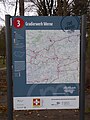 Radrevier.ruhr Knotenpunkt 3 Gradierwerk Werne Karte.jpg 3,672 × 4,896; 6.39 MB
-
 Radrevier.ruhr Knotenpunkt 3 Gradierwerk Werne Rettungspunkt.jpg 4,896 × 3,672; 6.55 MB
-
 Radrevier.ruhr Knotenpunkt 3 Gradierwerk Werne Wegweiser.jpg 3,672 × 4,896; 7.09 MB
-
 Radrevier.ruhr Knotenpunkt 3 Schloss Broich Karte.jpg 1,456 × 2,592; 1.59 MB
-
 Radrevier.ruhr Knotenpunkt 3 Schloss Broich Rettungspunkt.jpg 1,456 × 2,592; 1.28 MB
-
 Radrevier.ruhr Knotenpunkt 3 Schloss Broich Wegweiser.jpg 2,592 × 1,456; 2.17 MB
-
 Radrevier.ruhr Knotenpunkt 30 Bf Unna Königsborn Karte.jpg 3,672 × 4,896; 6.81 MB
-
 Radrevier.ruhr Knotenpunkt 30 Bf Unna Königsborn Rettungspunkt.jpg 4,896 × 3,672; 6.47 MB
-
 Radrevier.ruhr Knotenpunkt 30 Bf Unna Königsborn Wegweiser.jpg 3,672 × 4,896; 7.03 MB
-
 Radrevier.ruhr Knotenpunkt 30 Bf Wesel Karte.jpg 3,672 × 4,896; 6.86 MB
-
 Radrevier.ruhr Knotenpunkt 30 Bf Wesel Rettungspunkt.jpg 4,896 × 3,672; 6.81 MB
-
 Radrevier.ruhr Knotenpunkt 30 Bf Wesel Wegweiser.jpg 3,672 × 4,896; 6.88 MB
-
 Radrevier.ruhr Knotenpunkt 30 Ickersche Heide Karte.jpg 3,672 × 4,896; 7.03 MB
-
 Radrevier.ruhr Knotenpunkt 30 Ickersche Heide Rettungspunkt.jpg 3,672 × 4,896; 6.49 MB
-
 Radrevier.ruhr Knotenpunkt 30 Ickersche Heide Wegweiser.jpg 3,672 × 4,896; 7.02 MB
-
 Radrevier.ruhr Knotenpunkt 30 Innenhafen DU Wegweiser.jpg 2,592 × 1,456; 1.65 MB
-
 Radrevier.ruhr Knotenpunkt 30 Innenhafen Duisburg Karte.jpg 1,456 × 2,592; 1.46 MB
-
 Radrevier.ruhr Knotenpunkt 30 Innenhafen Duisburg Rettungspunkt.jpg 1,456 × 2,592; 1.05 MB
-
 Radrevier.ruhr Knotenpunkt 30 Innenhafen Duisburg Wegweiser.jpg 2,592 × 1,456; 1.59 MB
-
 Radrevier.ruhr Knotenpunkt 31 Dortmund-Ems-Kanal, Oberwiese Karte.jpg 3,672 × 4,896; 6.44 MB
-
 Radrevier.ruhr Knotenpunkt 31 Dortmund-Ems-Kanal, Oberwiese Rettungspunkt.jpg 3,672 × 4,896; 6.09 MB
-
 Radrevier.ruhr Knotenpunkt 31 Dortmund-Ems-Kanal, Oberwiese Wegweiser.jpg 3,672 × 4,896; 7.18 MB
-
 Radrevier.ruhr Knotenpunkt 31 Duisburg Kuhstraße Karte.jpg 1,456 × 2,592; 1.63 MB
-
 Radrevier.ruhr Knotenpunkt 31 Duisburg Kuhstraße Rettungspunkt.jpg 1,456 × 2,592; 1.23 MB
-
 Radrevier.ruhr Knotenpunkt 31 Duisburg Kuhstraße Wegweiser.jpg 2,592 × 1,456; 1.54 MB
-
 Radrevier.ruhr Knotenpunkt 31 Kurpark Königsborn Karte.jpg 1,456 × 2,592; 2.34 MB
-
 Radrevier.ruhr Knotenpunkt 31 Kurpark Königsborn Rettungspunkt.jpg 1,456 × 2,592; 1.76 MB
-
 Radrevier.ruhr Knotenpunkt 31 Kurpark Königsborn Wegweiser.jpg 3,672 × 4,896; 6.87 MB
-
 Radrevier.ruhr Knotenpunkt 31 Rathaus Wegweiser.jpg 3,672 × 4,896; 6.28 MB
-
 Radrevier.ruhr Knotenpunkt 32 Hbf. Duisburg Karte.jpg 1,456 × 2,592; 1.36 MB
-
 Radrevier.ruhr Knotenpunkt 32 Hbf. Duisburg Rettungspunkt.jpg 1,456 × 2,592; 874 KB
-
 Radrevier.ruhr Knotenpunkt 32 LWL-Industriemuseum Schiffhebewerk Henrichenburg Karte.jpg 3,672 × 4,896; 6.96 MB
-

-
 Radrevier.ruhr Knotenpunkt 32 LWL-Industriemuseum Schiffhebewerk Henrichenburg Wegweiser.jpg 3,672 × 4,896; 6.54 MB
-
 Radrevier.ruhr Knotenpunkt 32 Rathausplatz, Unna Karte.jpg 3,672 × 4,896; 7.01 MB
-
 Radrevier.ruhr Knotenpunkt 32 Rathausplatz, Unna Wegweiser.jpg 3,672 × 4,896; 6.96 MB
-
 Radrevier.ruhr Knotenpunkt 32 Rathausplatze, Unna Rettungspunkt.jpg 4,896 × 3,672; 7.12 MB
-
 Radrevier.ruhr Knotenpunkt 33 Duisburg-Hochfeld Karte.jpg 1,456 × 2,592; 1.69 MB
-
 Radrevier.ruhr Knotenpunkt 33 Duisburg-Hochfeld Rettungspunkt.jpg 1,456 × 2,592; 1.31 MB
-
 Radrevier.ruhr Knotenpunkt 33 Duisburg-Hochfeld Wegweiser.jpg 2,592 × 1,456; 1.46 MB
-
 Radrevier.ruhr Knotenpunkt 33 Morgenstr., Unna Wegweiser.jpg 3,672 × 4,896; 6.73 MB
-
 Radrevier.ruhr Knotenpunkt 33 Schleuse Datteln Karte.jpg 3,672 × 4,896; 7.04 MB
-
 Radrevier.ruhr Knotenpunkt 33 Schleuse Datteln Rettungspunkt.jpg 4,896 × 3,672; 6.6 MB
-
 Radrevier.ruhr Knotenpunkt 33 Schleuse Datteln Wegweiser.jpg 3,672 × 4,896; 7.05 MB
-
 Radrevier.ruhr Knotenpunkt 34 Haltern-Flaesheim Karte.jpg 3,672 × 4,896; 7.13 MB
-
 Radrevier.ruhr Knotenpunkt 34 Haltern-Flaesheim Rettungspunkt.jpg 4,896 × 3,672; 6.77 MB
-
 Radrevier.ruhr Knotenpunkt 34 Haltern-Flaesheim Wegweiser.jpg 3,672 × 4,896; 7.09 MB
-
 Radrevier.ruhr Knotenpunkt 34 Wasserstraße, Unna Karte.jpg 3,672 × 4,896; 6.52 MB
-
 Radrevier.ruhr Knotenpunkt 34 Wasserstraße, Unna Rettungspunkt.jpg 4,896 × 3,672; 6.55 MB
-
 Radrevier.ruhr Knotenpunkt 34 Wasserstraße, Unna Wegweiser.jpg 3,672 × 4,896; 6.66 MB
-
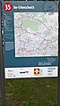 Radrevier.ruhr Knotenpunkt 35 Oer-Erkenschwick Karte.jpg 1,456 × 2,592; 1.55 MB
-
 Radrevier.ruhr Knotenpunkt 35 Oer-Erkenschwick Rettungspunkt.jpg 2,592 × 1,456; 847 KB
-
 Radrevier.ruhr Knotenpunkt 35 Oer-Erkenschwick Wegweiser.jpg 1,456 × 2,592; 1.54 MB
-
 Radrevier.ruhr Knotenpunkt 35 Tiger&Turtle Magic Mountain Karte.jpg 1,456 × 2,592; 1.57 MB
-
 Radrevier.ruhr Knotenpunkt 35 Tiger&Turtle Magic Mountain Rettungspunkt.jpg 1,456 × 2,592; 989 KB
-
 Radrevier.ruhr Knotenpunkt 35 Tiger&Turtle Magic Mountain Wegweiser.jpg 2,592 × 1,456; 1.44 MB


_Karte.jpg)
_Rettungspunkt.jpg)
_Wegweiser.jpg)
_Karte.jpg)
_Rettungspunkt.jpg)
_Wegweiser.jpg)


