Category:Kocherursprung
spring  | |||||
| Upload media | |||||
| Instance of | |||||
|---|---|---|---|---|---|
| Location |
| ||||
| Area |
| ||||
 | |||||
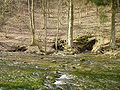
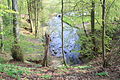
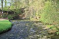
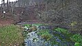
This category shows the natural monument in Oberkochen Baden-Württemberg with the ID 81360500011 and the name Ursprung des Schwarzen Kochers.
|
 |
 |
Media in category "Kocherursprung"
The following 17 files are in this category, out of 17 total.
-
 Felsen am Kocherursprung.jpg 5,184 × 3,456; 11.36 MB
-
 Kocher quelle 1.JPG 1,280 × 960; 486 KB
-
 Kocher quelle 2.jpg 1,280 × 960; 502 KB
-
 Kocher quelle 3.jpg 1,280 × 960; 533 KB
-
 Kocher quelle 4.jpg 1,280 × 960; 433 KB
-
 Kocherursprung 2.jpg 5,184 × 3,456; 8.29 MB
-
 Kocherursprung 3.jpg 5,184 × 3,456; 9.36 MB
-
 Kocherursprung 4.jpg 5,184 × 3,456; 10.91 MB
-
 Kocherursprung 5.jpg 5,184 × 3,456; 10.21 MB
-
 Kocherursprung 6.jpg 5,184 × 3,456; 8.44 MB
-
 Kocherursprung 7.jpg 5,184 × 3,456; 10.3 MB
-
 Kocherursprung.jpg 2,848 × 2,136; 2 MB
-
 Kocherursprung.JPG 5,184 × 3,456; 9.85 MB
-
 Kocherursprung.PNG 1,402 × 1,970; 86 KB
-
 Landappbw 299327 1824 Kocherursprung bei Oberkochen.jpg 3,264 × 1,840; 1.28 MB
-
 Oberkochen - Ursprung des Schwarzen Kochers.jpg 4,032 × 3,024; 5.38 MB
-
 Oberkochen Kocherursprung Schlackensteine.jpg 1,602 × 1,364; 570 KB


