Category:Kolhapur district
district of Maharashtra, India .svg) | |||||
| Upload media | |||||
| Instance of | |||||
|---|---|---|---|---|---|
| Location | Pune division, Maharashtra, India | ||||
| Capital | |||||
| Population |
| ||||
| Area |
| ||||
| official website | |||||
 | |||||
Media related to Kolhapur district, Maharashtra, India
Subcategories
This category has the following 9 subcategories, out of 9 total.
A
- Amba Ghat (13 F)
G
- Gaganbavda (Kolhapur) (5 F)
K
- Karul Ghat (6 F)
P
- Patgaon reservoir (5 F)
- Pohale Caves (21 F)
Media in category "Kolhapur district"
The following 24 files are in this category, out of 24 total.
-
 Kolhapur District map, 1956.jpg 1,524 × 1,524; 1.18 MB
-
 MaharashtraKolhapur.png 2,168 × 1,671; 426 KB
-
 Ashwattha at Nrusinhwadi.jpg 1,944 × 2,592; 1.81 MB
-
 Babu Jamal Dargah.jpg 3,750 × 2,500; 8.78 MB
-
 Chamunda khidrapur.jpg 768 × 1,152; 755 KB
-
 Chikkhal Gutta. Panning.jpg 2,000 × 1,335; 1.6 MB
-
 Chikkhal Gutta.jpg 2,000 × 1,362; 1.4 MB
-
 Dark Xbox controller (Unsplash).jpg 6,000 × 4,000; 2.79 MB
-
 Dipmal.jpg 1,440 × 2,560; 930 KB
-
 Diwali23.jpg 2,400 × 3,200; 892 KB
-
 Just Click.jpg 3,625 × 1,632; 1.99 MB
-
 Kolhapur Ratnagiri NH-166 scene 2011 IMG 1606.jpg 2,816 × 2,112; 575 KB
-
 Konavade.png 1,562 × 978; 2.8 MB
-
 Myviewtosavetrees.jpg 1,804 × 1,804; 629 KB
-
 Pavankhind.jpg 375 × 500; 210 KB
-
 PRAJAPITA BRAHMAKUMARI SHIVANI BEHENJI.jpg 4,000 × 1,844; 5.29 MB
-
 Sharad Institute Of Technology,Polytechnic.jpg 720 × 540; 45 KB
-
 Shop for religious books at narsoba wadi - panoramio.jpg 3,264 × 2,448; 1.47 MB
-
 Sweetmeat shop at narsoba wadi - panoramio.jpg 3,264 × 2,448; 1.96 MB
-
 The Keranchie, or Kidrapore Omnibus - ILN 1859.jpg 952 × 600; 105 KB
-
 Village kids.jpg 3,120 × 4,160; 7.1 MB
-
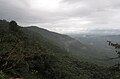 WesternGhat.jpg 4,320 × 2,841; 2.12 MB
-
 आप्पासाहेब पवार.jpg 2,308 × 2,709; 901 KB
-
 घन कचरा व्यवस्थापन.jpg 4,160 × 2,340; 4.47 MB


.jpg)


