Category:Kolonie Pod Bohdalcem
| Object location | | View all coordinates using: OpenStreetMap |
|---|
.jpg) | |||||
| Upload media | |||||
| Instance of | |||||
|---|---|---|---|---|---|
| Location | |||||
| Inception |
| ||||
| Population |
| ||||
 | |||||
Subcategories
This category has the following 4 subcategories, out of 4 total.
Media in category "Kolonie Pod Bohdalcem"
The following 35 files are in this category, out of 35 total.
-
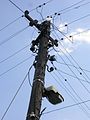 Elektrický sloup Pod Bohdalcem.jpg 1,536 × 2,048; 283 KB
-
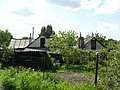
 Kolonie Pod Bohdalcem (01).jpg 2,048 × 1,536; 636 KB
-
 Kolonie Pod Bohdalcem (02).jpg 2,048 × 1,536; 641 KB
-
 Kolonie Pod Bohdalcem (03).jpg 2,048 × 1,536; 681 KB
-
 Kolonie Pod Bohdalcem (04).jpg 2,048 × 1,536; 689 KB
-
 Kolonie Pod Bohdalcem (06).jpg 2,048 × 1,536; 643 KB
-
 Kolonie Pod Bohdalcem (07).jpg 2,048 × 1,536; 678 KB
-
 Nouzová kolonie Pod Bohdalcem (1).JPG 3,648 × 2,736; 4.28 MB
-
 Nouzová kolonie Pod Bohdalcem (10).JPG 3,648 × 2,736; 3.36 MB
-
 Nouzová kolonie Pod Bohdalcem (11).JPG 3,648 × 2,736; 5.47 MB
-
 Nouzová kolonie Pod Bohdalcem (12).JPG 3,648 × 2,736; 4.48 MB
-
 Nouzová kolonie Pod Bohdalcem (13).JPG 3,648 × 2,736; 3.8 MB
-
 Nouzová kolonie Pod Bohdalcem (14).JPG 3,648 × 2,736; 5.16 MB
-
 Nouzová kolonie Pod Bohdalcem (15).JPG 3,648 × 2,736; 4.9 MB
-
 Nouzová kolonie Pod Bohdalcem (16).JPG 3,648 × 2,736; 4.86 MB
-
 Nouzová kolonie Pod Bohdalcem (17).JPG 3,648 × 2,736; 4.16 MB
-
 Nouzová kolonie Pod Bohdalcem (18).JPG 3,648 × 2,736; 3.73 MB
-
 Nouzová kolonie Pod Bohdalcem (19).JPG 3,648 × 2,736; 4.11 MB
-
 Nouzová kolonie Pod Bohdalcem (2).JPG 3,648 × 2,736; 5.64 MB
-
 Nouzová kolonie Pod Bohdalcem (20).JPG 3,648 × 2,736; 4.16 MB
-
 Nouzová kolonie Pod Bohdalcem (21).JPG 3,648 × 2,736; 4.33 MB
-
 Nouzová kolonie Pod Bohdalcem (22).JPG 3,648 × 2,736; 4.51 MB
-
 Nouzová kolonie Pod Bohdalcem (23).JPG 2,736 × 3,648; 5.45 MB
-
 Nouzová kolonie Pod Bohdalcem (24).JPG 3,648 × 2,736; 4.79 MB
-
 Nouzová kolonie Pod Bohdalcem (25).JPG 3,648 × 2,736; 4.28 MB
-
 Nouzová kolonie Pod Bohdalcem (26).JPG 3,648 × 2,736; 3.7 MB
-
 Nouzová kolonie Pod Bohdalcem (27).JPG 3,648 × 2,736; 4.38 MB
-
 Nouzová kolonie Pod Bohdalcem (3).JPG 3,648 × 2,736; 4.37 MB
-
 Nouzová kolonie Pod Bohdalcem (4).JPG 3,648 × 2,736; 4.35 MB
-
 Nouzová kolonie Pod Bohdalcem (5).JPG 3,648 × 2,736; 4.34 MB
-
 Nouzová kolonie Pod Bohdalcem (6).JPG 3,648 × 2,736; 4.6 MB
-
 Nouzová kolonie Pod Bohdalcem (7).JPG 3,648 × 2,736; 4.5 MB
-
 Nouzová kolonie Pod Bohdalcem (8).JPG 3,648 × 2,736; 3.73 MB
-
 Nouzová kolonie Pod Bohdalcem (9).JPG 3,648 × 2,736; 3.5 MB
-
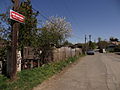
 Pod Bohdalcem I a II rozcestí.jpg 2,048 × 1,536; 622 KB

.jpg)
.jpg)
.jpg)
.jpg)
.jpg)
.JPG)
.JPG)
.JPG)
.JPG)
.JPG)
.JPG)
.JPG)
.JPG)
.JPG)
.JPG)
.JPG)
.JPG)
.JPG)
.JPG)
.JPG)
.JPG)
.JPG)
.JPG)
.JPG)
.JPG)
.JPG)
.JPG)
.JPG)
.JPG)
.JPG)
.JPG)
.JPG)
