Category:Koningshof (Katwijk)
| Object location | | View all coordinates using: OpenStreetMap |
|---|
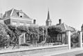
building in Katwijk, Netherlands  | |||||
| Upload media | |||||
| Instance of | |||||
|---|---|---|---|---|---|
| Location | Katwijk, South Holland, Netherlands | ||||
| Street address |
| ||||
| Heritage designation |
| ||||
 | |||||
|
This is a category about rijksmonument number 23522
|
| Address |
|
Media in category "Koningshof (Katwijk)"
The following 9 files are in this category, out of 9 total.
-
 Aanzicht - Katwijk aan den Rijn - 20124196 - RCE.jpg 1,200 × 809; 243 KB
-
 Aanzicht - Katwijk aan den Rijn - 20124197 - RCE.jpg 1,200 × 811; 259 KB
-
 Achtergevel "Koningshof" - Katwijk aan den Rijn - 20124198 - RCE.jpg 1,190 × 1,200; 445 KB
-
 Achtergevel "Koningshof" - Katwijk aan den Rijn - 20124199 - RCE.jpg 1,200 × 1,197; 437 KB
-
 Katwijk Koningshof v1.jpg 3,648 × 2,736; 3.95 MB
-
 Koningshof - Katwijk aan den Rijn - 20124221 - RCE.jpg 1,200 × 865; 289 KB
-

-
 Overzicht hofje en toegangshek - Katwijk aan den Rijn - 20365361 - RCE.jpg 1,200 × 956; 233 KB
-


