Category:Kraansteeg 14, Gorinchem
| Object location | | View all coordinates using: OpenStreetMap |
|---|
house in Gorinchem, Netherlands  | |||||
| Upload media | |||||
| Instance of | |||||
|---|---|---|---|---|---|
| Location | Gorinchem, South Holland, Netherlands | ||||
| Street address |
| ||||
| Located on street |
| ||||
| Heritage designation |
| ||||
 | |||||
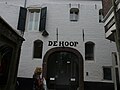
Nederlands: Pakhuis De Hoop
|
This is a category about rijksmonument number 16623
|
| Address |
|
Media in category "Kraansteeg 14, Gorinchem"
The following 3 files are in this category, out of 3 total.
-
 De Hoop P1050261.JPG 3,264 × 2,448; 3.22 MB
-

-
 Kraamsteeg 14-16 - Gorinchem - 20080988 - RCE.jpg 804 × 1,200; 170 KB

