Category:Kraftwerk Reichenau
| Object location | | View all coordinates using: OpenStreetMap |
|---|
 | |||||
| Upload media | |||||
| Instance of | |||||
|---|---|---|---|---|---|
| Location | |||||
| Located in or next to body of water | |||||
| Owned by | |||||
| Operator | |||||
| Service entry |
| ||||
| Inception |
| ||||
| Nominal power capacity |
| ||||
| Elevation above sea level |
| ||||
 | |||||
Media in category "Kraftwerk Reichenau"
The following 14 files are in this category, out of 14 total.
-
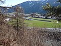
 Bonaduz und Reichenau Tamins.JPG 2,048 × 1,536; 707 KB
-
 Kraftw. Reichenau2.jpg 4,000 × 3,000; 6.77 MB
-
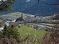
 Kraftwerk Reichenau 1.jpg 4,000 × 3,000; 3.29 MB
-
 Kraftwerk Reichenau 2.jpg 4,000 × 3,000; 2.62 MB
-
 Kraftwerk Reichenau 3.jpg 4,000 × 3,000; 3.31 MB
-
 Kraftwerk Reichenau view towards Ems 01.jpg 3,072 × 2,304; 3.55 MB
-
 Kraftwerk Reichenau view towards Ems 02.jpg 3,072 × 2,304; 3.6 MB
-
 Kraftwerk Reichenau view towards Ems 03.jpg 3,072 × 2,304; 3.71 MB
-
 Kraftwerk Reichenau view towards Ems 04.jpg 3,072 × 2,304; 3.29 MB
-
 Kraftwerk Reichenau view towards Ems 05.jpg 3,072 × 2,304; 3.38 MB
-
 Kraftwerk Reichenau view towards Ems 06.jpg 3,072 × 2,304; 3.64 MB
-
 Kraftwerk Reichenau view towards Ems 07.jpg 3,072 × 2,304; 3.37 MB
-
 Kraftwerk Reichenau view towards Ems 08.jpg 3,072 × 2,304; 3.51 MB
-
 Kraftwerk Reichenau.jpg 1,375 × 754; 483 KB


