Category:Kretinga in maps
This category includes the images that spot Kretinga city in larger geographical area. For maps that specifically represent the city of Kretinga more in detail, see Category:Maps of Kretinga.
Media in category "Kretinga in maps"
The following 6 files are in this category, out of 6 total.
-
 Reymanns Special-Karte B Memel.jpg 5,621 × 3,939; 4.93 MB
-
 R200 N34-02ne.jpg 2,244 × 1,467; 4.24 MB
-
 WIG Mapa Operacyjna Polski - 25 Kłajpeda 1936.jpg 6,465 × 5,839; 10.18 MB
-
 USSR map NN 34-2 Klaipeda.jpg 5,733 × 4,349; 5.84 MB
-
 KretingosM.png 629 × 654; 66 KB
-
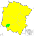
 LietuvaKretinga.png 721 × 556; 28 KB


