Category:Kreuth
municipality of Germany    | |||||
| Upload media | |||||
| Instance of |
| ||||
|---|---|---|---|---|---|
| Part of |
| ||||
| Location | Miesbach, Upper Bavaria, Bavaria, Germany | ||||
| Head of government |
| ||||
| Population |
| ||||
| Area |
| ||||
| Elevation above sea level |
| ||||
| Different from | |||||
| official website | |||||
 | |||||
Subcategories
This category has the following 11 subcategories, out of 11 total.
Media in category "Kreuth"
The following 50 files are in this category, out of 50 total.
-
 AK - Bad Kreuth mit Ross- und Buchstein - 1926.jpg 1,109 × 728; 578 KB
-
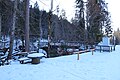
 Alpenverein Weg 604 kurz vor der Brücke über den Schwarzenbach 2023-02-12.jpg 5,472 × 3,648; 8.58 MB
-

-
 Blick durch das Fernrohr auf den Leonhardstein am Alpenverein Weg 604 2023-02-12.jpg 5,472 × 3,648; 4.75 MB
-
 Brücke über den Schwarzenbach am Alpenverein Weg 604 2023-02-12.jpg 5,472 × 3,648; 10.93 MB
-
 Brücke über die Weißach am südlichen Wanderparkplatz Klamm 2023-02-12.jpg 5,472 × 3,648; 8.7 MB
-
 Fernrohr mit Ausblick auf den Leonhardstein am Alpenverein Weg 604 2023-02-12.jpg 5,472 × 3,648; 11.82 MB
-
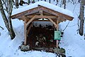 Frontalansicht Unterstand aus Fichtenholz am Alpenverein Weg 604 2023-02-12.jpg 5,472 × 3,648; 6.66 MB
-
 Frontalansicht Unterstand aus Lärchenholz am Alpenverein Weg 604 2023-02-12.jpg 5,472 × 3,648; 7.51 MB
-
 Frontalansicht Unterstand aus Tannenholz am Alpenverein Weg 604 2023-02-12.jpg 5,472 × 3,648; 6.04 MB
-
 Gefrorener Schwarzenbach Wasserfall am Alpenverein Weg 604 Bild 1 2023-02-12.jpg 5,472 × 3,648; 9.31 MB
-
 Gefrorener Schwarzenbach Wasserfall am Alpenverein Weg 604 Bild 2 2023-02-12.jpg 5,472 × 3,648; 10.25 MB
-
 Gernbergkopf.jpg 4,608 × 2,184; 4.03 MB
-

-

-
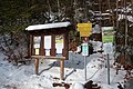
 Infotafel Der Hangpseudogley - eine schräge Sache am Alpenverein Weg 604 2023-02-12.jpg 5,472 × 3,648; 6.32 MB
-
 Infotafel Der Hauptdolomit komplett vereist am Alpenverein Weg 604 2023-02-12.jpg 5,472 × 3,648; 6.49 MB
-
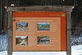 Infotafel Die Kraft des Wassers - Fluch oder Segen? am Alpenverein Weg 604 2023-02-12.jpg 5,472 × 3,648; 5.74 MB
-

-
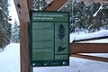
 Infotafel Eine Steilvorlage zur Bodenbildung am Alpenverein Weg 604 2023-02-12.jpg 5,472 × 3,648; 6.31 MB
-

-
-
 Infotafel Ohne Schutzwald geht's bergab am Alpenverein Weg 604 2023-02-12.jpg 5,472 × 3,648; 5.84 MB
-
 Infotafel Steile Hänge, bedrohte Böden am Alpenverein Weg 604 2023-02-12.jpg 5,472 × 3,648; 7.07 MB
-
-
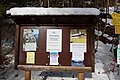
 Infotafel über Unterstand aus Lärchenholz am Alpenverein Weg 604 2023-02-12.jpg 5,472 × 3,648; 5.22 MB
-
 Infotafel über Unterstand aus Tannenholz am Alpenverein Weg 604 2023-02-12.jpg 5,472 × 3,648; 5.46 MB
-
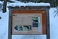
 Infotafeln und Unterstand aus Lärchenholz am Alpenverein Weg 604 2023-02-12.jpg 5,472 × 3,648; 6.81 MB
-

-
 Gemeindewappenkreuth.jpg 319 × 343; 14 KB
-
 Wappen von Kreuth.svg 856 × 938; 35 KB
-
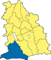 Kreuth - Lage im Landkreis.png 270 × 314; 38 KB
-
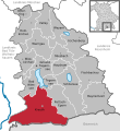 Kreuth in MB.svg 515 × 560; 318 KB
-
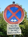 Kreuth, Halteverbot für Postmitarbeiter, 1.jpeg 2,160 × 2,880; 1.56 MB
-
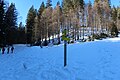
 Loipen parallel der Weißach auf dem Weg Richtung Parkplatz Kreuth Klamm 2023-02-12.jpg 5,472 × 3,648; 9.62 MB
-
 Loipen und Wanderweg parallel zur Weißach Richtung Kreuth 2023-02-12.jpg 5,472 × 3,648; 9.1 MB
-
 Rodelstrecke Richtung Wanderparkplatz kurz vor dem Tiefengraben 2023-02-12.jpg 5,472 × 3,648; 7.59 MB
-
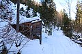 Unterstand aus Lärchenholz und Wanderweg 604 vom Alpenverein 2023-02-12.jpg 5,472 × 3,648; 8.33 MB
-

-
 Wegmarkierungen an der Brücke über den Schwarzenbach am Alpenverein Weg 604 2023-02-12.jpg 5,472 × 3,648; 10.68 MB
-
 Wegmarkierungen zum Wasserfall Schwarzenbach am Alpenverein Weg 604 2023-02-12.jpg 5,472 × 3,648; 7.89 MB
-
 Wegweiser am Abzweig zum Leonhardstein Bild 1 2023-02-12.jpg 5,472 × 3,648; 10.4 MB
-
 Wegweiser am Abzweig zum Leonhardstein Bild 2 2023-02-12.jpg 5,472 × 3,648; 8.13 MB
-
 Wegweiser an der Brücke über den Schwarzenbach am Alpenverein Weg 604 2023-02-12.jpg 5,472 × 3,648; 10.02 MB
-
 Wegweiser Boden erleben Station 9-12 am Alpenverein Weg 604 2023-02-12.jpg 5,472 × 3,648; 7.21 MB
-
 Wegweiser Boden erleben Stationen 7 und 8-12 am Alpenverein Weg 604 Bild 1 2023-02-12.jpg 5,472 × 3,648; 7.41 MB
-
 Wegweiser Boden erleben Stationen 7 und 8-12 am Alpenverein Weg 604 Bild 2 2023-02-12.jpg 5,472 × 3,648; 7.64 MB
-
-

-


